


Why visit Clophill
Townapedia lists 8 museums and landmarks, 9 parks and trails and 9 places to eat in and around town.
Highlights include Ailesbury Mausoleum, Cainhoe Castle, Wrest Park and Cut-throat Meadow.
Weather in Clophill
Forecast from MET Norway (CC BY 4.0). Full forecast
About Clophill
Clophill is a village and civil parish clustered on the north bank of the River Flit, Bedfordshire, England. It is recorded in the Domesday Book of 1086 as Clopelle. "Clop" likely means 'tree-stump' in Old English. However, it also has cognate terms for clay, with which the soil of mid Bedfordshire is rich.
From the Wikipedia article Clophill (this version), under CC BY-SA 4.0.
Photos of Clophill

Museums and landmarks8

Ailesbury Mausoleum
Monument and historic site · 1.5 mi
Mausoleum in Maulden, Central Bedfordshire, England, UK

Cainhoe Castle
Monument and historic site · 0.9 mi
11th century Norman castle in England

De Grey Mausoleum
Monument and historic site · 1.8 mi
Grade I listed building in Flitton, Central Bedfordshire, England, UK

Ruxox Cell
Monument and historic site · 2.4 mi
Moated site in Flitwick, Bedfordshire, England, UK


Parks, trails and playgrounds9

Wrest Park
Park · 1.4 mi
Country estate near Silsoe, Bedfordshire, England, UK



Cooper's Hill
Park · 3.3 mi
Nature reserve in Bedfordshire, England, UK

Restaurants and cafes9



Churches and places of worship8

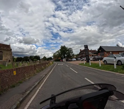
Church of All Saints, Houghton Conquest
Church · 3.3 mi
Church in Houghton Conquest, Bedfordshire, England, UK


Parish Church of All Saints, Campton
Church · 3.0 mi
Church in Bedfordshire, England, UK
St Mary's Church
Church · 2.3 mi
Church in Lower Gravenhurst, Bedfordshire, England, UK
St Marys Church, Clophill
Church · 0.9 mi
Church in Clophill, Bedfordshire, England, UK
Notable people from Clophill
- Jack DurstonEnglish cricketer and footballer (1893-1965)
- Jack Meyereducator and cricketer (1905-1991)
- Michael Trudgillchief Medical Officer of The UK
Born in Clophill, according to Wikidata (CC0). Each name links to its Wikipedia article.
Shopping2
Gas and EV charging1
Schools, colleges and libraries3
Map of Clophill
40 places. The map loads OpenStreetMap tiles when you open it.
Getting there and nearby towns
London Luton Airport (LTN) is the nearest airport with scheduled flights listed in OpenStreetMap, 11 miles away.
- Silsoe 1 mi south, about 2 min by car
- Maulden 2 mi west, about 3 min by car
- Greenfield 2 mi southwest, about 4 min by car
- Ampthill 3 mi west, about 5 min by car
- Chicksands 3 mi northeast, about 5 min by car
- Flitwick 3 mi southwest, about 6 min by car
- Houghton Conquest 3 mi northwest, about 5 min by car
- Shillington 4 mi southeast, about 6 min by car
- Meppershall 4 mi east, about 6 min by car
- Westoning 4 mi southwest, about 7 min by car
Drive times are estimates from straight-line distance, not routes.
Towns near Clophill


Keep exploring
Local news
Headlines from INDB.
Reviews, tips and questions
Loading what members have shared...
Sources and licences
- GeoNames (CC BY 4.0): population, coordinates, regions and time zone
- Mapillary (see each image): photos
- OpenStreetMap contributors (ODbL 1.0): places, airports, map data
- Wikidata (CC0 1.0): elevation, founding date, time zone, website, landmarks and historic places
- Wikimedia Commons (see each image): photos
- Wikipedia (CC BY-SA 4.0): overview and history text
Photo credits
- Backstreet, Clophill 01, Simon Burchell, CC BY-SA 4.0
- Backstreet, Clophill 02, Simon Burchell, CC BY-SA 4.0
- Backstreet, Clophill 03, Simon Burchell, CC BY-SA 4.0
- Backstreet, Clophill 04, Simon Burchell, CC BY-SA 4.0
- Backstreet, Clophill 05, Simon Burchell, CC BY-SA 4.0
- Backstreet, Clophill 06, Simon Burchell, CC BY-SA 4.0
- Backstreet, Clophill 07, Simon Burchell, CC BY-SA 4.0
- Ailesbury Mausoleum 04, Simon Burchell, CC BY-SA 4.0
- Cainhoe Castle, Dennis simpson, CC BY-SA 2.0
- De Grey M, Tatraplan at English Wikipedia, Public domain
- Ruxox Farm moated site 15, Simon Burchell, CC BY-SA 4.0
- WrestHouse3, Nigel Cox, CC BY-SA 2.0
- Cut-Throat Meadow 3, Dudley Miles, CC BY-SA 4.0
- River Flit in Flitwick Moor 3, Dudley Miles, CC BY-SA 4.0
- Church of St. Mary the Virgin, Maulden 88, Simon Burchell, CC BY-SA 4.0
- Silsoechurch2, User:Tatraplan, Public domain
- Wrest Park Orangery 2016, DeFacto, CC BY-SA 4.0
- Street-level photo, wasd42, CC BY-SA 4.0
- Street-level photo, adam2, CC BY-SA 4.0
Page built November 10, 2026. Spotted a mistake? Tell us or suggest a place.