


Why visit Maulden
Townapedia lists 11 museums and landmarks, 11 parks and trails and 37 places to eat in and around town.
Highlights include Ailesbury Mausoleum, Ruxox Cell, Cut-throat Meadow and Flitwick Moor.
Weather in Maulden
Forecast from MET Norway (CC BY 4.0). Full forecast
About Maulden
Maulden is a village and civil parish located in the county of Bedfordshire. The village is located 1.5 miles east of Ampthill and about 8 miles (13 km) south of Bedford. It has about 1,250 homes and 3130 residents.
From the Wikipedia article Maulden (this version), under CC BY-SA 4.0.
Photos of Maulden

Museums and landmarks11

Ailesbury Mausoleum
Monument and historic site · 0.5 mi
Mausoleum in Maulden, Central Bedfordshire, England, UK

Ruxox Cell
Monument and historic site · 1.3 mi
Moated site in Flitwick, Bedfordshire, England, UK

Cainhoe Castle
Monument and historic site · 2.9 mi
11th century Norman castle in England

De Grey Mausoleum
Monument and historic site · 1.4 mi
Grade I listed building in Flitton, Central Bedfordshire, England, UK


Katherine's Cross Ampthill Park
Monument and historic site · 1.6 mi
Architectural structure in Ampthill, Central Bedfordshire, England, UK
Amphill Water Pump
Monument and historic site · 1.0 mi
Https://www.ampthill-tc.gov.uk/amenities/town-pump https://historicengland.org.uk/listing/the-list/list-entry/1321449?section=overview
Parks, trails and playgrounds11


Wrest Park
Park · 2.9 mi
Country estate near Silsoe, Bedfordshire, England, UK

Ampthill Park
Park · 1.6 mi
Country house and former country estate in Ampthill, Bedfordshire, England, UK
Cooper's Hill
Park · 1.4 mi
Nature reserve in Bedfordshire, England, UK

Restaurants and cafes37
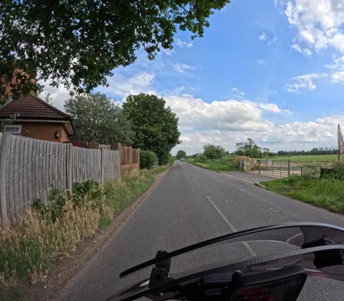
Wakey Joes
Cafe · Coffee Shop, Cake, Breakfast, Juice · 0.9 mi
A kiosk takeaway café serving wooden hill coffee, tea and Matcha. Speciality cakes including Vegan and Gluten Free options. Snacks...
Abbey Lane, Ampthill
Mo-Fr 08:00-16:00



25 more on the map.
Churches and places of worship11

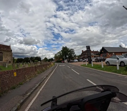
Church of All Saints, Houghton Conquest
Church · 2.2 mi
Church in Houghton Conquest, Bedfordshire, England, UK

Church of St Peter & St Paul, Flitwick
Church · 2.7 mi
Church in Flitwick, Bedfordshire, England, UK
St Marys Church, Clophill
Church · 2.6 mi
Church in Clophill, Bedfordshire, England, UK
History
Maulden was a parish in the union of Ampthill, hundred of Redbornestoke, county of Bedford, 1+1⁄2 miles from Ampthill; containing 1331 inhabitants.
The parish comprised nearly 3000 acres (12 km2), of which 260 were woodland and plantations, and of the remainder, two-thirds were arable and one third pasture.
Many of the women were employed in lacemaking and the plaiting of straw. There were some quarries of sandstone; and a pleasure fair was held in the week nearest to St. Bartholomews-day.
The living was a rectory, valued in the King's books at £15.9.7; net income £512; patron, the Marquess of Ailesbury. The tithes were commuted for land and a corn rent, under an act of enclosure in 1796. The church, principally in the latter English style, was, with little intermixture, completely restored in 1837. There were places of worship for baptists and Methodists.
From the History section of Maulden on Wikipedia, under CC BY-SA 4.0.
More about Maulden
Arts and culture
Maulden Players are an amateur dramatics society who meet weekly at Maulden Village Hall on a Monday night and 2 – 3 times a year put on performances for public audiences. The Players were founded in 1983 under the former guise of St. Mary's Parish Players. Originally only putting on one performance a year with the pantomime in January, the Players soon added more productions to their calendar which usually include a play in May/June for the adult members of the group and a youth production around September/October.
From the Wikipedia article Maulden, under CC BY-SA 4.0.
Notable people from Maulden
 Ryan OwensBritish cyclistPhoto: Nicola, CC BY-SA 4.0
- Charles WardEnglish cricketer and Anglican priest (1838-)
Born in Maulden, according to Wikidata (CC0). Each name links to its Wikipedia article.
Shopping5
Schools, colleges and libraries6
Healthcare1
Map of Maulden
82 places. The map loads OpenStreetMap tiles when you open it.
Getting there and nearby towns
London Luton Airport (LTN) is the nearest airport with scheduled flights listed in OpenStreetMap, 11 miles away.
- Ampthill 1 mi west, about 2 min by car
- Flitwick 2 mi southwest, about 3 min by car
- Greenfield 2 mi south, about 3 min by car
- Houghton Conquest 2 mi north, about 4 min by car
- Silsoe 2 mi southeast, about 4 min by car
- Stewartby 3 mi northwest, about 5 min by car
- Westoning 4 mi south, about 6 min by car
- Kempston Hardwick 4 mi north, about 7 min by car
- Lidlington 4 mi west, about 6 min by car
- Chicksands 5 mi east, about 7 min by car
Drive times are estimates from straight-line distance, not routes.
Towns near Maulden


Keep exploring
Local news
Headlines from INDB.
Reviews, tips and questions
Loading what members have shared...
Sources and licences
- GeoNames (CC BY 4.0): population, coordinates, regions and time zone
- Mapillary (see each image): photos
- OpenStreetMap contributors (ODbL 1.0): places, airports, map data
- Wikidata (CC0 1.0): elevation, founding date, time zone, website, landmarks and historic places
- Wikimedia Commons (see each image): photos
- Wikipedia (CC BY-SA 4.0): overview and history text
Photo credits
- AilesburyMausoleum Maulden Bedfordshire, No machine-readable author provided. Theone00 assumed (based on copyright claims)., CC BY-SA 2.5
- Ailesbury Mausoleum 04, Simon Burchell, CC BY-SA 4.0
- Ruxox Farm moated site 15, Simon Burchell, CC BY-SA 4.0
- Cainhoe Castle, Dennis simpson, CC BY-SA 2.0
- Cut-Throat Meadow 3, Dudley Miles, CC BY-SA 4.0
- River Flit in Flitwick Moor 3, Dudley Miles, CC BY-SA 4.0
- WrestHouse3, Nigel Cox, CC BY-SA 2.0
- De Grey M, Tatraplan at English Wikipedia, Public domain
- Houghton House, APB-CMX at English Wikipedia, Public domain
- Church of St. Mary the Virgin, Maulden 88, Simon Burchell, CC BY-SA 4.0
- Houghton House, Bedfordshire, 2026, Eothan, CC BY-SA 4.0
- Street-level photo, wasd42, CC BY-SA 4.0
- Street-level photo, wasd42, CC BY-SA 4.0
- Street-level photo, wasd42, CC BY-SA 4.0
Page built November 10, 2026. Spotted a mistake? Tell us or suggest a place.