


Why visit Coates
Townapedia lists 11 museums and landmarks, 3 parks and trails, 2 places to stay and 1 attraction in and around town.
Highlights include Corinium Dobunnorum, Corinium Museum, Cirencester Park and Sapperton Valley.
Weather in Coates
Forecast from MET Norway (CC BY 4.0). Full forecast
About Coates
Coates is a village and civil parish situated in Cotswold District, Gloucestershire, England. It is around 3 miles (4.8 km) west of Cirencester and close to Cirencester Park, part of the Bathurst Estate. It is the nearest village to the source of the river Thames at Thames Head, and it is close to the course of the Foss Way or Fosse Way, the ancient Roman road. The nearest railway station is Kemble.
From the Wikipedia article Coates, Gloucestershire (this version), under CC BY-SA 4.0.
Photos of Coates

Things to do1

Museums and landmarks11

Corinium Dobunnorum
Monument and historic site · 3.1 mi
British settlement of the Roman Empire at Cirencester
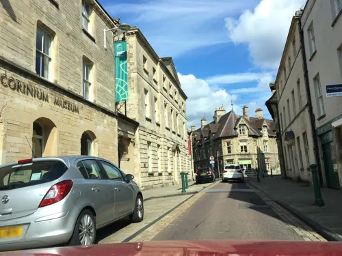
Corinium Museum
Museum · 2.8 mi
UK museum in the Cotswold town of Cirencester in England, United Kingdom

Rodmarton Manor
Museum · 2.9 mi
Grade I listed historic house museum in Cotswold, United Kingdom



Thames & Severn Way
Monument and historic site · 0.7 mi
Linking the Severn to the Thames following the route of the Stroudwater Navigation and Thames & Severn Canal as closely as possible...
Parks, trails and playgrounds3


Where to stay2

Churches and places of worship6
Schools, colleges and libraries1
Map of Coates
24 places. The map loads OpenStreetMap tiles when you open it.
Getting there and nearby towns
Cotswold Airport (GBA) is the nearest airport with scheduled flights listed in OpenStreetMap, 3 miles away.
- Cirencester 3 mi east, about 4 min by car
- Ashton Keynes 6 mi southeast, about 10 min by car
- Avening 6 mi west, about 10 min by car
- Brimscombe 7 mi west, about 11 min by car
- Stroud 8 mi northwest, about 12 min by car
- Painswick 9 mi northwest, about 14 min by car
- Charlton Kings 12 mi north, about 20 min by car
- Cheltenham 13 mi north, about 22 min by car
- Gloucester 14 mi northwest, about 23 min by car
- Swindon 15 mi southeast, about 24 min by car
Drive times are estimates from straight-line distance, not routes.
Towns near Coates


Keep exploring
Local news
Headlines from INDB.
Reviews, tips and questions
Loading what members have shared...
Sources and licences
- GeoNames (CC BY 4.0): population, coordinates, regions and time zone
- Mapillary (see each image): photos
- OpenStreetMap contributors (ODbL 1.0): places, airports, map data
- Wikidata (CC0 1.0): elevation, founding date, time zone, website, landmarks and historic places
- Wikimedia Commons (see each image): photos
- Wikipedia (CC BY-SA 4.0): overview and history text
Photo credits
- Roman mosaic, Corinium Museum, Cirencester, Tony Grist, Public domain
- Rodmarton Manor. - panoramio, Robert Powell, CC BY-SA 3.0
- 1206356 I Church of St John Baptist Cirencester 20250906 0017, Tilman2007, CC BY-SA 4.0
- DaglingworthChurchGloucestershire(AnthonyBrunning)Nov2004, Anthony Brunning, CC BY-SA 2.0
- St. Kenelm's Church, Sapperton, Gloucestershire, Celuici, CC BY-SA 4.0
- Dustinbourne Rouse StMichaels, Saffron Blaze, CC BY-SA 3.0
- RoyalAg2, Jongleur100, Public domain
- Source of the River Thames and start of the Thames Path, Thames Head - August 2023 - 01, Mertbiol, CC0
- Cirencester Park (16 March 2024), OrangeStarling1997, CC BY-SA 4.0
- Alfreds Hall, James MacWhinney, CC BY-SA 3.0
- ThamesMarker, Richard75 at English Wikipedia, CC BY-SA 3.0
- Ivy Lodge At Ngr So 990o26 And Attached Farmbuildings And Wall, OrangeStarling1997, CC BY-SA 4.0
- Thames Head Inn. - panoramio, Robert Powell, CC BY-SA 3.0
- Street-level photo, southglos, CC BY-SA 4.0

Page built November 10, 2026. Spotted a mistake? Tell us or suggest a place.