


Why visit Avening
Townapedia lists 7 museums and landmarks, 3 parks and trails and 2 places to eat in and around town.
Highlights include Chavenage House, Longstone of Minchinhampton and Neu-Lindsey Nature Reserve.
Weather in Avening
Forecast from MET Norway (CC BY 4.0). Full forecast
About Avening
Avening () is a village and civil parish in the Cotswold district of Gloucestershire, England, about three miles (5 km) north of Tetbury. According to the 2001 census it had a population of 1,094, decreasing to 1,031 at the 2011 census. Nearby is Gatcombe Park, the home of the Princess Royal.
From the Wikipedia article Avening (this version), under CC BY-SA 4.0.
Photos of Avening


Museums and landmarks7
Chavenage House
Museum · 1.8 mi
Grade I listed historic house museum in Gloucestershire, England, UK
Longstone of Minchinhampton
Monument and historic site · 1.2 mi
Standing stone on Minchinhampton Common in Minchinhampton, Gloucestershire, England, UK


Parks, trails and playgrounds3

Neu-Lindsey Nature Reserve
Park · 3.2 mi
Small nature reserve in England


Restaurants and cafes2
Bell Inn
Bar and pub · Indian
29 High Street, Avening
Tu-Th 17:00-23:00; Fr 16:00-23:00; Sa-Su 15:00-23:00
Churches and places of worship7

Church of St Mary
Church · 2.8 mi
Church building in Beverston, Cotswold, Gloucestershire, England, UK

Church of St Mary the Virgin
Church · 3.1 mi
Grade I listed church in Cotswold, United Kingdom

Church of the Holy Cross
Church
Church in Avening, Cotswold, Gloucestershire, England

St Mary of the Angels Church, Brownshill
Church · 2.9 mi
Grade II listed church in Chalford, Stroud, Gloucestershire, England, UK

History
Through Avening runs an unnamed stream which is a tributary of the River Frome.
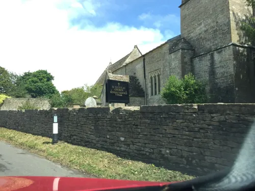
The Anglican Church of the Holy Cross was built in the late 11th century. It is a Grade I listed building.
During the Second World War, Avening lay on the GHQ Line, part of anti-invasion preparations. Extensive anti-tank ditches were constructed to the south and southeast, and were overlooked by a number of pillboxes.
From the History section of Avening on Wikipedia, under CC BY-SA 4.0.
Notable people from Avening
- Caroline Playnepacifist and historian
- Ruth GibsonBritish actress
Born in Avening, according to Wikidata (CC0). Each name links to its Wikipedia article.
Schools, colleges and libraries1
Map of Avening
20 places. The map loads OpenStreetMap tiles when you open it.
Getting there and nearby towns
Cotswold Airport (GBA) is the nearest airport with scheduled flights listed in OpenStreetMap, 5 miles away.
- Stroud 5 mi north, about 8 min by car
- Dursley 8 mi west, about 13 min by car
- Cirencester 9 mi east, about 14 min by car
- Gloucester 13 mi north, about 21 min by car
- Sutton Benger 13 mi south, about 20 min by car
- Churchdown 14 mi north, about 22 min by car
- Yate 14 mi southwest, about 23 min by car
- Chippenham 15 mi south, about 25 min by car
- Royal Wootton Bassett 15 mi southeast, about 24 min by car
- Cheltenham 16 mi north, about 25 min by car
Drive times are estimates from straight-line distance, not routes.
Towns near Avening


Keep exploring
Local news
Headlines from INDB.
Reviews, tips and questions
Loading what members have shared...
Sources and licences
- GeoNames (CC BY 4.0): population, coordinates, regions and time zone
- Mapillary (see each image): photos
- OpenStreetMap contributors (ODbL 1.0): places, airports, map data
- Wikidata (CC0 1.0): elevation, founding date, time zone, website, landmarks and historic places
- Wikimedia Commons (see each image): photos
- Wikipedia (CC BY-SA 4.0): overview and history text
Photo credits
- Avening1, Traveler100, CC BY-SA 3.0
- Avening Church (Holy Cross) (23199651601), Hugh Llewelyn from Keynsham, UK, CC BY-SA 2.0
- Avening Church (Holy Cross) (23199670191), Hugh Llewelyn from Keynsham, UK, CC BY-SA 2.0
- Avening Church (Holy Cross) (23282268795), Hugh Llewelyn from Keynsham, UK, CC BY-SA 2.0
- Avening Church (Holy Cross) (22986441960), Hugh Llewelyn from Keynsham, UK, CC BY-SA 2.0
- Avening Church (Holy Cross) (22655136793), Hugh Llewelyn from Keynsham, UK, CC BY-SA 2.0
- Avening Church (Holy Cross) (23173984942), Hugh Llewelyn from Keynsham, UK, CC BY-SA 2.0
- Avening Church (Holy Cross) (23256145526), Hugh Llewelyn from Keynsham, UK, CC BY-SA 2.0
- Avening Church (Holy Cross) (22888149427), Hugh Llewelyn from Keynsham, UK, CC BY-SA 2.0
- Avening Church (Holy Cross) (23282267925), Hugh Llewelyn from Keynsham, UK, CC BY-SA 2.0
- Avening Church (Holy Cross) (23199646461), Hugh Llewelyn from Keynsham, UK, CC BY-SA 2.0
- Avening Church (Holy Cross) (23199635611), Hugh Llewelyn from Keynsham, UK, CC BY-SA 2.0
- Avening Church (Holy Cross) (22986441110), Hugh Llewelyn from Keynsham, UK, CC BY-SA 2.0
- Tettigonia viridissima, Kristian Peters -- Fabelfroh 12:00, 16 September 2007 (UTC), CC BY-SA 3.0
- StMary'sChurch1 LoRez, Alexander Williams, CC BY-SA 4.0
- Tetbury8431, Clem Rutter, Rochester Kent, CC BY 2.5
- St Mary of the Angels Church, Brownshill 03, Rodw, CC BY-SA 4.0
- AveningChurch8423, Clem Rutter, Rochester Kent, CC BY 2.5
- Gatcombe Park ST8798, Philip Halling, CC BY-SA 2.0
- Street-level photo, southglos, CC BY-SA 4.0
- Street-level photo, southglos, CC BY-SA 4.0
- Street-level photo, southglos, CC BY-SA 4.0
- Street-level photo, southglos, CC BY-SA 4.0
- Street-level photo, RyanBush, CC BY-SA 4.0
- Street-level photo, southglos, CC BY-SA 4.0
- Street-level photo, RyanBush, CC BY-SA 4.0


Page built November 10, 2026. Spotted a mistake? Tell us or suggest a place.