


Painswick, United Kingdom
Painswick is a town of 1,762 people in England, United Kingdom.
Why visit Painswick
Townapedia lists 12 museums and landmarks, 8 parks and trails, 8 places to eat, 3 places to stay and 5 attractions in and around town.
Highlights include Painswick Centre, Pitchcombe War Memorial, Frome Banks and Snows Farm Nature Reserve.
Weather in Painswick
Forecast from MET Norway (CC BY 4.0). Full forecast
About Painswick
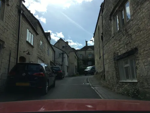
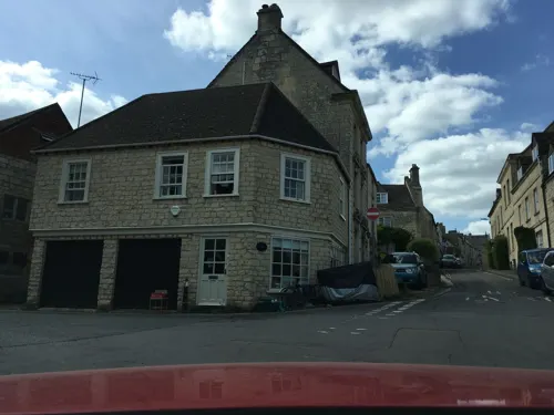
Painswick is a town and civil parish in the Stroud District in Gloucestershire, England. Originally the town grew from the wool trade, but it is now best known for its parish church's yew trees and the local Painswick Rococo Garden. The village is mainly constructed of locally quarried Cotswold stone. Many of the buildings feature south-facing attic rooms once used as weavers' workshops.
From the Wikipedia article Painswick (this version), under CC BY-SA 4.0.
Photos of Painswick


Things to do5


Museums and landmarks12



Parks, trails and playgrounds8


Stratford Park
Park · 2.7 mi
Green flag-awarded area of Stroud in Gloucestershire, southwest England



Restaurants and cafes8


WILD Wick Street Farm Shop Cafe
Cafe · 1.5 mi
Tu-Sa 10:00-17:00; Su 09:00-16:00; Mo off

History
There is evidence of settlement in the area as long ago as the Iron Age. This can be seen in Kimsbury hill fort, a defensive earthwork on nearby Painswick Beacon, which has wide views across the Severn Vale. A Roman villa was built just to the north of the present village, dated by Welbore St Clair Baddeley to the late second century. The local monastery, Prinknash Abbey, was established in the 11th century. Painswick itself first appears in historical records in the Domesday Book of 1086, as Wiche, 'dairy-farm'. It continues to appear by this name into the 13th century. The form Painswik first appears in 1237, but must originate in the name of an earlier lord of the manor, Pain Fitzjohn (d. 1137). Pain was a common Anglo-Norman name (itself originating in paiën, Latin paganus, 'heathen').
During the first English Civil War (1642–45) Gloucester was a Parliamentarian stronghold of some strategic importance, but it was surrounded by forces loyal to King Charles I. After the siege of Gloucester was broken on 5 September 1643, the Royalist army, which had been surrounding the city, encamped overnight at Painswick, with the king staying at Court House. Some damage was caused by the troops and a scar from two small cannonballs can still be seen on the tower of St. Mary's parish church.
Read more of the history
Painswick House dates from the 1730s and is the home of Baron Dickinson. Its Rococo Garden was laid out in the 1740s by Benjamin Hyett.
Gyde House, a prominent Edwardian Cotswold stone building overlooking the town, was formerly a children's home called "Gyde Orphanage" or "Gyde Home". The building started in 1913 with money bequeathed by a local man, Edwin Francis Gyde (1812 - 1894). The orphanage was designed by Percy Richard Morley Horder, and opened in 1919 to accommodate up to 70 children from ages 5 to 12. The home ran into financial difficulties in the 1930s and was taken over by the National Children's Home charity (NCH). In 1987, Gyde House was offered for free to Coral Atkins, an English actress, for supporting children who had experienced severe abuse. The home closed in 1997 and was subsequently converted into apartments.
From the History section of Painswick on Wikipedia, under CC BY-SA 4.0.
Notable people from Painswick
 Hugh Algernon WeddellAnglo-French botanist, physician, and explorer (1819-1877)Photo: Photographie Richelieu G. Numa 83,..., Public domain
 Madame RestellAmerican abortionistPhoto: Unknown author, Public domain
- Thomas TwiningEnglish businessman and merchant (1675-1741)
- Edward StantonBritish officer and diplomat (1827–1907)
- Albert EstcourtEnglish builder and stone mason
- Ernest SibreeBritish Egyptologist
Born in Painswick, according to Wikidata (CC0). Each name links to its Wikipedia article.
Where to stay3
Churches and places of worship12
Gas and EV charging1
Schools, colleges and libraries2
Healthcare1
Map of Painswick
52 places. The map loads OpenStreetMap tiles when you open it.
Getting there and nearby towns
Gloucestershire Airport (GLO) is the nearest airport with scheduled flights listed in OpenStreetMap, 7 miles away.
- Stroud 2 mi south, about 4 min by car
- Gloucester 6 mi north, about 9 min by car
- Churchdown 6 mi north, about 10 min by car
- Shurdington 6 mi northeast, about 10 min by car
- Avening 7 mi south, about 12 min by car
- Cheltenham 9 mi northeast, about 15 min by car
- Charlton Kings 9 mi northeast, about 15 min by car
- Dursley 10 mi southwest, about 16 min by car
- Cirencester 11 mi southeast, about 17 min by car
- Bishops Cleeve 13 mi northeast, about 20 min by car
Drive times are estimates from straight-line distance, not routes.
Towns near Painswick


Keep exploring
Local news
Headlines from INDB.
Reviews, tips and questions
Loading what members have shared...
Sources and licences
- GeoNames (CC BY 4.0): population, coordinates, regions and time zone
- Mapillary (see each image): photos
- OpenStreetMap contributors (ODbL 1.0): places, airports, map data
- Wikidata (CC0 1.0): elevation, founding date, time zone, website, landmarks and historic places
- Wikimedia Commons (see each image): photos
- Wikipedia (CC BY-SA 4.0): overview and history text
Photo credits
- PainswickView2, Jongleur100, Public domain
- Spire House, Painswick, Dave.Dunford, CC BY-SA 4.0
- Gatepiers and walls to Hazelbury House, Painswick, Dave.Dunford, CC BY-SA 4.0
- Rossway, Painswick 02, Dave.Dunford, CC BY-SA 4.0
- Rossway, Painswick 01, Dave.Dunford, CC BY-SA 4.0
- Hazelbury House, Painswick, Dave.Dunford, CC BY-SA 4.0
- St Andrews, Painswick, Dave.Dunford, CC BY-SA 4.0
- Packers, Painswick, Dave.Dunford, CC BY-SA 4.0
- Gravestone, St. Mary's Church, Painswick. - panoramio (1), Robert Powell, CC BY-SA 3.0
- RiverFrome, Jongleur100, Public domain
- Yellow-wort, Cwmhiraeth, CC BY-SA 3.0
- Stratford lake, Jongleur100, Public domain
- Painswick Church (7817365226), Hugh Llewelyn, CC BY-SA 2.0
- Royal Oak, Painswick, Dave.Dunford, CC BY-SA 4.0
- The Patchwork Mouse, Painswick, Dave.Dunford, CC BY-SA 4.0
- Sheepscombe Methodist Chapel 03, Dave.Dunford, CC BY-SA 4.0
- PITCHCOMBE, St John the Baptist, exterior (46626203985), The National Churches Trust, CC BY 2.0
- Painswick Beacon - panoramio, Keith Daulby, CC BY 3.0
- Painswick Rococo Garden Eagle House Gloucestershire Cotswolds England 04, Acabashi, CC BY-SA 4.0
- Painswick Rococo Garden Exedra architectural feature Gloucestershire Cotswolds England 02, Acabashi, CC BY-SA 4.0
- Street-level photo, southglos, CC BY-SA 4.0
- Street-level photo, southglos, CC BY-SA 4.0
- Street-level photo, swinetown, CC BY-SA 4.0
- Street-level photo, swinetown, CC BY-SA 4.0
- Street-level photo, southglos, CC BY-SA 4.0
- Street-level photo, southglos, CC BY-SA 4.0
- Street-level photo, southglos, CC BY-SA 4.0
- Street-level photo, southglos, CC BY-SA 4.0
- Street-level photo, southglos, CC BY-SA 4.0
- Street-level photo, southglos, CC BY-SA 4.0
- Street-level photo, southglos, CC BY-SA 4.0
- Street-level photo, southglos, CC BY-SA 4.0
- Street-level photo, southglos, CC BY-SA 4.0


Page built November 10, 2026. Spotted a mistake? Tell us or suggest a place.