


Sleaford, United Kingdom
Sleaford is a town of 17,359 people in England, United Kingdom.
Why visit Sleaford
Townapedia lists 8 museums and landmarks, 5 parks and trails, 26 places to eat, 3 places to stay and 3 attractions in and around town.
Highlights include Cogglesford Mill, Playhouse, Sleaford, Mareham Pastures and Lollycocks Field.
Weather in Sleaford
Forecast from MET Norway (CC BY 4.0). Full forecast
About Sleaford
Sleaford is a market town and civil parish in the North Kesteven district of Lincolnshire, England. On the edge of the Fenlands, it is 11 miles (18 kilometres) north-east of Grantham, 16 mi (26 km) west of Boston, and 17 mi (27 km) south of Lincoln. It is the largest settlement in North Kesteven with a population of 19,807 in 2021. Centred on the former parish of New Sleaford, the modern boundaries and urban area include Quarrington to the south-west, Holdingham to the north-west and Old Sleaford to the east.
From the Wikipedia article Sleaford (this version), under CC BY-SA 4.0.
Travel tips from other travellers: Sleaford on Wikivoyage (CC BY-SA 4.0).
Things to do3

Cogglesford Mill
Bridge · 0.5 mi
Grade II listed building in Lincolnshire, England, UK


Museums and landmarks8

Parks, trails and playgrounds5


Restaurants and cafes26
Tiamo
Restaurant · Italian
Italian Restaurant
Mo-Th 12:00-14:00,17:00-22:00; Fr-Sa 12:00-14:00,17:00-23:00; Su off

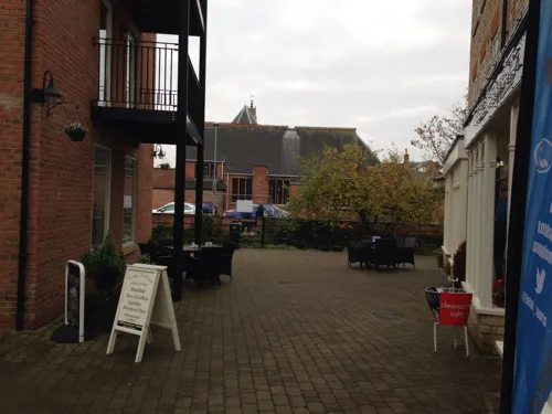
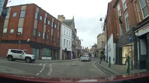
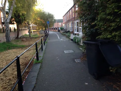

14 more on the map.
History
The earliest records of the place-name Sleaford are found in a charter of 852 as Slioford and in the Anglo-Saxon Chronicle as Sliowaford. In the Domesday Book (1086), it is recorded as Eslaforde and in the early 13th century as Sliforde. In the 13th century Book of Fees it appears as Lafford. The name is formed from the Old English words sliow and ford, together meaning "ford over a muddy or slimy river".
Archaeological material from the Bronze Age and earlier has been recovered and excavations have shown there was unsustained late-Neolithic and Bronze Age human activity in the vicinity. The earliest known permanent settlement dates from the Iron Age, where a track northwards from Bourne crossed the River Slea. Although only sparse pottery evidence has been found for the middle Iron Age period, 4,290 pellet mould fragments, probably used for minting and dated to 50 BC–AD 50, have been uncovered south-east of the modern town centre, south of a crossing of the River Slea and near Mareham Lane in Old Sleaford. The largest of its kind in Europe, the deposit has led archaeologists to consider that the site in Old Sleaford was one of the largest Corieltauvian settlements in the period and possibly a tribal centre.
Read more of the history
During the Roman occupation of Britain (AD 43–409), the settlement was "extensive and of considerable importance". It may have been an economic and administrative centre for stewards and owners of fenland estates. There are signs of a road connecting Old Sleaford to Heckington, where Roman tile kilns have been uncovered and may imply the presence of a market. When the first roads were built by the Romans, Sleaford was bypassed as "less conveniently located" and more "geared to native needs". A smaller road, Mareham Lane, which the Romans renewed, ran through Old Sleaford, and south along the fen edge towards Bourne. Where it passed through Old Sleaford, excavations have shown a large Roman domestic residence, associated farm buildings and field systems, and several burials. Other Roman remains, including a burial, have been excavated.
There is little evidence of continuous settlement between the late Roman and Anglo-Saxon periods but the Saxons did establish themselves eventually. South of the modern town, a 6th- to 7th-century cemetery has been uncovered with an estimated 600 burials, many showing signs of pagan rites. The now-ruined church at Old Sleaford has been discovered and excavations of the market place have uncovered Anglo-Saxon remains from the 8th–9th centuries, indicating some form of enclosure with domestic features.
The earliest documentary reference to Sleaford occurs in a 9th-century charter, when it was owned by Medehamstede Abbey in Peterborough, a Mercian royal foundation. There is little evidence of estate structure until the late Saxon period, but there may have been a market and court before the Norman Conquest, and it may have been an economic and jurisdictional centre for surrounding settlements. The Slea played a big part in the town's economy: it never ran dry or froze, and by the 11th century it supported a dozen watermills. The mills and others in nearby Quarrington and the lost hamlet of Millsthorpe formed the "most important mill cluster in Lincolnshire".
In the later Middle Ages, the Romano-British settlement became known as Old Sleaford, while New Sleaford was a settlement centred on St Denys' Church and the market place. The Domesday Book of 1086 has two entries under Eslaforde (Sleaford) recording land held by Ramsey Abbey and the Bishop of Lincoln. The location of these manors is unclear. One theory endorsed by Maurice Beresford is that they focused on the settlement at Old Sleaford, due to evidence that New Sleaford was planted in the 12th century by the bishop to increase his income, a development associated with the construction of Sleaford Castle (1123–39). Beresford's theory has been criticised by the historians Christine Mahany and David Roffe who have reinterpreted the Domesday material and argued that in 1086 the Bishop's manor included the church and associated settlement which became "New" Sleaford.
A charter to hold a fair on the feast day of St Denis was granted by King Stephen to Alexander, Bishop of Lincoln, in 1136–1140. Between 1154 and 1165, Henry II granted the bishop of Lincoln the right to hold a market at Sleaford and Edward III confirmed this in 1329. The town later had at least two guilds comparable to those found in developed towns. However, there was no formal charter outlining the town's freedoms; tight control by the bishops meant the economy was mainly geared to serve them. It thus retained a strong tradition of demesne farming well into the 14th century. A survey of burgage tenure from 1258 survives, analysis of which indicates that demesne farming centred on the hamlet of Holdingham. As the economic initiative passed more to burgesses and middlemen who formed ties with nearby towns such as Boston, evidence suggests that Sleaford developed a locally important role in the wool trade. In the Lay Subsidy of 1334, New Sleaford was the wealthiest settlement in the Flaxwell wapentake, with a value of £16 0s. 81/4d. Meanwhile, Old Sleaford, an "insignificant" place since the end of the Roman period, declined and may have been deserted by the 16th century.
From the History section of Sleaford on Wikipedia, under CC BY-SA 4.0.
More about Sleaford
Geography
Sleaford is a civil parish and market town in the North Kesteven district of Lincolnshire. It is bounded by the civil parishes of Leasingham to the north; Ewerby and Evedon, and Kirkby la Thorpe to the east; Silk Willoughby to the south; and Wilsford, South Rauceby and North Rauceby to the west. These neighbouring parishes are rural, comprising villages separated from Sleaford's urban area by fields, though Kirkby la Thorpe also includes the Milton Way housing estate on Sleaford's eastern fringe.
Sleaford's urban area includes the town centre, focused on the marketplace (fronted by St Denys' Church), where Eastgate, Northgate, Southgate and Westgate meet. Though some parts have been redeveloped in the 20th century, including the Riverside Shopping Precinct and Flaxwell House, the area follows a medieval street layout and is home to many of the town's oldest buildings; it is also the retail and commercial hub. Carre Street (running parallel to Southgate to the east), once home to industry and wharves, has been regenerated in the late 20th and early 21st centuries.
Economy
The Sleaford built-up area is the urban centre of the North Kesteven district, and one of the district's centres of employment. According to a local authority report, Sleaford is also "the main retail, service and employment centre for people living in the town and in the surrounding villages". The town's primary employment zones are Sleaford Enterprise Park, the adjoining business park at Woodbridge Road and along East Road, and the town centre (focused on Southgate, Northgate and the Market Place). Many of North Kesteven's residents also commute out of the district to work, including to Lincoln, Grantham and Newark-on-Trent; one study found that, in 2011, 70% of workers living in the housing built at Quarrington since the 1980s worked outside of Sleaford: 24% of the total in other parts of North Kesteven, 13% in South Kesteven, 8% in Lincoln, and the remainder mostly in other districts of the East Midlands.
Arts and culture
The Hub, an arts centre, opened in 2002 and houses exhibitions of applied and contemporary art. Opened in 2010, the Carre Gallery is operated by Sleaford Gallery Arts Trust. The Playhouse theatre on Westgate was constructed in 1825 for Joseph Smedley and sold in 1856 to be converted into a school and later a library and offices. Sleaford Little Theatre restored it and in 2000 it reopened as a theatre. The Sleaford Picturedrome opened in 1920; the cinema closed in 2000 and has since been occupied by nightclubs and bars.
Sleaford hosted an annual carnival in the 20th century; it was last held in 1995 before being revived in 2013; it ran for three years before the planned 2016 carnival was cancelled. The RiverLight Festival, offering activities, open days and exhibitions, has taken place annually since 2022. As of 2024, Sleaford Live Week is organised annually to showcase local musicians and artists.
Education
Sleaford has four state primary schools. William Alvey Church of England School, founded in 1729 following a bequest by William Alvey, became an academy in 2012 and in 2022 was rated "good" by the Office for Standards in Education, Children's Services and Skills (Ofsted); it caters for 650 pupils aged 4 to 11. Founded in 1867, St Botolph's Church of England School is voluntary controlled, has 406 pupils aged 5 to 11 on roll, and was rated "good" by Ofsted in 2023. Our Lady of Good Counsel Roman Catholic School was established in 1882 and converted to an academy in 2013; in 2023, it had 166 boys and girls aged 4 to 11 on roll and was rated "good" by Ofsted. Church Lane Primary School, formerly Sleaford Infants' School, opened in 1908; a community school with a nursery, it caters for 203 boys and girls aged 3 to 11 as of 2023; at its latest Ofsted inspection (in 2014), Church Lane Primary School was rated "outstanding".
From the Wikipedia article Sleaford, under CC BY-SA 4.0.
Notable people from Sleaford
 Jennifer SaundersEnglish comedian, screenwriter, actress and teacherPhoto: Diggies99, CC BY-SA 3.0
- Eric ThompsonEnglish actor (1929–1982)
- Charles Haslewood ShannonEnglish artist (1863-1937)
- Morris GleitzmanAustralian writer
- Reuben JamesAmerican sailor
- Gary CrosbyEnglish footballer (born 1964)
- Kenneth WadeBritish chemist
- Bertie FosterEnglish footballer (1884-1959)
- Richard MassinghamBritish actor (1898-1953)
- Reg TomlinsonEnglish footballer (1914-1971)
- Ian MooreEnglish cricketer (1941-2010)
- Paul ButlerEnglish cricketer (born 1963)
Born in Sleaford, according to Wikidata (CC0). Each name links to its Wikipedia article.
Where to stay3
Churches and places of worship11
Shopping7
Gas and EV charging2
Schools, colleges and libraries9
Our Lady of Good Counsel Catholic Primary School
School · Roman Catholic · 0.5 mi
The Drove, Sleaford
Healthcare5
Map of Sleaford
79 places. The map loads OpenStreetMap tiles when you open it.
Getting there and nearby towns
RAF Coningsby (QCY) is the nearest airport with scheduled flights listed in OpenStreetMap, 12 miles away.
- Lincoln 17 mi north, about 27 min by car
- Spalding 18 mi southeast, about 29 min by car
- Stamford 24 mi south, about 39 min by car
- Peterborough 30 mi south, about 48 min by car
- Nottingham 31 mi west, about 50 min by car
- Wisbech 33 mi southeast, about 53 min by car
- Skegness 33 mi east, about 52 min by car
- Whittlesey 33 mi south, about 52 min by car
- Mansfield 34 mi west, about 55 min by car
- Leicester 39 mi southwest, about 1 h by car
Drive times are estimates from straight-line distance, not routes.
Towns near Sleaford


Keep exploring
Local news
Headlines from INDB.
Reviews, tips and questions
Loading what members have shared...
Sources and licences
- GeoNames (CC BY 4.0): population, coordinates, regions and time zone
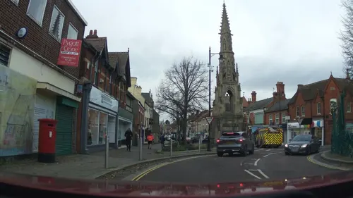
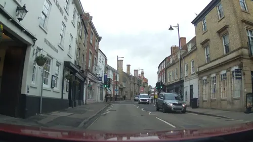
- Mapillary (see each image): photos
- OpenStreetMap contributors (ODbL 1.0): places, airports, map data
- Wikidata (CC0 1.0): elevation, founding date, time zone, website, landmarks and historic places
- Wikimedia Commons (see each image): photos
- Wikipedia (CC BY-SA 4.0): overview and history text
Photo credits
- White Hart Hotel, Sleaford, Lincolnshire, Mick Lobb, CC BY-SA 2.0
- Nine Foot River, Sleaford, Lincolnshire, Mick Lobb, CC BY-SA 2.0
- 10 and 12 Southgate Sleaford UK, David Hallam-Jones, CC BY-SA 2.0
- Bull and Dog public house, Sleaford, Lincolnshire, Mick Lobb, CC BY-SA 2.0
- Cogglesford Mill race and bypass weir, Brunnian, CC BY 3.0
- Quarrington, St Botolph's church - 49697149402, Jules & Jenny, CC BY 2.0
- Sleaford, St Denys, West fassade, -- Rensi 12:54, 28. Dez. 2009 (CET), Public domain
- The Packhorse Inn - Northgate - Sleaford, Noswall59, CC BY-SA 4.0
- Plaque at The White Hart, HodgsonBrothers, CC BY-SA 4.0
- Plaque at the White Hart, Close, HodgsonBrothers, CC BY-SA 4.0
- Street-level photo, southglos, CC BY-SA 4.0
- Street-level photo, southglos, CC BY-SA 4.0
- Street-level photo, sandy_rogers, CC BY-SA 4.0
- Street-level photo, southglos, CC BY-SA 4.0
- Street-level photo, southglos, CC BY-SA 4.0
- Street-level photo, christhecat, CC BY-SA 4.0
- Street-level photo, southglos, CC BY-SA 4.0
- Street-level photo, christhecat, CC BY-SA 4.0
- Street-level photo, southglos, CC BY-SA 4.0
- Street-level photo, christhecat, CC BY-SA 4.0
- Street-level photo, southglos, CC BY-SA 4.0
- Street-level photo, christhecat, CC BY-SA 4.0
- Street-level photo, southglos, CC BY-SA 4.0
- Street-level photo, christhecat, CC BY-SA 4.0
- Street-level photo, christhecat, CC BY-SA 4.0
- Street-level photo, southglos, CC BY-SA 4.0
- Street-level photo, sandy_rogers, CC BY-SA 4.0
- Street-level photo, southglos, CC BY-SA 4.0
- Street-level photo, christhecat, CC BY-SA 4.0
- Street-level photo, southglos, CC BY-SA 4.0
- Street-level photo, christhecat, CC BY-SA 4.0
- Street-level photo, christhecat, CC BY-SA 4.0
- Street-level photo, southglos, CC BY-SA 4.0
- Street-level photo, hodg, CC BY-SA 4.0


Page built November 10, 2026. Spotted a mistake? Tell us or suggest a place.