
Market Deeping, United Kingdom
Market Deeping is a town of 13,574 people in England, United Kingdom.
Why visit Market Deeping
Townapedia lists 5 museums and landmarks, 23 parks and trails, 36 places to eat and 2 places to stay in and around town.
Highlights include Deeping Lakes Nature Reserve.
Weather in Market Deeping
Forecast from MET Norway (CC BY 4.0). Full forecast
About Market Deeping
Market Deeping is a market town and civil parish in the South Kesteven district of Lincolnshire, England, on the north bank of the River Welland and the A15 road. The population of the town at the 2011 census was 6,008.
From the Wikipedia article Market Deeping (this version), under CC BY-SA 4.0.
Museums and landmarks5

Parks, trails and playgrounds23

Deeping Lakes Nature Reserve
Park · 3.1 mi
Nature reserve in Lincolnshire


11 more on the map.
Restaurants and cafes36
The Pack Horse
Bar and pub · Regional · 1.5 mi
4 Lincoln Road, Peterborough
Tu-We 12:00-22:30; Th 12:00-22:30; Fr-Sa 12:00-23:30; Su...



24 more on the map.
Where to stay2

R J Broughton - Bed & Breakfast
Motel and hotel · 0.4 mi
44 Halfleet, Peterborough
History
The name Deeping derives from the Old English dēoping meaning 'deep place'. The town's market has been held since at least 1220.
The town developed around the commercial use of the River Welland, which today is backed onto by many pleasant Georgian stone buildings. The town is part of a group of Lincolnshire villages and hamlets, collectively called the Deepings, which include Deeping Gate, West Deeping, Deeping St James and Langtoft.
The Grade II listed limestone Packhorse Bridge was built in 1651, just after the English Civil War. The bridge was narrow, allowing for single file traffic only. Refuge ledges were built into either side of the bridge for pedestrian safety. A marker on the side of the bridge indicates the level of the water during the floods of 1880. The river was once of great commercial importance, navigable as far as Stamford.
Today the river trade has all but gone and the navigation greatly diminished - its head now terminating at the derelict lock at Deeping St James, just upstream of the Packhorse Bridge. Although no longer navigable for commercial traffic, the river provides pleasant scenic walks. Access to the town from the south nowadays is via a later and wider road bridge with two lanes for traffic and pavements on either side.
Read more of the history
The £10 million four-mile-long (6.4 km) A15 and A16 bypass opened in July 1998, which incorporates a 2.5-mile (4.0 km) stretch of single and dual carriageway. The A16 has now moved to the former A1073 from Crowland to Spalding, and the bypass became the A1175 in October 2011.
From the History section of Market Deeping on Wikipedia, under CC BY-SA 4.0.
More about Market Deeping
Geography
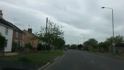
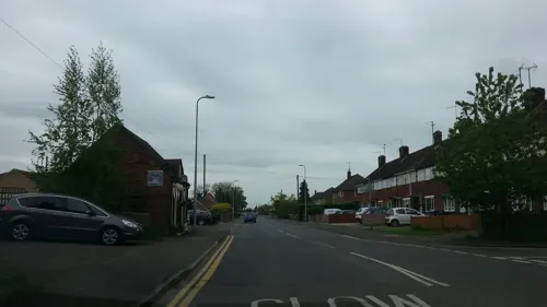
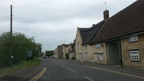
Market Deeping, with 2,462 households, is the largest of The Deepings followed by the large village Deeping St James. The River Welland forms the border with the Peterborough unitary authority area. It is the seventh-lowest-lying town in terms of height above sea level in England. The town is known for its stone buildings dating back to the 17th century, its largely 15th-century church dedicated to St. Guthlac and the remains of a market cross.
Economy
On 1 February 1994 Prince Edward, Duke of Kent visited Park Air Electronics on the Northfields Industrial Estate, accompanied by Sir Henry Nevile, then the Lord Lieutenant of Lincolnshire. This company is now called Park Air Systems, owned by Northrop Grumman. Best of British magazine is based on Market Gate. In July 2010 the Eventus Business Centre was opened on the Northfields Industrial Estate, a purpose-built business centre financed through Lincolnshire County Council.
From the Wikipedia article Market Deeping, under CC BY-SA 4.0.
Notable people from Market Deeping
- Anna WoolhouseBritish sports journalist and presenter
- Ian StrangeEnglish ornithologist
- Eric RobinsonSouth African veterinarian
Born in Market Deeping, according to Wikidata (CC0). Each name links to its Wikipedia article.
Churches and places of worship7
Our Lady of Lincoln and St Guthlac
Church · Roman Catholic · 1.0 mi
Hereward Way, Peterborough
The Deepings Methodist Church
Church · Methodist · 1.0 mi
Church Street, Peterborough
Shopping2
Gas and EV charging2
Schools, colleges and libraries6
William Hildyard Church of England Primary and Nursery School
School · Anglican
Godsey Lane, Peterborough
Healthcare3
Map of Market Deeping
86 places. The map loads OpenStreetMap tiles when you open it.
Getting there and nearby towns
RAF Coningsby (QCY) is the nearest airport with scheduled flights listed in OpenStreetMap, 29 miles away.
- Stamford 7 mi west, about 12 min by car
- Peterborough 8 mi south, about 12 min by car
- Spalding 10 mi northeast, about 17 min by car
- Whittlesey 11 mi southeast, about 18 min by car
- Oakham 17 mi west, about 28 min by car
- March 19 mi southeast, about 31 min by car
- Wisbech 20 mi east, about 32 min by car
- Sleaford 23 mi north, about 36 min by car
- Melton Mowbray 25 mi west, about 40 min by car
- Saint Ives 26 mi southeast, about 42 min by car
Drive times are estimates from straight-line distance, not routes.
Towns near Market Deeping


Keep exploring
Local news
Headlines from INDB.
Reviews, tips and questions
Loading what members have shared...
Sources and licences
- GeoNames (CC BY 4.0): population, coordinates, regions and time zone
- Mapillary (see each image): photos
- OpenStreetMap contributors (ODbL 1.0): places, airports, map data
- Wikidata (CC0 1.0): elevation, founding date, time zone, website, landmarks and historic places
- Wikipedia (CC BY-SA 4.0): overview and history text
Photo credits
- Street-level photo, adam2, CC BY-SA 4.0
- Street-level photo, adam2, CC BY-SA 4.0
- Street-level photo, adam2, CC BY-SA 4.0
- Street-level photo, adam2, CC BY-SA 4.0
- Street-level photo, adam2, CC BY-SA 4.0
- Street-level photo, adam2, CC BY-SA 4.0
- Street-level photo, adam2, CC BY-SA 4.0
- Street-level photo, adam2, CC BY-SA 4.0
- Street-level photo, adam2, CC BY-SA 4.0
- Street-level photo, adam2, CC BY-SA 4.0
Page built November 10, 2026. Spotted a mistake? Tell us or suggest a place.