


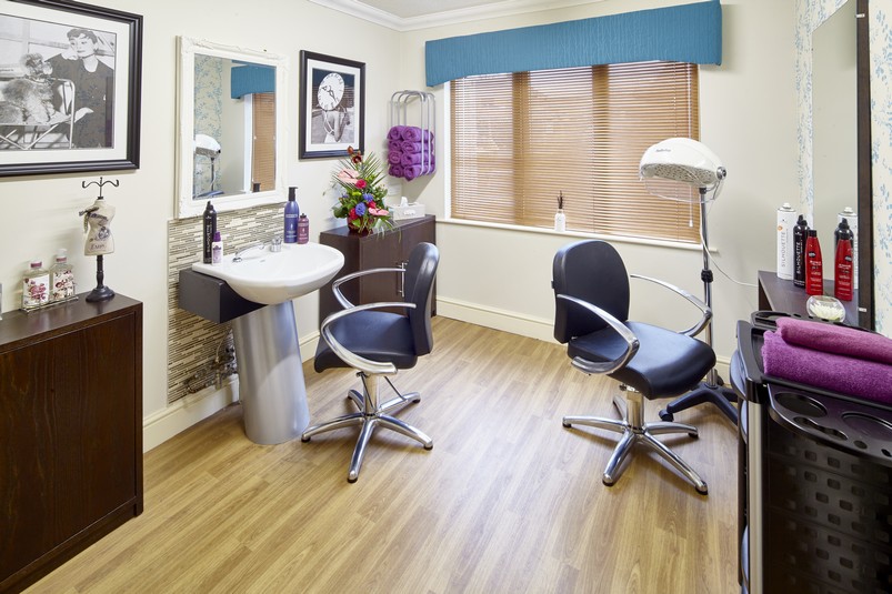
Why visit Corby
Townapedia lists 20 museums and landmarks, 21 parks and trails, 174 places to eat, 12 places to stay and 4 attractions in and around town.
Highlights include Corby Cube, Savoy Corby, Eleanor Cross and Kirby Hall.
Weather in Corby
Forecast from MET Norway (CC BY 4.0). Full forecast
About Corby
Corby is a town and civil parish in the North Northamptonshire district, in Northamptonshire, England, 23 miles (37 km) northeast of Northampton. In 2021, the parish had a population of 62,341, while the wider built-up area had a population of 68,160. From 1974 to 2021, it was the administrative headquarters of the Borough of Corby; at the 2021 census, the former borough had a population of 75,571.
From the Wikipedia article Corby (this version), under CC BY-SA 4.0.
Travel tips from other travellers: Corby on Wikivoyage (CC BY-SA 4.0).
Photos of Corby


Things to do4

Corby Cube
Cinema and theater · 0.9 mi
Council chamber, offices and arts centre complex in Corby, England
George Street, Corby

Museums and landmarks20

Eleanor Cross
Monument and historic site · 4.0 mi
Eleanor Cross: one of a series of twelve stone monuments topped with crosses erected between 1291 and about 1295 in England from Lincoln...


Rockingham Castle
Museum · 1.9 mi
Grade I listed historic house museum in Rockingham, Northamptonshire, England, UK

Boughton House
Museum · 5.0 mi
Grade I listed country house in Weekley, Northamptonshire, England, UK

Deene Park
Museum · 4.2 mi
Country house in Northamptonshire, England, UK

Lyddington Bede House
Museum · 4.7 mi
Grade I listed historic house museum in Lyddington, Rutland, England, UK


Samuel Rowlatt
Monument and historic site · 4.1 mi
Chest tomb of Samuel Rowlatt, circa 10 metres South of Church of St Mary Magdelene
Geddington Cross: Eleanor Cross and Conduit House
Monument and historic site · 4.0 mi
8 more on the map.
Parks, trails and playgrounds21


Barford Wood and Meadows
Park · 4.8 mi
Nature reserve in the United Kingdom

Great Merrible Wood
Park · 5.4 mi
Woodland and nature reserve in Leicestershire, England, United Kingdom

Great Oakley Meadow
Park · 3.0 mi
Nature reserve in the United Kingdom

King's Wood, Corby
Park · 2.2 mi
Nature reserve in Northamptonshire, England

Stoke Wood End Quarter
Park · 2.6 mi
Nature reserve in the United Kingdom




Blackthorn Wood Golf Complex
Golf course · 2.3 mi
Mo-Fr 08:00-20:00; Sa-Su 08:00-18:00; Dec 24 08:00-15:00; Dec...
9 more on the map.
Restaurants and cafes174

Pizza Hut
Restaurant · Pizza · 1.8 mi
8 Charter Court, Corby
Mo-We 15:30-22:30; Th-Sa 11:30-23:00; Su 11:30-22:30


Coach House Cafe and Heritage Centre
Cafe · 3.6 mi
East Carlton Country Park, Market Harborough
Oct-Mar Mo-Su 10:00-15:30; Apr-Sep Mo-Su 10:00-16:30
Costa
Cafe · Coffee Shop · 0.9 mi
1 Willow Place, Corby
Mo-Sa 08:00-17:30; Su 09:00-16:30
162 more on the map.
History
Mesolithic and Neolithic artefacts have been found in the area surrounding Corby and human remains dating to the Bronze Age were found in 1970 at Cowthick. The first evidence of permanent settlement comes from the 8th century when Danish invaders arrived and the settlement became known as "Kori's by" – Kori's settlement. The settlement was recorded in the Domesday Book of 1086 as "Corbei". Corby's emblem, the raven, derives from an alternative meaning of this word. These Danish roots were recognised in the naming of the most southern of the town's housing estates, Danesholme, around which one of the Danish settlements was located.
Corby was granted the right to hold two annual fairs and a market by Henry III in 1226. In 1568 Corby was granted a charter by Elizabeth I that exempted local landowners from tolls (the fee paid by travellers to use the long-distance public roads), dues (an early form of income tax) and gave all men the right to refuse to serve in the local militia. A popular legend is that the Queen was hunting in Rockingham Forest when she (dependent on the legend) either fell from her horse or became trapped in a bog whilst riding. Upon being rescued by villagers from Corby she granted the charter in gratitude for her rescue. Another popular explanation is that it was granted as a favour to her alleged lover Sir Christopher Hatton.
Read more of the history
The Corby Pole Fair is an event that has taken place every 20 years since 1862 in celebration of the charter. The 1942 fair was not held due to the Second World War; it took place five years later. According to a newspaper report dated 14 June 1862 which focuses on the extravagances of the fair, the fugitive slave John Anderson was described as being educated in the Corby British School, giving the town an unusual link to slavery in the United States.
The most recent pole fair was held on Friday, 3 June 2022, to coincide with The Queen's Platinum Jubilee celebrations.
The local area has been worked for iron ore since Roman times. An ironstone industry developed in the 19th century with the coming of the railways and the discovery of extensive ironstone beds. By 1910 an ironstone works had been established. In 1931 Corby was a small village with a population of around 1,500. It grew rapidly into a reasonably sized industrial town, when the owners of the ironstone works, the steel firm Stewarts & Lloyds, decided to build a large integrated ironstone and steel works on the site. The start of construction in 1934 drew an inflow of population, including Scottish and Irish labourers. The first steel was produced in October 1935 and for decades afterwards the steel works dominated the town. By 1939 the population had grown to around 12,000, at which time Corby was thought to be the largest "village" in the country, but it was at that point that Corby was re-designated an urban district (see the Local Government section below).
During the Second World War the Corby steelworks were expected to be a target for German bombers but in the event there were only a few bombs dropped by solitary planes and there were no casualties. This may be because the whole area was blanketed in huge dense black, low-lying clouds created artificially by the intentional burning of oil and latex to hide the glowing Bessemer converter furnaces at the steelworks from German bomber crews. The only known remaining scars from German attacks can be found in the form of bullet holes visible on the front fascia of the old post office in Corby village. The Corby steelworks made a notable contribution to the war effort by manufacturing the steel tubes used in Operation Pluto (Pipe Line Under the Ocean) to supply fuel to Allied forces on the European continent.
In 1950, with a population of 18,000, Corby was designated a New Town with William Holford as its architect. By 1951, he prepared the development plan with a car oriented layout and many areas of open space and woodland. In 1952, Holford produced the town centre plan and in 1954 the layout for the first 500 houses. The town now underwent its second wave of expansion, mainly from Scotland. Corby is famous for its Scottish heritage based on decades of incoming steel workers and was for a time known locally as "Little Scotland".
In 1967 the British steel industry was nationalised and the Stewarts & Lloyds steel tube works at Corby became part of British Steel Corporation. The Government approved a ten-year development strategy with expenditure of £3,000 million from 1973 onwards, the objective of which was to convert BSC from a large number of small scale works, using largely obsolete equipment, to a far more compact organisation with highly competitive plant. Steelmaking was to be concentrated in five main areas: South Wales, Sheffield, Scunthorpe, Teesside, and Scotland, most of which are coastal sites with access to economic supplies of iron-rich imported ores.
It was not until 1975 that a closure programme was agreed upon after a 14-month review by Lord Beswick, then Minister of State for Industry. Corby was not one of the Beswick plants named to close in the review. By this time BSC was plunging into loss and important parts of the investment programme were held back. The European Union's Davignon Plan had also asked for steel capacity in Europe to be significantly reduced.
In May 1979, the new Conservative government minister, Sir Keith Joseph, announced the closure of Corby Steelworks. By the end of 1981 more than 5,000 jobs had been lost from British Steel in Corby, and further cuts took the total loss to 11,000, leading to an unemployment rate of over 30%. Steel tube making continued, however, initially supplied with steel by rail from Teesside and later from South Wales.
The title track of Steeltown by Big Country is about the loss of jobs in Corby.
The ensuing redevelopment of the location of the former Corby Steelworks led to the Corby toxic waste case.
From the History section of Corby on Wikipedia, under CC BY-SA 4.0.
More about Corby
Geography
Corby is 72 miles (116 km) north-northwest of London, 23 miles (37 km) northeast of Northampton, 28 miles (45 km) southeast of Leicester, 51 miles (82 km) east of Birmingham and 19 miles (31 km) west of Peterborough, its nearest city.
The built up area of Corby had a population of 56,810 in 2011 compared with 61,255 for the Borough of Corby. The urban area had an area of 20.5 km2 compared with 80.3 km2 for the larger borough. Corby is expanding rapidly, with the borough having a population of 53,400 in 2001 and increasing to 61,300 in 2011. The expansion has resulted in villages like Great Oakley and Weldon being absorbed into the town's urban area. However, the latter remains a parish, being separated from the rest of Corby by the A43.
Most of Corby's population live in the town itself, however in terms of area it is mostly rural. This list includes the villages within the borough but also districts of the urban area and modern housing developments. The borough of Corby is made up of 11 wards following a boundary change after the 2011 census.
From the Wikipedia article Corby, under CC BY-SA 4.0.
Notable people from Corby
 Emma KennedyEnglish actressPhoto: Loz Pycock from London, UK, CC BY-SA 2.0
 Stuart CampbellBritish footballer (born 1977)Photo: Hayden Schiff from Cincinnati, USA, CC BY 2.0
- Brendan CoyleBritish and Irish actor
- Billy McKayBritish footballer (born 1988)
- James AshworthEnglish soldier and Victoria Cross recipient (1989-2012)
- Phil ChardEnglish footballer and manager (born 1960)
- Paul FerrisBritish actor (1941-1995)
- Douglas Samuel JonesBritish mathematician (1922–2013)
- Dick GrahamEnglish footballer (1922–2013)
- Norman DeanEnglish footballer (born 1944)
- Gerard LavinFootballer (born 1974)
- Mark SteeleEnglish cricketer (born 1976)
Born in Corby, according to Wikidata (CC0). Each name links to its Wikipedia article.
Where to stay12
Best Western Rockingham Forest Hotel
Motel and hotel · 1.3 mi
Rockingham Road, Corby
Churches and places of worship61
Shopping31
Gas and EV charging10
Schools, colleges and libraries37
Brigstock Latham's Church of England Primary School
School · Anglican · 4.2 mi
Latham Street, Kettering
Cottingham Church of England Primary School
School · Anglican · 3.0 mi
Berryfield Road, Market Harborough
Healthcare16
Mr Pickford's Express Pharmacy
Clinic and pharmacy · 0.8 mi
2 Spencer Court, Corby
Map of Corby
250 places. The map loads OpenStreetMap tiles when you open it.
Getting there and nearby towns
Sywell Aerodrome (ORM) is the nearest airport with scheduled flights listed in OpenStreetMap, 14 miles away.
- Kettering 7 mi south, about 11 min by car
- Desborough 7 mi southwest, about 11 min by car
- Market Harborough 10 mi west, about 16 min by car
- Oakham 12 mi north, about 19 min by car
- Wellingborough 13 mi south, about 22 min by car
- Stamford 14 mi northeast, about 22 min by car
- Rushden 15 mi south, about 24 min by car
- Wigston Magna 18 mi west, about 29 min by car
- Northampton 19 mi southwest, about 30 min by car
- Peterborough 19 mi east, about 31 min by car
Drive times are estimates from straight-line distance, not routes.
Towns near Corby


Keep exploring
Local news
Headlines from INDB.
Reviews, tips and questions
Loading what members have shared...
Sources and licences
- GeoNames (CC BY 4.0): population, coordinates, regions and time zone
- Mapillary (see each image): photos
- OpenStreetMap contributors (ODbL 1.0): places, airports, map data
- Wikidata (CC0 1.0): elevation, founding date, time zone, website, landmarks and historic places
- Wikimedia Commons (see each image): photos
- Wikipedia (CC BY-SA 4.0): overview and history text
Photo credits
- Corby skyline, Tom walker, CC BY 3.0
- Corby, UK - panoramio (28), Dmitrij M, CC BY 3.0
- Corby, UK - panoramio (27), Dmitrij M, CC BY 3.0
- Glenmoor House Residential Care Home Corby, Avery Healthcare, CC BY-SA 4.0
- Glenmoor House Care Home Corby, Avery Healthcare, CC BY-SA 4.0
- Glenmoor House Care Home Corby 28, Avery Healthcare, CC BY-SA 4.0
- Glenmoor House Care Home Corby 18, Avery Healthcare, CC BY-SA 4.0
- Glenmoor House Care Home Corby 67, Avery Healthcare, CC BY-SA 4.0
- Glenmoor House Care Home Corby 40, Avery Healthcare, CC BY-SA 4.0
- Glenmoor House Care Home Corby 12, Avery Healthcare, CC BY-SA 4.0
- Corby Cube, Cj1340, CC BY-SA 3.0
- Rockingham Castle entrance, Brian Coleman, CC BY-SA 2.0
- Deene Park Northamptonshie, Julian Dowse, CC BY-SA 2.0
- Lyddington Bede House, Julian Dowse, CC BY-SA 2.0
- Barford Wood and Meadows 4, Dudley Miles, CC BY-SA 4.0
- Great Merrible Wood 5, Dudley Miles, CC BY-SA 4.0
- Great Oakley Meadow ridge and furrow, Dudley Miles, CC BY-SA 4.0
- Stoke Wood End Quarter 3, Dudley Miles, CC BY-SA 4.0
- Tailby Meadow 3, Dudley Miles, CC BY-SA 4.0
- The Plens 7, Dudley Miles, CC BY-SA 4.0
- BISBROOKE,RUTLAND, Dave, CC BY-SA 2.0
- King's Wood, Corby 2, Dudley Miles, CC BY-SA 4.0
- Corby Business Academy Front, eboaden, CC BY-SA 4.0
- Geddington Eleanor cross, Lofty at English Wikipedia, CC BY 2.5
- Seagrave House Care Home, Avery Healthcare, CC BY-SA 4.0
- Kirby Hall 1, Admiralgary, CC BY-SA 4.0
- Boughton House, Philip Halling, CC BY-SA 2.0
- Summer Finlay WCMX Adrenaline Alley (Blue Peter Filming), SummersStory, CC BY-SA 4.0
- Street-level photo, southglos, CC BY-SA 4.0
- Street-level photo, adam2, CC BY-SA 4.0
- Street-level photo, adam2, CC BY-SA 4.0
- Street-level photo, adam2, CC BY-SA 4.0
- Street-level photo, adam2, CC BY-SA 4.0
- Street-level photo, adam2, CC BY-SA 4.0
- Street-level photo, adam2, CC BY-SA 4.0
- Street-level photo, southglos, CC BY-SA 4.0
- Street-level photo, adam2, CC BY-SA 4.0
- Street-level photo, southglos, CC BY-SA 4.0


Page built November 10, 2026. Spotted a mistake? Tell us or suggest a place.