


Why visit Cove
Townapedia lists 7 museums and landmarks, 11 parks and trails, 7 places to eat, 2 places to stay and 10 attractions in and around town.
Highlights include Bridge of Dee, Girdleness Lighthouse, Aberdeen Art Gallery and Aberdeen Maritime Museum.
Weather in Cove
Forecast from MET Norway (CC BY 4.0). Full forecast
About Cove
Cove Bay, or simply Cove, is a suburb on the south-east edge of Aberdeen, Scotland.
From the Wikipedia article Cove Bay (this version), under CC BY-SA 4.0.
Things to do10


Girdleness Lighthouse
Lighthouse · 3.0 mi
Lighthouse in Aberdeen, Scotland, UK

King George VI Bridge
Bridge · 2.2 mi
Arch bridge in Aberdeen, Scotland, UK, carries the B9077 road across River Dee

Music Hall Aberdeen
Cinema and theater · 3.2 mi
Arts venue in Aberdeen, Scotland, UK

Queen Elizabeth Bridge
Bridge · 2.5 mi
Bridge in Aberdeen, Scotland, UK, carries the A956 road across River Dee

Queen Victoria Bridge
Bridge · 2.8 mi
Bridge in Aberdeen City, Scotland, UK, carries a minor road across River Dee

Tivoli Theatre, Aberdeen
Cinema and theater · 3.2 mi
Theatre in Aberdeen, Scotland, UK

Union Bridge, Aberdeen
Bridge · 3.2 mi
Road bridge in Aberdeen, Scotland, UK, carries Union Street across Denburn Road and the Aberdeen-Inverness railway line
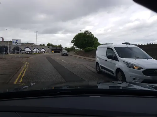
Wellington Suspension Bridge
Bridge · 2.5 mi
Suspension bridge in Aberdeen, Scotland

Museums and landmarks7

Aberdeen Art Gallery
Museum · 3.4 mi
Local Authority Museum in Scotland, United Kingdom

Aberdeen Maritime Museum
Museum · 3.2 mi
Local Authority Museum in Scotland, United Kingdom

Lang Stane, Aberdeen
Monument and historic site · 3.2 mi
Menhir in Aberdeen, Scotland, UK

Provost Skene's House
Museum · 3.4 mi
House museum in Aberdeen, Scotland, United Kingdom

Tolbooth Museum
Museum · 3.3 mi
Museum in Aberdeen, Scotland, United Kingdom

Oscar - Canmore 206146
Monument and historic site · 3.0 mi
Shipwreck off the Scottish coast
Parks, trails and playgrounds11


Rubislaw and Queens Terrace Gardens
Park · 3.2 mi
Park in Aberdeen City, Scotland, UK

Union Terrace Gardens
Park · 3.3 mi
Park in Aberdeen City, Scotland, UK





Restaurants and cafes7
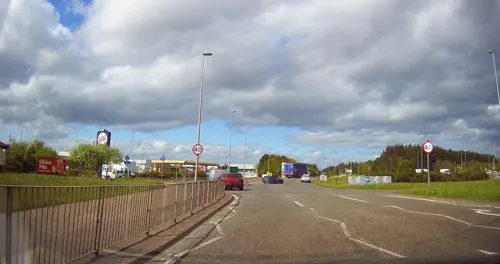


The Snooty Fox
Bar and pub
Loirston Avenue, Aberdeen
Mo-We 12:00-22:00, Th 12:00-23:00, Fr 12:00-01:00, Sa 11:00-01:00,...

Sea Salt and Sole
Fast food · Fish And Chips · 0.5 mi
81 Charleston Road North, Aberdeen
History
Cove Bay is situated to the east of the ancient Causey Mounth, which road was built on high ground to make passable this only available medieval route from coastal points south from Stonehaven to Aberdeen. This ancient trackway specifically connected the River Dee crossing (where the Bridge of Dee is located) via Portlethen Moss, Muchalls Castle and Stonehaven to the south. The route was that taken by William Keith, 7th Earl Marischal and the Marquess of Montrose, who led a Covenanter army of 9000 men in the battle of the Civil War in 1639.
Historically in the extreme north-east corner of Kincardineshire, until 1975 it was governed from the county town of Stonehaven, when it was added to the City of Aberdeen district. Though simply referred to as Cove, in the 19th and early 20th centuries it was known as The Cove, becoming Cove Bay around 1912.
Cove Bay railway station opened in 1850 and operated until 1956 for passengers and 1964 for goods. The line remains in use and is now part of the Dundee–Aberdeen line.
St Mary's Church was opened in 1864, and also served as the local boys' school until the 1890s when Cove School was built nearby. Cove School closed in 1981, when the newer Loirston Primary School was opened, becoming a community centre known as Loirston Annexe.
Read more of the history
In 2019, 5 cairns were erected with information plaques detailing the history of Cove Bay and Altens as a farming community. This was made possible with a donation from the late Margaret Allan, whose family occupied the Mains of Loirston farm, and latterly Sergent's Croft.
Cove has been noted for industries such as granite, which was quarried in several locations to the south of the village. Owing to its close-grained texture, Cove granite was one of the hardest in north-east Scotland and proved highly resistant to frost, making it ideal for causeway stones used in the construction of roads. It was widely exported to cities in England, including Billingsgate Market in London.
The village itself sprung up around the fishing industry, with the boats berthed on a shingle beach, a gap in the rocks that afforded a natural harbour. During this time, it is estimated that approximately 300 people lived in the area. In the mid 19th century the fishing was at its height, which, over years, has included cod, haddock, salmon, herring and shellfish. The piers and breakwater were constructed in 1878.At present only a couple of boats pursue shellfish on a part-time basis.
The Annual Reports of the Fishery Board for Scotland provide an insight into the fishing in Cove in the years before the First World War. The summary for 1900 also applies to Downies and Portlethen: "These three fishing villages, almost solely dependent on the line fishing, are unfortunately falling behind. The combinded catch, when compared with the preceding year, shows a decline of 803 Cwts and £503. Fish are scarce on the inshore grounds and small generally. As at best the men are now only making a precarious living, they are gradually leaving the villages and taking up residence in Aberdeen. The fishermens's wives, who hawk the fish, are amiable helpmates in the struggle. Cove harbour and several of the boats there were wrecked in the gale of February. Since then the harbour has been repaired. Fishing goes on in a small way, but the prospects are anything but bright."
Cove Bay harbour has been the centre of a legal battle between a local landowner, who purchased part of the harbour in 2001, and the local fishermen who use the harbour. Attempts were made by the landowner to get the fishermen to remove their boats, as the shore was now considered private land meaning the fishermen could no longer store their equipment and boats on the shore. This legal battle ended in 2018, with the landowner succeeding. Public right of way for vehicles and pedestrians is maintained down Balmoral Terrace, leading to the harbour, and the pier itself.
In 2019, many of the remaining boats on the shore and the storage shed were set ablaze in what was thought to be a deliberate arson attack.
Between 1894 and 1937, Cove also housed a fishmeal factory, the Aberdeen Fish Meal Factory, which was located at the edge of the cliffs. It produced quality manure which was exported to both Europe and America. It became locally known as "the stinker" because of the processing odour, which was highlighted by the Aberdeen entertainer Harry Gordon in a parody entitled A Song of Cove.
From the History section of Cove Bay on Wikipedia, under CC BY-SA 4.0.
More about Cove
Education
Cove has two primary schools, Charleston Primary School (opened 2001) and Loirston Primary School (opened 1981). Most secondary pupils attend the nearby Lochside Academy, but some choose to go to Portlethen Academy. Charleston Primary school also contains a nursery. There is also a private nursery located next to Catto Park.
From the Wikipedia article Cove Bay, under CC BY-SA 4.0.
Where to stay2
Churches and places of worship12
St Peter's Roman Catholic Church, 2 Chapel Court, Aberdeen
Church · 3.4 mi
Shopping2
Gas and EV charging5
Schools, colleges and libraries7
Healthcare1
Map of Cove
64 places. The map loads OpenStreetMap tiles when you open it.
Getting there and nearby towns
Aberdeen International Airport (ABZ) is the nearest airport with scheduled flights listed in OpenStreetMap, 8 miles away.
- Aberdeen 3 mi north, about 5 min by car
- Portlethen 3 mi southwest, about 5 min by car
- Cults 3 mi west, about 5 min by car
- Newtonhill 5 mi southwest, about 8 min by car
- Milltimber 6 mi west, about 10 min by car
- Peterculter 7 mi west, about 11 min by car
- Dubford 7 mi north, about 12 min by car
- Westhill 8 mi northwest, about 13 min by car
- Stonehaven 11 mi southwest, about 17 min by car
- Newmacher 12 mi north, about 19 min by car
Drive times are estimates from straight-line distance, not routes.
Towns near Cove


Keep exploring
Local news
Headlines from INDB.
Reviews, tips and questions
Loading what members have shared...
Sources and licences
- GeoNames (CC BY 4.0): population, coordinates, regions and time zone
- Mapillary (see each image): photos
- OpenStreetMap contributors (ODbL 1.0): places, airports, map data
- Wikidata (CC0 1.0): elevation, founding date, time zone, website, landmarks and historic places
- Wikimedia Commons (see each image): photos
- Wikipedia (CC BY-SA 4.0): overview and history text
Photo credits
- DSCN3771 Cove Bay Hotel, AlasdairW, CC BY-SA 4.0
- Bridge of Dee Aberdeen, Peter Ward, CC BY-SA 2.0
- Girdle Ness Lighthouse (13795233863), Alan Jamieson from Aberdeen, Scotland, CC BY 2.0
- King George VI Bridge, User:Peartree85, CC BY-SA 3.0
- Victoria Bridge, Chadlongstaff at English Wikipedia, Public domain
- The Tivoil, Guild St, Aberdeen, Scotland, Ragazzi99, CC BY-SA 3.0
- Union Bridge, Aberdeen, Lucas Kendall, CC BY-SA 2.0
- Aberdeen Art Gallery (53533915342), Tom Parnell from Scottish Borders, Scotland, CC BY-SA 2.0
- Provost Skene's House, Ryan Mitchell, CC BY-SA 4.0
- 18th Jan 2014 - Tolbooth Museum, Ragazzi99, CC BY-SA 3.0
- Duthie Park - Winter Gardens, The original uploader was PMJ at English Wikipedia ., CC BY-SA 3.0
- Rubislaw Terrace Gardens, UltrasonicMadness, CC BY-SA 4.0
- Union Terrace Gardens, June 2026, Lucas Kendall, CC BY-SA 4.0
- Gilcomston Church, Aberdeen, Lucas Kendall, CC BY-SA 2.0
- Greyfriars (John Knox) Kirk, Broad Street, Aberdeen, AberdeenBill, CC BY-SA 3.0
- Holburn West Church, CCMCB, CC BY-SA 4.0
- Queen's Cross, Colin Smith, CC BY-SA 2.0
- St John's Episcopal Church - panoramio, T. Thielemans, CC BY 3.0
- St Mary's Cathedral, Aberdeen 2025, Lucas Kendall, CC BY-SA 2.0
- Aberdeen St Nicholas Kirk, Ikiwaner, CC BY-SA 3.0
- Triple Kirk's Public House, 69 Schoolhill, Aberdeen, Watty62, CC BY-SA 4.0
- Plaza at The Robert Gordon University 2, Jackofhearts101, CC BY-SA 3.0
- Interior of The Music Hall, Aberdeen, Ian Watt, CC BY-SA 4.0
- Queen Elizabeth Bridge, watty62, CC BY-SA 4.0
- Outside Aberdeen Maritime Museum (172014), Tore Sætre, CC BY-SA 4.0
- Lang stane Aberdeen, Bobbacon, Public domain
- Street-level photo, tallguy, CC BY-SA 4.0
- Street-level photo, StreetSnaps, CC BY-SA 4.0
- Street-level photo, smsm1, CC BY-SA 4.0
- Street-level photo, tallguy, CC BY-SA 4.0
- Street-level photo, toho, CC BY-SA 4.0
- Street-level photo, smsm1, CC BY-SA 4.0
- Street-level photo, toho, CC BY-SA 4.0
- Street-level photo, toho, CC BY-SA 4.0
- Street-level photo, StreetSnaps, CC BY-SA 4.0
- Street-level photo, StreetSnaps, CC BY-SA 4.0
- Street-level photo, StreetSnaps, CC BY-SA 4.0
- Street-level photo, tallguy, CC BY-SA 4.0


Page built November 10, 2026. Spotted a mistake? Tell us or suggest a place.