


Why visit Crieff
Townapedia lists 20 museums and landmarks, 9 parks and trails, 36 places to eat, 11 places to stay and 7 attractions in and around town.
Highlights include Falls of Barvick, Falls of Monzie, Glenturret Distillery Visitor Centre and Crieff Visitor Centre.
Weather in Crieff
Forecast from MET Norway (CC BY 4.0). Full forecast
About Crieff
Crieff ( ; Scottish Gaelic: Craoibh, meaning "tree") is a Scottish market town in Perth and Kinross on the A85 road between Perth and Crianlarich, and the A822 between Greenloaning and Aberfeldy. The A822 joins the A823 to Dunfermline. It had a population of 7,142 in 2022.
From the Wikipedia article Crieff (this version), under CC BY-SA 4.0.
Travel tips from other travellers: Crieff on Wikivoyage (CC BY-SA 4.0).
Things to do7

Falls of Barvick
Waterfall · 2.1 mi
Waterfall in Perth and Kinross, Scotland, UK
Falls of Monzie
Waterfall · 3.2 mi
Waterfall in Perth and Kinross, Scotland, UK
Falls of Turret
Waterfall · 2.3 mi
Waterfall in Perth and Kinross, Scotland, UK

Museums and landmarks20

Glenturret Distillery Visitor Centre
Monument and historic site · 1.3 mi
The Hosh, Crieff
Mo-Su 10:00-17:00

8 more on the map.
Parks, trails and playgrounds9



Restaurants and cafes36

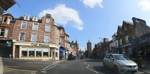
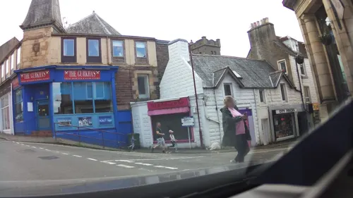
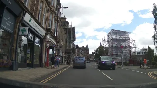
The Thai Esan
Restaurant · Thai
7 James Square, Creiff
Mo-Tu off; We-Su 16:00-21:00
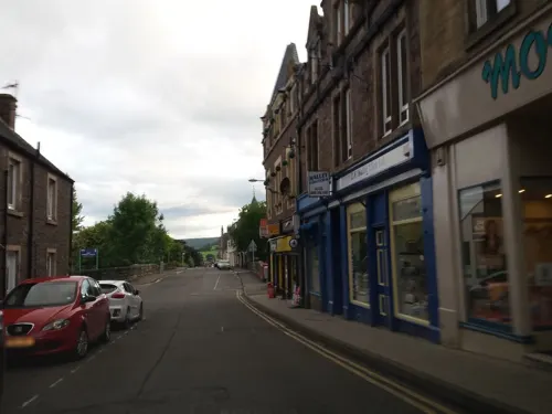
Ellies Cellar
Brewery and winery
8 James Square, Crieff
Mo-Sa 10:00-22:00; Su 12:30-22:00

Damsel Bakery
Bakery
Neighbourhood bakery serving freshly made sourdough breads, pastries, and quality coffee to go.
5 West High Street, Crieff
Th-Su 08:00-15:00

24 more on the map.
History
For centuries Highlanders came to Crieff to sell their black cattle, whose meat and hides were sought by the growing urban populations in Lowland Scotland and the north of England. The town acted as a gathering point for the Michaelmas cattle sale held during the "October Tryst" each year, when the surrounding fields and hillsides would be black with some 30,000 cattle, some from as far away as Caithness and the Outer Hebrides.
Rob Roy MacGregor and his followers visited Crieff in October 1714: they gathered in Crieff for the October Tryst. They marched to Crieff Town Square and, in front of the gathering crowd, sang Jacobite songs and drank loyal toasts to their uncrowned King James VIII.
Read more of the history
In 1716, 350 Highlanders returning from the Battle of Sheriffmuir burned most of Crieff to the ground. In 1731, James Drummond, 3rd Duke of Perth, laid out the town's central James Square and established a textile industry with a flax factory. In the 1745 rising, the Highlanders were itching to fire the town again and were reported as saying "she shoud be a braw toun gin she haed anither sing". It was saved by the Duke of Perth, a friend and supporter of Prince Charles. In February 1746, the Jacobite army was quartered in and around the town, with Prince Charles Edward Stuart holding his final war council in the old Drummond Arms Inn in James Square, located behind the present abandoned hotel building in Hill Street.
By the late 18th century, the hanging tree used by the Earls of Strathearn to punish criminals had been replaced by a wooden structure in an area called Gallowhaugh, now Gallowhill, at the bottom of Burrell Street. What is now Ford Road was Gallowford Road which led down past the gallows to the crossing point over the River Earn. Sir Walter Scott, visiting Crieff in 1796, saw the gallows as "Gallowsford".
Crieff Town Hall was completed in 1850. In the 19th century, Crieff became a fashionable destination for tourists visiting the Highlands and a country retreat for wealthy businessmen from Edinburgh, Glasgow and beyond. Many such visitors attended the Crieff hydropathic establishment, now the Crieff Hydro, which opened in 1868.
Crieff was once served by Crieff railway station, which linked the town to Perth, Comrie and Gleneagles. The station was opened in 1856 by the Crieff Junction Railway but was closed in 1964 by British Railways as part of the Beeching cuts.
From the History section of Crieff on Wikipedia, under CC BY-SA 4.0.
Notable people from Crieff
 Denis LawsonScottish actor (born 1947)Photo: Kevin Paul, CC BY 4.0
 Thomas ThomsonScottish chemist (1773-1852)Photo: Unknown author, Public domain
 George MurrayBritish Army general, politician and colonial administrator (1772-1846)Photo: John Hoppner, Public domain
 William WrightBritish physician, botanist and slave owner (1735-1819)Photo: Unknown author, Public domain
 Daniel John CunninghamScottish anatomistPhoto: Unknown author Unknown author, Public domain
 David JacksAmerican businessman (1822-1909)Photo: I.W. Taber, Public domain
 Alexander DowBritish orientalist and writer; (1735-1779)Photo: Joshua Reynolds, Public domain
- Gavin StrangScottish politician (born 1943)
- Sophie StewartBritish actress (1908–1977)
- Alexander MurrayScottish geologist immigrated in Canada (1810-1884)
- Jim MacLarenFootballer (1921-2004)
- George William Thomson OmondScottish advocate and writer
Born in Crieff, according to Wikidata (CC0). Each name links to its Wikipedia article.
Where to stay11
Churches and places of worship9
Innerpeffray Collegiate Church of the Blessed Virgin
Church · 3.0 mi
Crieff Seventh-day Adventist Church
Church · Seventh Day Adventist · 0.5 mi
Gwydyr Road, Crieff
Shopping15
Schools, colleges and libraries8
Healthcare4
Map of Crieff
119 places. The map loads OpenStreetMap tiles when you open it.
Getting there and nearby towns
Perth Airport (PSL) is the nearest airport with scheduled flights listed in OpenStreetMap, 19 miles away.
- Methven 10 mi east, about 17 min by car
- Almondbank 13 mi east, about 20 min by car
- Dunblane 14 mi south, about 22 min by car
- Doune 15 mi southwest, about 24 min by car
- Perth 16 mi east, about 25 min by car
- Tillicoultry 16 mi south, about 25 min by car
- Dollar 16 mi southeast, about 26 min by car
- Sauchie 17 mi south, about 28 min by car
- Stirling 18 mi south, about 29 min by car
- Alloa 18 mi south, about 29 min by car
Drive times are estimates from straight-line distance, not routes.
Towns near Crieff


Keep exploring
Local news
Headlines from INDB.
Reviews, tips and questions
Loading what members have shared...
Sources and licences
- GeoNames (CC BY 4.0): population, coordinates, regions and time zone
- Mapillary (see each image): photos
- OpenStreetMap contributors (ODbL 1.0): places, airports, map data
- Wikidata (CC0 1.0): elevation, founding date, time zone, website, landmarks and historic places
- Wikimedia Commons (see each image): photos
- Wikipedia (CC BY-SA 4.0): overview and history text
Photo credits
- Crieff Hydro - general view from SE, Tom Parnell, CC BY-SA 4.0
- The grave of Thomas Morison, St Cuthberts, Edinburgh, Stephencdickson, CC BY-SA 4.0
- Glenturret, Garrit, CC BY-SA 3.0
- Hydropathic, Creiff, (i.e., Crieff), Scotland, Photochrom Print Collection, Public domain
- Street-level photo, southglos, CC BY-SA 4.0
- Street-level photo, rudolfmayer, CC BY-SA 4.0
- Street-level photo, rudolfmayer, CC BY-SA 4.0
- Street-level photo, southglos, CC BY-SA 4.0
- Street-level photo, southglos, CC BY-SA 4.0
- Street-level photo, hobgoblin, CC BY-SA 4.0
- Street-level photo, southglos, CC BY-SA 4.0
- Street-level photo, southglos, CC BY-SA 4.0
- Street-level photo, southglos, CC BY-SA 4.0
- Street-level photo, hobgoblin, CC BY-SA 4.0
- Street-level photo, southglos, CC BY-SA 4.0
- Street-level photo, rudolfmayer, CC BY-SA 4.0
- Street-level photo, hobgoblin, CC BY-SA 4.0
- Street-level photo, southglos, CC BY-SA 4.0
- Street-level photo, rudolfmayer, CC BY-SA 4.0
- Street-level photo, rudolfmayer, CC BY-SA 4.0
- Street-level photo, hobgoblin, CC BY-SA 4.0
- Street-level photo, hobgoblin, CC BY-SA 4.0
- Street-level photo, hobgoblin, CC BY-SA 4.0
- Street-level photo, rudolfmayer, CC BY-SA 4.0
- Street-level photo, southglos, CC BY-SA 4.0
- Street-level photo, rudolfmayer, CC BY-SA 4.0
- Street-level photo, southglos, CC BY-SA 4.0
Page built November 10, 2026. Spotted a mistake? Tell us or suggest a place.