


Dunblane, United Kingdom
Dunblane is a town of 9,310 people in Scotland, United Kingdom.
Why visit Dunblane
Townapedia lists 11 museums and landmarks, 7 parks and trails, 13 places to eat, 4 places to stay and 2 attractions in and around town.
Highlights include Kinbuck Bridge, Macrobert Arts Centre, Dunblane Museum and Leighton Library.
Weather in Dunblane
Forecast from MET Norway (CC BY 4.0). Full forecast
About Dunblane
Dunblane (, Scottish Gaelic: Dùn Bhlàthain) is a historic cathedral town in the council area of Stirling, in central Scotland; it is inside the historic boundaries of the county of Perthshire. It is a commuter town, with many residents making use of good transport links to much of the Central Belt, including Glasgow and Edinburgh.
From the Wikipedia article Dunblane (this version), under CC BY-SA 4.0.
Travel tips from other travellers: Dunblane on Wikivoyage (CC BY-SA 4.0).
Photos of Dunblane


Things to do2

Kinbuck Bridge
Bridge · 2.6 mi
Bridge in Stirling, Scotland, UK, carries the B8033 road across Allan Water

Macrobert Arts Centre
Cinema and theater · 3.1 mi
Arts centre of the University of Stirling, Scotland, UK
Museums and landmarks11

Dunblane Museum
Museum
Museum in Dunblaine, Stirling, Scotland, United Kingdom
Apr 01-Oct 15 Mo-Sa 10:15-16:30; Su off



Parks, trails and playgrounds7

Blair Drummond Safari and Adventure Park
Park · 3.3 mi
Zoo in Stirling, Scotland, UK


Restaurants and cafes13
Beech Tree Cafe
Cafe · Coffee Shop, Sandwich, Regional, Breakfast
2 Beech Road, Dunblane
Mo-Fr 08:00-16:30; Sa 09:00-17:00; Su off
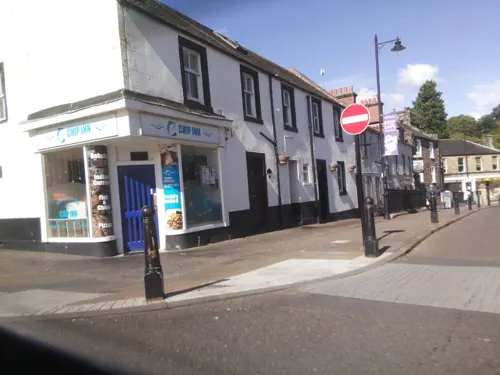
Artiz
Fast food · Pizza
6 Stirling Road, Dunblane
Th,Su 17:00-20:00; Fr 15:00-21:00; Sa 16:00-21:30; Mo-We off
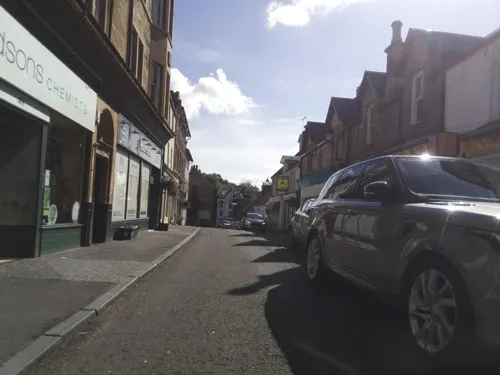



New Palace Chinese Takeaway
Fast food · Chinese
Mo-Tu off; We-Th,Su 16:30-22:00; Fr-Sa 16:30-23:00
1 more on the map.
History
The earliest evidence for Christianity on the site are two cross-slabs of the 10th to 11th centuries which are preserved in the cathedral. Incorporated into the later medieval building, but originally free-standing, is an 11th-century bell-tower, whose height was increased in the 15th century. The nave and aisleless choir date from the 13th century.
Dunblane did not have a rich or extensive medieval diocese (37 parishes), and so the cathedral is relatively modest in scale, but its refined architecture is much admired, as is its setting overlooking the valley of the Allan Water. After the Reformation, the nave of the cathedral was abandoned and soon became roofless and used for burials. The choir was retained as the parish church.
In 1715, the Battle of Sherriffmuir was fought on land very close to Dunblane. Many combatants were billeted in the town before the battle.
Dunblane railway station opened in 1848, as a stop on the Scottish Central Railway's Stirling to Perth line; it later served as a junction with another line to Callander that eventually reached Oban. This line was closed in 1965 during the Beeching axe.
During the boom years of the Hydropathy movement in the 19th century, Dunblane was the location of a successful hydropathic establishment. The nave of the cathedral was re-roofed between 1889 and 1893, with new furnishings provided by Robert Rowand Anderson.
Read more of the history
Since the early 1970s the town has grown extensively and is now regarded as a highly sought-after commuter town due to its excellent road and rail links and good schools. Dunblane is close to the University of Stirling's campus at Bridge of Allan and is a popular location for academics.
On 13 March 1996, local man Thomas Hamilton shot dead 16 children and their teacher, Gwen Mayor, in Dunblane Primary School's gymnasium before killing himself. He used his licensed weapons and ammunition.
There is a memorial to the 17 victims in the local cemetery and a cenotaph in the cathedral. There are also stained-glass windows in Church of the Holy Rude, St Blanes and Lecropt tempering the Children and their Teacher. The funds raised in the aftermath of the tragedy were used to build a new community centre (the Dunblane Centre). Following the incident, the government passed legislation banning ownership of most handguns—firearms under 60 centimetres (23.6 in) in overall length, in the United Kingdom.
Tennis players Jamie Murray and Andy Murray were in the school at the time of the massacre.
From the History section of Dunblane on Wikipedia, under CC BY-SA 4.0.
More about Dunblane
Education
Dunblane Primary School is on Doune Road, on the western side of Dunblane. The school has a large playing field (with a basketball court), regularly used for extra-curricular activities and by local clubs. A council-run nursery is attached to the school, in a separate building. As of 2022, it is the second largest primary school in Stirling Council with 395 students. In 1996, the school's gym was the scene of the Dunblane massacre. The school reopened within days, and the old gym was quickly demolished and replaced with an extension at the other end of the building. The former gym site became a memorial garden. Dunblane Primary's uniform consists of blue polo shirts and red jumpers (except Primary 7, whose jumpers are black). The colour of the school logo on jumpers varies by house. The houses are named after local castles; Airthrey (red), Doune (blue), Drummond (yellow) and Kilbryde (green).
From the Wikipedia article Dunblane, under CC BY-SA 4.0.
Notable people from Dunblane
 Jamie MurrayBritish tennis player (born 1986)Photo: Keith Allison from Hanover, MD, USA, CC BY-SA 2.0
 Jane StirlingScottish amateur pianist (1804–1859)Photo: Achille Devéria, Public domain
 Dougie MacLeanScottish singerPhoto: Palak Dudani, CC BY-SA 4.0
 James Gillespie GrahamScottish architectPhoto: Stephencdickson, CC BY-SA 4.0
 Henry BurdenAmerican industrialistPhoto: Unknown author Unknown author, Public domain
 James TowersScottish obstetricianPhoto: Stephencdickson, CC BY-SA 4.0
- Ebenezer BryceAmerican Mormon pioneer and architect (1830–1913)
- Donald WilsonBritish Screenwriter and Television Producer (1910-2002)
- Johnny McGuireAmerican soccer player (1893-1962)
- Kit NapierScottish association football player (1943-2019)
- Archie ManuelBritish politician (1901-1976)
- Alex ChristieBritish association football player (1873-?)
Born in Dunblane, according to Wikidata (CC0). Each name links to its Wikipedia article.
Where to stay4
Churches and places of worship8
Shopping11
Schools, colleges and libraries6
Map of Dunblane
62 places. The map loads OpenStreetMap tiles when you open it.
Getting there and nearby towns
Glasgow Airport (GLA) is the nearest airport with scheduled flights listed in OpenStreetMap, 29 miles away.
- Doune 3 mi west, about 5 min by car
- Stirling 5 mi south, about 8 min by car
- Alloa 8 mi southeast, about 13 min by car
- Sauchie 9 mi southeast, about 14 min by car
- Tillicoultry 9 mi east, about 14 min by car
- Plean 9 mi south, about 15 min by car
- Dunipace 11 mi south, about 18 min by car
- Airth 11 mi southeast, about 18 min by car
- Dollar 11 mi east, about 18 min by car
- Larbert 13 mi southeast, about 20 min by car
Drive times are estimates from straight-line distance, not routes.
Towns near Dunblane


Keep exploring
Local news
Headlines from INDB.
Reviews, tips and questions
Loading what members have shared...
Sources and licences
- GeoNames (CC BY 4.0): population, coordinates, regions and time zone
- Mapillary (see each image): photos
- OpenStreetMap contributors (ODbL 1.0): places, airports, map data
- Wikidata (CC0 1.0): elevation, founding date, time zone, website, landmarks and historic places
- Wikimedia Commons (see each image): photos
- Wikipedia (CC BY-SA 4.0): overview and history text
Photo credits
- FK15 105 - Andy Murray's gold postbox, Dunblane (14837355650), vclaw from Inverness, Scotland, CC BY-SA 2.0
- FK15 105 - Andy Murray's gold postbox, Dunblane (14837355650) (cropped), vclaw from Inverness, Scotland, CC BY-SA 2.0
- Dunblane Museum, Graham Laird, CC BY-SA 3.0
- Babybactrian, Marmoset1000 at en.wikipedia, Public domain
- Dunblane Cathedral 20080506, Otter, CC BY-SA 3.0
- Dunblane Catholic Church, Cathedralcityestates, CC BY-SA 4.0
- LB48951 Dunblane Library, AllyD, CC BY-SA 4.0
- Leighton Library, internal shot bookcases, LMRodger, CC BY-SA 4.0
- Leighton Library, internal shot window and display units, LMRodger, CC BY-SA 4.0
- Leighton Library, internal shot window and bookcase, LMRodger, CC BY-SA 4.0
- Old Bleaching Green Monument, SulaLib, CC BY-SA 4.0
- Street-level photo, ccbb7766, CC BY-SA 4.0
- Street-level photo, southglos, CC BY-SA 4.0
- Street-level photo, southglos, CC BY-SA 4.0
- Street-level photo, southglos, CC BY-SA 4.0
- Street-level photo, southglos, CC BY-SA 4.0
- Street-level photo, southglos, CC BY-SA 4.0
- Street-level photo, gmc, CC BY-SA 4.0
- Street-level photo, southglos, CC BY-SA 4.0
- Street-level photo, ccbb7766, CC BY-SA 4.0
- Street-level photo, southglos, CC BY-SA 4.0
- Street-level photo, southglos, CC BY-SA 4.0
- Street-level photo, southglos, CC BY-SA 4.0
- Street-level photo, southglos, CC BY-SA 4.0
- Street-level photo, southglos, CC BY-SA 4.0
- Street-level photo, southglos, CC BY-SA 4.0
- Street-level photo, ccbb7766, CC BY-SA 4.0
- Street-level photo, southglos, CC BY-SA 4.0
- Street-level photo, gmc, CC BY-SA 4.0
- Street-level photo, gmc, CC BY-SA 4.0

Page built November 10, 2026. Spotted a mistake? Tell us or suggest a place.