


Why visit Croft
Townapedia lists 24 parks and trails, 17 places to eat, 1 place to stay and 4 attractions in and around town.
Highlights include Wild Wings Birds of Prey, Gulliver's World Resort, Birchwood Forest Park and Birchwood Park.
Weather in Croft
Forecast from MET Norway (CC BY 4.0). Full forecast
About Croft
Croft is a village and civil parish in Borough of Warrington, Cheshire, England, about four miles north of Warrington town centre. At the 2001 census it had a population of 2,920. It is a semi-rural, residential district.
From the Wikipedia article Croft, Cheshire (this version), under CC BY-SA 4.0.
Photos of Croft


Things to do4

Wild Wings Birds of Prey
Zoo and aquarium · 1.4 mi
Aviary, open Fri-Sun. 'We hold a full Zoo Licence including an Animal Activities Licence issued via DEFRA and Warrington Borough Council.'
New Hall Lane, Warrington
Fr-Su 10:00-16:00

Gulliver's World Resort
Monument and historic site · 3.4 mi
Children's theme park resort in Warrington, Cheshire.

Howley Footbridge
Bridge · 3.4 mi
Footbridge in Warrington, Cheshire, England, UK

Parks, trails and playgrounds24

Birchwood Forest Park
Park · 1.7 mi
Park in Birchwood, Warrington, Cheshire, England, United Kingdom
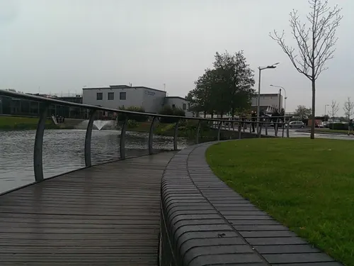

Culcheth Linear Park
Park · 1.4 mi
Park in the district of Culcheth, Warrington, England

Highfield Moss
Park · 2.1 mi
Nature reserve in Greater Manchester, England

Paddington Meadows
Park · 2.8 mi
Nature reserve in Paddington, Warrington, Cheshire, England, United Kingdom




Orford Park
Park · 2.5 mi
Park in Orford, Warrington, Cheshire, England, United Kingdom
Woolston Park
Park · 2.1 mi
Park in Woolston, Warrington, Cheshire, England, United Kingdom
12 more on the map.
Restaurants and cafes17



5 more on the map.
Where to stay1

More about Croft
Geography
Within the boundaries of the historic county of Lancashire, the village is on the northern edge of the borough of Warrington, north of the interchange of the M6 and M62 motorways, known as the Croft Interchange. It is close to the border with Merseyside and Greater Manchester. It borders Culcheth to the east, Lowton to the north, Winwick to the west and Risley to the south.
Croft was struck by an F1/T3 tornado on 23 November 1981, as part of the record-breaking nationwide tornado outbreak on that day. The tornado later moved over Warrington town centre.
From the Wikipedia article Croft, Cheshire, under CC BY-SA 4.0.
Churches and places of worship15
Gas and EV charging2
Schools, colleges and libraries9
Healthcare1
Map of Croft
73 places. The map loads OpenStreetMap tiles when you open it.
Getting there and nearby towns
Manchester Airport (MAN) is the nearest airport with scheduled flights listed in OpenStreetMap, 12 miles away.
- Newton-le-Willows 2 mi northwest, about 4 min by car
- Warrington 3 mi southwest, about 5 min by car
- Golborne 4 mi northwest, about 6 min by car
- Leigh 5 mi north, about 7 min by car
- Great Sankey 5 mi southwest, about 8 min by car
- Lymm 5 mi southeast, about 8 min by car
- Irlam 5 mi east, about 8 min by car
- Ashton in Makerfield 5 mi northwest, about 9 min by car
- Abram 5 mi north, about 9 min by car
- Haydock 6 mi northwest, about 9 min by car
Drive times are estimates from straight-line distance, not routes.
Towns near Croft


Keep exploring
Local news
Headlines from INDB.
Reviews, tips and questions
Loading what members have shared...
Sources and licences
- GeoNames (CC BY 4.0): population, coordinates, regions and time zone
- Mapillary (see each image): photos
- OpenStreetMap contributors (ODbL 1.0): places, airports, map data
- Wikidata (CC0 1.0): elevation, founding date, time zone, website, landmarks and historic places
- Wikimedia Commons (see each image): photos
- Wikipedia (CC BY-SA 4.0): overview and history text
Photo credits
- Flickr - ronsaunders47 - VILLAGE POND IN CROFT. WARRINGTON CHESHIRE UK., Ronald Saunders from Warrington, UK, CC BY-SA 2.0
- Flickr - ronsaunders47 - It's a hard life. Croft ,Warrington Cheshire. UK., Ronald Saunders from Warrington, UK, CC BY-SA 2.0
- Sankey Valley Park May 2007, Daniel Bagshaw ( Dan1980 ), CC BY 3.0
- Woolston Eyes nature reserve main hide, Andy Mabbett, CC BY 3.0
- Culcheth Bell3, Eionmac, CC BY-SA 3.0
- St Mary's Church, Lowton, Alan Nixon, CC BY-SA 2.0
- St Mary's Church, Warrington, JThomas, CC BY-SA 2.0
- St Oswald's Church, Winwick, andy, CC BY-SA 2.0
- Croft - Saint Lewis' Catholic Church, Alexander P Kapp, CC BY-SA 2.0
- Flickr - ronsaunders47 - THE WORKING DAY IS OVER.., Ronald Saunders from Warrington, UK, CC BY-SA 2.0
- Flickr - ronsaunders47 - GREEN BOAT AND A MURKY POND., Ronald Saunders from Warrington, UK, CC BY-SA 2.0
- Birchwood Forest Park - Moss Gate Entrance © David Dixon, David Dixon, CC BY-SA 2.0
- Culcheth Linear Park Entrance, OpenStreetMap contributors https://www.openstreetmap.org/copyright, CC BY 4.0
- Galatea At Highfield Moss, ARG_Flickr, CC BY 2.0
- River Mersey at Paddington Meadows, Warrington, Szzuk, CC0
- Street-level photo, ianatkin, CC BY-SA 4.0
- Street-level photo, mapillarygelec, CC BY-SA 4.0
- Street-level photo, ianatkin, CC BY-SA 4.0
- Street-level photo, ianatkin, CC BY-SA 4.0
- Street-level photo, ianatkin, CC BY-SA 4.0
- Street-level photo, ianatkin, CC BY-SA 4.0


Page built November 10, 2026. Spotted a mistake? Tell us or suggest a place.