
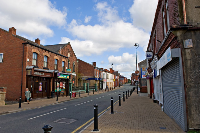


Golborne, United Kingdom
Golborne is a town of 24,021 people in England, United Kingdom.
Why visit Golborne
Townapedia lists 8 museums and landmarks, 16 parks and trails, 43 places to eat and 2 places to stay in and around town.
Highlights include Golborne North, Haydock Park, Culcheth Linear Park and Highfield Moss.
Weather in Golborne
Forecast from MET Norway (CC BY 4.0). Full forecast
About Golborne
Golborne (pronounced GOHL-born) is a town in the Metropolitan Borough of Wigan, in Greater Manchester, England. It lies 5 miles (8.0 km) south-south-east of Wigan, 6 miles (9.7 km) north-east of Warrington and 14 miles (22.5 km) to the west of the city of Manchester. Along with the neighbouring village of Lowton, it recorded a population of 24,041.
From the Wikipedia article Golborne (this version), under CC BY-SA 4.0.
Museums and landmarks8


Parks, trails and playgrounds16

Culcheth Linear Park
Park · 3.3 mi
Park in the district of Culcheth, Warrington, England

Highfield Moss
Park · 1.6 mi
Nature reserve in Greater Manchester, England

Golborne Park
Park · 0.4 mi
Former slag heaps (coal spoil) associated with Golborne Colliery, which opened in 1860s-1989, and now grassed over with some...
24/7

Pennington Flash Country Park
Park · 2.1 mi
Park in Leigh, Greater Manchester, England, United Kingdom; surroundings of lake formed by mining subsidence frequented by birdwatchers
Three Sisters Recreation Area
Park · 2.5 mi
Nature reserve and park in Wigan, Greater Manchester, England, UK


4 more on the map.
Restaurants and cafes43

Traveller's Rest
Bar and pub · 1.1 mi
443 Newton Road, Warrington
Mo off; Tu-Th,Su 12:00-22:30; Fr,Sa 12:00-23:00

Frith's Bar
Bar and pub
Formerly Impressions Printing and Embroidery - opened as Frith's Bar on 19th December 2024, owned by local musician Mark Frith.
83 High Street, Warrington

31 more on the map.
Where to stay2

History
The name Golborne derives from the Old English golde and burna, meaning "stream where marsh marigolds grow". The earliest settlements in the present-day town were on banks of the Millingford Brook, hence its name being derived from a water course where calendula grew. Golborne has been recorded in ancient documents as Goldeburn in 1187, Goldburc in 1201, Goseburn and Goldburn in 1212 and Golburne in 1242. Golborne and Gowborne were 16th-century spellings.
A settlement at Golborne has existed since at least the time of the Domesday Book of 1086. The manor was held in two moieties, half by the Lords of Lowton, and the half by the Golbornes up to the reign of Henry III, and later by various families including the Fleetwoods and Leghs.
The old Manor of Golborne stood to the north side of the village, giving its name to a public house on Church Street (now demolished). The manor and its lands extended as far as St Luke's Church in Lowton, and also gives its name to Manor Avenue and Manor Court.
Read more of the history
The Venerable Bede wrote in his Historia ecclesiastica gentis Anglorum of a well near Golborne sacred to St. Oswald's memory. This well had been suggested as the site where Penda, the pagan king of Mercia, slew the Christian King Oswald, later St Oswald, in the Battle of Maserfield, in 642. It is more generally accepted though that the site of that battle was some considerable distance to the southwest, near Oswestry.
Holcroft Hall, now a farm, was the home of Colonel Blood who, during the reign of Charles II, attempted to steal the Crown Jewels. King Charles was amused by Blood's audacity and pardoned him. Blood married Maria Holcroft of Holcroft Hall at Newhurch Church against the will of her father.
In 1648, the Battle of Red Gap was fought by the old road south from Golborne (probably the Red Bank area of Newton le Willows) during the 2nd Civil War. The Scots, on the side of Charles I, had advanced into England. Oliver Cromwell, leader of the Roundhead Army, intercepted the Scots at Preston; in a series of running battles between Preston, Wigan and Warrington, of which Red Gap was one, he defeated the Scots even though his army was outnumbered by ten to one.
The former village grew rapidly during the Industrial Revolution as the mining industry expanded. On 18 March 1979, there was a methane explosion at the town's colliery caused by an electrical spark, which took the lives of ten miners. Of the eleven present, only one survived. The colliery closed in 1989. The location of the former colliery is known locally as the Bonk, which is now the largest park in Golborne.
The closure of the colliery led to the loss of employment for a large proportion of Golborne's population, as well as people from nearby towns and villages such as Abram, Lowton and Ashton-in-Makerfield. Unemployment problems have been mostly eradicated in recent years with the development of different industries which has brought in new jobs, further aided by the creation of Stone Cross Industrial Park and Golborne Enterprise Park.
From the History section of Golborne on Wikipedia, under CC BY-SA 4.0.
Notable people from Golborne
 Davey Boy SmithBritish professional wrestler (1962–2002)Photo: James, CC BY-SA 2.0
 Jimmy PenningtonEnglish footballer (born 1939)Photo: Mikey3390, CC BY-SA 4.0
- Dynamite KidBritish professional wrestler (1958-2018)
- Paul HartEnglish football player and manager (born 1953)
- Johnny HartEnglish football player and manager (1928-2018)
- Fred ElseEnglish footballer and manager (1933-2015)
- Billy HibbertEnglish footballer (1884-1949)
- Peter KaneBritish boxer (1918–1991)
- William JenkinsonEnglish footballer (1892-1967)
- Nigel HartEnglish former footballer (born 1958)
- Bert LlewellynFootballer (1939-2016)
- Jack RigbyFootballer (1924-1997)
Born in Golborne, according to Wikidata (CC0). Each name links to its Wikipedia article.
Churches and places of worship17
Catholic Church of St Oswald and St Edmund Arrowsmith
Church · 1.9 mi
Shopping4
Gas and EV charging2
Schools, colleges and libraries11
Healthcare5
Map of Golborne
108 places. The map loads OpenStreetMap tiles when you open it.
Getting there and nearby towns
Liverpool John Lennon Airport (LPL) is the nearest airport with scheduled flights listed in OpenStreetMap, 14 miles away.
- Newton-le-Willows 2 mi south, about 3 min by car
- Haydock 4 mi west, about 6 min by car
- Hindley 4 mi north, about 6 min by car
- Ince-in-Makerfield 4 mi north, about 6 min by car
- Wigan 5 mi north, about 8 min by car
- Warrington 6 mi south, about 9 min by car
- St Helens 6 mi west, about 10 min by car
- Westhoughton 6 mi northeast, about 9 min by car
- Irlam 8 mi east, about 12 min by car
- Rainhill 8 mi southwest, about 13 min by car
Drive times are estimates from straight-line distance, not routes.
Towns near Golborne


Keep exploring
Local news
Headlines from INDB.
Reviews, tips and questions
Loading what members have shared...
Sources and licences
- GeoNames (CC BY 4.0): population, coordinates, regions and time zone
- Mapillary (see each image): photos
- OpenStreetMap contributors (ODbL 1.0): places, airports, map data
- Wikidata (CC0 1.0): elevation, founding date, time zone, website, landmarks and historic places
- Wikimedia Commons (see each image): photos
- Wikipedia (CC BY-SA 4.0): overview and history text
Photo credits
- High Street, Golborne, Dave Green, CC BY-SA 2.0
- St Thomas, Golborne, David Dixon, CC BY-SA 2.0
- Golborne - In Memory of the Miners, Keith Williamson, CC BY-SA 2.0
- St Oswald's church, Ashton-in-Makerfield 1, Rodhullandemu, CC BY-SA 4.0
- Christ Church, Pennington, David Dixon, CC BY-SA 2.0
- Church of St James the Great, Haydock 1, Rodhullandemu, CC BY-SA 4.0
- St John the Baptist Church, Earlestown 1, Rodhullandemu, CC BY-SA 4.0
- St John's Church, Abram, S Parish, CC BY-SA 2.0
- St Mary's Church, Lowton, Alan Nixon, CC BY-SA 2.0
- St Oswald's Church, Winwick, andy, CC BY-SA 2.0
- St Peter's Church, Leigh, S Parish, CC BY-SA 2.0
- St Thomas, Ashton-in-Makerfield 1, Rodhullandemu, CC BY-SA 4.0
- Golborne North Railway Station, Zentron1, CC BY-SA 4.0
- Culcheth Linear Park Entrance, OpenStreetMap contributors https://www.openstreetmap.org/copyright, CC BY 4.0
- Galatea At Highfield Moss, ARG_Flickr, CC BY 2.0
- Street-level photo, southglos, CC BY-SA 4.0


Page built November 10, 2026. Spotted a mistake? Tell us or suggest a place.