
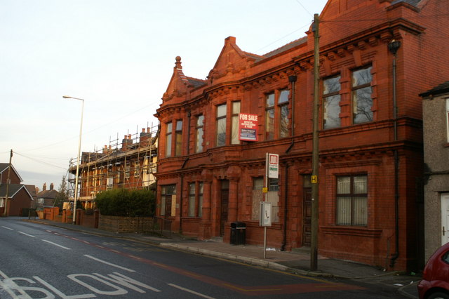



Why visit Abram
Townapedia lists 8 museums and landmarks, 11 parks and trails, 17 places to eat and 1 attraction in and around town.
Highlights include Adam Viaduct, Museum of Wigan Life, Walk of Fame and Borsdane Wood.
Weather in Abram
Forecast from MET Norway (CC BY 4.0). Full forecast
About Abram
Abram is a village and electoral ward in the Metropolitan Borough of Wigan, Greater Manchester, England. It lies on flat land on the northeast bank of the Leeds and Liverpool Canal, 2 miles (3.2 km) west of Leigh, 3 miles (4.8 km) southeast of Wigan, and 14.5 miles (23 km) west of Manchester. Abram is a dormitory village with a population of 9,855.
From the Wikipedia article Abram, Greater Manchester (this version), under CC BY-SA 4.0.
Photos of Abram


Things to do1

Adam Viaduct
Bridge · 3.2 mi
Railway bridge in Wigan, Greater Manchester, England, UK
Museums and landmarks8

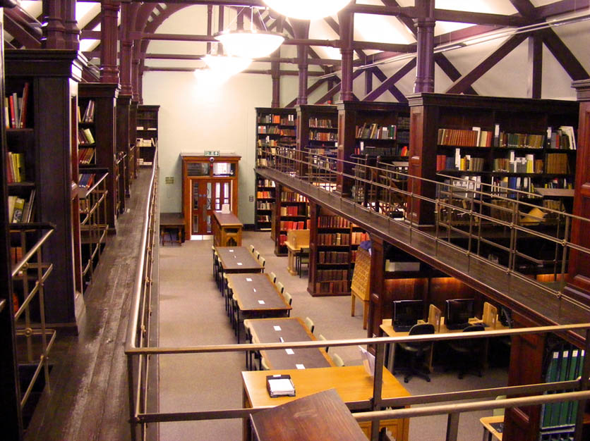
Museum of Wigan Life
Museum · 2.9 mi
Centre in Wigan, Greater Manchester, England, United Kingdom
Walk of Fame
Monument and historic site · 3.0 mi
Public walkway in Wigan, England

Wigan War Memorial
Monument and historic site · 3.0 mi
War memorial in Wigan, England


Bickershaw Junction
Monument and historic site · 1.4 mi
Walls and brick structures over wide area - remnants of old railway station on West Leigh and Bedford line abandoned 1960s.
Parks, trails and playgrounds11

Pennington Flash Country Park
Park · 2.4 mi
Park in Leigh, Greater Manchester, England, United Kingdom; surroundings of lake formed by mining subsidence frequented by birdwatchers
Three Sisters Recreation Area
Park · 1.4 mi
Nature reserve and park in Wigan, Greater Manchester, England, UK

Platt Bridge Community Green
Park · 0.8 mi
Long planned community space now formally designated. See...
Restaurants and cafes17

Galloways
Bakery · 0.8 mi
Unit 1 Walthew Lane, Wigan
Mo-Sa 07:30-17:30; Su 10:00-16:00; BH 10:00-16:00



A Fine Kettle of Fish
Fast food · Burger, Fish And Chips, Haggis, Breakfast · 0.8 mi
Unit 2 Walthew Lane, Wigan
5 more on the map.
History
The village name is recorded as Edburgham in 1212 and Adburgham in 1246. The form Abraham is found in the 16th century, and the current name of Abram in the 18th.
The manor was probably part of the larger manor of Newton until it was granted to "Warine son of Godfrey" by Henry II who reigned 1154–1189. The family adopted the name of the settlement, and remained Lords of the Manor until the 17th century. The family was ruined by the English Civil War, in which they supported the Royalists. When the last in male line of the Abraham family died in the 17th century, possession of the manor passed through many hands, and the title of Lord of the Manor was still around at the start of the 20th century although held no manorial rights.
Read more of the history
Just after 17:00 on 18 August 1908 there was an explosion at the No 1, Cannell Mine of the Maypole Coal Pit. A total of 75 men and boys died in this mining accident. Because the explosion occurred deep underground, it was not until November 1909 that all the bodies were recovered. The inquest ruled that the explosion was caused by a combination of a buildup of coal dust and gas, and the use of explosives to bring down coal from the ceiling. The physical effects of the disaster on Abram are described as "profound"; the explosion made 44 women widows and killed the fathers of more than 120 children. At the time, Irish people were a large ethnic minority in Lancashire, making up between a quarter and a third of the populations of Leigh, St Helens, and Wigan. The Irish Catholic immigrants were seeking works on the Lancashire Coalfield, as demonstrated by the fact that 13 of the dead were Catholic migrants from Ireland. Many of the families affected by the disaster returned to Ireland shortly afterwards.
From the History section of Abram, Greater Manchester on Wikipedia, under CC BY-SA 4.0.
More about Abram
Geography
At 53°30′29″N 2°35′17″W (53.508°,-2.588°) and 173 miles (278 km) northwest of central London, Abram lies on mostly flat ground, with slightly undulating land at its southern end. The larger towns of Wigan and Leigh lie to the northwest and east respectively. For purposes of the Office for National Statistics, Abram forms part of the Wigan Urban Area. Suburban localities in and around Abram include Bamfurlong, Bickershaw, Bryn Gates and Platt Bridge.
The land around Abram is generally flat and used for coal mining and arable farming. As a result, collieries were scattered across the landscape. The local geology consists of coal measures in the north and sandstone in the south; the soil is clayey and as a result, the area is susceptible to flooding.
To the south of the village lies Abram Flashes a 39.6-hectare (97.9-acre) Site of Special Scientific Interest (SSSI). The site lies adjacent to the Leigh Branch Canal and is part of Wigan Flashes an area of wetland stretching for 6.2 miles (10 km) between Wigan and Leigh. The flashes are shallow bodies of water that originate from flooding due to the subsidence caused by shallow mining. Abram flashes was designated an SSSI in 1990 due to its biological interest which includes various habitats such as open water, swamp, tall herb fen and wet marshy grassland.
Arts and culture
The village has historic associations with traditional Morris dancing and is home to Abram Morris Dancers. A plot of land by Park Lane in the southwest of Abram is known as the Morris Dancers' ground, and is popularly supposed to be held by the Abram Morris Dancers on condition that a Morris dance be celebrated there once every 20 years. The Abram Circle is a dance native to Abram and is "renowned to morris dancers". The Abram Morris Dancers' logo appears on the boundary signs for the village.
Abram has one main primary school: St John's Church of England Primary School.
From the Wikipedia article Abram, Greater Manchester, under CC BY-SA 4.0.
Notable people from Abram
- John Elisha GrimshawEnglish recipient of the Victoria Cross (1893-1980)
Born in Abram, according to Wikidata (CC0). Each name links to its Wikipedia article.
Churches and places of worship23
Catholic Church of St Oswald and St Edmund Arrowsmith
Church · 2.6 mi
Shopping2
Gas and EV charging1
Schools, colleges and libraries8
Healthcare2
Map of Abram
73 places. The map loads OpenStreetMap tiles when you open it.
Getting there and nearby towns
Liverpool John Lennon Airport (LPL) is the nearest airport with scheduled flights listed in OpenStreetMap, 16 miles away.
- Hindley 2 mi north, about 3 min by car
- Ince-in-Makerfield 2 mi northwest, about 3 min by car
- Golborne 2 mi south, about 4 min by car
- Wigan 3 mi northwest, about 5 min by car
- Ashton in Makerfield 3 mi southwest, about 5 min by car
- Westhoughton 4 mi northeast, about 6 min by car
- Newton-le-Willows 4 mi south, about 7 min by car
- Atherton 4 mi east, about 7 min by car
- Haydock 5 mi southwest, about 7 min by car
- St Helens 7 mi southwest, about 11 min by car
Drive times are estimates from straight-line distance, not routes.
Towns near Abram


Keep exploring
Local news
Headlines from INDB.
Reviews, tips and questions
Loading what members have shared...
Sources and licences
- GeoNames (CC BY 4.0): population, coordinates, regions and time zone
- Mapillary (see each image): photos
- OpenStreetMap contributors (ODbL 1.0): places, airports, map data
- Wikidata (CC0 1.0): elevation, founding date, time zone, website, landmarks and historic places
- Wikimedia Commons (see each image): photos
- Wikipedia (CC BY-SA 4.0): overview and history text
Photo credits
- Former Abram Urban District Council Offices, David Long, CC BY-SA 2.0
- St John's Church, Abram, S Parish, CC BY-SA 2.0
- Taylor Gallery at the Museum of Wigan Life, Hindleyite, CC BY 3.0
- War memorial at Wigan Parish Church, Rept0n1x, CC BY-SA 3.0
- Wigan Parish Church and war memorial, Rept0n1x, CC BY-SA 3.0
- St Oswald's church, Ashton-in-Makerfield 1, Rodhullandemu, CC BY-SA 4.0
- Christ Church, Ince-in-Makerfield, David Long, CC BY-SA 2.0
- Christ Church, Pennington, David Dixon, CC BY-SA 2.0
- St James' Church, Wigan, S Parish, CC BY-SA 2.0
- St Jude, Wigan, David Dixon, CC BY-SA 2.0
- St Mary's Church, Leigh, SMJ, CC BY-SA 2.0
- St Mary's Church, Lowton, Alan Nixon, CC BY-SA 2.0
- Boar's Head, Haigh, Hindley, Pemberton, Plank Lane, Strangeways & Wigan RJD 77, Railway Clearing House, Public domain
- Maypole Memorial, David Dixon, CC BY-SA 2.0
- Liverpool Docks and the Wirral, M J Richardson, CC BY-SA 2.0
- Street-level photo, mappo2, CC BY-SA 4.0
- Street-level photo, tonys999, CC BY-SA 4.0


Page built November 10, 2026. Spotted a mistake? Tell us or suggest a place.