


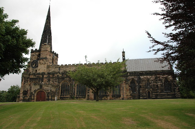
Great Sankey, United Kingdom
Great Sankey is a town of 43,793 people in England, United Kingdom.
Why visit Great Sankey
Townapedia lists 41 museums and landmarks, 27 parks and trails, 65 places to eat, 2 places to stay and 4 attractions in and around town.
Highlights include Warrington Bridge, Gulliver's World Resort, Warrington Museum and Art Gallery and Museum of Policing in Cheshire.
Weather in Great Sankey
Forecast from MET Norway (CC BY 4.0). Full forecast
About Great Sankey
Great Sankey is a civil parish in the Borough of Warrington in Cheshire, England. It is 2 miles (3.2 km) west of Warrington town centre and has a population of 31,600 according to the 2021 census.
From the Wikipedia article Great Sankey (this version), under CC BY-SA 4.0.
Photos of Great Sankey


Things to do4

Warrington Bridge
Bridge · 2.1 mi
Bridge in Warrington, Cheshire, England, United Kingdom

Gulliver's World Resort
Monument and historic site · 1.3 mi
Children's theme park resort in Warrington, Cheshire.

Howley Footbridge
Bridge · 2.5 mi
Footbridge in Warrington, Cheshire, England, UK

Museums and landmarks41

Warrington Museum and Art Gallery
Museum · 1.9 mi
Grade II listed building and museum in Warrington, United Kingdom

Museum of Policing in Cheshire
Museum · 1.7 mi
Museum in Warrington, England, United Kingdom
29 more on the map.
Parks, trails and playgrounds27



Orford Park
Park · 2.4 mi
Park in Orford, Warrington, Cheshire, England, United Kingdom

15 more on the map.
Restaurants and cafes65

Anmol
Restaurant · Indian · 0.6 mi
62 Warrington Road, Warrington
Mo-Th 17:30-23:00; Fr-Sa 17:00-23:30; Su 15:00-22:30
Chapelford Farm
Restaurant · British
Santa Rosa Boulevard, Warrington
Su-Th 08:00-23:00, Fr-Sa 08:00-24:00

Costa
Cafe · Coffee Shop · 1.1 mi
100 Westbrook Centre, Warrington
Mo-Fr 08:00-18:00; Sa-Su 09:00-18:00
Cafe Fresh
Cafe · 1.1 mi
49 Grafton Street, Warrington
Tu 09:35-14:45; We-Fr 09:45-14:45; Sa; Su 09:30-14:45
Costa
Cafe · Coffee Shop · 1.1 mi
Unit 2 Fortress Boulevard, Warrington
Mo-Sa 06:00-20:00; Su 07:00-19:00

CJ'S Coffee House & Tearoom
Cafe · Coffee Shop · 1.0 mi
195 Warrington Road, Warrington
Tu-Th 09:30-14:00; Fr 09:30-16:00; Sa 09:30-14:00
53 more on the map.
History
The township of Great Sankey was originally a chapelry in Prescot parish in Lancashire. It became formally a separate civil parish in 1866, and it was transferred to Cheshire in 1974. There was industrial growth along the banks of the Sankey Canal at Sankey Bridges during the 19th century but otherwise the area was rural. In the 20th century the area became largely a residential area. RAF Burtonwood was built on the outskirts in 1939, and the land is now transformed into Chapelford Urban Village and the Omega Development Site.
From the History section of Great Sankey on Wikipedia, under CC BY-SA 4.0.
More about Great Sankey
Education
The secondary school is Great Sankey High School. This site also contains facilities for its sixth form under the name of Barrow Hall College. Nine primary schools (Barrow Hall, St Philips, Park Road, Old Hall, St Joseph's, Chapelford Village, St James, Callands and Burtonwood) serve Great Sankey.
Sycamore Lane Primary School closed in early 2013, with staff and pupils relocating to Chapelford Village Primary School.
From the Wikipedia article Great Sankey, under CC BY-SA 4.0.
Notable people from Great Sankey
- Frederick KelsallEnglish rugby league footballer
Born in Great Sankey, according to Wikidata (CC0). Each name links to its Wikipedia article.
Where to stay2
Churches and places of worship25
Shopping11
Gas and EV charging4
Schools, colleges and libraries22
Sankey Valley St James Church of England Primary School
School · Anglican · 0.4 mi
Dorchester Road, Warrington
Healthcare10
Map of Great Sankey
211 places. The map loads OpenStreetMap tiles when you open it.
Getting there and nearby towns
Liverpool John Lennon Airport (LPL) is the nearest airport with scheduled flights listed in OpenStreetMap, 9 miles away.
- Warrington 2 mi east, about 4 min by car
- Widnes 4 mi southwest, about 7 min by car
- Newton-le-Willows 4 mi north, about 7 min by car
- Runcorn 5 mi southwest, about 8 min by car
- Haydock 5 mi north, about 9 min by car
- Rainhill 5 mi west, about 9 min by car
- St Helens 6 mi northwest, about 9 min by car
- Golborne 6 mi north, about 10 min by car
- Ashton in Makerfield 6 mi north, about 10 min by car
- Whiston 6 mi west, about 10 min by car
Drive times are estimates from straight-line distance, not routes.
Towns near Great Sankey


Keep exploring
Local news
Headlines from INDB.
Reviews, tips and questions
Loading what members have shared...
Sources and licences
- GeoNames (CC BY 4.0): population, coordinates, regions and time zone
- Mapillary (see each image): photos
- OpenStreetMap contributors (ODbL 1.0): places, airports, map data
- Wikidata (CC0 1.0): elevation, founding date, time zone, website, landmarks and historic places
- Wikimedia Commons (see each image): photos
- Wikipedia (CC BY-SA 4.0): overview and history text
Photo credits
- Mersey Street Bridge, Warrington, Lancs, Mersey_Street_Bridge,_Warrington_-_DSC05919.JPG : Green Lane derivative work: Hogweard ( talk ), CC BY-SA 3.0
- Front of Museum, RDJ226, CC BY 3.0
- Sankey Valley Park May 2007, Daniel Bagshaw ( Dan1980 ), CC BY 3.0
- St John the Evangelist's Church, Higher Walton 01, Dave.Dunford, CC BY-SA 4.0
- St Mary's Church, Warrington, JThomas, CC BY-SA 2.0
- St Oswald's Church, Winwick, andy, CC BY-SA 2.0
- Saint Mary's Sankey, User:Racklever, CC BY-SA 3.0
- Sacred Heart Church, Warrington, David Dixon, CC BY-SA 2.0
- GuzziLeMans1000, KevFoote, CC BY-SA 4.0
- Guzzilemans1000mk5, KevFoote, CC BY-SA 4.0
- Street-level photo, simonrandles, CC BY-SA 4.0
- Street-level photo, mapillarygelec, CC BY-SA 4.0
- Street-level photo, mapillarygelec, CC BY-SA 4.0


Page built November 10, 2026. Spotted a mistake? Tell us or suggest a place.