


Why visit Leigh
Townapedia lists 15 museums and landmarks, 22 parks and trails, 132 places to eat, 3 places to stay and 3 attractions in and around town.
Highlights include Tyldesley Little Theatre, North West Computer Museum, Lancashire Mining Museum and Pennington Flash County Park.
Weather in Leigh
Forecast from MET Norway (CC BY 4.0). Full forecast
About Leigh
Leigh is a town in the Wigan district, in Greater Manchester, England, on low-lying land northwest of Chat Moss. It is situated approximately 6 miles (9.7 km) southeast of Wigan and 11 miles (18 km) west of Manchester city centre. In 2011 it had a population of 53,000.
From the Wikipedia article Leigh, Greater Manchester (this version), under CC BY-SA 4.0.
Photos of Leigh


Things to do3
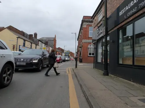
Tyldesley Little Theatre
Cinema and theater · 2.4 mi
Theatre in Tyldesley, England


Museums and landmarks15

Lancashire Mining Museum
Museum · 3.0 mi
Mining museum in Greater Manchester, United Kingdom

New Hall moated site
Monument and historic site · 2.8 mi
Scheduled monument in Tyldesley, Greater Manchester, England, UK
Bedford Colliery
Monument and historic site · 1.1 mi
Former main site for Bedford Colliery.
Rugby League
Monument and historic site · 0.5 mi
Commemorating rugby union played at former pitch on Siddow Common now part of post war industrial site to rear.
3 more on the map.
Parks, trails and playgrounds22

Pennington Flash County Park
Park · 1.2 mi
Pennington Flashes Local Nature Reserve is part of the wider country park. The lake and surrounding marshland are home to a diverse...


Firs Park
Park · 0.7 mi
15 acre public park gifted to community by local mill owner in early 1920s.
Firs Lane, Leigh
24/7
Culcheth Linear Park
Park · 3.2 mi
Park in the district of Culcheth, Warrington, England
Pennington Flash Country Park
Park · 1.3 mi
Park in Leigh, Greater Manchester, England, United Kingdom; surroundings of lake formed by mining subsidence frequented by birdwatchers
Public Toilets
Park · 0.8 mi
Toilet operated by volunteers. Open most week ends but limited openings during the week due risk of damage.
Sa-Su 10:30 - 16:30


10 more on the map.
Restaurants and cafes132
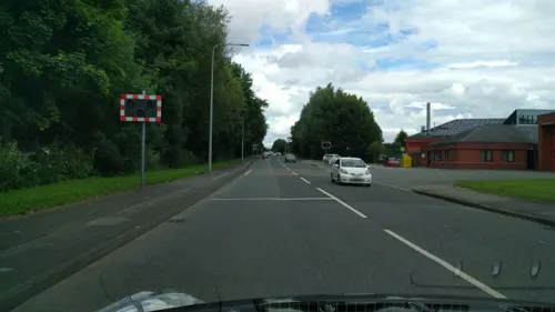



The Thomas Burke
Bar and pub
Former variety theatre with a 32 feet wide proscenium, became Leigh Classic Cinema post war and then in 2007 a Wetherspoons named after...
20A Leigh Road, Leigh
Mo,Tu,We,Th,Su 08:00-24:00; Fr,Sa 08:00-25:00



120 more on the map.
History
Leigh is derived from the Old English leah which meant a place at the wood or woodland clearing, a glade and subsequently a pasture or meadow, it was spelt Legh in 1276. Other recorded spellings include Leech, 1264; Leeche, 1268; Leghthe, 1305; Leght, 1417; Lech, 1451; Legh, 16th century. As its name denotes it was a district rich in meadow and pasture land, and the produce of its dairies, the Leigh cheese, was formerly noted for its excellence.
Westleigh, the west clearing, was Westeley in 1237, Westlegh in 1238 and Westlay in Legh in 1292.
Pennington was recorded as Pininton and Pynynton in 1246 and 1360, Penynton in 1305, Pynyngton in 1351 and 1442 and Penyngton in 1443, the ending tun denotes an enclosure, farmstead or manor in Old English. The ford of Beda, probably through the Pennington Brook gave its name to Bedford which was recorded as Beneford from 1200 to 1221 and Bedeford in 1200 and 1296.
Read more of the history
The earliest signs of human activity in Leigh are evidenced by a Neolithic stone axe found in Pennington and a bronze spearhead from south of Gas Street. A single Roman coin was found at Butts in Bedford. After the Roman departure from Britain, and into the history of Anglo-Saxon England, nothing was written about Leigh. However, evidence for the presence of Saxons in what was a sparsely populated and isolated part of the country is provided by local township place names that incorporate the Old English suffix leah, such as Leigh, Tyldesley, Shakerley and Astley.
In the 12th century the ancient parish of Leigh was made up of six townships, including Pennington, Bedford, Westleigh, Atherton, Astley, and Tyldesley cum Shakerley. Weekly markets were held by the parish church and a cattle fair held twice-yearly.
The land to the south of Atherton includes the feudal barony of Atherleigh, created by Queen Elizabeth, and Bedford manor, which was mentioned in documents in 1202 when it was held by Sir Henry de Kighley whose family held it until the 16th century, but never actually lived there.
The Shuttleworths, landowners from the 14th century, were another prominent Bedford family. Richard Shuttleworth married a daughter of the Urmstons from Westleigh and brought part of
the Westleigh inheritance to Bedford. This family lived at Shuttleworth House, or Sandypool Farm as it is also known, which is south of the Bridgewater Canal near to the old manor house, Bedford Hall, which survives today as a Grade II listed building. Another prominent Bedford family, the Sales of Hope Carr Hall, had a great deal of influence in Bedford for over 400 years, and owned more land than the Shuttleworths. The family were recusants and secretly kept the "old faith" when Roman Catholicism was subject to civil or criminal penalties. Hope Carr Hall was moated as was nearby Brick House.
The manor house of Westleigh was at Higher Hall and existed in Richard I's time (1189–1199). In 1292 Sigreda, the heiress of the manor, married Richard de Urmston, and the manor passed to the Urmston family and remained there until the last of the male Urmstons died in 1659. It was later abandoned because of mining subsidence and Westleigh Old Hall became the manor by repute. The Ranicars and the Marsh families lived here. Westleigh Old Hall was another Leigh hall that had a moat.
The Pennington family owned Pennington Hall from about 1200 until they were replaced by the Bradshaw or Bradshaighs in 1312. The Bradshaws held the manor until 1703 when John, the last of the male line died. Pennington Hall was rebuilt in 1748 by the then-owner Samuel Hilton and in 1807 sold to the Gaskell family of Thornes, Wakefield, who let it to a succession of tenants. Around 1840 James Pownall, a founder member of the silk manufacturing firm, Bickham and Pownall, was a tenant. Later occupants were Charles Jackson, a cotton manufacturer, Jabez Johnson, and F.W. Bouth founder of Bouth's Mill in 1862, The last resident was the brewer George Shaw. On 3 December 1919 George Shaw & Co Ltd offered the hall and grounds to the people of Leigh. The gift was accepted and opened to the public on 25 August 1920. The hall was converted to a museum and art gallery in 1928 but was demolished in 1963. The grounds are now Pennington Park.
Leigh was divided in its allegiance during the English Civil War, some of the population supporting the Royalists' cause while others supported the Parliamentarians. A battle was fought in the town on 2 December 1642, when a group of Chowbenters, men from neighbouring Atherton, beat back and then routed Cavalier troops under the command of James Stanley, the 7th Earl of Derby.
Sir Thomas Tyldesley of Myerscough and Morleys Hall, Astley, was killed on 25 August 1651 at the Battle of Wigan Lane and is buried in the Tyldesley Chapel in Leigh Parish Church.
The Earl of Derby passed through Leigh again in 1651, when he spent his last night in the King's Arms, before going on to his execution outside Ye Olde Man & Scythe Inn in Bolton.
At the end of the 16th century, although agriculture and the dairy industry, particularly the production of Leigh cheese, sometimes known as Leigh Toaster, were important, spinning and weaving began to develop as a cottage industry. Work was supplied from Manchester by agents who brought work weekly often to an inn, and where they collected the finished cloth. At first, the work was done to supplement the income of local farmers and their families. The cloth woven in Leigh was fustian, a sort of rough corduroy, and by the end of the 17th-century middlemen, fustian masters, were dealing directly with weavers and selling the finished cloth in Manchester.
It is a tradition in the town that a local man, Thomas Highs, was the inventor of a spinning jenny and the water frame in the 1760s, the latter invention being pirated by Richard Arkwright, who subsequently made a fortune from the patent royalties.
From the History section of Leigh, Greater Manchester on Wikipedia, under CC BY-SA 4.0.
More about Leigh
Geography
Leigh is low-lying; land to the south and east, close to Chat Moss, is 50 feet (15 m) above mean sea level. The highest land, to the north and west, rises gently to 125 feet (38 m). Astley and Bedford Mosses are fragments of the raised bog that once covered a large area north of the River Mersey and along with Holcroft and Risley Mosses are part of Manchester Mosses, a European Union designated Special Area of Conservation. The area is in the River Mersey Basin; drained into the Mersey by several streams, including the Westleigh and Pennington Brooks that join others flowing through Bedford to form the Glaze Brook. The southeast of the town has alluvial and peaty soils, but the rest is loam overlaying sandstone, or coal measures in the north. Magnesian limestone occurs in Bedford and neighbouring Astley. Mining subsidence and flooding have caused the formation of "flashes" to the south and west of the town, the largest of which is south of the Leeds and Liverpool Canal in Pennington. Pennington Flash Country Park is a 490-acre (200 ha) country park and nature reserve with a 170-acre (69 ha) flash or lake.
Economy
Leigh has a traditional town centre with daily outdoor and indoor markets. Part of the town centre is pedestrianised and there are local independent and multiple retailers. The Spinning Gate Centre in the centre of town has about thirty retail units.
A retail park developed on the old Parsonage Colliery site is within walking distance of the town centre.
Opened in 2008, Leigh Sports Village has an 12,000-capacity stadium (anchored by Leigh Leopards and shared with the reserves of Manchester United), an athletics arena for Leigh Harriers, facilities for Leigh East Rugby League Club, a college campus, hotel, leisure retail and business facilities for the community. In 2011, a Morrisons store opened at the sports village. Additionally, Manchester United's main women's team began to play home games at the stadium in 2018.
Another regeneration project, on the site of the former Bickershaw Colliery complex which closed in 1992, has redeveloped the site and canal side with a country park and housing.
In 2011, "The Loom" a £50 million retail development opened on the north side of the Bridgewater Canal with a seven-screen cinema, Tesco Extra store, Nando's and Frankie and Benny's.
Arts and culture
Many of Leigh's old halls have been demolished but the sites of Lilford Park, once the grounds of Atherton Hall, a gift to Leigh from Lord Lilford in 1914 and Pennington Park, the grounds of Pennington Hall which was demolished in 1963 after being used as a museum, are open to the public.
Leigh's wealth as an industrial town resulted in many outlets for the entertainment of its population, including theatres, cinemas and public houses. In 1908 the Hippodrome Theatre on Leigh Road was built on the site of Walker's silk mill of 1827, this subsequently became a cinema, first the Odeon, later the Classic. Another theatre, the Theatre Royal, was built on Lord Street which later became the Leigh Casino Club. The Palace Cinema was built in 1913 on Railway Road and the assembly rooms above the Conservative Club, were converted to a cinema known as the Sems in 1908. Brewery Lane is a reminder that there was once a brewery in Bedford belonging to George Shaw & Co.
The old Leigh College and Library on Railway Road was built between 1894 and 1896 by the Leigh Literary Society to designs by J. C. Prestwich and J. H. Stephen. The present library was built in 1971 between the parish church and town hall.
Leigh Hackspace was founded as a UK Community interest company in 2015
Education
Leigh Grammar School existed in 1655 but its foundation is unclear. The building was next to the churchyard, but the school moved to Manchester Road in 1931. Leigh Girls' Grammar School was established in 1921, but both schools were abolished by the then Secretary of State for Education, Shirley Williams, in the 1976 Education Act. Leigh high schools include Bedford High School, and The Westleigh School. Pupils also attend schools in Atherton, Lowton, Golborne and Astley. Wigan and Leigh College provides post-16 education.
From the Wikipedia article Leigh, Greater Manchester, under CC BY-SA 4.0.
Notable people from Leigh
 Nigel ShortEnglish chess player and writerPhoto: GibChess, CC BY 3.0
 Pete ShelleyBritish singer-songwriter (1955–2018)Photo: Bruce (kingArthur_aus), CC BY 2.0
 Alan R. BattersbyBritish chemist (1925-2018)Photo: Martinb94556, CC BY-SA 4.0
 Georgie FameEnglish rhythm and blues and jazz singer and keyboard playerPhoto: Mark Kent, CC BY-SA 2.0
 Kathleen Mary Drew-BakerBritish phycologist (1901–1957)Photo: Smithsonian Institution from United..., No restrictions
 Paul MasonBritish journalistPhoto: Marta Jara ( eldiario.es ), CC BY-SA 3.0 es
 Sarah Jayne DunnEnglish actressPhoto: Marple Bridge Photography, CC BY-SA 2.0
 Brian SimpsonBritish politician, MEP (born 1953)Photo: Martin Kraft, CC BY-SA 3.0 de
 John WorrallphilosopherPhoto: Unknown author, No restrictions
 David MorrisBritish politician (born 1966)Photo: Richard Townshend, CC BY 3.0
 Phil GartsideBritish businessman (1952-2016)Photo: John Dobson, CC BY-SA 2.0
- Ada SmithBritish artistic gymnast (1903-1994)
Born in Leigh, according to Wikidata (CC0). Each name links to its Wikipedia article.
Where to stay3
Churches and places of worship30
Shopping23
Gas and EV charging5
Schools, colleges and libraries19
Healthcare7
Map of Leigh
250 places. The map loads OpenStreetMap tiles when you open it.
Getting there and nearby towns
Manchester Airport (MAN) is the nearest airport with scheduled flights listed in OpenStreetMap, 14 miles away.
- Atherton 2 mi northeast, about 3 min by car
- Tyldesley 2 mi northeast, about 4 min by car
- Abram 3 mi west, about 5 min by car
- Golborne 3 mi southwest, about 6 min by car
- Westhoughton 4 mi north, about 6 min by car
- Hindley 4 mi northwest, about 6 min by car
- Newton-le-Willows 5 mi southwest, about 7 min by car
- Ince-in-Makerfield 5 mi northwest, about 8 min by car
- Walkden 5 mi east, about 8 min by car
- Little Hulton 5 mi northeast, about 8 min by car
Drive times are estimates from straight-line distance, not routes.
Towns near Leigh


Keep exploring
Local news
Headlines from INDB.
Reviews, tips and questions
Loading what members have shared...
Sources and licences
- GeoNames (CC BY 4.0): population, coordinates, regions and time zone
- Mapillary (see each image): photos
- OpenStreetMap contributors (ODbL 1.0): places, airports, map data
- Wikidata (CC0 1.0): elevation, founding date, time zone, website, landmarks and historic places
- Wikimedia Commons (see each image): photos
- Wikipedia (CC BY-SA 4.0): overview and history text
Photo credits
- Market Street, Leigh, Dave Bevis, CC BY-SA 2.0
- George and Dragon, Leigh, David Dixon, CC BY-SA 2.0
- Back Market Street Leigh, Mikey from Wythenshawe, Manchester, UK, CC BY 2.0
- Leigh Arms public house, Ian Roberts, CC BY-SA 2.0
- Leigh bus station, ray blow, CC BY-SA 2.0
- Leigh town Hall, J3Mrs, CC BY-SA 3.0
- Chowbent Chapel, J3Mrs ( talk ), CC BY-SA 3.0
- Christ Church, Pennington, David Dixon, CC BY-SA 2.0
- Culcheth Bell3, Eionmac, CC BY-SA 3.0
- St Anne's Church, Atherton, Margaret Clough, CC BY-SA 2.0
- St George, Tyldesley, north, J3Mrs ( talk ), CC BY-SA 3.0
- St James' Church, Daisy Hill, David Long, CC BY-SA 2.0
- St John's Church, Abram, S Parish, CC BY-SA 2.0
- St Mary's Church, Leigh, SMJ, CC BY-SA 2.0
- LeighStadium-May2008, Dave Green, CC BY-SA 2.0
- Boar's Head, Leigh, Dave Bevis, CC BY-SA 2.0
- Flickr - ronsaunders47 - PENNINGTON FLASH .PATH AROUND THE LAKE., Ronald Saunders from Warrington, UK, CC BY-SA 2.0
- Stagecoach Wigan 16953 MX07BVD (8470906947), Alan Sansbury from Liverpool, England, CC BY 2.0
- Network Warrington 84 DK09ELW (8472003784), Alan Sansbury from Liverpool, England, CC BY 2.0
- Maytree Travel MX60BWU (8470949079), Alan Sansbury from Liverpool, England, CC BY 2.0
- Network Warrington 59 DK56MLJ (8472002668), Alan Sansbury from Liverpool, England, CC BY 2.0
- Jim Stones 12 T1KET (8472002870), Alan Sansbury from Liverpool, England, CC BY 2.0
- Market Street facade, J3Mrs, CC BY 3.0
- South Lancs Travel bus (K70 SLT), 14 March 2008, Pimlico Badger, CC BY-SA 2.0
- Maytree Travel MX09HHN (8470884157), Alan Sansbury from Liverpool, England, CC BY 2.0
- Street-level photo, ianatkin, CC BY-SA 4.0
- Street-level photo, ianatkin, CC BY-SA 4.0
- Street-level photo, tonys999, CC BY-SA 4.0


Page built November 10, 2026. Spotted a mistake? Tell us or suggest a place.