


Crowborough, United Kingdom
Crowborough is a town of 21,688 people in England, United Kingdom.
Why visit Crowborough
Townapedia lists 1 museum or landmark, 12 parks and trails, 38 places to eat, 1 place to stay and 2 attractions in and around town.
Highlights include Crowborough Country Park and Brickfield Meadow.
Weather in Crowborough
Forecast from MET Norway (CC BY 4.0). Full forecast
About Crowborough
Crowborough is a town and civil parish in East Sussex, England, in the Weald at the edge of Ashdown Forest and the highest town in the High Weald Area of Outstanding Natural Beauty.
From the Wikipedia article Crowborough (this version), under CC BY-SA 4.0.
Travel tips from other travellers: Crowborough on Wikivoyage (CC BY-SA 4.0).
Things to do2


Museums and landmarks1

Parks, trails and playgrounds12




Restaurants and cafes38

The Boars Head Inn
Bar and pub · 1.3 mi
Unspoilt 17th. Century Inn.
Boars Head Road, Crowborough
Mo-Su 12:00-23:00


Ütopia
Restaurant · Fish And Chips · 0.9 mi
Whitehill Road, Crowborough
Mo-Sa 12:00-14:00, 17:00-22:00
Crowborough Spice
Restaurant · Indian · 1.4 mi
24 Crowborough Hill, Crowborough
Mo-Th 17:00-22:30; Fr,Sa 17:00-23:00; Su 14:00-22:30
Li's
Restaurant · Chinese · 1.4 mi
Crowborough Hill, Crowborough
Tu-Sa 17:00-22:30; Su 16:30-22:00


26 more on the map.
History
The town's name means "hill or mound frequented by crows", from the Old English crāwe + beorg. The name Crowborough is first seen c. 1346 as a clearance near the village of Rotherfield.
In 1734, Sir Henry Fermor, a local benefactor, bequeathed money for a church and charity school for the benefit of the "very ignorant and heathenish people" that lived in the part of Rotherfield "in or near a place called Crowborough and Ashdown Forest". The church, dedicated to All Saints, and primary school still survive today.
The railway arrived in 1868, leading to significant growth of the town. By 1880, the town had grown so much that the ecclesiastical parish of All Saints was separated from that of St Denys, Rotherfield.
In the late 19th century, Crowborough was promoted as a health resort based on its high elevation, the rolling hills and surrounding forest. Estate agents even called it "Scotland in Sussex". The town's golf course opened in 1895, followed by a fire station and hospital in 1900.
From 1942 to 1982, a site near Crowborough hosted notable radio transmitters, including the Aspidistra transmitter during World War II and, after the war, the BBC External Service broadcasts to Europe transmitters.
From the History section of Crowborough on Wikipedia, under CC BY-SA 4.0.
More about Crowborough
Geography
Crowborough is located in the northern part of East Sussex, around 6 kilometres (4 miles) from the county border with Kent. The town is 57 kilometres (35 miles) south of central London. The nearest major towns are Royal Tunbridge Wells, 12 kilometres (7 miles) to the north-east; Brighton, 34 kilometres (21 miles) to the south-west; and Crawley, 26 kilometres (16 miles) to the west. The county town of Lewes is 24 kilometres (15 miles) to the south-west.
The town is located on the eastern edge of the Ashdown Forest, an ancient area of open heathland which is protected for its ecological importance and was the setting for A. A. Milne's stories about Winnie-the-Pooh.
The highest point in the town is 242 m (794 ft) above sea level. This summit is the highest point of the High Weald and second highest point in East Sussex (the highest is Ditchling Beacon). Its relative height is 159 m (522 ft), meaning Crowborough qualifies as one of England's Marilyns. The summit is not marked on the ground.
The town has grown from a series of previously separate villages and hamlets including Jarvis Brook, Poundfield, Whitehill, Stone Cross, Alderbrook, Sweet Haws, St Johns and Steel Cross.
Education
Crowborough has one secondary school, Beacon Academy, and seven primary schools:
Ashdown Primary School, formed from the merging of Whitehill Infant School and Herne Junior School in September 2015.
From the Wikipedia article Crowborough, under CC BY-SA 4.0.
Notable people from Crowborough
 Piers SellersBritish-born American astronautPhoto: NASA, Public domain
 Kevin BrownlowEnglish filmmaker and film historianPhoto: Moviebuff1921, CC BY-SA 4.0
 Pippa FunnellBritish equestrianPhoto: Owain.davies, CC BY-SA 4.0
 Percy Seymour, 18th Duke of SomersetDuke of SomersetPhoto: Allan warren, CC BY-SA 3.0
 Steve ArgüellesBritish musicianPhoto: Christophealary, CC BY-SA 3.0
 Jim CornfordEnglish cricketer (1911-1985)Photo: Unknown author Unknown author, Public domain
 Ben CarterWelsh rugby union player born 2001Photo: Jamcar67, CC0
- E. E. Evans-PritchardBritish anthropologist (1902–1973)
- P. H. NewbyEnglish novelist and broadcasting administrator (1918–1997)
- Adrian Conan DoyleEnglish scion and writer (1910–1970)
- Tom DribergBritish journalist, politician and clergyman (1905-1976)
- Andrew CornfordEnglish cricketer (born 1970)
Born in Crowborough, according to Wikidata (CC0). Each name links to its Wikipedia article.
Where to stay1
Churches and places of worship15
Shopping10
Gas and EV charging4
Schools, colleges and libraries10
Healthcare7
The Brook Health Centre
Clinic and pharmacy · 1.2 mi
Crowborough Hill, Crowborough
Map of Crowborough
100 places. The map loads OpenStreetMap tiles when you open it.
Getting there and nearby towns
London Gatwick Airport (LGW) is the nearest airport with scheduled flights listed in OpenStreetMap, 17 miles away.
- Uckfield 7 mi southwest, about 11 min by car
- East Grinstead 9 mi northwest, about 14 min by car
- Hailsham 14 mi south, about 23 min by car
- Crawley 15 mi west, about 25 min by car
- Sevenoaks 15 mi north, about 24 min by car
- Lewes 15 mi southwest, about 23 min by car
- Oxted 15 mi northwest, about 25 min by car
- Horley 16 mi northwest, about 26 min by car
- Hurstpierpoint 17 mi southwest, about 28 min by car
- Brighton 21 mi southwest, about 33 min by car
Drive times are estimates from straight-line distance, not routes.
Towns near Crowborough


Keep exploring
Local news
Headlines from INDB.
Reviews, tips and questions
Loading what members have shared...
Sources and licences
- GeoNames (CC BY 4.0): population, coordinates, regions and time zone
- Mapillary (see each image): photos
- OpenStreetMap contributors (ODbL 1.0): places, airports, map data
- Wikidata (CC0 1.0): elevation, founding date, time zone, website, landmarks and historic places
- Wikimedia Commons (see each image): photos
- Wikipedia (CC BY-SA 4.0): overview and history text
Photo credits
- Crowborough Country Park (1), Dudley Miles, CC BY-SA 4.0
- St John the Evangelist's Church, Heron's Ghyll (IoE Code 295892), The Voice of Hassocks, CC0
- Christ the King Church (Evangelical), Crowborough, The Voice of Hassocks, CC0
- Rehoboth Strict Baptist Chapel, Jarvis Brook, Crowborough, The Voice of Hassocks, CC0
- Boar's Head Inn, Eridge Road, Boarshead, Crowborough (NHLE Code 1028170) (March 2011), User:Hassocks5489, CC0
- All Saints Church, Crowborough (IoE Code 295929), The Voice of Hassocks, CC0
- St John the Evangelist's Church, St John's, Crowborough, The Voice of Hassocks, CC0
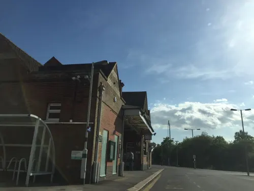
- Street-level photo, tommorris, CC BY-SA 4.0
- Street-level photo, tommorris, CC BY-SA 4.0
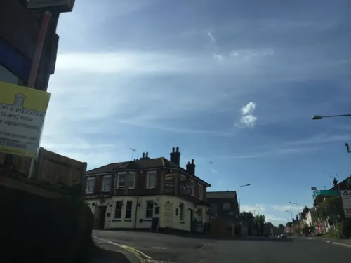
- Street-level photo, tommorris, CC BY-SA 4.0
- Street-level photo, tommorris, CC BY-SA 4.0
- Street-level photo, tommorris, CC BY-SA 4.0

Page built November 10, 2026. Spotted a mistake? Tell us or suggest a place.