


Sevenoaks, United Kingdom
Sevenoaks is a town of 29,506 people in England, United Kingdom.
Why visit Sevenoaks
Townapedia lists 7 museums and landmarks, 14 parks and trails, 62 places to eat, 2 places to stay and 3 attractions in and around town.
Highlights include Knole House, Sevenoaks Museum, Kemsing Down and Montreal Park.
Weather in Sevenoaks
Forecast from MET Norway (CC BY 4.0). Full forecast
About Sevenoaks
Sevenoaks is a town and civil parish in Kent, England. Situated 21 miles (34 km) south-east of Charing Cross, Sevenoaks is served by the South Eastern Main Line commuter railway into London. It is the principal town of the Sevenoaks district, followed by Swanley and Edenbridge. At the 2021 census, the parish had a population of 21,167, while the larger built-up area had a population of 26,475.
From the Wikipedia article Sevenoaks (this version), under CC BY-SA 4.0.
Travel tips from other travellers: Sevenoaks on Wikivoyage (CC BY-SA 4.0).
Photos of Sevenoaks


Things to do3


Museums and landmarks7


Sevenoaks Kaleidoscope Art Gallery
Museum
Buckhurst Lane, Sevenoaks
Mo 10:00-18:00; Tu-Fr 10:00-17:00; Sa 10:00-16:00; PH off

Parks, trails and playgrounds14


Montreal Park
Park · 0.9 mi
Location of a demolished stately home, turned into a housing development

Sevenoaks Wildlife Reserve
Park · 1.3 mi
Protected area in Kent, England
Knole Park
Park · 1.2 mi
Park in Sevenoaks, Kent, UK; Site of Special Scientific Interest


2 more on the map.
Restaurants and cafes62

The White Hart
Bar and pub · 1.3 mi
Tonbridge Road
Mo-Sa 11:30-23:00; Su 12:00-22:30


Bullfinch
Bar and pub · 1.4 mi
London Road
Mo-We 12:00-21:00; Th-Sa 12:00-22:00; Su 12:00-19:00

Malabar
Cafe · Coffee Shop · 1.2 mi
28 London Road
Mo-Sa 08:00-17:00; Su 08:30-17:00
50 more on the map.
History
There are few records earlier than the 13th century for the town, when it was given market status. The weekly cattle market was held in Hitchen Hatch Lane until 1999. It was closed to make way for the 160 BT building in London Road. A food market is held in the centre of town every Saturday. In the Middle Ages, two hospitals were provided by religious orders for the care of old or sick people, especially those going on pilgrimage.
Sevenoaks School, at the south end of High Street, is one of the oldest lay foundations in England. It was founded by William Sevenoke in 1432. Sevenoke, a foundling, had been brought up in the town. In later life he became a merchant and served as alderman, sheriff and Mayor of London. Founding the school and adjacent almshouses was his thanks to the town. In 1560 the school was granted letters patent by Queen Elizabeth I and became known as Queen Elizabeth's Grammar School.
In 1456, Thomas Bourchier, Archbishop of Canterbury, purchased the Knole estate and built Knole House. The mansion dominates the town.
Read more of the history
The eponymous oak trees in Knole Park have been replaced several times over the centuries. In 1902, seven oaks were planted on the north side of The Vine cricket ground to commemorate the coronation of King Edward VII. During the Great Storm of 1987, six of those trees were blown down. Their replacements, planted in a ceremony involving well-known people from television shows such as Blue Peter and locals such as Gloria Hunniford and Caron Keating, were vandalised, leaving the one mature tree standing. The trees have been replaced and eight oak trees of varying ages line The Vine.
A serious railway accident occurred nearby on 24 August 1927. Southern Railway K class passenger tank engine No. A800 River Cray was derailed hauling a Cannon Street to Deal express, knocking a road bridge and killing 13 passengers. The locomotive crew survived. The entire K class was subsequently rebuilt to prevent such an event from occurring again. The accident called into question the quality of track laying in the area.
From the History section of Sevenoaks on Wikipedia, under CC BY-SA 4.0.
More about Sevenoaks
Geography
The town is situated at the junction of two main routes from the north before traffic climbs over the Greensand Ridge which crosses Kent from west to east; that situation is similar to Maidstone and Ashford. This road was one of the earliest in the county to be turnpiked in 1709, because of the clay soils.
The valley to the north is that of the River Darent; that river turns to the north to cut through the North Downs. Several lakes are located along the course of the river here, the result of the extraction of sand and gravel in the past.
The built-up area of the town has developed primarily along the main roads. The settlement of Riverhead to the north-west is the largest; other parts of the town (in clockwise order from the north) include Greatness; Wildernesse; St John's; Hollybush; Sevenoaks Common; and Kippington.
Economy
Sevenoaks, like much of West Kent, is characterised by high levels of economic activity and a skilled resident workforce. A large proportion of that workforce commutes elsewhere to their places of employment, mostly to central London. Those factors have led to high house prices and pressure on the local area to build more houses. Many of those houses attract high prices, making it difficult for people to buy property. A wide range of middle-class occupations are in short supply locally. Industries such as finance and business services tend to predominate. Transport links are generally very busy and town centre congestion is common at peak times.
The main industrial area is located north of the town, alongside the A225. Sevenoaks Quarry is on Bat and Ball Road, also to the north.
The shopping area in High Street includes the new Bligh's development. It is a typical small town centre, with one M&S department store having opened in 2014.
Bligh's shopping development opened in phases in 2002. The site was originally a meadow, before becoming a bus station and car park. Access can be gained from several directions including the High Street and London Road. Much of the architecture is based on slightly earlier periods but with a contemporary edge.
Arts and culture
The Stag Theatre, cinema and the Plaza music and conference complex is located at the top of London Road (TN13 1ZZ). It was reopened as a community arts centre by Sevenoaks Town Council on 2 January 2009 and is supported by a strong network of volunteers. It became a not-for-profit charity in 2010. The multiplex cinema is open daily showing films. Around £550,000 has invested in equipment, infrastructure and the building since it re-opened.
The demonym for a person from Sevenoaks is Sennockian. The demonym Old Sennockian is used by alumni of Sevenoaks School.
Education
There is one mixed state secondary school, the Knole Academy, which was created in 2009 from an amalgamation of Wildernesse School (for boys) and Bradbourne School (for girls) and four state primary schools, one of which is Church of England and another of which is Catholic.
Lady Boswell's C of E Primary School on Plymouth Drive dates back to 1675 and is one of the oldest state primary schools in England. Lady Margaret Boswell left a bequest to educate 12 poor scholars of the town. The first school building was erected on London Road in 1818: it is a Grade II Listed building with a neo-Classical frontage, now called Lady Boswell House. The school moved to its current site in 1972. The school have an association with St Nicholas's Church and the Rector of St Nicholas is a Foundation Governor.
A Christian Free School called Trinity School, opened in the 2010s on the Seal Hollow Road on the north-eastern edge of town, and Seal Hollow Road is also the site of the controversial first new UK Grammar school, an annex of Weald of Kent Grammar School for girls in Tonbridge, in over 50 years. A further annex grammar school, of Tunbridge Wells Grammar School for Boys, opened in September 2021.
From the Wikipedia article Sevenoaks, under CC BY-SA 4.0.
Notable people from Sevenoaks
 Bill BrufordEnglish drummerPhoto: Steven Rieder, CC BY-SA 3.0
 Lizzy YarnoldBritish skeleton racerPhoto: 121a0012, CC BY-SA 4.0
 Charlie WhitingFormula One race directorPhoto: Morio, CC BY-SA 3.0
 Anne Seymour DamerBritish artist (1748–1828)Photo: Michalis Famelis, CC BY-SA 4.0
 Ben TulettBritish cyclistPhoto: Hoebele, CC BY-SA 4.0
 Robert ZaehnerBritish spy and academic on Eastern religions (1913–1974)Photo: Rob Croes for Anefo, CC0
 Tom BosworthBritish racewalkerPhoto: JoeDooleyD, CC BY-SA 4.0
 Andrew ThorneBritish Army general (1885–1970)Photo: Major Hunt, No. 5 Army Film and..., Public domain
 Jimmy NelsonBritish photographerPhoto: Sillerkiil, CC BY-SA 4.0
- John Miller AdyeBritish Army general (1819-1900)
- Lance PercivalBritish actor and comedian (1933-2015)
- Meredith BelbinBritish management consultant
Born in Sevenoaks, according to Wikidata (CC0). Each name links to its Wikipedia article.
Where to stay2
Churches and places of worship20
Shopping9
Gas and EV charging4
Schools, colleges and libraries21
Lady Boswell's Church of England Voluntary Aided Primary School
School · Anglican · 0.4 mi
Plymouth Drive, Sevenoaks
Healthcare7
Map of Sevenoaks
149 places. The map loads OpenStreetMap tiles when you open it.
Getting there and nearby towns
London Biggin Hill Airport (BQH) is the nearest airport with scheduled flights listed in OpenStreetMap, 8 miles away.
- Swanley 9 mi north, about 14 min by car
- West Wickham 11 mi northwest, about 18 min by car
- Sidcup 11 mi north, about 18 min by car
- Bexley 12 mi north, about 19 min by car
- Snodland 12 mi east, about 19 min by car
- Shirley 13 mi northwest, about 20 min by car
- Swanscombe 13 mi northeast, about 21 min by car
- Maidstone 14 mi east, about 23 min by car
- Croydon 15 mi northwest, about 24 min by car
- Tilbury 15 mi northeast, about 24 min by car
Drive times are estimates from straight-line distance, not routes.
Towns near Sevenoaks


Keep exploring
Local news
Headlines from INDB.
Reviews, tips and questions
Loading what members have shared...
Sources and licences
- GeoNames (CC BY 4.0): population, coordinates, regions and time zone
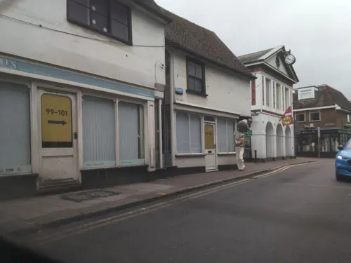
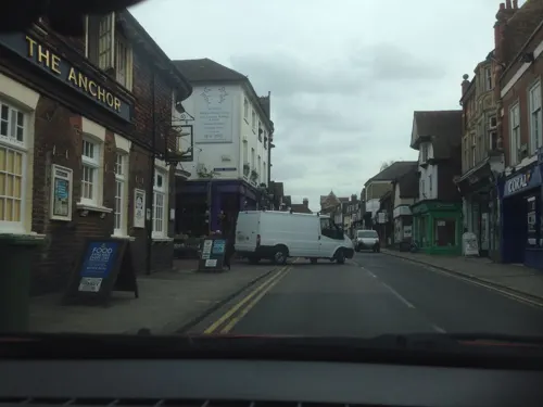
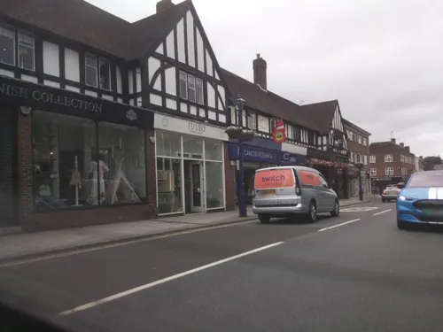
- Mapillary (see each image): photos
- OpenStreetMap contributors (ODbL 1.0): places, airports, map data
- Wikidata (CC0 1.0): elevation, founding date, time zone, website, landmarks and historic places
- Wikimedia Commons (see each image): photos
- Wikipedia (CC BY-SA 4.0): overview and history text
Photo credits
- Sevenoaks - London Road, Stacey Harris, CC BY-SA 2.0
- Sevenoaks District Council Offices, Richard Kelly, CC BY 4.0
- Knole, Sevenoaks in Kent - March 2009, Diliff, CC BY-SA 3.0
- Kemsing Down 2, Dudley Miles, CC BY-SA 4.0
- Neale(1818) p2.210 - Montreal, Kent, John Preston Neale, Public domain
- St Nicholas' Church, Sevenoaks, The Voice of Hassocks, CC0
- The White Hart, Tonbridge Road, Sevenoaks, Kent - May 2026 - 02, Mertbiol, CC0
- St Mary's Church, Riverhead, The Voice of Hassocks, CC0
- St Luke's Church, Sevenoaks, The Voice of Hassocks, CC0
- Service awards for nurses who worked in Kent Nursing Institute, ELMatronmaker, CC BY-SA 4.0
- Close-up of the inscription (OpenBenches 1984), Anonymous Unknown author, CC BY-SA 4.0
- View from the bench (OpenBenches 1984-2), Anonymous Unknown author, CC BY-SA 4.0
- Long shot of the bench (OpenBenches 1984-1), Anonymous Unknown author, CC BY-SA 4.0
- Arriva Kent & Sussex 1605 W605 YKN, Arriva436, CC BY-SA 3.0
- Street-level photo, tallguy, CC BY-SA 4.0
- Street-level photo, tallguy, CC BY-SA 4.0
- Street-level photo, southglos, CC BY-SA 4.0
- Street-level photo, tallguy, CC BY-SA 4.0
- Street-level photo, osde8info, CC BY-SA 4.0
- Street-level photo, southglos, CC BY-SA 4.0
- Street-level photo, tallguy, CC BY-SA 4.0
- Street-level photo, tallguy, CC BY-SA 4.0
- Street-level photo, osde8info, CC BY-SA 4.0
- Street-level photo, southglos, CC BY-SA 4.0
- Street-level photo, tallguy, CC BY-SA 4.0
- Street-level photo, tallguy, CC BY-SA 4.0
- Street-level photo, southglos, CC BY-SA 4.0
- Street-level photo, tallguy, CC BY-SA 4.0
- Street-level photo, jjhaslanded, CC BY-SA 4.0
- Street-level photo, jjhaslanded, CC BY-SA 4.0
- Street-level photo, tallguy, CC BY-SA 4.0
- Street-level photo, jjhaslanded, CC BY-SA 4.0
- Street-level photo, tallguy, CC BY-SA 4.0
- Street-level photo, osde8info, CC BY-SA 4.0
- Street-level photo, jjhaslanded, CC BY-SA 4.0
- Street-level photo, osde8info, CC BY-SA 4.0
- Street-level photo, southglos, CC BY-SA 4.0
- Street-level photo, southglos, CC BY-SA 4.0


Page built November 10, 2026. Spotted a mistake? Tell us or suggest a place.