


Why visit Oxted
Townapedia lists 8 museums and landmarks, 14 parks and trails, 41 places to eat, 1 place to stay and 6 attractions in and around town.
Highlights include Everyman Cinema Oxted, Botley Hill, Titsey Place and Chartwell.
Weather in Oxted
Forecast from MET Norway (CC BY 4.0). Full forecast
About Oxted
Oxted is a town and civil parish in the Tandridge district of Surrey, England. It is at the foot of the North Downs, 9 miles (14 km) south-east of Croydon, 9 miles (14 km) west of Sevenoaks, and 9 miles (14 km) north of East Grinstead.
From the Wikipedia article Oxted (this version), under CC BY-SA 4.0.
Photos of Oxted


Things to do6



Museums and landmarks8

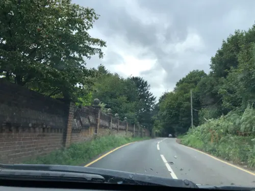
Chartwell
Museum · 3.9 mi
Country house south of Westerham, Kent, England, UK
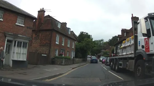
Quebec House
Museum · 3.6 mi
Grade I listed military museum in Westerham, Sevenoaks, Kent, England, UK

Limpsfield Common Family and Easy Access Trails
Monument and historic site · 2.2 mi
Self guided walks
Parks, trails and playgrounds14

Kitchen Copse
Park · 4.0 mi
English private wooded nature reserve in Surrey


Nore Hill Pinnacle
Park · 3.1 mi
Local nature reserve in Surrey, England


2 more on the map.
Restaurants and cafes41



Golden Bengal Tandoori
Restaurant · Indian
51 Station Road East, Oxted
Mo-Su,PH 12:00-14:00,18:00-23:00


Costa
Cafe
62 Station Road East, Oxted
Mo-Fr 06:00-18:30; Sa 07:00-18:30; Su 08:00-17:30
29 more on the map.
History
The earliest evidence of human activity in the civil parish is from the Iron Age and finds include a metal brooch dating from the 3rd or 4th centuries BCE. During the Roman period, the roads from London to Lewes and London to Brighton ran either side of Oxted. The name Oxted suggests that the modern settlement was founded in the Anglo-Saxon period and it is possible that St Mary's Church is built on a pre-Christian religious site. From late Saxon times, the area was administered as part of the Tandridge Hundred.
Oxted appears in the Domesday Book as Acsted and was held by Eustace II, Count of Boulogne. Its Domesday assets were: 5 hides; 1 church, 2 mills worth 12s 6d, 20 ploughs, 4 acres (1.6 ha) of meadow, pannage worth 100 hogs. It rendered £14 and 2d from a house in Southwark to its feudal overlords per year.
Read more of the history
The early medieval manor of Oxted was centred on Oxted Court Farm, to the south of St Mary's Church. For much of this period, up until the end of the 13th century, it was held by the de Acstede family, who were mesne lords to the Crown. As the Middle Ages progressed, Oxted was broken up into smaller estates. In around 1246, Broadham manor, thought to have been centred on the present day Broadham Green, to the west of Hurst Green, was granted to Battle Abbey. Records from 1312 and 1408 indicate that Broadham manor covered an area greater than 250 acres (100 ha) and that the annual rent from the abbey was 51s. Similarly, in 1283, the "Bursted" or "Birsted" estate was granted in perpetuity to Tandridge Priory, but it is unclear where in the parish this land was located.
The last male member of the de Acstede family, Roland de Acstede, was summoned to Parliament in 1290, but he died shortly afterwards. His estate was inherited by his five daughters, each of whom was given a share of the land. By 1300, one part of the manor was held by the sisters Clarica and Alina de Acstede, with the remainder by Hugh de Nevile. In 1342, John de Wellesworth, grandson of Roland, sold the de Acstede portion of the manor to Robert de Stangrave and his wife Joan.
Following the death of Robert de Stangrave in 1344, the former de Acstede portion of the manor of Oxted passed to his wife's family, the Cobhams. and in around 1350, John de Nevile, sold the remainder to them. The Cobham family lived at Starborough Castle near Lingfield and their lands in Oxted were run by a resident steward from Oxted Court Farm. In the 15th century, the manor passed to the Burgh family and, in 1587, Charles Hoskins purchased the "manor and advowson of Oxted" which covered some 605 acres (245 ha). By the mid-17th century, Barrow Green Court appears to have superseded Oxted Court Farm as the manor house. The Hoskins family held Oxted until the death of Susannah Hoskins in 1868, when it was inherited by her aunt, Katherine Master. She passed the manor to her descendants, the Hoskins Master family.
The civil parish of Oxted was formed in 1894. Oxted was part of the Godstone Rural District from 1894 until 1974, when it was combined with the Caterham and Warlingham Urban District to create the Tandridge District.
The turnpike road from Wrotham Heath to Godstone passed through the town. The modern-day A25 road divides the original town ("Old Oxted") from "New Oxted", the development that grew up to the north-east after the railway station opened in 1884. A bypass diverting the A25 to the north of Old Oxted was built in the late 1960s.
The first act of Parliament to authorise the construction of a railway through Oxted was granted in July 1865. It authorised the Surrey and Sussex Junction Railway (S&SJR) to build a line from Croydon to Groombridge, where there was to be a junction with the East Grinstead to Tunbridge Wells line. The act was controversial as the S&SJR was sponsored by the London, Brighton and South Coast Railway (LBSCR), but ran into a part of Surrey and East Sussex which was considered South Eastern Railway territory.
In three years, the S&SJR managed to build the 2,267 yd-long (2.073 km) Oxted Tunnel and two shorter tunnels at Riddlesdown and Limpsfield. However, construction became increasingly difficult as a result of the 1866 financial panic caused by failure of Overend, Gurney and Company and, in 1869, there was a riot at Edenbridge because Belgian navvies were being employed to build the line. A second act of Parliament was obtained in 1869 to formally transfer line to the LBSCR, who immediately asked for powers to suspend works. The company paid a penalty of £32,250 and construction ceased immediately. No work took place on the unfinished railway line until 1878, when a third act of Parliament authorised the Croydon, Oxted and East Grinstead railway, which would take over construction and be jointly owned by LBSCR and SER. Among the works that were completed by the new company was the iron viaduct between Oxted station and Limpsfield tunnel.
The new line finally opened to passenger traffic in March 1884. Oxted station, originally called Oxted and Limpsfield, was provided with two through platforms and a south-facing bay platform. There was also a freight yard with a south-facing connection to the line. A second station in the parish, Hurst Green Halt opened with line and was replaced by Hurst Green station, to the north, by British Rail in 1961.
The line south from Hurst Green to Eridge was opened in December 1887. A century later, in 1987, Hurst Green Junction signal box closed as part of a resignalling programme for the whole line. Electrification of the line through Oxted to East Grinstead completed July 1987, but the line to Uckfield remains unelectrified.
Although there is thought to have been a religious building on the site of St Mary's Church since before the Norman Conquest, it is unclear whether there was a significant nucleated settlement close to the site. It is possible that much of the population was thinly dispersed throughout the parish until the 12th century.
From the History section of Oxted on Wikipedia, under CC BY-SA 4.0.
More about Oxted
Geography
Oxted is in east Surrey, around 18 mi (29 km) south of central London. It is on the Greenwich Meridian, which passes through Oxted School, Station Road East and East Hill (the A25). The town straddles the London to East Grinstead railway line, which runs roughly north–south through the Parish.
The civil parish extends from the North Downs in the north to the settlement of Holland in the south. It includes Old Oxted and Hurst Green, which are to the west and south of the town respectively. Although the urban area of Limpsfield is contiguous with that of Oxted, the village is part of a separate parish. Much of Oxted and the surrounding area is drained by the headwaters of the River Eden, a tributary of the River Medway. The highest point in the civil parish is at Botley Hill, which at 269.6 m (885 ft) above ordnance datum is the highest point on the North Downs.
Arts and culture
1918 The Oxted Branch of Comrades of The Great War was established. A well built 20 ft x 80 ft Army hut costing £377 was opened in July 1919. The hut was sited on the corner of the then recreation ground owned by Mr Charles Hoskins Master, near Court Farm and St Mary's Church.The branch was one of about 700 in 30 counties UK wide. An organisation created to inaugurate and maintain in a strong, stimulating, united and democratic comradeship all those who have served in any capacity in the Sea, Land, and Air Forces during the Great War, so that neither their efforts nor their interests shall be forgotten or neglected. They called themselves affectionately "Comrades of the Hut".
In May 1921 The British Legion was founded bringing together four similarly minded organisations, creating a unified national voice for ex-servicemen and their families. On 5 July 1921 The Oxted Branch of the Comrades of the Great War became the Oxted Branch of the Royal British Legion. On Thursday 26 May 1943 the Oxted Branch of the Women's Section Branch was formed.
Education
St Mary's C of E Primary School opened as a National school in Beadles Lane in 1872. Between 1963 and 1974, it moved in stages to its current site in Silkham Road. In 2018, it merged with the adjacent Downs Way School to create a primary school with a total enrolment of 660 pupils.
Hurst Green Infant School opened as a primary school in 1960. In 1993, it became an infants school with a nursery department and since then has educated children aged from two to eight. Holland Junior School opened in 1971 as a middle school. It became a junior school in 1993 and educates pupils aged from eight to eleven.
Oxted School was opened in 1929 and was the first co-educational grammar school in Surrey. Originally called Oxted Secondary School, it opened with 22 pupils, but numbers had grown to 120 by 1932. Following the Second World War, it adopted the name Oxted County School and was renamed to Oxted School in September 1999. In August 1998, a fire destroyed 22 classrooms, the dining hall and the library, but the school reopened for the Autumn Term on time, with many lessons held in temporary buildings. A replacement building, named the Meridian Building, was opened in January 2000. The refurbished arts centre was opened in 2019 by musician Richard Stilgoe as part of the school's 90th anniversary celebrations.
From the Wikipedia article Oxted, under CC BY-SA 4.0.
Notable people from Oxted
 Granville Leveson-GowerEnglish historian and archaeologistPhoto: Camille Silvy, Public domain
- Laura TrottBritish politician and Conservative MP
- David MillsBritish lawyer
- Ernest BennBritish publisher, writer, and political economic pamphleteer
- Edward RoseBritish cricketer (born 1936)
- Francis IngallBritish army officer
- Richard Bromleycricketer (born 1946)
- Catherine Cavendish, Duchess of DevonshireBritish noblewoman
- Terence ArmstrongBritish polar geographer
- Chris BaurBritish journalist
- William Ibbettsubmariner, radio broadcaster
Born in Oxted, according to Wikidata (CC0). Each name links to its Wikipedia article.
Where to stay1
Days Inn
Motel and hotel · 2.2 mi
Clacket Lane Motorway Service Area, M25 Westbound
Churches and places of worship20
Shopping6
Gas and EV charging3
Schools, colleges and libraries11
Healthcare4
Map of Oxted
114 places. The map loads OpenStreetMap tiles when you open it.
Getting there and nearby towns
London Biggin Hill Airport (BQH) is the nearest airport with scheduled flights listed in OpenStreetMap, 6 miles away.
- Sanderstead 6 mi northwest, about 10 min by car
- West Wickham 8 mi north, about 12 min by car
- Sevenoaks 8 mi east, about 14 min by car
- Reigate 9 mi west, about 14 min by car
- Shirley 9 mi north, about 14 min by car
- Croydon 10 mi northwest, about 16 min by car
- Wallington 10 mi northwest, about 16 min by car
- Sutton 11 mi northwest, about 17 min by car
- Thornton Heath 11 mi north, about 17 min by car
- Crawley 13 mi southwest, about 20 min by car
Drive times are estimates from straight-line distance, not routes.
Towns near Oxted


Keep exploring
Local news
Headlines from INDB.
Reviews, tips and questions
Loading what members have shared...
Sources and licences
- GeoNames (CC BY 4.0): population, coordinates, regions and time zone
- Mapillary (see each image): photos
- OpenStreetMap contributors (ODbL 1.0): places, airports, map data
- Wikidata (CC0 1.0): elevation, founding date, time zone, website, landmarks and historic places
- Wikimedia Commons (see each image): photos
- Wikipedia (CC BY-SA 4.0): overview and history text
Photo credits
- Everyman cinema, 7 Station Road West, Oxted, Surrey - June 2025, Mertbiol, CC0
- 26 Station Road West, Oxted, Surrey - June 2025, Mertbiol, CC0
- 32 Station Road West, Oxted, Surrey - June 2025, Mertbiol, CC0
- 14-16 Station Road West, Oxted, Surrey - June 2025, Mertbiol, CC0
- 10 Station Road West, Oxted, Surrey - June 2025, Mertbiol, CC0
- 9 Station Road West, Oxted, Surrey - June 2025, Mertbiol, CC0
- Tandridge Leisure Centre, Hoskins Road, Oxted, Surrey - June 2025 - 01, Mertbiol, CC0
- Tandridge Leisure Centre, Hoskins Road, Oxted, Surrey - June 2025 - 02, Mertbiol, CC0
- Oxted Post Office. 13 Station Road West, Oxted, Surrey - June 2025 - 02, Mertbiol, CC0
- Oxted Post Office. 13 Station Road West, Oxted, Surrey - June 2025 - 01, Mertbiol, CC0
- Oxted railway station 1, Stephen Craven, CC BY-SA 2.0
- The Woodhouse Centre, Hoskins Road, Oxted, Surrey - June 2025, Mertbiol, CC0
- 17-19 Station Road West, Oxted, Surrey - June 2025 - 01, Mertbiol, CC0
- 17-19 Station Road West, Oxted, Surrey - June 2025 - 02, Mertbiol, CC0
- Oxted War Memorial Cross, Church Lane, Oxted, Surrey - June 2025 - 02, Mertbiol, CC0
- Oxted War Memorial Cross, Church Lane, Oxted, Surrey - June 2025 - 01, Mertbiol, CC0
- 23 Station Road West, Oxted, Surrey - June 2025 - 01, Mertbiol, CC0
- 23 Station Road West, Oxted, Surrey - June 2025 - 02, Mertbiol, CC0
- Titsey Place Oxted Surrey, Anthony Whitworth, CC BY-SA 3.0
- Kitchen Copse (3), Dudley Miles, CC BY-SA 4.0
- Tilburstow Hill Road, Godstone, Hywel Williams, CC BY-SA 2.0
- Holy Trinity Church in Crockham Hill, Glen, CC BY 2.0
- Church Of The Sacred Heart Of Jesus, Tag Scientist, CC BY-SA 4.0
- Hazelwood School, Oxted, Ndovu09, CC BY-SA 4.0
- Oxted School, 27 Bluehouse Lane, Oxted, Surrey - June 2026 - 01, Mertbiol, CC0
- St Nicholas' Church, Church Lane, Godstone (NHLE Code 1188347), The Voice of Hassocks, CC0
- The Old Bell Inn, Oxted 03, Simon Burchell, CC BY-SA 4.0
- The Bull Inn, High Street, Limpsfield, Surrey - June 2026 - 02, Mertbiol, CC0
- Barn Theatre, 25 Bluehouse Lane, Oxted, Surrey - June 2026 - 03, Mertbiol, CC0
- Street-level photo, jjhaslanded, CC BY-SA 4.0
- Street-level photo, southglos, CC BY-SA 4.0
- Street-level photo, xdTAGCLAN, CC BY-SA 4.0
- Street-level photo, richardc, CC BY-SA 4.0
- Street-level photo, edloach, CC BY-SA 4.0


Page built November 10, 2026. Spotted a mistake? Tell us or suggest a place.