


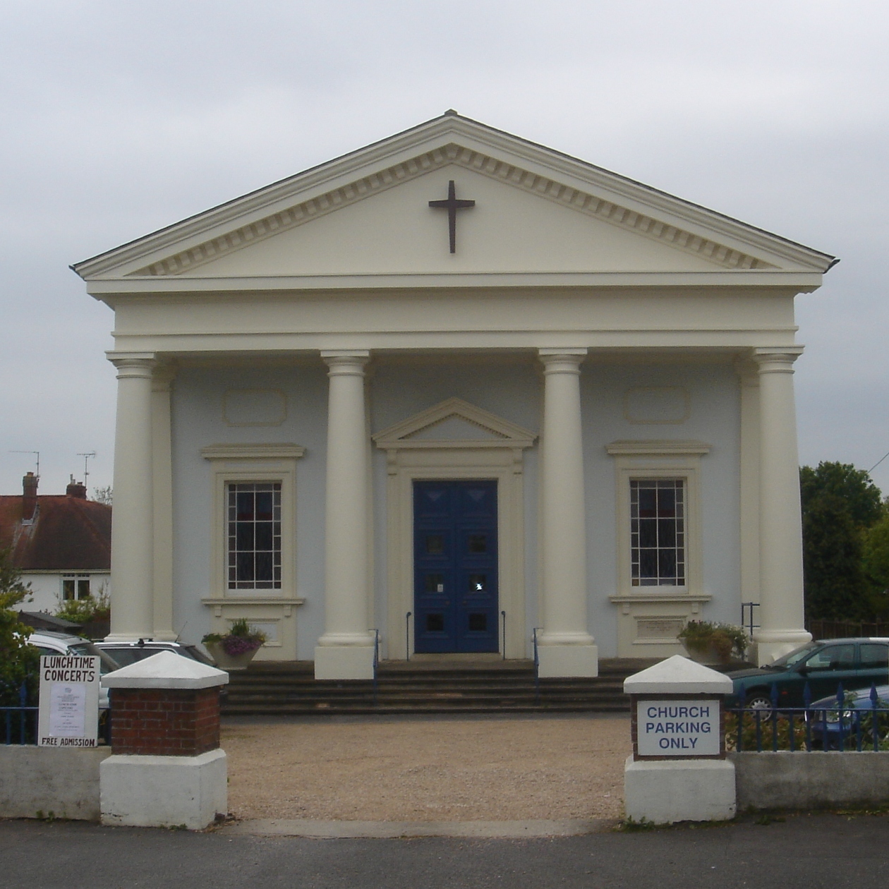


Ditchling, United Kingdom
Ditchling is a town of 1,476 people in England, United Kingdom.
Why visit Ditchling
Townapedia lists 8 museums and landmarks, 23 parks and trails, 55 places to eat, 5 places to stay and 4 attractions in and around town.
Highlights include Gardner Arts Centre, Ditchling Beacon, Ditchling Museum of Art + Craft and Chattri.
Weather in Ditchling
Forecast from MET Norway (CC BY 4.0). Full forecast
About Ditchling
Ditchling is a village and civil parish in the Lewes District of East Sussex, England. The village is contained within the boundaries of the South Downs National Park; the order confirming the establishment of the park was signed in Ditchling. There are two public houses, The Bull and The White Horse; two cafes, The Nutmeg Tree and The Green Welly; a post office, florist, delicatessen and other shops. Ditchling has community groups and societies, including the Ditchling Film Society and the Ditchling Singers.
From the Wikipedia article Ditchling (this version), under CC BY-SA 4.0.
Travel tips from other travellers: Ditchling on Wikivoyage (CC BY-SA 4.0).
Photos of Ditchling

Things to do4

Gardner Arts Centre
Cinema and theater · 4.1 mi
Arts centre in Brighton, England



Museums and landmarks8

Ditchling Museum of Art + Craft
Museum
Local museum in Ditchling, East Sussex, England, United Kingdom
Lodge Hill Lane, Hassocks

Chattri
Monument and historic site · 2.9 mi
War memorial in Brighton and Hove, UK

Plumpton Place
Monument and historic site · 2.4 mi
Ditchling Road, Lewes

Jill Windmill
Monument and historic site · 1.8 mi
Occasionally open to the public in the summer



Clayton Holt
Monument and historic site · 1.4 mi
The landscape is undulating; many of the mounds are not natural but tumuli or ancient burial mounds. Before the windmills is Clayton...
Parks, trails and playgrounds23





11 more on the map.
Restaurants and cafes55




Friars Oak
Bar and pub · 1.6 mi
London Road, Hassocks
Mo-Fr 11:30-23:00; Sa 09:00-23:00; Su 09:00-22:00

43 more on the map.
History
The place has been inhabited in some way or other for thousands of years. Above the village to the west is Lodge Hill (TQ 324 155) there is evidence of Mesolithic people in the form of their flint tools.
The terrace of the Roman Greensand Way passes across its south flank. Though damaged in the past, Lodge Hill's sandy pasture has sheep's sorrel and sheep's fescue in similar fashion to Sandy Field at Danny House, which the Roman Road also crosses.
The original village embraced both Clayton, Keymer and Wivelsfield. In the starting centuries of the Saxon settlement it was probably the capital of several Sussex 'regio', or microkingdoms, and controlled the area between the Adur and the Ouse. Later it is recorded that the Manor and its lands were held by King Alfred the Great (871–899). Alfred left it in his will to a kinsmen named Osferth, and it reverted to the Crown under Edward the Confessor.
Read more of the history
After the Norman Conquest, the land was held by William de Warenne. The Domesday Book of 1086 notes there were 196 households of which 111 were villagers, 69 were smallholders, six were burgesses and ten were slaves; land included meadows and woodland with a total value, including mill and church, of £72. In 1095 there is mention of a manor house, now Wings Place. The land passed through several hands until in 1435 it was owned by the Marquess of Abergavenny who held it until the 20th century, when it was sold to developers who failed to get planning permission to build on it.
In the 18th and 19th centuries the Old Meeting House in Ditchling was an important centre for Baptists from the wider area, whose records and memorandum books allow a unique insight into a small rural religious community of the period. These records (in the East Sussex Record Office) bear witness to often fractious and heated debates about morality and religion.
In the 1960s, Ditchling's tithe barn was dismantled and moved to Loughton, where it now forms the Corbett Theatre on the University of Essex campus there.
In January 2007, Ditchling featured in a five-part BBC Documentary entitled Storyville: A Very English Village. This was filmed, produced and directed by a Ditchling resident, but the series itself came under criticism from local residents.
In the 2017 novel Rabbitman, by Michael Paraskos, the village was the setting for a Catholic Worker anarchist commune in an imagined post-Brexit dystopia.
From the History section of Ditchling on Wikipedia, under CC BY-SA 4.0.
More about Ditchling
Education
There is one school in Ditchling, Ditchling (St Margaret's) Church of England Primary School. This is a voluntary controlled primary school for children aged 2–11. In 2022, the school became an academy and joined the Hurst Education Trust, sponsored by the nearby independent school, Hurstpierpoint College. Many of the children after leaving this school go to Downlands Community School in the village of Hassocks located in the adjoining county of West Sussex. Located in the centre of the village is Ditchling Museum of Art + Craft.
From the Wikipedia article Ditchling, under CC BY-SA 4.0.
Notable people from Ditchling
- John Nealcricketer (1926-2012)
- James Hodsoncricketer (1808-1879)
- Selby Ashcricketer (1836-1870)
Born in Ditchling, according to Wikidata (CC0). Each name links to its Wikipedia article.
Where to stay5
Churches and places of worship27
All Saints' United Reformed Church
Church · United Reformed · 2.3 mi
Junction Road, Burgess Hill
Shopping4
Gas and EV charging1
Schools, colleges and libraries11
Healthcare4
Map of Ditchling
142 places. The map loads OpenStreetMap tiles when you open it.
Getting there and nearby towns
Brighton City Airport (ESH) is the nearest airport with scheduled flights listed in OpenStreetMap, 10 miles away.
- Burgess Hill 3 mi north, about 4 min by car
- Hurstpierpoint 3 mi west, about 5 min by car
- Plumpton Green 3 mi east, about 4 min by car
- Haywards Heath 5 mi north, about 9 min by car
- Brighton 6 mi south, about 10 min by car
- Lewes 6 mi southeast, about 10 min by car
- Hove 7 mi south, about 11 min by car
- Portslade 7 mi southwest, about 11 min by car
- Rottingdean 8 mi south, about 13 min by car
- Shoreham-by-Sea 9 mi southwest, about 15 min by car
Drive times are estimates from straight-line distance, not routes.
Towns near Ditchling


Keep exploring
Local news
Headlines from INDB.
Reviews, tips and questions
Loading what members have shared...
Sources and licences
- GeoNames (CC BY 4.0): population, coordinates, regions and time zone
- Mapillary (see each image): photos
- OpenStreetMap contributors (ODbL 1.0): places, airports, map data
- Wikidata (CC0 1.0): elevation, founding date, time zone, website, landmarks and historic places
- Wikimedia Commons (see each image): photos
- Wikipedia (CC BY-SA 4.0): overview and history text
Photo credits
- Ditchling, Paste Talk, CC BY-SA 3.0
- Gardner Arts Centre, University of Sussex, The Voice of Hassocks, Public domain
- The Chattri, Patcham, Brighton, The Voice of Hassocks (original picture: User:Briantist ), Public domain
- All Saints URC Church, Burgess Hill, The Voice of Hassocks, Public domain
- All Saints Church, Patcham (NHLE Code 1380264), The Voice of Hassocks, CC0
- Wivelsfield Strict Baptist Chapel, Charlesdrakew, Public domain
- Church of the Transfiguration, Pyecombe 04, Simon Burchell, CC BY-SA 4.0
- The Old Meeting House (Unitarian Chapel) and adjacent Cottage, Ditchling, The Voice of Hassocks, Public domain
- Ote Hall Chapel, Ditchling Road, Wivelsfield (NHLE Code 1223103) (September 2021) (10), Hassocks5489, CC0
- Former Providence Chapel, Burgess Hill, The Voice of Hassocks, Public domain
- St Cosmas and St Damian Church, Keymer, Paste, CC BY-SA 3.0
- St. John the Evangelist's church, Burgess Hill, Antiquary, CC BY 3.0
- St John the Baptist's Church, Clayton, West Sussex - Exterior from Northeast, The Voice of Hassocks, Public domain
- D Beacon (N from Summit), Hassocks5489 at English Wikipedia, Public domain
- Downlands School, Paste, CC BY-SA 3.0
- St Wilfrid's RC Church, Station Road, Burgess Hill, The Voice of Hassocks, CC0
- The Greyhound pub, Keymer Road, Keymer, Hassocks (NHLE Code 1180587) (August 2019) (2), Hassocks5489, CC0
- Hassocks Infants School, Keymer Road, Hassocks (December 2013) (2), Hassocks5489, CC0
- Plumpton Place, Antiquary, CC BY-SA 4.0
- Claychurch1, Cupcakekid at English Wikipedia, CC BY 2.5
- Ditchling Museum of Art and Craft, John Lord, CC BY 2.0
- Jill Windmill (view from carpark) - Clayton Windmills 2025-09-08, Andy Li, CC0
- Jack Windmill with its cap removed - Clayton Windmills 2025-09-08, Andy Li, CC0
- BH00057 Ulmus. Stanmer Park Arboretum, Brighton. (4), Peter Bourne, CC BY-SA 3.0
- Street-level photo, stevemarsh, CC BY-SA 4.0


Page built November 10, 2026. Spotted a mistake? Tell us or suggest a place.