

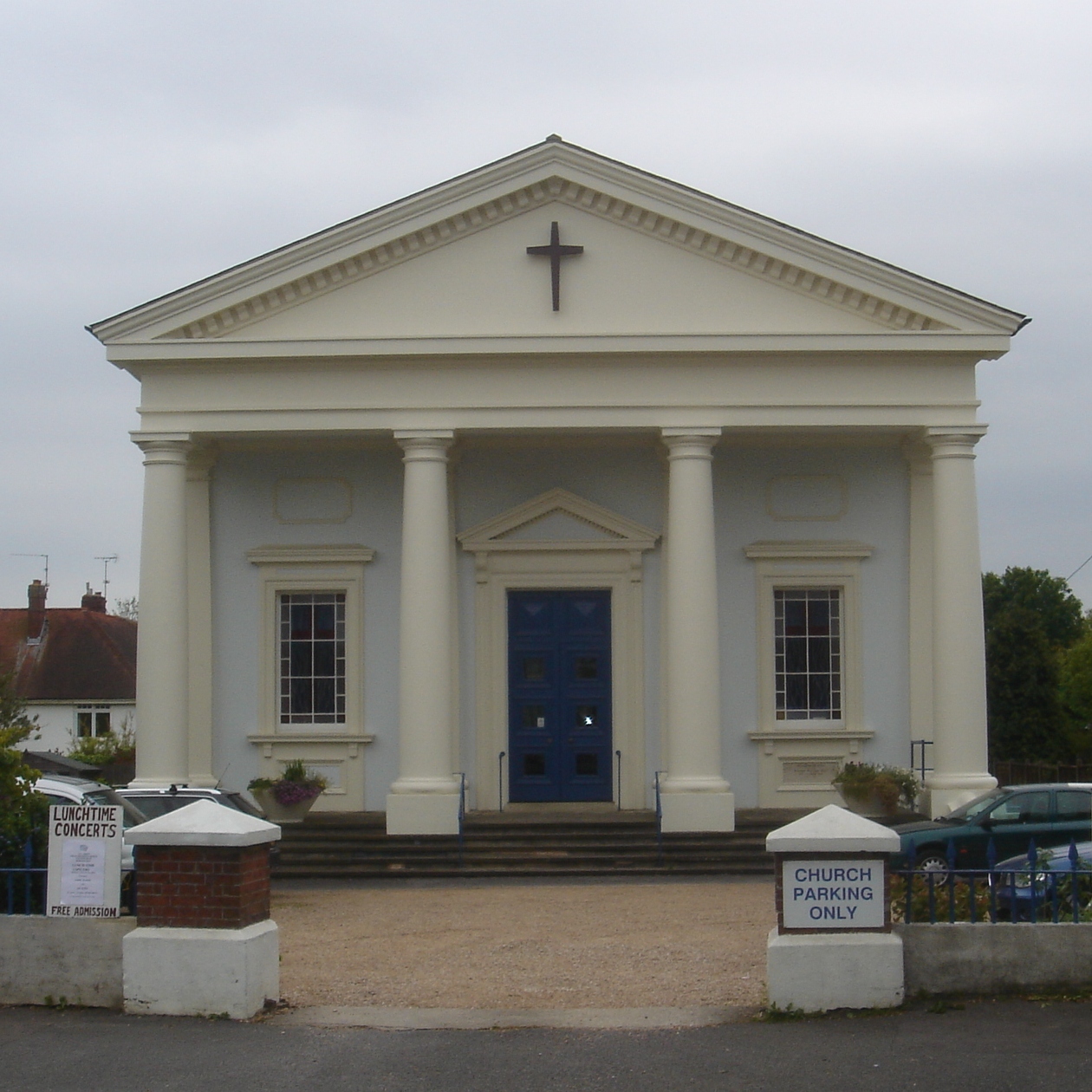


Plumpton Green, United Kingdom
Plumpton Green is a town of 1,123 people in England, United Kingdom.
Why visit Plumpton Green
Townapedia lists 4 museums and landmarks, 2 parks and trails, 3 places to eat and 2 places to stay in and around town.
Highlights include Ditchling Museum of Art + Craft and Chapel Farmhouse.
Weather in Plumpton Green
Forecast from MET Norway (CC BY 4.0). Full forecast
About Plumpton Green
Plumpton is a village and civil parish in the Lewes District of East Sussex, England. The village is located 5 mi (8.0 km) north-west of Lewes. The parish measures 6.5 mi (10.5 km) in length on its north–south axis and 1 mi (1.6 km) at its widest on the B2116 Underhill Road. The southern half of the parish lies within the South Downs National Park and at the highest point, 214 m (702 ft), the South Downs Way traverses the crest of Plumpton Plain.
From the Wikipedia article Plumpton, East Sussex (this version), under CC BY-SA 4.0.
Museums and landmarks4

Ditchling Museum of Art + Craft
Museum · 2.5 mi
Local museum in Ditchling, East Sussex, England, United Kingdom

Parks, trails and playgrounds2


Restaurants and cafes3


Where to stay2

History
Plumpton is mentioned in the Domesday Book of 1086 as having a church and two mills, and is shown as Pluntune, meaning 'town or settlement where plum-trees grew'.
Simon de Montfort fought and defeated King Henry III at the Battle of Lewes in 1264. He gained a strategic advantage, and achieved complete surprise, by using a night march to position his numerically inferior army on Downland high above the town by early morning. To avoid detection they ascended the Downs four miles to the north-west of Lewes up Warningore Bostal, a deeply-worn track that exists to this day. Before marching on the town de Montfort is reputed to have rallied his forces, wearing large white crosses on their tunics for identification, on Plumpton Plain. Although now no longer in place, within living memory a sandstone block at the centre of the cross bore the inscription 'Battle of Lewes 1264'.
Read more of the history
As in the medieval Sussex Weald generally, Plumpton parish and Plumpton's manorial outliers to the north (known as 'Plumpton Boscage') had huge amounts of common land. By 1596, 240 acres (97 ha) of Plumpton Common had been enclosed and divided, though Plumpton Green remained common land until 1842. There is little evidence now of the commons. Place names like 'Riddens' Farm and Wood and 'Inholmes' Farm indicate very ancient enclosures from the wild. The place name 'Lentridge' Farm perhaps denotes the more widespread ancient presence of small-leaved lime, which is rare now in the Weald. ('Lent' = 'lind', as in 'linden', lime). The scarce Wild Service Tree is occasionally present in the hedgerows.
Schooling began in 1837, where two teachers taught in a small building (measuring 22×16' – 6.7×4.9m) in the south of the parish in Plumpton village. This was the main centre of the parish population, which was then around 275, with some 20 children attending school.
The railway station was opened 1863, two miles to the north, and the centre of the parish gradually moved towards it. By the 1870s there were three drinking establishments, the village shop and a few other small businesses to the north of the station, spaced along Station Road. There were also a number of brickmaking sites in the open fields to either side of the road. Apart from brick-making and farming there were other rural activities such as bird-scaring, hare-coursing, acorn-picking, horse-driving, steeplechasing; even collecting flowers for the May Day celebrations. The Elementary Education Act 1870 introduced compulsory education and during 1875 the newly formed Plumpton School Board approached a total of six local landowners to sell a half-acre plot for the building of the school. All refused. The threat of compulsory purchase finally procured, for £250, a corner of a meadow bordered by a stream 200m north of the railway and in 1877 building commenced on a large single schoolroom, surmounted by a prominent bell-tower, with adjoining three-bedroomed house for the schoolmaster. The parish population was about 400 at this time; the school was designed for 64 pupils, and opened in 1878. During the first few years absenteeism was very high as it was common for children to work from an early age.
The school functioned for almost a century, and was extended at least twice to accommodate the ever-increasing population. It was eventually superseded by the present school, which was built in 1974 at the end of Southdowns cul-de-sac, and provides education facilities for 150 pupils, ranging from the ages of 4 to 11 in seven educational years. The redundant old school building had a number of community uses and then became a private residence until, in the late 1980s, with the addition of three new cottages it was converted into a total of seven dwellings. The school bell, still intact in the tower, was presented to the new school, where it is prominently displayed in the courtyard. The adjoining schoolhouse was unaffected by this development, and remained unchanged.
From the History section of Plumpton, East Sussex on Wikipedia, under CC BY-SA 4.0.
More about Plumpton Green
Education
Plumpton Primary School is located in Plumpton Green and was built in 1974 for children living in Plumpton and surrounding villages, especially Wivelsfield, Hamsey, and Chailey. The school has an assembly hall, a student library, a playing field and a (now defunct) swimming pool.
From the Wikipedia article Plumpton, East Sussex, under CC BY-SA 4.0.
Churches and places of worship8
Schools, colleges and libraries2
Map of Plumpton Green
21 places. The map loads OpenStreetMap tiles when you open it.
Getting there and nearby towns
Brighton City Airport (ESH) is the nearest airport with scheduled flights listed in OpenStreetMap, 12 miles away.
- Burgess Hill 4 mi northwest, about 6 min by car
- Haywards Heath 5 mi northwest, about 8 min by car
- Lewes 5 mi southeast, about 8 min by car
- Hurstpierpoint 5 mi west, about 8 min by car
- Uckfield 7 mi east, about 12 min by car
- Brighton 8 mi southwest, about 13 min by car
- Hove 9 mi southwest, about 14 min by car
- Rottingdean 9 mi south, about 14 min by car
- Portslade 9 mi southwest, about 15 min by car
- Peacehaven 10 mi south, about 16 min by car
Drive times are estimates from straight-line distance, not routes.
Towns near Plumpton Green


Keep exploring
Local news
Headlines from INDB.
Reviews, tips and questions
Loading what members have shared...
Sources and licences
- GeoNames (CC BY 4.0): population, coordinates, regions and time zone
- OpenStreetMap contributors (ODbL 1.0): places, airports, map data
- Wikidata (CC0 1.0): elevation, founding date, time zone, website, landmarks and historic places
- Wikimedia Commons (see each image): photos
- Wikipedia (CC BY-SA 4.0): overview and history text
Photo credits
- Plumpton Green Church 6, Charlesdrakew, Public domain
- All Saints URC Church, Burgess Hill, The Voice of Hassocks, Public domain
- Wivelsfield Strict Baptist Chapel, Charlesdrakew, Public domain
- The Old Meeting House (Unitarian Chapel) and adjacent Cottage, Ditchling, The Voice of Hassocks, Public domain
- Ote Hall Chapel, Ditchling Road, Wivelsfield (NHLE Code 1223103) (September 2021) (10), Hassocks5489, CC0
- St Cosmas and St Damian Church, Keymer, Paste, CC BY-SA 3.0
- East Chiltington Church 3, Charlesdrakew, Public domain
- Streat Church three gables, Charlesdrakew, Public domain
- Ditchling Museum of Art and Craft, John Lord, CC BY 2.0


Page built November 10, 2026. Spotted a mistake? Tell us or suggest a place.