


Why visit Dorking
Townapedia lists 30 museums and landmarks, 26 parks and trails, 89 places to eat, 5 places to stay and 10 attractions in and around town.
Highlights include Village Greens, South Street Gallery & Picture Framing, Hope Mausoleum and Norbury Park.
Weather in Dorking
Forecast from MET Norway (CC BY 4.0). Full forecast
About Dorking
Dorking () is a market town in Surrey in South East England about 21 mi (34 km) south-west of London. It is in Mole Valley District and the council headquarters are to the east of the centre. The High Street runs roughly east–west, parallel to the Pipp Brook and along the northern face of an outcrop of Lower Greensand. The town is bordered on three sides by the Surrey Hills National Landscape and is close to Box Hill and Leith Hill.
From the Wikipedia article Dorking (this version), under CC BY-SA 4.0.
Travel tips from other travellers: Dorking on Wikivoyage (CC BY-SA 4.0).
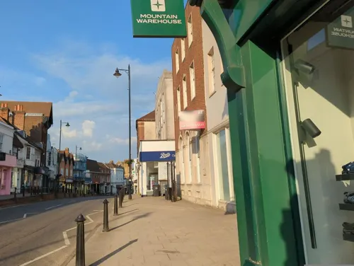
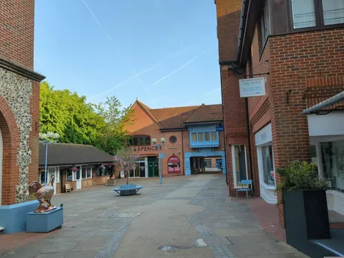
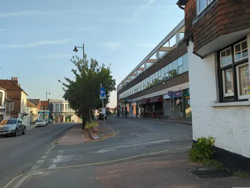
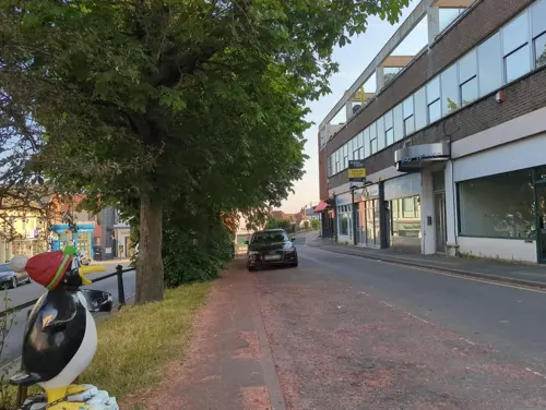
Photos of Dorking


Things to do10





Museums and landmarks30
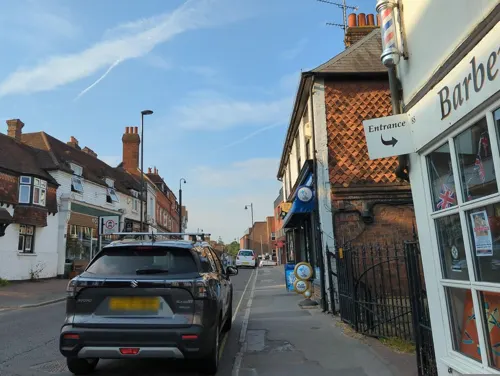
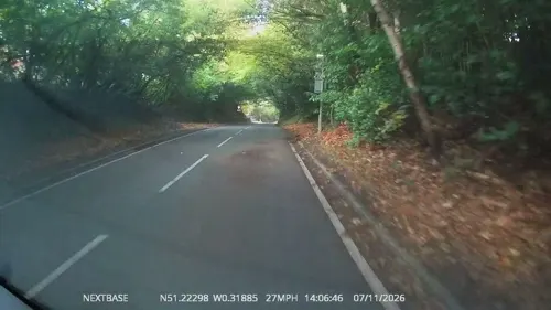

Polesden Lacey
Museum · 2.5 mi
Country house in Great Bookham, Surrey, England, UK




18 more on the map.
Parks, trails and playgrounds26


Glory Wood and Devil's Den
Park · 0.9 mi
Nature reserve in Surrey, England


14 more on the map.
Restaurants and cafes89
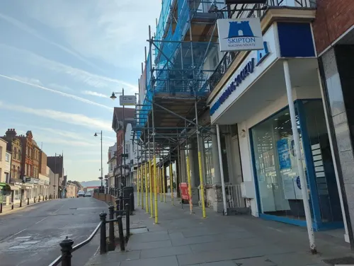
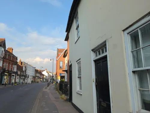
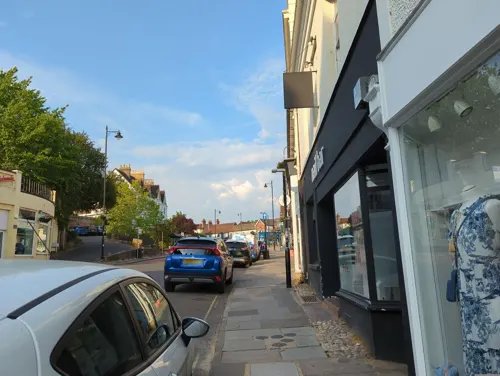
The Bull's Head
Bar and pub · Regional
11 South Street, Dorking
Tu-We 15:00-22:00; Th-Sa 12:00-23:00; Su 12:00-18:00; Mo off
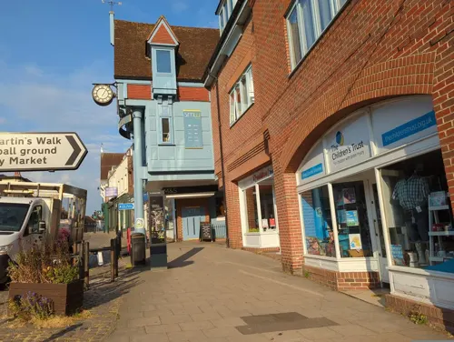
Tikka Nation
Restaurant · Indian
41-43 High Street, Dorking
Mo-Th 11:00-22:00; Fr-Sa 11:00-23:00; Su 12:00-20:30
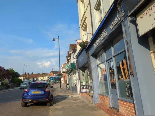
Two Many Cooks
Cafe · Coffee Shop, Breakfast
32 South Street, Dorking
Mo 08:00-17:00; Tu-Th 08:00-16:00; Sa 08:30-17:00; Su 09:00-16:00
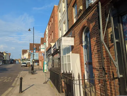
Umami
Restaurant · Japanese
187 High Street, Dorking
Tu-Sa 12:30-14:30,17:30-21:30; Su 17:30-21:30; Mo off
Holme Stores
Restaurant · Breakfast, Pizza
41 South Street, Dorking
Mo-Tu,Su off; We,Sa 08:00-16:00; Th-Fr 08:00-22:00
Rialto Lounge
Restaurant · Italian, Ice Cream, Italian Pizza
33 South Street, Dorking
Mo-Sa 12:00-22:00; Su 12:00-21:00

77 more on the map.
History
The earliest evidence of human activity in Dorking comes from the Mesolithic and Neolithic periods and includes flint tools and flakes found during construction development in South Street. During the rebuilding of the Waitrose supermarket in South Street in 2013, charred hazelnut shells, radiocarbon dated to between 8625 and 8465 BCE, were discovered. A ring ditch containing two ceramic urns, was also found. Other ditches identified during the same excavation may indicate the presence of a Bronze Age field system, although the date of these later earthworks is less certain. Bowl barrows from the same period have been found at the Glory Wood (to the south of the town centre), on Milton Heath (to the west) and on Box Hill (to the northeast).
Read more of the history
There is thought to have been a settlement at Dorking in Roman times, although its size and extent are unclear. Coins from the reigns of Hadrian (117–138 AD), Commodus (180–192) and Claudius Gothicus (214–270), as well as tiles and pottery fragments, have been found in the town. Stane Street, the Roman road linking London to Chichester, was constructed during the first century AD and is thought to have run through Dorking. The exact course through the town is not known and no definitive archaeological evidence has been discovered for the route in the 3 mi (5 km) gap between the crossing of the River Mole at the Burford Bridge and North Holmwood. A posting station is thought to have been located in the area and sites have been proposed in the town centre, at Pixham and at the Burford Bridge, where the road crossed the River Mole.
Although the name Dorking implies a settlement that was well established by the time of the Norman Conquest, archaeological evidence of Saxon activity in the town centre is limited to pottery sherds. Probable Saxon cemeteries have been found close to Yew Tree Road (to the north of the centre) and at Vincent Lane (to the west). In 1817, the so-called "Dorking Hoard" of around 700 silver pennies, dating from the mid-8th to the late-9th centuries, was found near the source of the Pipp Brook on the northern slopes of Leith Hill. In the late Saxon period, the manor and parish were administered as part of the Wotton Hundred and may have been part of a large royal estate centred on Leatherhead.
Dorking appears in Domesday Book of 1086 as the Manor of Dorchinges. It was held by William the Conqueror, who had assumed the lordship in 1075 on the death of Edith of Wessex, widow of Edward the Confessor. The settlement included one church, three mills worth 15s 4d, 16 ploughs, woodland and herbage for 88 hogs and 3 acres (1.2 ha) of meadow. It rendered £18 per year in 1086. The residents included 38 villagers, 14 smallholders and 4 villeins, which placed it in the top 20% of settlements in England by population.
In around 1087, William II granted the manor of Dorking to Willam de Warenne, the first Earl of Surrey, whose descendants have held the lordship almost continuously until the present day. By the early 14th century, the manor had been divided for administrative purposes into four tithings: Eastburgh and Chippingburgh (corresponding respectively to the eastern and western halves of the modern town); Foreignburgh (the area covered by the Holmwoods) and Waldburgh (which would later be renamed Capel). On the death of the seventh Earl, John de Warenne, in 1347, the manor passed to his brother-in-law, Richard Fitzalan, the third Earl of Arundel. In 1580 both Earldoms passed through the female line to Phillip Howard, whose father, Thomas Howard, had forfeited the title of Duke of Norfolk and had been executed for his involvement in the Ridolfi plot to assassinate Elizabeth I. The dukedom was restored to the family in 1660, following the accession of Charles II.
As the status of the de Warennes and their descendants increased, they became less interested in the town. In the 14th and 15th centuries, prominent local families (including the Sondes and the Goodwyns) were able to buy the leases on some of the lordship lands. One such area was the Deepdene, first mentioned in a court roll of 1399. This woodland was held by several tenants, before being inherited in 1652 by Charles Howard, the fourth son of the 15th Earl of Arundel, in whose family it remained until 1790. The estate was expanded by successive owners, including the Anglo-Dutch banker Thomas Hope and his eldest son Henry Thomas Hope, who commissioned William Atkinson to remodel the main house as a "sumptuous High Renaissance palazzo".
Unlike the neighbouring towns of Guildford and Reigate, Dorking was never granted a Borough Charter and remained under the control of the Lord of the Manor throughout the Middle Ages. Reforms during the Tudor period reduced the importance of manorial courts and the day-to-day administration of towns such as Dorking became the responsibility of the vestry of the parish church. There was little change in local government structure over the subsequent three centuries, until the Poor Law Amendment Act 1834 transferred responsibility for poor relief to the Poor Law Commission, whose local powers were delegated to the newly formed Poor Law union in 1836. In 1841, the Dorking Union constructed a new workhouse, south of the town centre, designed by William Shearburn. The entrance block still stands and is now part of Dorking Hospital.
From the History section of Dorking on Wikipedia, under CC BY-SA 4.0.
More about Dorking
Geography
Dorking is in central Surrey, about 21 mi (34 km) south of London and 10 mi (16 km) east of Guildford. It is close to the intersection of two valleys – the north-south Mole Gap (where the River Mole cuts through the North Downs) and the west–east Vale of Holmesdale (a narrow strip of low-lying land between the North Downs and the Greensand Ridge). The highest point in the town is the Glory Wood, south east of the centre, where the summit (137 m (449 ft)) is marked by a Bronze Age bowl barrow.
The basic plan of the town centre has not changed since medieval times (and may be Anglo-Saxon in origin). The main streets (the High Street, West Street and South Street) meet at Pump Corner, forming a " Y " shape. Together, West Street and the High Street run approximately west–east, paralleling the Pipp Brook, a tributary of the Mole, which runs to the north of the centre.
The town is surrounded by the Metropolitan Green Belt (which also covers the Glory Wood) and is bordered on three sides by the Surrey Hills National Landscape. Several Sites of Special Scientific Interest are close by, including the Mole Gap to Reigate Escarpment, immediately to the north. The National Trust owns several properties in the area, including Box Hill, Leith Hill Tower and Polesden Lacey.
Arts and culture
The Dorking Group of Artists, established in 1947, exhibits locally twice a year, in Betchworth and at Denbies. The Arts Society Dorking promotes local art appreciation and the preservation of the town's artistic heritage.
The three-day Leith Hill Musical Festival for local, amateur choral societies, founded in 1905, takes place at the Dorking Halls each year. Ralph Vaughan Williams was the Festival Conductor until 1953, a post currently held by Jonathan Willcocks.
Each day features a different group (or division) of choirs, which compete against each other in the morning and then combine to give a concert in the evening. Following the tradition established by Vaughan Williams, the Messiah by Handel and the St Matthew and St John Passions by J. S. Bach are frequently performed.
After the death of Vaughan Williams in 1958, the festival committee commissioned David McFall to design a bronze bas relief likeness of the composer: one cast was placed in St Martin's Church and another in the Dorking Halls.
Education
There are five primary schools in Dorking, the oldest of which is Powell Corderoy School. It was founded in 1816 as The Dorking British School, and its original premises were in West Street; but twenty years later it moved to North Street. Towards the end of the nineteenth century, the school had expanded and the funds for a new building in Norfolk Road were raised by Edith Corderoy and Mr T. Powell. The new site was opened in 1898 and the school adopted its present name in 1906. The school moved to its current location in Longfield Road in 1968.
St Martin's Primary School was founded as a National School by the vestry in the 1830s, however there is thought to have been a school located in the transepts of the parish church as early as the 17th century. The National School was moved from the grounds of the church to West Street in 1862. The Middle School relocated to Ranmore Road in 1969 and was joined by the First School in 1985. The Pixham First School was founded in 1880 by Mary Mayo and was built to a design by Gilbert Redgrave. St Paul's Primary School was founded in 1860.
From the Wikipedia article Dorking, under CC BY-SA 4.0.
Notable people from Dorking
 Laurence OlivierEnglish actor and director (1907–1989)Photo: Allan warren, CC BY-SA 3.0
 Jamie MackieBritish footballer (born 1985)Photo: james cumberpatch, CC BY-SA 2.0
 Thomas McMahonRoman Catholic Bishop (1936–2025)Photo: Fr James Bradley from Southampton, UK, CC BY 2.0
 Laila MorseEnglish actress (born 1945)Photo: Garry Knight, CC BY-SA 2.0
 Walter Dendy SadlerBritish artist (1854-1923)Photo: Walter Dendy Sadler, Public domain
- Cyril Mackworth-PraedBritish sport shooter, ornithologist and naturalist (1891-1974)
- Simon Hiscockssailor
- Priscilla AldenMayflower passenger and New World colonist (1602–1685)
- Alexander BonsorEnglish footballer (1851-1907)
- Susy Kaneactress
- Peter DennisBritish actor (1933-2009)
- Rupert MatthewsBritish politician (born 1961)
Born in Dorking, according to Wikidata (CC0). Each name links to its Wikipedia article.
Where to stay5
Churches and places of worship19
Shopping32
Gas and EV charging3
Schools, colleges and libraries11
Healthcare10
Map of Dorking
235 places. The map loads OpenStreetMap tiles when you open it.
Getting there and nearby towns
London Gatwick Airport (LGW) is the nearest airport with scheduled flights listed in OpenStreetMap, 8 miles away.
- Great Bookham 4 mi northwest, about 6 min by car
- Reigate 6 mi east, about 9 min by car
- Epsom 7 mi north, about 12 min by car
- Horley 9 mi southeast, about 14 min by car
- Hook 9 mi north, about 15 min by car
- Sutton 10 mi northeast, about 16 min by car
- Crawley 11 mi southeast, about 17 min by car
- Woking 11 mi northwest, about 18 min by car
- Worcester Park 11 mi north, about 18 min by car
- Weybridge 11 mi northwest, about 18 min by car
Drive times are estimates from straight-line distance, not routes.
Towns near Dorking


Keep exploring
Local news
Headlines from INDB.
Reviews, tips and questions
Loading what members have shared...
Sources and licences
- GeoNames (CC BY 4.0): population, coordinates, regions and time zone
- Mapillary (see each image): photos
- OpenStreetMap contributors (ODbL 1.0): places, airports, map data
- Wikidata (CC0 1.0): elevation, founding date, time zone, website, landmarks and historic places
- Wikimedia Commons (see each image): photos
- Wikipedia (CC BY-SA 4.0): overview and history text
Photo credits
- Dorking, United Kingdom Apr 14, 2024 01-19-42 pm, Monkeez, CC BY-SA 4.0
- United Reformed Church, West Street, Dorking, Surrey - December 2024, Mertbiol, CC0
- Polesden lacey, Martyn Davies, CC BY-SA 2.0
- NorburyPark-NewManorHouse-01, Vox Humana 8', CC BY 2.5
- St Joseph's RC Church, Falkland Grove, Dorking, The Voice of Hassocks, CC0
- Betchworth.castle, Peter van der Linden, CC BY-SA 3.0
- Deepdene (1850), Thomas Allom, Public domain
- Pippbrook House Dorking, MartynDavies, CC BY-SA 3.0
- St Barnabas' Church, Ranmore Common Road, Ranmore Common (NHLE Code 1189879), The Voice of Hassocks, CC0
- Holy Trinity Church, Guildford Road, Westcott (NHLE Code 1227892), The Voice of Hassocks, CC0
- St Mary the Virgin's Church, Pixham Lane, Pixham (NHLE Code 1279086), The Voice of Hassocks, CC0
- St Paul's Church Dorking 1, Ademac, CC BY-SA 4.0
- St John the Evangelist's Church, Inholms Lane, North Holmwood (NHLE Code 1228416), The Voice of Hassocks, CC0
- United Reformed Church Dorking, Ademac, CC BY-SA 4.0
- Betchworth Castle (3), AndyScott, CC BY-SA 4.0
- VESSEL, Surrey County Council, Simon Maslin, 2020-01-26 07:51:21, CC BY 2.0
- Box Hill Salomons Memorial, Ian Capper, CC BY-SA 2.0
- Denbies hillside - panoramio, Benjamin Rusholme, CC BY-SA 3.0
- Dorking Halls, Reigate Road, Dorking, Surrey - April 2026 - 03, Mertbiol, CC0
- View from Box Hill viewpoint, Arriva436, CC BY-SA 3.0
- The Temple, The Nower, Dorking, Surrey - April 2026 - 01, Mertbiol, CC0
- Street-level photo, inanov, CC BY-SA 4.0
- Street-level photo, inanov, CC BY-SA 4.0
- Street-level photo, inanov, CC BY-SA 4.0
- Street-level photo, inanov, CC BY-SA 4.0
- Street-level photo, inanov, CC BY-SA 4.0
- Street-level photo, inanov, CC BY-SA 4.0
- Street-level photo, inanov, CC BY-SA 4.0
- Street-level photo, inanov, CC BY-SA 4.0
- Street-level photo, inanov, CC BY-SA 4.0
- Street-level photo, inanov, CC BY-SA 4.0
- Street-level photo, inanov, CC BY-SA 4.0
- Street-level photo, inanov, CC BY-SA 4.0
- Street-level photo, inanov, CC BY-SA 4.0
- Street-level photo, inanov, CC BY-SA 4.0
- Street-level photo, inanov, CC BY-SA 4.0
- Street-level photo, inanov, CC BY-SA 4.0
- Street-level photo, inanov, CC BY-SA 4.0
- Street-level photo, inanov, CC BY-SA 4.0
- Street-level photo, inanov, CC BY-SA 4.0
- Street-level photo, inanov, CC BY-SA 4.0
- Street-level photo, inanov, CC BY-SA 4.0
- Street-level photo, daveemtb, CC BY-SA 4.0
- Street-level photo, inanov, CC BY-SA 4.0
- Street-level photo, inanov, CC BY-SA 4.0
- Street-level photo, inanov, CC BY-SA 4.0
- Street-level photo, inanov, CC BY-SA 4.0
- Street-level photo, OrangeHurst97, CC BY-SA 4.0


Page built November 10, 2026. Spotted a mistake? Tell us or suggest a place.