


Why visit Reigate
Townapedia lists 37 museums and landmarks, 16 parks and trails, 93 places to eat, 3 places to stay and 5 attractions in and around town.
Highlights include Everyman Cinema, Reigate, Colley Hill, Reigate Tunnel Road Caves and Inglis Memorial.
Weather in Reigate
Forecast from MET Norway (CC BY 4.0). Full forecast
About Reigate
Reigate is a town in Surrey, England. It is sited around 19 miles (30 km) south of central London and 9 mi (14 km) north of Gatwick Airport. The settlement is recorded in the Domesday Book of 1086 as Cherchefelle and first appears with its modern name in the 1190s. The earliest archaeological evidence for human activity is from the Paleolithic and Neolithic; during the Roman period, tile-making took place to the north-east of the modern centre.
From the Wikipedia article Reigate (this version), under CC BY-SA 4.0.
Travel tips from other travellers: Reigate on Wikivoyage (CC BY-SA 4.0).
Photos of Reigate

Things to do5
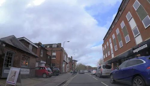

Reigate Hill
Scenic view · 1.4 mi
Engraved Panorama directional marker on level top of plinth (about 70cm high) includes places out of sight such as Canterbury 59 miles

George V Jubilee
Scenic view · 1.3 mi
Originally a sighting post used in construction of the Redhill - Tonbrige railway line.
Redhill Common, Redhill
Museums and landmarks37
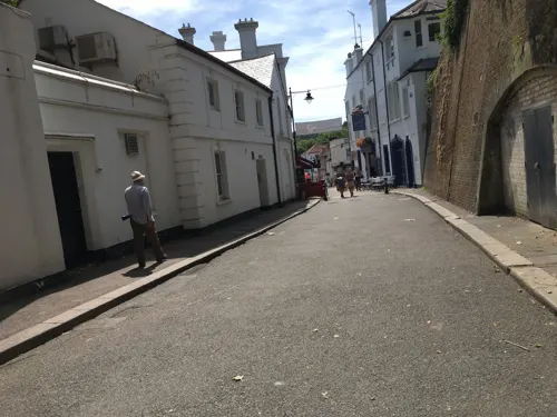
Reigate Tunnel Road Caves
Monument and historic site
Tunnel Road, Reigate
May 09; Jun 13; Jul 11; Aug 08; Sep 12

Inglis Memorial
Monument and historic site · 1.1 mi
Roof has mosaic representation of sun and planets



The Fire Brigades of Surrey
Museum · 0.6 mi
Croydon Road, Reigate
"During Surrey Fire HQ Open Days, or by Appointment"

Boys Air raid shelter
Monument and historic site · 1.3 mi
Naif painting, by children?, stories of Dick Wittington, Treasure Island etc.
Heritage weekend - Sept [booking required]
Holmesdale Natural History Club Museum
Monument and historic site · 0.4 mi
The Museum, 14 Croydon Road, Reigate
25 more on the map.
Parks, trails and playgrounds16



4 more on the map.
Restaurants and cafes93
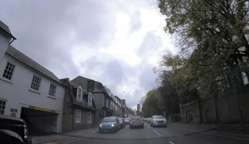
Parkside
Restaurant · Fine Dining, International, Breakfast, Brunch
A highly regarded family run independent restaurant in the heart of Reigate serving breakfast, lunch & dinner. We use local produce from...
71 Bell Street, Reigate
Mo-Su 08:30-15:00, Th-Sa 18:00-23:00
Five Spice
Restaurant · Chinese
7 Holmesdale Road, Reigate
Mo-Th 12:00-14:00,18:00-22:00; Fr-Sa 12:00-14:00,17:30-22:00; Su...
borgo
Restaurant · Italian
1 Church Street, Reigate
Mo-Th 12:00-14:30,17:00-22:00; Fr 12:00-14:30,17:00-22:30; Sa...



Sea Salt
Restaurant · Fish And Chips · 0.4 mi
41 Lesbourne Road, Reigate
Mo-We 16:30-21:00, Th-Sa 11:30-14:00,16:30-21:00, Su closed

81 more on the map.
History
The earliest evidence of human activity in the Reigate area is a triangular stone axe from the Paleolithic, which was found in Woodhatch in 1936. Worked flints from the later Neolithic have been found on Colley Hill. Finds from the Bronze Age include a gold penannular ring, dated to c. 1150 – c. 750 BCE, and a barbed spearhead from Priory Park. The eight barrows on Reigate Heath are thought to date from the same period, when the surrounding area may have been marshland.
During the Roman period, the Doods Road area was a centre for tile-making. An excavation in 2014 uncovered the remains of a second- or third-century kiln with several types of tile, identified as tegulae, imbrices and pedales. Artefacts discovered to the south-west of the town centre in 2011 suggest that there was a high-status villa nearby. Coins from the reigns of Vespasian (69–79), Hadrian (117–138), Severus Alexander (222–235) and Arcadius (383–408), indicate that there was Roman activity in the local area throughout the occupation of Britain.
Read more of the history
The former name Cherchefelle suggests that the most recent period of permanent settlement in Reigate began in Anglo-Saxon times. The main settlement is thought to have been located in the area of the parish church, to the east of the modern centre, although much of the population was probably thinly dispersed around the parish. Excavations in Church Street in the late 1970s uncovered a Saxon glass jar and remains of a skeleton of uncertain age, but archaeological evidence from this period elsewhere in the town is sparse.
Reigate appears in Domesday Book of 1086 as Cherchefelle. It was held by William the Conqueror, who had assumed the lordship in 1075 on the death of Edith of Wessex, widow of Edward the Confessor. The settlement included two mills worth 11s 10d, land for 29 plough teams, woodland and herbage for 140 swine, pasture for 43 pigs and 12 acres (4.9 ha) of meadow. The manor rendered £40 per year in 1086 and the residents included 67 villagers and 11 smallholders. The Domesday Book also records that the town was part of the larger Hundred of Cherchefelle.
The non-corporate Borough of Reigate, covering roughly the town centre, was formed in 1295. It elected two MPs until the Reform Act 1832 when it lost one. In 1868, Reigate borough was disenfranchised for corruption, but representation in the House of Commons was restored to the town in the Redistribution of Seats Act 1885 (48 & 49 Vict. c. 23).
The manor of Cherchefelle was granted to William de Warenne when he became Earl of Surrey c. 1090 and under his patronage, Reigate began to thrive. The castle was constructed shortly afterwards and the modern town was established to the south in the late 12th century. An Augustinian priory, founded by the fifth Earl of Surrey, is recorded in 1240. By 1276, a regular market was being held and a record of 1291 describes Reigate as a borough. On the death of the seventh Earl, John de Warenne, in 1347, the manor passed to his brother-in-law, Richard Fitzalan, the third Earl of Arundel. In 1580, both Earldoms passed through the female line to Phillip Howard, whose father, Thomas Howard, had forfeited the title of Duke of Norfolk and had been executed for his involvement in the Ridolfi plot to assassinate Elizabeth I. The dukedom was restored to the family in 1660, following the accession of Charles II.
Reforms during the Tudor period reduced the importance of manorial courts and the day-to-day administration of towns such as Reigate became the responsibility of the vestry of the parish church. By the early 17th century, the 5,000-acre (2,000 ha) ecclesiastical parish had been divided for administrative purposes into two parts: the Borough of Reigate, which broadly corresponded to the modern town centre, and "Reigate Foreign", which included the five petty boroughs of Santon, Colley, Woodhatch, Linkfield and Hooley. The two parts were reunited in 1863 as a Municipal Borough with a council of elected representatives chaired by a mayor. The borough was extended in 1933 to include Horley, Merstham, Buckland and Nutfield.
The Local Government Act 1972 created Reigate and Banstead Borough Council, by combining the Reigate Borough with Banstead Urban District and the eastern part of the Dorking and Horley Rural District. Since its inception in 1974, the council has been based in the Town Hall in Castlefield Road, Reigate.
Reigate Castle was built in the late 11th or early 12th century, most likely by William de Warenne, 2nd Earl of Surrey. Taking the form of a motte-and-bailey castle, it was originally constructed of timber, but the curtain walls were rebuilt in stone around a century later. A water-filled moat section was dug into the clay on the north side and a dry ditch was excavated around the remainder of the structure. The large size of the motte indicates that the castle was designed both as a fortification and as the lord's residence from the outset.
Following the dissolution of the monasteries, the lords of the manor moved their primary residence to Reigate Priory, to the south of the town. The castle was allowed to decay, with only small outlays recorded in the manor accounts for repairs, until 1686, when the buildings were reported as ruinous. Much of the masonry was most likely removed for local construction projects, but in around 1777, Richard Barnes, who rented the grounds, built a new gatehouse folly using the remaining stone. A century later, the borough council was granted a long lease on the property, which had been turned into a public garden. Regular tours of the caves beneath the castle are run by the Wealden Cave and Mine Society.
From the History section of Reigate on Wikipedia, under CC BY-SA 4.0.
More about Reigate
Geography
The town is in the Vale of Holmesdale, below the North Downs escarpment; the average elevation in the centre is 80 m (262 ft) above OD. The area is drained by the Wallace Brook and its tributaries, which feed the river Mole.
Woodhatch lies on the Weald Clay, a sedimentary rock primarily consisting of mudstone that was deposited in the early Cretaceous. Much of Reigate is on the strata of the Lower Greensand Group. This group is multi-layered and includes the sandy Hythe Beds overlain by the clayey Sandgate Beds, which together form the high ground of Priory Park. Reigate Heath and the town centre are on quartz-rich Folkestone Beds and the water-filled part of the castle moat is dug into narrow band of clay present in the sandstone. To the north of the railway line is the Gault Formation, a stiff, blue-black, shaly clay, deposited in a deep-water marine environment. At the base of the North Downs is a thin outcrop of Upper Greensand, above which lies the Chalk Group.
Economy
The airline Air Europe had its head office in Europe House in Reigate. Redland plc, the FTSE 100 building materials company, was headquartered in the town before its acquisition by Lafarge; its former headquarters are now occupied by the insurance company esure.
Canon UK had its headquarters on the southern outskirts of Reigate. The building, opened by Prince Philip, Duke of Edinburgh in 2000, has won numerous design and 'green' awards.
The European headquarters of Kimberly-Clark are on London Road in the town, just south of Reigate railway station. Further along London Road towards the town centre can be found the former European headquarters of Willis Towers Watson, prior to the merger with Willis, when the global and British headquarters relocated to Lime Street in London.
Pilgrim Brewery was founded in 1982 and moved to West Street in 1984. It was the first new brewery to be established in Surrey for over a century.
Arts and culture
Reigate Priory Museum holds an early-16th century portrait of John Lymden, the final Prior of Reigate. The Town Hall holds several artworks, including paintings by Henry Tanworth Wells (1828-1903), George Leon Little (1862-1941) and George Hooper (1910-94).
Landscapes depicting scenes of the Reigate area by the artists Alfred Walter Williams (1823-1905), James Thomas Linnell (1826-1905) and Albert Ernest Bottomley (1873-1950) are held by Leicester Museum and Art Gallery, the Royal Pavilion and Museums Trust, Brighton, and Derby Museum and Art Gallery respectively.
Among the works of public art in the town is a statue of the ballet dancer, Margot Fonteyn, by the artist Nathan David, which was installed at the south end of London Road in 1980.
Reigate is the setting for the Sherlock Holmes short story "The Adventure of the Reigate Squire", (also known as "The Adventure of the Reigate Squires" and "The Adventure of the Reigate Puzzle"). It is one of twelve stories featured in The Memoirs of Sherlock Holmes by Sir Arthur Conan Doyle.
Education
Dovers Green School and Wray Common Primary School are members of the Greensand Multi-Academy Trust. Sandcross Primary School is part of the Everychild Trust.
Reigate Parish Church Primary School was founded as the Reigate National School. Originally in West Street, it moved to London Road in 1854 and then to Blackborough Road in 1995.
Reigate Priory Junior School traces its origins to a non-denominational school, founded in 1852 in the High Street. It moved to Holmesdale Road in the 1860s and in 1993 moved to the priory, taking over the classrooms previously used by Reigate Priory Middle School. The school educates children between the ages of 7 and 11 and is due to move to new premises on Cockshott Hill in 2023.
Reigate School is a secondary school in Woodhatch, educating children aged 11 to 16. It is part of the Greensand Multi-Academy Trust. It opened as the Woodhatch County Secondary School in September 1958.
From the Wikipedia article Reigate, under CC BY-SA 4.0.
Notable people from Reigate
 Margot FonteynBritish ballerinaPhoto: Hurok Concerts (U.S.), Public domain
 Max Chiltonracecar driverPhoto: Tambeau212, CC BY-SA 3.0
 Tom ChiltonBritish racecar driverPhoto: Robk23oxf, CC BY-SA 3.0
 Caroline QuentinEnglish actress, broadcaster and television presenterPhoto: Eimaiegw, CC BY-SA 4.0
 Newton FaulknerEnglish singer-songwriterPhoto: Bryan Ledgard, CC BY-SA 2.0
 Dylan LlewellynEnglish actorPhoto: DavidPMaynard, CC BY-SA 4.0
 Robert Raglanactor (1906-1985)Photo: episode screenshot (ABC), Public domain
 Alexander Carr-SaundersBritish sociologist and biologist (1886–1966)Photo: Unknown author, No restrictions
- Anne V. CoatesBritish film editor (1925-2018)
- Mary HesseEnglish philosopher (1924-2016)
- Kate MaberlyBritish actress and singer
- David Vincent HooperBritish chess player and writer (1915–1998)
Born in Reigate, according to Wikidata (CC0). Each name links to its Wikipedia article.
Where to stay3
Churches and places of worship25
Shopping35
Gas and EV charging4
Schools, colleges and libraries18
Healthcare8
Map of Reigate
244 places. The map loads OpenStreetMap tiles when you open it.
Getting there and nearby towns
London Gatwick Airport (LGW) is the nearest airport with scheduled flights listed in OpenStreetMap, 6 miles away.
- Sutton 8 mi north, about 13 min by car
- Crawley 9 mi south, about 14 min by car
- Sanderstead 9 mi northeast, about 14 min by car
- Wallington 9 mi north, about 15 min by car
- Worcester Park 10 mi north, about 16 min by car
- Croydon 11 mi northeast, about 18 min by car
- Shirley 12 mi northeast, about 19 min by car
- Thornton Heath 12 mi north, about 19 min by car
- West Wickham 12 mi northeast, about 19 min by car
- Walton-on-Thames 14 mi northwest, about 22 min by car
Drive times are estimates from straight-line distance, not routes.
Towns near Reigate


Keep exploring
Local news
Headlines from INDB.
Reviews, tips and questions
Loading what members have shared...
Sources and licences
- GeoNames (CC BY 4.0): population, coordinates, regions and time zone
- Mapillary (see each image): photos
- OpenStreetMap contributors (ODbL 1.0): places, airports, map data
- Wikidata (CC0 1.0): elevation, founding date, time zone, website, landmarks and historic places
- Wikimedia Commons (see each image): photos
- Wikipedia (CC BY-SA 4.0): overview and history text
Photo credits
- St Andrew's, Gatton - exterior, Dlg south, CC BY-SA 4.0
- St John the Evangelist's Church, Woodlands Road, Redhill (NHLE Code 1029141) (September 2012), The Voice of Hassocks, CC0
- Reigate Castle 002, Rjwilmsi, Public domain
- Reigate School, Surrey, main entrance, AdamLehodey, CC BY-SA 4.0
- The Bulls Head, 55 High Street, Reigate, Surrey - March 2026 - 01, Mertbiol, CC0
- St Mark's Church, Alma Road, Reigate (June 2013) (2), Hassocks5489, CC0
- Steps to serenity, Sidney Sambu, CC BY-SA 3.0
- Reigate Hill Viewpoint, Tim Sheerman-Chase, CC BY 2.0
- Inglis Memorial, Colley Hill, Reigate, Surrey - July 2015, Leimenide, CC BY 2.0
- Street-level photo, 4004, CC BY-SA 4.0
- Street-level photo, 4004, CC BY-SA 4.0
- Street-level photo, 4004, CC BY-SA 4.0
- Street-level photo, 4004, CC BY-SA 4.0
- Street-level photo, 4004, CC BY-SA 4.0
- Street-level photo, southglos, CC BY-SA 4.0
- Street-level photo, southglos, CC BY-SA 4.0
- Street-level photo, 4004, CC BY-SA 4.0
- Street-level photo, 4004, CC BY-SA 4.0
- Street-level photo, southglos, CC BY-SA 4.0
- Street-level photo, southglos, CC BY-SA 4.0
- Street-level photo, southglos, CC BY-SA 4.0
- Street-level photo, 4004, CC BY-SA 4.0
Page built November 10, 2026. Spotted a mistake? Tell us or suggest a place.