


Dovercourt, United Kingdom
Dovercourt is a town of 1,001 people in England, United Kingdom.
Why visit Dovercourt
Townapedia lists 14 museums and landmarks, 16 parks and trails, 65 places to eat, 10 places to stay and 7 attractions in and around town.
Highlights include Harwich Maritime Museum, Harwich High Lighthouse, HMS Ganges and Beacon Hill Fort.
Weather in Dovercourt
Forecast from MET Norway (CC BY 4.0). Full forecast
About Dovercourt
Dovercourt is a town and an area of Harwich in the Tendring district of Essex, England. Dovercourt has been administered as part of Harwich since at least the 17th century and forms part of the Harwich built up area. It is sometimes described as a suburb of Harwich and sometimes as a separate town. The area around Dovercourt High Street now serves as the main town centre of the Harwich built up area; there are few retail facilities in the old town of Harwich.
From the Wikipedia article Dovercourt (this version), under CC BY-SA 4.0.
Photos of Dovercourt


Things to do7
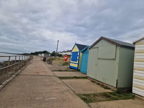

Harwich High Lighthouse
Lighthouse · 0.7 mi
Lighthouse in Harwich, Essex, England, UK
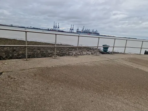
Harwich Low Lighthouse
Lighthouse · 0.7 mi
Lighthouse in Harwich, Tendring, Essex, England, UK
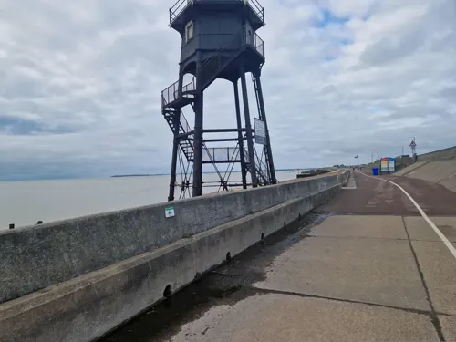


Museums and landmarks14

HMS Ganges
Monument and historic site · 1.4 mi
Royal Navy shore establishment




Lightship LV18
Monument and historic site · 0.9 mi
The ex-Trinity House vessel LV18 is the last surviving example of a manned light vessel in British waters, which has been preserved in...
The Quay, Harwich


2 more on the map.
Parks, trails and playgrounds16







4 more on the map.
Restaurants and cafes65


53 more on the map.
History
The name is common Brittonic with "Dover" coming from "dwfr", which is "water" in modern Welsh; the origin of "court" is unknown but possibly meant "land cut off by". Dovercourt was recorded as 'Douorcortae' in the year 1000.
Dovercourt appears in the Domesday Book of 1086, when it was a manor. The Domesday Book records that a Saxon lord called Wulwin or Ulwin had been lord of the manor in 1066; by 1086 the estate was in possession of Aubrey de Vere and remained part of the barony of his descendants, the Earls of Oxford, until the 16th century. It formed part of the dowry of Juliana de Vere when she married Hugh Bigod in the mid-12th century, and the sub-tenancy passed to the Bigod earls of Norfolk who held it as one knight's fee of the Veres. Countess Juliana's son Roger Bigod, 2nd Earl of Norfolk founded a chapel at Harwich and granted it to Colne Priory, Essex, a Vere foundation.
The original village of Dovercourt, later known as Upper Dovercourt, stands a little way inland around the parish church, dedicated to All Saints; the current building dates back to the 12th century.
Read more of the history
Harwich grew up from the 12th century within the parish of Dovercourt, standing on a peninsula at its eastern end. Harwich had a chapel of ease by 1177 but remained a small settlement until the mid-13th century. Harwich was given the right to hold a market in 1253 and the town developed significantly after that as a market town and port, and was granted its first borough charter in 1318. Harwich was deemed to be a separate parish from Dovercourt for civil purposes by the 16th century, but remained part of the ecclesiastical parish of Dovercourt until 1871, when its chapel of St Nicholas was upgraded to being a parish church.
Harwich is known to have been granted several borough charters in medieval times, but the earliest surviving charter was issued in 1604. This charter confirms that the borough covered the whole area of the two parishes of Harwich St Nicholas and Dovercourt; it is not clear whether Dovercourt was added to the borough by virtue of that charter or whether Dovercourt was already included in the borough under the earlier lost charters.
In 1845 a property developer called John Bagshaw bought land in the area then known as Lower Dovercourt, immediately west of Harwich and to the east of Upper Dovercourt. He developed plans to develop a new resort overlooking the sea with the help of W.H. Lindsey, a London architect. He started the project in 1845 by building a mansion, Cliff House, for himself and his family and actively promoted the railway link to the Harwich area; Dovercourt railway station opened with the line to Harwich in 1854. When a chalybeate spring was discovered in the grounds of Cliff House, Bagshaw extended the property to incorporate a spa, library, pump room, and conservatory. He next developed Orwell Terrace where his son Robert John Bagshaw, like his father an MP for Harwich, moved into Banksea House in 1857. However the development project, which included Marine Parade and the Cliff Estate, caused Bagshaw financial difficulties and he was declared bankrupt in 1859. Although Cliffe House was demolished in 1909 and the Spa in 1920, most of his other developments still stand.
From at least 1604, the borough of Harwich had covered the two parishes of Dovercourt and Harwich St Nicholas. In 1925 the two civil parishes were merged into a single parish of Harwich matching the borough. At the 1921 census (the last before the abolition of the civil parish), Dovercourt had a population of 7,695.
Both Upper Dovercourt and Lower Dovercourt were being described as suburbs of Harwich by the early 20th century. Lower Dovercourt came to be known as Dovercourt and it now has the main town centre for the Harwich built up area; there are today few retail facilities in the old town of Harwich.
In 1939 Warner's Holiday Camp, in Low Road, was used for refugee children arriving in the UK in the Kindertransport mission. This was carried out under the direction of Anna Essinger and aided by several of the staff from Bunce Court School, In the 1980s Warner's was used as the set for the filming of BBC sitcom Hi-de-Hi!. The site, with the original 1930s chalets, was transformed into Maplin’s. It is now a housing estate known as Hightrees.
In the 1400s All Saints Church in Main Road drew thousands of pilgrims after the wooden cross (or rood) on its rood screen became a shrine. "It acquired a miraculous reputation and was said to have spoken on some occasions" said the historian John Ashdown-Hill. The 1600 version of the play Grim, the Collier of Croydon says: "And now the rood of Dovercourt did speak, Confirming his opinions to true."
The accounts of John Howard, 1st Duke of Norfolk, show that he donated money to the shrine "including clothing in 1482 used to dress the image of Christ on the rood", according to Ashdown-Hill.
The 1981 edition of Brewer's Dictionary of Phrase & Fable says that John Foxe reported that the crowd in the church was so great "no man could shut the door". It adds that the word "Dovercourt" can mean "a confused gabble, a babel [sic]".
In 1532 four young Protestants from Dedham, Essex and East Bergholt rode to Dovercourt. According to Foxe, they were intrigued by the rood's miraculous reputation and wanted to see whether it could defend itself. They took down the rood and burnt it. Three of the men were caught and hanged. The site of the burning is commemorated by the road name Holyrood on a nearby 1960s housing estate.
Brewer's Dictionary of Phrase & Fable notes that the females of Dovercourt had a reputation for being "scolds and chattering women". This is possibly connected with the Dovercourt shrine, above. The book cites Lines in the Belfry of St Peter's, Shaftesbury, as saying: "When bells ring round and their order be, They do denote how neighbours should agree; But when they claim, the harsh sound spoils the sport, And 'tis like women keeping Dovercourt."
From the History section of Dovercourt on Wikipedia, under CC BY-SA 4.0.
Notable people from Dovercourt
 Roy Salvadoriracecar driverPhoto: C5813, CC BY-SA 4.0
 Mick RogersBritish musicianPhoto: Stefan Brending ( 2eight ), CC BY-SA 3.0 de
 B. G. HornimanJournalist who supported Indian Independence and establishment of Federal Republic of India.Photo: Shyamal, Public domain
 Andrew KarneyBritish businessmanPhoto: Akarney, CC BY-SA 3.0
 Peter PiperRoyal Naval Reserve officerPhoto: Dave Spicer, CC BY-SA 2.0
- Keith BrookeBritish writer
- Jean MitchellBritish sport sailor
- Kenneth H. MannBritish Canadian marine ecologist
- Frederick KettleEnglish footballer
Born in Dovercourt, according to Wikidata (CC0). Each name links to its Wikipedia article.
Where to stay10
Churches and places of worship8
Kingsway Evangelical Church
Church · Evangelical · 0.9 mi
479-485 Main Road, Dovercourt
Shopping20
Gas and EV charging3
Schools, colleges and libraries10
All Saints' Church of England Voluntary Aided Primary School
School · Anglican · 1.0 mi
Main Road, Harwich
Healthcare4
Map of Dovercourt
157 places. The map loads OpenStreetMap tiles when you open it.
Getting there and nearby towns
RAF Honington (BEQ) is the nearest airport with scheduled flights listed in OpenStreetMap, 35 miles away.
- Harwich 0 mi northeast, about 1 min by car
- Felixstowe 4 mi northeast, about 6 min by car
- Walton-on-the-Naze 6 mi south, about 10 min by car
- Frinton-on-Sea 7 mi south, about 12 min by car
- Kesgrave 9 mi north, about 14 min by car
- Ipswich 10 mi northwest, about 16 min by car
- Clacton-on-Sea 11 mi southwest, about 18 min by car
- Woodbridge 11 mi north, about 18 min by car
- Colchester 16 mi west, about 26 min by car
- Stowmarket 21 mi northwest, about 34 min by car
Drive times are estimates from straight-line distance, not routes.
Towns near Dovercourt


Keep exploring
Local news
Headlines from INDB.
Reviews, tips and questions
Loading what members have shared...
Sources and licences
- GeoNames (CC BY 4.0): population, coordinates, regions and time zone
- Mapillary (see each image): photos
- OpenStreetMap contributors (ODbL 1.0): places, airports, map data
- Wikidata (CC0 1.0): elevation, founding date, time zone, website, landmarks and historic places
- Wikimedia Commons (see each image): photos
- Wikipedia (CC BY-SA 4.0): overview and history text
Photo credits
- HMS Ganges mast, Coote, R G G (Lt) Royal Navy official photographer, Public domain
- High Lighthouse, Maria, CC BY-SA 3.0
- Electric Palace Cinema, Maria, CC BY-SA 3.0
- Locals up in arms as alien spaceship lands on Harwich allotments (17315033826), John Fielding from Norwich, UK, CC BY 2.0
- Dovercourt, - All Saints Church, Lonpicman, CC BY-SA 3.0
- The Mayflower Primary School, Victuallers, CC BY-SA 4.0
- Harwich lifeboat museum, Geof Sheppard, CC BY-SA 4.0
- Calshot Spit lightvessel, Murgatroyd49, CC BY-SA 4.0
- DC61PAN-YX61BXJ 111116 CPS (34798934825), Chris Sampson, CC BY 2.0
- Tower Hotel 2024 Harwich, Victuallers, CC BY-SA 4.0
- 2016 photo - IMG 5128 (26147229629), Howard Lake from Colchester, UK, CC BY-SA 2.0
- 2016 photo - IMG 5126 (26147230049), Howard Lake from Colchester, UK, CC BY-SA 2.0
- 2016 photo - IMG 5127 (37891917062), Howard Lake from Colchester, UK, CC BY-SA 2.0
- Beacon Hill Fort in Harwich (17334519062), John Fielding from Norwich, UK, CC BY 2.0
- Essex Way, Copperas Wood, west of Harwich. - panoramio, Maarten Sepp, CC BY-SA 3.0
- Street-level photo, edloach, CC BY-SA 4.0
- Street-level photo, edloach, CC BY-SA 4.0
- Street-level photo, edloach, CC BY-SA 4.0
- Street-level photo, edloach, CC BY-SA 4.0
- Street-level photo, smsm1, CC BY-SA 4.0
- Street-level photo, adam2, CC BY-SA 4.0
- Street-level photo, edloach, CC BY-SA 4.0
- Street-level photo, edloach, CC BY-SA 4.0
- Street-level photo, edloach, CC BY-SA 4.0
- Street-level photo, edloach, CC BY-SA 4.0
- Street-level photo, edloach, CC BY-SA 4.0
- Street-level photo, edloach, CC BY-SA 4.0
- Street-level photo, smsm1, CC BY-SA 4.0
- Street-level photo, edloach, CC BY-SA 4.0
- Street-level photo, edloach, CC BY-SA 4.0
- Street-level photo, edloach, CC BY-SA 4.0
- Street-level photo, edloach, CC BY-SA 4.0
- Street-level photo, edloach, CC BY-SA 4.0
- Street-level photo, edloach, CC BY-SA 4.0
- Street-level photo, edloach, CC BY-SA 4.0
- Street-level photo, edloach, CC BY-SA 4.0
- Street-level photo, edloach, CC BY-SA 4.0
- Street-level photo, edloach, CC BY-SA 4.0
- Street-level photo, edloach, CC BY-SA 4.0
Page built November 10, 2026. Spotted a mistake? Tell us or suggest a place.