


Why visit Downton
Townapedia lists 6 museums and landmarks, 5 parks and trails, 7 places to eat, 2 places to stay and 2 attractions in and around town.
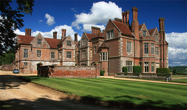
Highlights include Breamore House and Trafalgar House.
Weather in Downton
Forecast from MET Norway (CC BY 4.0). Full forecast
About Downton
Downton is a village and civil parish on the River Avon in southern Wiltshire, England, about 6 miles (10 km) southeast of the city of Salisbury. The parish is on the county boundary with Hampshire and is close to the New Forest; it includes the villages of Wick and Charlton-All-Saints, and the small ancient settlement of Witherington. The Trafalgar Park estate erased the former settlement of Standlynch. The parish church, Trafalgar House, and two more houses are Grade I listed.
From the Wikipedia article Downton, Wiltshire (this version), under CC BY-SA 4.0.
Things to do2


Museums and landmarks6

Breamore House
Museum · 2.1 mi
Country house in Breamore, Hampshire, England, UK


Whitsbury Castle
Monument and historic site · 3.2 mi
Hillfort in Hampshire, England, UK
Parks, trails and playgrounds5


Restaurants and cafes7


History
Downton can trace its ancient inhabitants to Neolithic, Iron Age, Roman and Saxon times. Evidence of Neolithic occupation was found at Downton in 1956–7 during archaeological excavations in advance of a housing development. Close to this site, in 1953 the site of a Roman villa was discovered. Excavations in 1955–56 revealed a villa with tessellated floors, at least two featuring mosaics, a hypocaust and bath house. Roman features were found over an area of about 12 acres. The villa is no longer visible, but the finds, including one of the mosaics, are displayed in Salisbury Museum. Clearbury Ring, on high ground in the northwest of the parish, is an Iron Age hillfort.
The ancient parish of Downton covered a large area, extending north to Nunton and southeast beyond Redlynch as far as Hamptworth. Downton was probably the principal village in the 7th and 8th centuries, and became important as the centre of the manor belonging to the Bishop of Winchester.
The Domesday Book of 1068 recorded a large settlement of 131 households at Downton. Henry of Blois, Bishop of Winchester, built a (possibly incomplete) motte-and-bailey castle near the river.
Read more of the history
Moot House (or The Moot) was built c. 1700 just to the east; the castle site, of some 3.6 hectares (8.9 acres), was developed as the gardens of the house c. 1720. Today the house is a Grade I listed building. The gardens are owned and managed by a preservation trust and are open to the public.
The Manor House, northwest of the parish church, is a Grade I listed hall house with attached chapel from the 14th century, altered in the 17th and 19th. The house and church were an endowment to Winchester College by William of Wykeham in 1380; the house was later leased by Elizabeth I, and was occupied by a brother of Sir Walter Raleigh in the 17th century.
The manor house at Standlynch was built in 1733 for Sir Peter Vandeput and extended in 1766 by Henry Dawkins, plantation owner and Member of Parliament. In 1814 the nation bought the estate and gave it to Lord Nelson's heirs. They changed its name to Trafalgar Park, to commemorate Nelson's victory at the Battle of Trafalgar.
The artist John Constable visited Downton in 1820, and his sketch of the Avon with the church in the background is held in the British Museum. In 1836, a time of continued agricultural hardship, the parish sponsored an emigration of more than 200 of its poor people to Upper Canada for opportunities there; they sailed in April 1836 on the ship King William.
From 1880 to 1906 John Wrightson, a pioneer in agricultural education, had his Downton Agricultural College here.
The Salisbury and Dorset Junction Railway, linking Salisbury with the line to Poole and Bournemouth, was built north–south across the parish and opened in 1866. Its route passed close to the east of Downton village, with Downton station reached from Lode Hill. The line was absorbed into the LSWR in 1883. It was closed in 1964 and the track was lifted the following year.
Nunton (with Bodenham) and Standlynch) became civil parishes in the 19th century, then as the population grew and churches were built, Downton was reduced in size. In 1896 its eastern part became Redlynch civil parish, in 1897 Charlton and Witherington were united with Standlynch to form the civil parish of Standlynch with Charlton All Saints, and in 1923 Morgan's Vale and Woodfalls were taken to form a new civil parish. Finally, in 1934 Standlynch and Charlton were reunited with Downton, and Morgan's Vale and Woodfalls were added to Redlynch.
For about a decade from around 1961, Downton had an important part to play in British motorsport. Its Downton Engineering Works produced some of the motors used by racing cars.
Housebuilding in the 20th and 21st centuries has developed the Wick area into a western extension of Downton village.
In 1999 a community project, The Downton Millennial Book Fund, published an illustrated history of the village from its ancient days.
Downton is the namesake for the British ITV show Downton Abbey, but there Downton is placed in Yorkshire. As a result of this confusion, the place received some inflow of American tourists, searching for the fictional manor house (which was actually Highclere Castle). The creator Julian Fellowes stated that the name was inspired from the Downton College of Agriculture (which was located in Salisbury and closed in 1906) that had been operated by John Wrightson, whose daughter Georgiana was Fellowes' paternal grandmother.
From the History section of Downton, Wiltshire on Wikipedia, under CC BY-SA 4.0.
More about Downton
Geography
The River Avon flows through Downton. For centuries, villagers maintained reed beds for harvesting materials to make baskets, trays and wicker furniture. The river is the source of occasional flooding in the village. Major flood defence work was carried out in 2002 after a severe flood following heavy rains. The water meadows – fields through which irrigation channels were made using weirs and ditches – use the water from this river.
Economy
Until the 20th century, the primary economic activity of the village had been agriculture and related crafts. For instance, in the early 1900s, craftsmen still maintained reed beds in the river for their materials to make baskets and furniture. Tanning was an important industry, with a tannery recorded as existing in the village in the 16th century. A new tannery, which became Downton Tanning Company Ltd, was built in the early 19th century. It made leather for harnesses and saddles until it closed in 1998. Its building has been converted into housing and retirement homes.
Downton Business Centre, on the A338, is home to a variety of businesses, including: Hop Back Brewery and Help for Heroes Trading. Hop Back first brewed its beer in 1986 at the Wyndham Arms in Salisbury. Six years later, the company moved to larger premises in Downton. As of 2010, Hop Back owned eleven public houses around the south of England. Nearby is the smaller Downton Brewery, established in 2003. Help for Heroes (H4H) is a charity that raises money to supplement existing government provision for injured members of the British Armed Forces.
Education
Downton has a primary school and a secondary school. Downton CofE (VA) Primary School dates from 1895, when it replaced older schools. Children of all ages attended until the secondary school opened.
The Trafalgar School at Downton (for ages 11–16) opened at Wick in 1964, at first as a secondary modern, then becoming a comprehensive called Downton School in the early 1970s. The school was renamed in 2005 to commemorate the 200th anniversary of the Battle of Trafalgar.
From the Wikipedia article Downton, Wiltshire, under CC BY-SA 4.0.
Notable people from Downton
 Roger CurtisBritish Royal Navy admiral (1746-1816)Photo: British school of the 18th century, Public domain
 Nicholas Belfield DennysBritish civil servant, journalist and SinologistPhoto: Unknown author Unknown author, Public domain
- George ManningsEnglish cricketer (1843-1876)
- Mary MitchellMitchell, Mary Frances (1923–1988), landscape architect
Born in Downton, according to Wikidata (CC0). Each name links to its Wikipedia article.
Where to stay2
Churches and places of worship7
Gas and EV charging1
Schools, colleges and libraries4
Morgan's Vale and Woodfalls Church of England Primary School
School · Anglican · 1.4 mi
Morgans Vale Road, Salisbury
Healthcare1
Map of Downton
35 places. The map loads OpenStreetMap tiles when you open it.
Getting there and nearby towns
Bournemouth Airport (BOH) is the nearest airport with scheduled flights listed in OpenStreetMap, 15 miles away.
- Alderbury 4 mi north, about 6 min by car
- Whiteparish 5 mi east, about 7 min by car
- Salisbury 6 mi north, about 9 min by car
- West Wellow 7 mi east, about 12 min by car
- Wilton 8 mi northwest, about 12 min by car
- Cadnam 9 mi southeast, about 15 min by car
- Verwood 10 mi southwest, about 16 min by car
- Ringwood 10 mi south, about 17 min by car
- Romsey 11 mi east, about 18 min by car
- Totton 12 mi southeast, about 20 min by car
Drive times are estimates from straight-line distance, not routes.
Towns near Downton


Keep exploring
Local news
Headlines from INDB.
Reviews, tips and questions
Loading what members have shared...
Sources and licences
- GeoNames (CC BY 4.0): population, coordinates, regions and time zone
- Mapillary (see each image): photos
- OpenStreetMap contributors (ODbL 1.0): places, airports, map data
- Wikidata (CC0 1.0): elevation, founding date, time zone, website, landmarks and historic places
- Wikimedia Commons (see each image): photos
- Wikipedia (CC BY-SA 4.0): overview and history text
Photo credits
- BreamoreHouse, Mike Searle, CC BY-SA 2.0
- Breamore Church, Plumbago, CC BY-SA 3.0
- All Saints' Church, Charlton All Saints 01, Simon Burchell, CC BY-SA 3.0
- Trafalgar House, Charlton All Saints 02, Simon Burchell, CC BY-SA 4.0
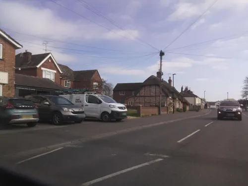
- Street-level photo, southglos, CC BY-SA 4.0
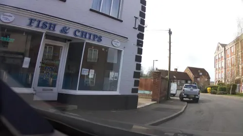
- Street-level photo, southglos, CC BY-SA 4.0
- Street-level photo, southglos, CC BY-SA 4.0
- Street-level photo, southglos, CC BY-SA 4.0
- Street-level photo, southglos, CC BY-SA 4.0
- Street-level photo, southglos, CC BY-SA 4.0
- Street-level photo, RyanBush, CC BY-SA 4.0
Page built November 10, 2026. Spotted a mistake? Tell us or suggest a place.