
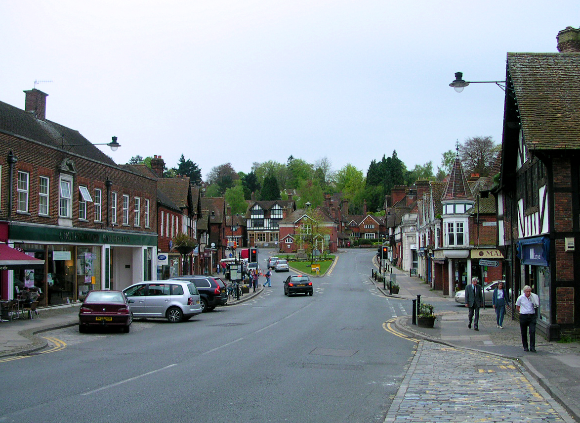


Haslemere, United Kingdom
Haslemere is a town of 17,279 people in England, United Kingdom.
Why visit Haslemere
Townapedia lists 11 museums and landmarks, 10 parks and trails, 54 places to eat, 3 places to stay and 16 attractions in and around town.
Highlights include Haslemere Hall, Blackdown, Haslemere Town Well and Haslemere War Memorial.
Weather in Haslemere
Forecast from MET Norway (CC BY 4.0). Full forecast
About Haslemere
The town of Haslemere () and the villages of Shottermill and Grayswood are in south-west Surrey, England, around 38 miles (62 km) south-west of London. Together with the settlements of Hindhead and Beacon Hill, they comprise the civil parish of Haslemere in the Borough of Waverley. The tripoint between the counties of Surrey, Hampshire and West Sussex is at the west end of Shottermill.
From the Wikipedia article Haslemere (this version), under CC BY-SA 4.0.
Travel tips from other travellers: Haslemere on Wikivoyage (CC BY-SA 4.0).
Photos of Haslemere


Things to do16

Blackdown
Scenic view · 2.3 mi
Highest hill in Sussex. Great views over the Weald.



Green Hill
Scenic view · 2.7 mi
The small pine covered hill west of Fernhurst, dwarfed by Marley Heights to the north.
Fridays Hill
Scenic view · 2.1 mi
So called, apparently, because people from Fernhurst went over it to market in Haslemere on Fridays!
4 more on the map.
Museums and landmarks11



Haslemere Educational Museum
Museum
Geology, natural and human history museum, United Kingdom
High Street, Haslemere

Hindhead Commons and the Devil's Punch Bowl
Monument and historic site · 1.9 mi
London Road, Hindhead
The Sailor's Stone
Monument and historic site · 1.7 mi
In dedication of a barberous murder committed here on an unknown sailor on September 24, 1786
Hyde Park Court
Monument and historic site · 1.8 mi
Godalming 7 miles; Liphook 5 miles
Parks, trails and playgrounds10



Restaurants and cafes54
ASK Italian
Restaurant · Italian
West Street, Haslemere
Mo-Th 11:30-22:00; Fr-Sa 11:30-23:00; Su 11:30-22:00
Harper's Steakhouse
Bar and pub · French · 0.5 mi
Lower Street, Haslemere
Mo-Th 07:00-23:00; Fr 07:00-00:00; Sa 08:00-00:00; Su 08:00-22:30
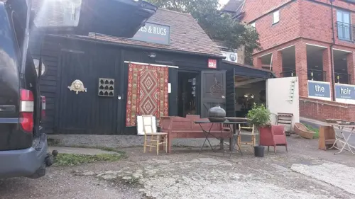
Pizzaman
Restaurant · Pizza, Burger, Kebab
12 Lower Street, Haslemere
Mo-Th 11:30-23:00, Fr-Sa 11:30-23:30, Su 11:30-23:00
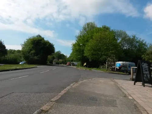
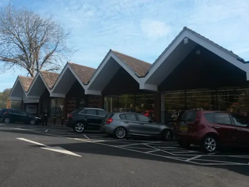
Apple Tree
Bar and pub · 1.0 mi
2 Lion Green, Haslemere
Mo 15:00-22:00; Tu-Th 12:00-22:30; Fr,Sa 12:00-23:30; Su 12:00-22:00
Shahanaz
Restaurant · Indian, Curry · 0.8 mi
59-61 Wey Hill, Haslemere
Mo-Su,PH 12:00-14:30,17:30-23:00
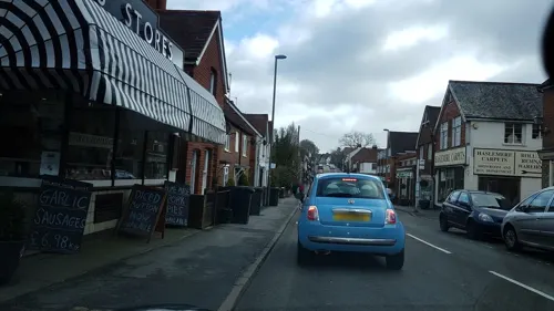
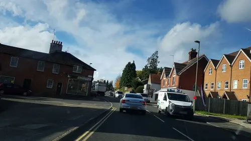
The Cabin
Cafe · Coffee Shop · 0.5 mi
Station Approach, Haslemere
Mo-Th 05:30-15:00; Fr 05:30-19:00; Sa 08:00-18:00; Su 08:00-13:30
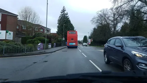
Wok Star
Restaurant · Chinese · 0.9 mi
89 Wey Hill, Haslemere
Mo off; Tu-Th 17:00-22:30; Fr-Sa 17:00-23:00; Su 17:00-22:00; PH...

Cafe Twenty5
Cafe · Cake, Coffee Shop · 2.0 mi
25 London Road
We-Mo 09:00-15:00
42 more on the map.
History
The earliest evidence for human activity in the Haslemere area is from the Neolithic. Flints dating from 4000 to 2400 BCE were discovered during archaeological surveys conducted prior to the construction of the Hindhead Tunnel. There may have been a settlement in the area in the mid-late Bronze Age and a Romano-British cemetery was discovered on the site of Beech Road, to the north of the town centre, at the start of the 20th century.
Neither Shottermill nor Haslemere are directly mentioned in Domesday Book, but the land on which the two settlements are now located was divided between the Farnham and Godalming Hundreds respectively. The south western corner of Surrey is thought to have been sparsely populated in the 11th century, but it is possible that some of the mills listed under the entry for Farnham, were located on the Wey in the Shottermill area.
The first indication of a settlement at Haslemere is from 1180, when there is a record of a "Chapel of Piperham". The chapel belonged to the Parish of Chiddingfold, part of the manor of Godalming and is thought to have been either on or close to the site of the current St Bartholomew's Church. There may also have been a settlement on Haste Hill, to the south east of the town centre, and there are references to "Churchliten field" and the "Old church-yard" in records of the area.
Read more of the history
The first use of the modern name Haslemere is from 1221, when permission for a market was given to Richard Poore, Bishop of Salisbury, indicating that the settlement was sufficiently large to be considered a town. In 1397, Richard II granted a charter to the settlement, confirming the order from 1221 and permitting an annual fair to be held in the town. The town remained in the possession of the Bishops of Salisbury until c. 1540, when it was purchased by the Crown.
The first indication of a settlement at Shottermill is from 1285, when reference is made to a Manor of Pitfold, covering the extreme southern portion of Farnham Hundred. From 1344, the manor was held by Edward III, but was granted to the Convent of Dartford in 1362. The land remained in the convent's possession until the Dissolution of the Monasteries in 1536, when it reverted to the Crown. A new charter was issued to Haslemere town by Elizabeth I in 1596. Today, this special status is celebrated with the Charter fair, held once every two years in the High Street.
Reforms during the Tudor period replaced the day-to-day administration of towns such as Haslemere in the hands of the vestry of the parish church. The vestry was charged with appointing a parish constable, running a lock-up, maintaining local roads and administering poor relief. In 1839, many administrative responsibilities were transferred to the Hambledon Rural District Council and in 1863, the civil parish of Haslemere was created, although local elections did not take place until the following year. In 1896, the Surrey Times praised the town's authorities, writing: "No parish council in the country has done better work than the Haslemere council. Sanitation, allotments, charities, lighting, roads, footpaths and waste lands have all been thoroughly and prudently looked after." A further change took place in 1913, when town was removed from the Hambledon Rural District and the Parish Council was promoted to the status of an Urban District Council (UDC). Initially the UDC was based at the Town Hall, but moved in 1926 to a building on Museum Hill, which had been vacated by the Haslemere Educational Museum.
Until 1896, Shottermill was part of the Frensham civil parish. It became independent in 1896, following the passing of the Local Government Act 1894. In 1900, the new council set up a District Sanitary Association to improve drainage and to install a sewerage system in the village. The Shottermill civil parish was disbanded in 1933, when the area became part of the Haslemere Urban District.
The most recent change in local government took place in 1974, when the urban districts of Farnham, Godalming and Haslemere were merged with Hambledon Rural District to form Waverley District. The Haslemere UDC was reduced to a town council and the reformed body readopted the town hall as its main meeting place.
Haslemere may have become a parliamentary borough as early as 1230, when there is a record of the grant of a burgage plot in the settlement. It is referred to as a burgus in a document of 1377, but the first known MPs for the town were not elected until 1584. Elizabeth I confirmed the borough status in the charter of 1596. Until the Reform Act 1832, two MPs were elected to represent the town in the House of Commons. The electorate was confined to those holding property either as freeholders or as tenants of burgage properties, who paid rent to the lord of the manor. Electoral records show that for the elections of 1664 and 1735, there were only 82 and 85 eligible properties respectively. By the early 17th century, Haslemere had acquired a reputation as a pocket borough.
The More family, who owned Loseley Park, effectively controlled the borough for much of the 17th century. However, in 1722, More Molyneux and his favoured co-candidate, Montague Blundell, 1st Viscount Blundell, lost the election to James Oglethorpe and Peter Burrell. In 1754, James More Molyneux, son of More Molyneux, was determined to reclaim the seat for his family. He and his favoured co-candidate, Philip Carteret Webb, purchased 34 freeholds and tenements, and installed their own representative as Bailiff to oversee the election. The freehold of the Red Cow Inn was split into shares, to further increase the number likely to vote for More Molyneux and Webb, who were duly elected.
The final elections in Haslemere Borough took place in 1830 and two years later the constituency was combined with that of Farnham.
From the History section of Haslemere on Wikipedia, under CC BY-SA 4.0.
More about Haslemere
Geography
The civil parish of Haslemere is in the borough of Waverley in south west Surrey, close to the borders with both Hampshire and West Sussex. The parish includes the villages of Hindhead, Beacon Hill and Grayswood, the settlements of Shottermill and Critchmere, as well as the town of Haslemere. The area is served by two principal transport routes, the London to Portsmouth railway line and the A3 trunk road, both of which run via Guildford.
Much of the civil parish is in the catchment area of the south branch of the River Wey, which rises on the northern slopes of Blackdown, to the south of Haslemere town. The area to the east of the town is drained by the River Arun. Around 48% of the civil parish is covered by woodland, 85 ha (210 acres) of which is classified as Ancient Woodland. Approximately 17% of the parish, 395 ha (980 acres), is protected and includes parts of two Special Protection Areas, one Special Area of Conservation and four Sites of Special Scientific Interest. The main settlements are surrounded by the Surrey Hills National Landscape.
Arts and culture
Several artists have painted landscapes of the Haslemere area, including George Shalders (c. 1826–1873), Alexander Fraser (1827–1899), George Vicat Cole (1833–1893) and Cecil Gordon Lawson (1849–1882). The Haslemere Educational Museum holds several artworks, including a bust of Alfred, Lord Tennyson by Thomas Woolner (1825–1892), portraits by Frank Dicksee (1853–1928) and Vera Cummings (1891–1940), as well as several carved wooden figures from the Yoruba School of Nigeria.
Among the works of public art in the town, is a bust of Elizabeth I by Malcolm Stathers, which commemorates the charter issued to Haslemere by the queen. In 2019, a series of four sculptures was commissioned from the artist, Andrew Brighty. The works are inspired by the Arts and Crafts movement and are intended to form part of an arts trail around the town. The first two works, in the High Street and at Clements Corner, were installed in 2020 and are entitled Progress and Mimesis respectively. The third sculpture, Serenade to the Sky, celebrates the area's musical connections and was unveiled near Lion Green in March 2021.
Education
St Bartholomew's Primary School was founded as a National school c. 1813. In 1869 a school board was established in Haslemere, which commissioned the construction of a new building adjacent to the parish church. The school moved to its current site on Derby Road in 1986.
Shottermill Infant School and Shottermill Junior School trace their origins to a Church of England school that was opened in the village c. 1846. Initially there were 40 pupils and only one teacher, but as numbers increased, the school moved to new premises to the north east of Shottermill Church. The building was extended in 1885 and again in 1896–98. In the early 1900s, the infants department became a separate school in its own right and moved to Church Road. In 1927, the county council took over the running of the two schools and constructed new premises for each on Lion Lane.
Grayswood Primary School was founded as a National school in 1862. It moved to its current site, as an infants' school, in January 1905 with 100 pupils. It was expanded in 2015 to become a primary school, educating up to 210 children between the ages of 4 and 11.
From the Wikipedia article Haslemere, under CC BY-SA 4.0.
Notable people from Haslemere
 Rex Orange CountyBritish singer-songwriter (born 1998)Photo: SkyGuy711, CC BY-SA 4.0
 Lucy PrebbleBritish playwrightPhoto: Raph_PH, CC BY 2.0
 Guy FarleyBritish film score composerPhoto: Tamborina23, CC BY-SA 4.0
 Paul GobleAmerican writer and illustrator (1933–2017)Photo: Temp07, Public domain
 Ron ReynoldsEnglish footballer (1928-1999)Photo: Harry Pot for Anefo, CC0
 Glenn Ralphprofessional golferPhoto: Pvt pauline, CC BY-SA 3.0
 Nick Jobprofessional golferPhoto: Pvt pauline, CC BY-SA 3.0
 Nick Talbotmolecular geneticist and professor at the University of ExeterPhoto: Royal Society uploader, CC BY-SA 4.0
- Rachel PortmanBritish composer
- Grace Chisholm YoungEnglish mathematician (1878–1944)
- Charles EdwardsBritish actor (born 1969)
- Humphrey Patrick Guinnesspolo player
Born in Haslemere, according to Wikidata (CC0). Each name links to its Wikipedia article.
Where to stay3
Churches and places of worship15
Shopping17
Gas and EV charging4
Schools, colleges and libraries17
Grayshott Church of England Controlled Primary School
School · Anglican · 2.7 mi
School Road, Hindhead
Healthcare5
Map of Haslemere
152 places. The map loads OpenStreetMap tiles when you open it.
Getting there and nearby towns
Farnborough Airport (FAB) is the nearest airport with scheduled flights listed in OpenStreetMap, 13 miles away.
- Petersfield 11 mi southwest, about 18 min by car
- Woking 17 mi north, about 27 min by car
- Sandhurst 18 mi north, about 29 min by car
- Basingstoke 20 mi northwest, about 33 min by car
- Rustington 21 mi southeast, about 34 min by car
- Weybridge 22 mi northeast, about 36 min by car
- Sunninghill 22 mi north, about 35 min by car
- Crawley 23 mi east, about 37 min by car
- Worthing 24 mi southeast, about 38 min by car
- Portsmouth 26 mi southwest, about 42 min by car
Drive times are estimates from straight-line distance, not routes.
Towns near Haslemere


Keep exploring
Local news
Headlines from INDB.
Reviews, tips and questions
Loading what members have shared...
Sources and licences
- GeoNames (CC BY 4.0): population, coordinates, regions and time zone
- Mapillary (see each image): photos
- OpenStreetMap contributors (ODbL 1.0): places, airports, map data
- Wikidata (CC0 1.0): elevation, founding date, time zone, website, landmarks and historic places
- Wikimedia Commons (see each image): photos
- Wikipedia (CC BY-SA 4.0): overview and history text
Photo credits
- Haslemere, Charlesdrakew, Public domain
- The Cottage, Haslemere, Simon Burchell, CC BY-SA 4.0
- Heath Edge, Haslemere, Simon Burchell, CC BY-SA 4.0
- The Small House, 74 High Street, Haslemere, Surrey, Mertbiol, CC0
- Haslemere Museum 01, Simon Burchell, CC BY-SA 4.0
- Haslemere Museum 02, Simon Burchell, CC BY-SA 4.0
- The Small House, Haslemere, Simon Burchell, CC BY-SA 4.0
- 72 High Street, Haslemere, Simon Burchell, CC BY-SA 4.0
- Cooksbridge Meadow (4), Dudley Miles, CC BY-SA 4.0
- All Saints Church, Grayswood Road, Grayswood (June 2015) (8), Hassocks5489, CC0
- Celtic cross on Gibbet Hill, Charlesdrakew, Public domain
- St Eds Back, PSCAVC, CC BY-SA 4.0
- Blackdown, The original uploader was Marknesbitt at English Wikipedia ., Public domain
- St. Peter's Church Linchmere 1, Simon Burchell, CC BY-SA 3.0
- Lythe Hill Farmhouse DSC 2327, Ainslie, CC BY-SA 3.0
- St Bartholomew's Church, Haslemere, Surrey, Attila, CC BY-SA 2.0
- St Christopher's Church, Farnham Lane, Haslemere (June 2015) (5), Hassocks5489, CC0
- Haslemere Town Well 02, Simon Burchell, CC BY-SA 4.0
- St Luke's Church, Headley Road, Grayshott (NHLE Code 1338981) (May 2021) (2), Hassocks5489, CC0
- Haslemere town hall and war memorial, SovalValtos, CC BY-SA 4.0
- St Stephen's Church, Liphook Road, Shottermill (June 2015) (1), Hassocks5489, CC0
- St. Paul's Church, Camelsdale 2, Simon Burchell, CC BY-SA 3.0
- Devil's Punch Bowl A3 Portsmouth Road, Arriva436, CC BY-SA 3.0
- Street-level photo, richardc, CC BY-SA 4.0
- Street-level photo, helenst, CC BY-SA 4.0
- Street-level photo, richardc, CC BY-SA 4.0
- Street-level photo, richardc, CC BY-SA 4.0
- Street-level photo, richardc, CC BY-SA 4.0
- Street-level photo, helenst, CC BY-SA 4.0
- Street-level photo, helenst, CC BY-SA 4.0
- Street-level photo, helenst, CC BY-SA 4.0
- Street-level photo, helenst, CC BY-SA 4.0
- Street-level photo, helenst, CC BY-SA 4.0
- Street-level photo, helenst, CC BY-SA 4.0
- Street-level photo, richardc, CC BY-SA 4.0
- Street-level photo, sk53, CC BY-SA 4.0
- Street-level photo, richardc, CC BY-SA 4.0
- Street-level photo, helenst, CC BY-SA 4.0
- Street-level photo, richardc, CC BY-SA 4.0
- Street-level photo, richardc, CC BY-SA 4.0
- Street-level photo, richardc, CC BY-SA 4.0
- Street-level photo, helenst, CC BY-SA 4.0
- Street-level photo, helenst, CC BY-SA 4.0
- Street-level photo, helenst, CC BY-SA 4.0
- Street-level photo, helenst, CC BY-SA 4.0
- Street-level photo, helenst, CC BY-SA 4.0
- Street-level photo, richardc, CC BY-SA 4.0
- Street-level photo, sk53, CC BY-SA 4.0
- Street-level photo, richardc, CC BY-SA 4.0
- Street-level photo, helenst, CC BY-SA 4.0
- Street-level photo, sk53, CC BY-SA 4.0
- Street-level photo, richardc, CC BY-SA 4.0


Page built November 10, 2026. Spotted a mistake? Tell us or suggest a place.