


Eton Wick, United Kingdom
Eton Wick is a town of 2,029 people in England, United Kingdom.
Why visit Eton Wick
Townapedia lists 29 museums and landmarks, 23 parks and trails, 164 places to eat, 10 places to stay and 14 attractions in and around town.
Highlights include Theatre Royal, Windsor Bridge, Montem Mound and Eton College Collections.
Weather in Eton Wick
Forecast from MET Norway (CC BY 4.0). Full forecast
About Eton Wick
Eton Wick is a village in the civil parish of Eton, in the Windsor and Maidenhead district, in Berkshire, England. Historically it was part of Buckinghamshire. Between the River Thames and the Jubilee River, the village is close to the towns of Windsor, Eton and Slough.
From the Wikipedia article Eton Wick (this version), under CC BY-SA 4.0.
Photos of Eton Wick

Things to do14


Windsor Bridge
Bridge · 1.4 mi
Pedestrian and cycle bridge in sight of Windsor Castle, England


Datchet Bridge
Bridge · 2.5 mi
Road bridge which crossed the River Thames at Datchet

Legoland Windsor
Monument and historic site · 2.4 mi
Lego theme park in Windsor, Berkshire, England

Maidenhead Railway Bridge
Bridge · 3.3 mi
Railway bridge in Maidenhead, Berkshire, England

Theatre Royal, Windsor
Cinema and theater · 1.4 mi
Theatre in Windsor, England

Victoria Bridge
Bridge · 2.0 mi
Road bridge between Datchet and Windsor in the English county of Berkshire


Windsor Safari Park
Zoo and aquarium · 2.4 mi
Former British safari park
2 more on the map.
Museums and landmarks29
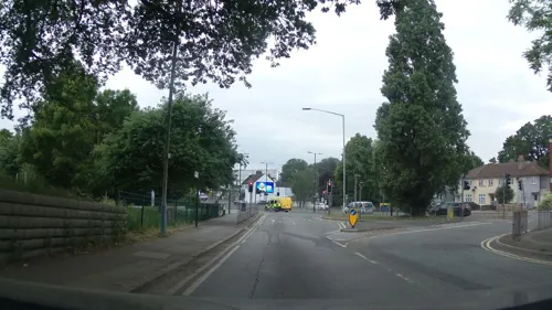
Montem Mound
Monument and historic site · 1.5 mi
Archaeological site in Slough, United Kingdom

Eton College Collections
Museum · 1.2 mi
Collection of items kept by Eton College

Eton College Natural History Museum
Museum · 1.2 mi
Museum in Eton College, Berkshire, England

Frogmore House
Museum · 2.3 mi
Grade I listed historic house museum in Windsor, United Kingdom

Kiosk To South East Of Cottage In Frogmore Grounds
Monument and historic site · 2.2 mi
Memorial in Windsor and Maidenhead, Berkshire, England, UK

Mausoleum of the Duchess of Kent
Monument and historic site · 2.3 mi
Grade I listed mausoleum in Windsor and Maidenhead, United Kingdom

Dorney Court
Monument and historic site · 1.5 mi
Stately home, grounds and house open to public in June

Cippenham Moat
Monument and historic site · 0.8 mi
Remains of a 13th Century Royal Palace created by King Henry III
Hitcham War Memorial
Monument and historic site · 3.1 mi
War memorial in Hitcham, Buckinghamshire, England, UK
Slough Museum
Museum · 2.2 mi
Local museum located in Slough, Berkshire, United Kingdom
17 more on the map.
Parks, trails and playgrounds23


Slough Trading Estate
Park · 1.7 mi
Business park in Slough, Berkshire, England, UK

Sutherland Grange
Park · 1.1 mi
Local Nature Reserve in Berkshire, England

Home Park
Park · 1.9 mi
Royal park on the eastern side of Windsor Castle


11 more on the map.
Restaurants and cafes164
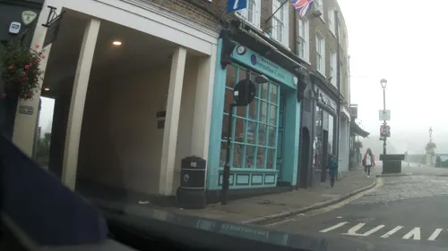
Costa
Cafe · Coffee Shop · 1.3 mi
64-65 High Street, Windsor
Mo-Fr 06:30-18:00; Sa 07:00-18:00; Su 08:00-18:00
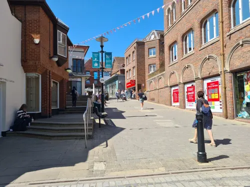
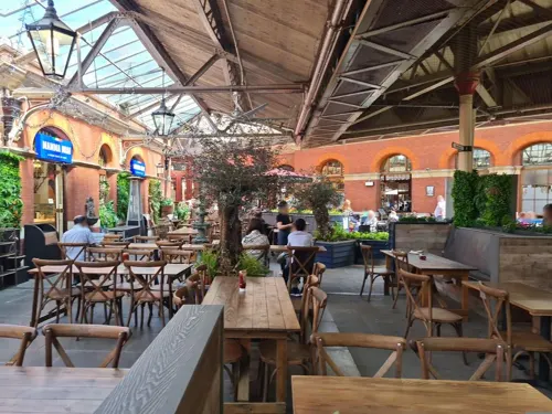

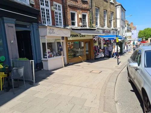
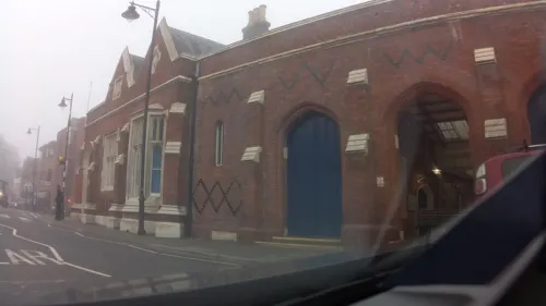



Unit Four Brewery Tap
Bar and pub · 1.1 mi
1-4 Vansittart Estate, Windsor
Mo-Th 12:00-22:00; Fr 12:00-23:00; Sa 10:00-23:00; Su 12:00-20:00
152 more on the map.
History
Eton Wick's history extends to the Neolithic era, as indicated by archaeological findings of a causewayed enclosure and various artefacts. Over centuries, the area evolved through Roman and Medieval periods, maintaining a predominantly agricultural character.
After the construction of Eton College in the 15th century, a small group of houses were built immediately west to the college grounds. Making up the homes of shoemakers, tailors, and college workers, the hamlet was physically separated from the rest of Eton by land owned by the college, and was known as the wick. The wick was on the very edge of the parish, on the opposite side of the border adjacent to the village; cottages were built to house farmhands working at nearby Bell Farm.
Read more of the history
In the 18th century, Eton Wick saw changes in agriculture with the introduction of crop rotations and selective breeding. The village was traditionally managed through a system of Lammas rights, which allowed communal grazing on the commons. The 19th century brought industrial advances and the village began to modernize with the introduction of railway connections and better road infrastructure. The college was traditionally responsible for the social well-being of the settlement and throughout the 19th century, scholars at Eton College took a personal interest in the village. building a village hall and, in 1840, a small school in the village. Eton Wick Census records reveal that in 1851 that there were 76 children recorded as "Scholars". The village grew rapidly between the 1880s and the 2000s.
Eton Wick school was first opened in 1840 near the then Greyhound Public House.
In 1880, the owner of Bell Farm, Charles Dorney, sold some of his land for residential building. The new village was called Boveney New Town. After the Civil Parish Act 1894, the Wick was transferred from Eton parish to Boveney parish and became known as Eton Wick. Eton Wick and Boveney New Town were almost immediately next to each other yet both retained their own councils until 1934. The population of the villages during this time was around 500.
A new school was built in between 1886 and 1888 on Sheepcote Road and was upgraded and expanded in the 1950s, 1960s, and 1990s as the villagee grew in the 1950s, 1960s and 1990s.
The early 20th century was a period of significant social and physical development for Eton Wick. In 1906, Edward Littleton Vaughan, master at Eton College for 27 years, played a pivotal role in founding the Eton Wick and Boveney Institute, now known as the Village Hall, which became a social hub for the community. The hall was intended to foster fellowship and recreation, initially excluding, but later including, women and girls in its activities.
During the World Wars, Eton Wick adapted to the national demands, with the village hall serving as a school for evacuees and a gathering place for community support activities.
Several 3.72” anti-aircraft guns of 564 Battery stationed on the SM7 Site in Dorney Common during WW2.
Locals retrieved the body of a dead German fighter pilot from Thames Field after his parachute failed to deploy on June 29th, 1940.
On 2nd October 1940 a bomb fell near East of Manor Farm Dorney and near Dorney Court.
On 1st/2nd November 1940 1 high explosive and 3 unexploded HE bombs fell on Boveney.
On 15th and 18th November 1940 1 unexploded bomb fell on Eton Wick.
On April 14th, 1941, 2 incendiary bombs fell on Eton Wick school and 'a number of incendiaries' fell on the allotments below the school in Sheepcote Road.
During May 10th, 1941,1 or 2 small high explosive bombs fell on Dorney Army Camp along with an incendiary oil bomb that went in to the neighbouring Roundmoor Ditch. 2-12 bombs (depending on the person's account) fell on Dorney sewage works. Eton Wick also got a high explosive bomb that did not explode on impact.
The German pilot, Oberleutnant Fisher, was captured near his shot down aircraft on September 30th, 1941.
A bomb fell on February 22 or 23, 1944 making a crater 12ft by 5ft diameter and damaging 50 houses.
The buildings of the camp from April/May, 1940 to 1944 or 1945, and it's AA-guns were on Dorney Common, but the armoury and a few other small building opposite Roundmoor Ditch were on the land now covered by Tillstone Close. It was permanently closed in 1945.
The armoury was converted in to a home and homeless people squatted in the Nissen huts between 1946 and 1947. The flood of 1947 damaged them beyond repair and the site was levelled in 1950, or 1945-1955, depending on the account given. They were rehoused during the housing building spree that occurred between 1945 and 1952.
Post-war Eton Wick witnessed a period of renewal, marked by the introduction of secondary education and the establishment of modern council housing bringing the population up to around 3,000.
In 1965, the land surrounding the village was registered as common land under the Commons Registration Act, meaning the land cannot be developed without permission from the Secretary of State for the Environment.
From the History section of Eton Wick on Wikipedia, under CC BY-SA 4.0.
More about Eton Wick
Arts and culture
Eton Wick has maintained a strong community spirit evidenced by its many local traditions and activities. Annual events such as the Eton Wick Horticultural Show and various community gatherings at the Village Hall highlight the village's social cohesion. The village hall, a central institution, continues to host events and activities, such as regular meetings of the Eton Wick History Group fostering a sense of community among residents. The village is also home to the History on Wheels motor museum, housing a wide collection of military and civilian vehicles, and militaria dating from 1900 to the 1950’s.
From the Wikipedia article Eton Wick, under CC BY-SA 4.0.
Notable people from Eton Wick
- Gary LovedayEnglish cricketer (born 1964)
Born in Eton Wick, according to Wikidata (CC0). Each name links to its Wikipedia article.
Where to stay10
Churches and places of worship42
St Edward's Roman Catholic Church
Church · Catholic · 1.5 mi
44 Alma Road, Windsor
Shopping51
Gas and EV charging5
Schools, colleges and libraries25
Slough and Eton Church of England Business and Enterprise College
School · Anglican · 1.4 mi
Ragstone Road, Slough
St Edward's Royal Free Ecumenical Middle School
School · Anglican, Roman Catholic · 1.1 mi
Parsonage Lane, Windsor
Healthcare8
Map of Eton Wick
250 places. The map loads OpenStreetMap tiles when you open it.
Getting there and nearby towns
Heathrow Airport (LHR) is the nearest airport with scheduled flights listed in OpenStreetMap, 8 miles away.
- Slough 2 mi northeast, about 3 min by car
- Windsor 2 mi southeast, about 3 min by car
- Burnham 3 mi northwest, about 5 min by car
- Taplow 3 mi northwest, about 5 min by car
- Maidenhead 4 mi northwest, about 7 min by car
- Horton 4 mi southeast, about 7 min by car
- Egham 6 mi southeast, about 9 min by car
- Ascot 6 mi south, about 10 min by car
- Staines 7 mi southeast, about 12 min by car
- Sunninghill 7 mi south, about 11 min by car
Drive times are estimates from straight-line distance, not routes.
Towns near Eton Wick


Keep exploring
Local news
Headlines from INDB.
Reviews, tips and questions
Loading what members have shared...
Sources and licences
- GeoNames (CC BY 4.0): population, coordinates, regions and time zone
- Mapillary (see each image): photos
- OpenStreetMap contributors (ODbL 1.0): places, airports, map data
- Wikidata (CC0 1.0): elevation, founding date, time zone, website, landmarks and historic places
- Wikimedia Commons (see each image): photos
- Wikipedia (CC BY-SA 4.0): overview and history text
Photo credits
- Windsortownbridge, The original uploader was Wyrdlight at English Wikipedia ., CC BY-SA 2.5
- Albert Bridge, Dachet (Nancy), Nancy, CC BY-SA 3.0
- Black Potts Bridge (Nancy), Nancy, CC BY-SA 3.0
- Entrance to Legoland Windsor, Rob Young profile, CC BY 2.0
- Queen Elizabeth Bridge, Windsor (Nancy), Nancy, CC BY-SA 3.0
- Victoria Bridge Datchet, Nancy, CC BY-SA 4.0
- Brunelwindsorbridge, The original uploader was Wyrdlight at English Wikipedia ., CC BY-SA 3.0
- IndianKiosk, pam fray, CC BY-SA 2.0
- Kentmausoleum, The original uploader was Wyrdlight at English Wikipedia ., CC BY-SA 3.0
- Tree Fungus (33750287933), Timo Newton-Syms from Helsinki, Finland & Maidenhead, Berkshire, UK, CC BY-SA 2.0
- Cocksherd Wood (3), Dudley Miles, CC BY-SA 4.0
- Haymill Valley (5), Dudley Miles, CC BY-SA 4.0
- Herschel Park LNR (5), Dudley Miles, CC BY-SA 4.0
- Aerial View of Slough Trading Estate, Sloughmani, CC BY 3.0
- Harmonia axyridis var. conspicua (33721516641), David Short from Windsor, UK, CC BY 2.0
- Stoke Poges Church, UKgeofan at English Wikipedia )UKGeofan, CC BY-SA 3.0
- St. Mary's Church, Slough, Jordan Butterfield, CC BY-SA 4.0
- St Mary Magdalene Church Boveney, UKgeofan ( talk ), CC BY-SA 3.0
- Theatre Royal - Windsor, Jim Linwood uploaded and derivative work: MrPanyGoff, CC BY 2.0
- Etoncoll natural History mus, Kobayashis ( talk ), CC BY-SA 3.0
- Eton College front 4, Evka W, CC BY-SA 4.0
- Master Gifts & Souvenirs, 22 Thames St, Windsor, Paul the Archivist, CC BY-SA 4.0
- Harte & Garter, High St, Windsor, Paul the Archivist, CC BY-SA 4.0
- Nando's, 10 Thames St, Windsor, Paul the Archivist, CC BY-SA 4.0
- Eton College Natural History Museum Darwin, Kobayashis ( talk ), CC BY-SA 2.5
- Datchet Bridge 1750 William Oram, William Oram, Public domain
- Bray Pit (3), Dudley Miles, CC BY-SA 4.0
- NCN Millennium Milepost MP170 Boveney Buckinghamshire, Jonathan Thacker, CC BY-SA 2.0
- Maidenhead Railway Bridge - The Sounding Bridge plaque, Oosoom at English Wikipedia, CC BY-SA 3.0
- Frogmore House 16-08-2014, Karen Roe from Bury St Edmunds, Suffolk, UK, CC BY 2.0
- Street-level photo, southglos, CC BY-SA 4.0
- Street-level photo, southglos, CC BY-SA 4.0
- Street-level photo, dsmm, CC BY-SA 4.0
- Street-level photo, dsmm, CC BY-SA 4.0
- Street-level photo, dsmm, CC BY-SA 4.0
- Street-level photo, dsmm, CC BY-SA 4.0
- Street-level photo, dsmm, CC BY-SA 4.0
- Street-level photo, kravietz, CC BY-SA 4.0
- Street-level photo, southglos, CC BY-SA 4.0
- Street-level photo, myaccessible_eu, CC BY-SA 4.0
- Street-level photo, southglos, CC BY-SA 4.0
- Street-level photo, southglos, CC BY-SA 4.0
- Street-level photo, dsmm, CC BY-SA 4.0
- Street-level photo, southglos, CC BY-SA 4.0
- Street-level photo, southglos, CC BY-SA 4.0
- Street-level photo, southglos, CC BY-SA 4.0
- Street-level photo, myaccessible_eu, CC BY-SA 4.0
- Street-level photo, southglos, CC BY-SA 4.0
- Street-level photo, dsmm, CC BY-SA 4.0
- Street-level photo, southglos, CC BY-SA 4.0
- Street-level photo, geoengtechel, CC BY-SA 4.0
- Street-level photo, dsmm, CC BY-SA 4.0


Page built November 10, 2026. Spotted a mistake? Tell us or suggest a place.