


Why visit Taplow
Townapedia lists 35 museums and landmarks, 49 parks and trails, 152 places to eat, 13 places to stay and 10 attractions in and around town.
Highlights include Maidenhead Bridge, Bourne End Railway Bridge, Stanley Spencer Gallery and Montem Mound.
Weather in Taplow
Forecast from MET Norway (CC BY 4.0). Full forecast
About Taplow
Taplow is a village and civil parish in Buckinghamshire, England. It sits on the left bank of the River Thames, facing Maidenhead in the neighbouring county of Berkshire, with Cippenham and Burnham to the east. It is the south-westernmost settlement in Buckinghamshire.
From the Wikipedia article Taplow (this version), under CC BY-SA 4.0.
Things to do10

Maidenhead Bridge
Bridge · 0.9 mi
Grade I listed bridge in Buckinghamshire, England


Maidenhead Railway Bridge
Bridge · 1.0 mi
Railway bridge in Maidenhead, Berkshire, England


Norden Farm Centre for the Arts
Cinema and theater · 2.8 mi
Arts centre in Maidenhead, England

Taplow Bridge
Bridge · 0.5 mi
Footbridge over Thames between Maidenhead and Taplow

Museums and landmarks35

Stanley Spencer Gallery
Museum · 2.0 mi
Art museum in Cookham, Berkshire, United Kingdom
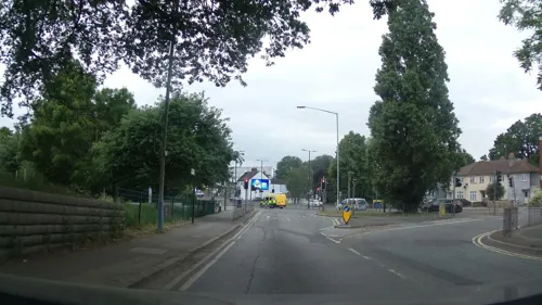
Montem Mound
Monument and historic site · 3.7 mi
Archaeological site in Slough, United Kingdom


Maidenhead Heritage Centre
Museum · 1.6 mi
Museum in United Kingdom
18 Park Street, Maidenhead
Tu-Sa 10:00-16:00

Burnham War Memorial
Monument and historic site · 1.2 mi
First World War memorial, with bronze statue by Leonard S Merrifield, unveiled on 19 December 1920, with later additions for the Second...
Cippenham Moat
Monument and historic site · 3.0 mi
Remains of a 13th Century Royal Palace created by King Henry III
Cookham Abbey
Monument and historic site · 2.1 mi
Abbey in Berkshire, England, UK
Dorney Court
Museum · 2.2 mi
Grade I listed historic house museum in South Bucks, United Kingdom
Hitcham War Memorial
Monument and historic site · 0.5 mi
War memorial in Hitcham, Buckinghamshire, England, UK
Slough Museum
Museum · 2.9 mi
Local museum located in Slough, Berkshire, United Kingdom
Taplow burial
Monument and historic site · 0.4 mi
Medieval barrow in England
23 more on the map.
Parks, trails and playgrounds49


Ockwells Park
Park · 3.1 mi
Park in Cox Green, Berkshire, England, UK

Park Wood and Goulding's Wood
Park · 3.7 mi
Protected area in Berkshire, England

Slough Trading Estate
Park · 2.7 mi
Business park in Slough, Berkshire, England, UK

Sutherland Grange
Park · 3.7 mi
Local Nature Reserve in Berkshire, England


Burnham Beeches
Park · 3.0 mi
Nature reserve in Buckinghamshire, England
Littleworth Common
Park · 2.8 mi
Protected area in Buckinghamshire, England
37 more on the map.
Restaurants and cafes152

King's Arms
Bar and pub · 2.1 mi
High Street, Maidenhead
Mo-We 10:00-23:00; Th-Sa 10:00-00:00; Su 11:00-22:30

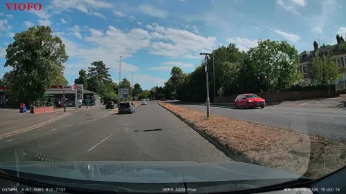
Emperor of India
Restaurant · Indian · 2.2 mi
5 Windsor Road, Maidenhead
Mo-Sa 17:30-22:00, Su 12:00-15:00, 17:30-22:00
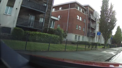
Maidenhead Spice
Restaurant · Indian · 1.2 mi
117 Bridge Road, Maidenhead
Mo-Su 12:00-14:00, Su-Th 17:30-22:30, Fr,Sa 17:30-23:00
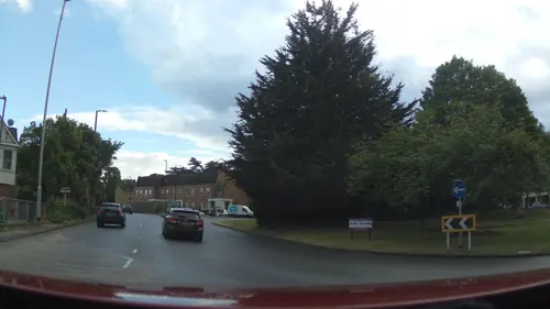
The Greek House
Restaurant · Greek · 1.7 mi
126 High Street, Maidenhead
Mo-Th 12:00-22:00, Fr-Sa 12:00-23:00, Su 12:00-21:00

Lee Dynasty
Restaurant · Chinese · 1.6 mi
29 High Street, Maidenhead
Mo off; Tu-Th 12:00-14:30,17:00-22:00; Fr-Sa...
Nando's
Restaurant · Chicken, Portuguese · 1.7 mi
57 King Street, Maidenhead
Mo-We 11:00-22:00; Th-Sa 11:00-22:30; Su 11:00-22:00

Bella Italia
Restaurant · Italian · 0.8 mi
8, Maidenhead
Mo-Th 12:00-22:00; Fr-Sa 11:00-22:00; Su 12:00-22:00

Caffè Nero
Cafe · Coffee Shop · 1.6 mi
53 High Street, Maidenhead
Mo-Fr 07:00-18:00; Sa 07:30-18:30; Su 08:30-17:30
140 more on the map.
History
The village has a geological Site of Special Scientific Interest, South Lodge Pit, dating to the late Cretaceous.
The village's name is Anglo-Saxon in origin, and means Tæppa's barrow; the Anglo-Saxon burial mound of Tæppa can still be visited, and important artefacts excavated there are now in the British Museum, notably a gold belt buckle. Taplow was recorded in the Domesday Book of 1086 as Thapeslau. Taplow Court nearby is also the site of an early Iron Age hill fort and was the site of the manor house.
William Grenfell, 1st Baron Desborough lived at Taplow Court. Neighbouring is Cliveden, former home and parkland of Nancy Astor in the parish. Both aspects of Cliveden are today open under the National Trust scheme though part of the main building is used as a hotel for visiting dignitaries to the UK.
In 1883 a number of important Anglo-Saxon royal grave goods were discovered, reflecting similar discoveries in Prittlewell, Broomfield, and Sutton Hoo. Though the overall collection is less than that from the ship-burial in Mound 1 at Sutton Hoo, many individual objects are closely comparable and of similar quality.
The church of St Nicholas was built in 1911 but includes one of the earliest surviving brass memorials to a civilian in England, made in about 1350, which would place it during the Black Death.
From the History section of Taplow on Wikipedia, under CC BY-SA 4.0.
Notable people from Taplow
 Rob WilliamsBritish rower (born 1985)Photo: Steve Elliott, CC BY-SA 2.0
 Phillip LeeBritish politician (born 1970)Photo: Chris McAndrew, CC BY 3.0
 Clayton Mordaunt CracherodeBritish art collectorPhoto: William Henry Worthington / Henry Edridge, Public domain
 Carl PetteferEnglish footballer (born 1981)Photo: Alistair Lockyer, CC BY 4.0
 Tom GuestEnglish rugby union playerPhoto: Nick, CC BY 2.0
 Martin SchröderBritish chemist of Estonian origin (born 1954)Photo: Graystorm123, CC BY 4.0
 Ajaz Khowaj Quoram AhmedBritish BusinessmanPhoto: Dan Reid, CC BY-SA 4.0
 Sandra MadgwickEnglish ballerinaPhoto: Dcyjd562, CC BY-SA 4.0
- Brion GysinBritish-Canadian painter, writer, sound poet, and performance artist (1916-1986)
- Richard SandersonBritish singer
- Ian Gouldcricket umpire
- Brian ConnorEnglish footballer (born 1969)
Born in Taplow, according to Wikidata (CC0). Each name links to its Wikipedia article.
Where to stay13
Churches and places of worship33
Shopping26
Gas and EV charging9
Schools, colleges and libraries29
Our Lady of Peace Catholic Primary and Nursery School
School · Roman Catholic · 1.5 mi
Derwent Drive, Slough
Healthcare9
Map of Taplow
250 places. The map loads OpenStreetMap tiles when you open it.
Getting there and nearby towns
Wycombe Air Park (HYC) is the nearest airport with scheduled flights listed in OpenStreetMap, 7 miles away.
- Burnham 1 mi east, about 1 min by car
- Maidenhead 2 mi southwest, about 3 min by car
- Slough 4 mi east, about 7 min by car
- Little Marlow 4 mi northwest, about 7 min by car
- Marlow 5 mi northwest, about 7 min by car
- Windsor 5 mi southeast, about 8 min by car
- Beaconsfield 6 mi north, about 9 min by car
- High Wycombe 7 mi north, about 12 min by car
- Gerrards Cross 7 mi northeast, about 11 min by car
- Chalfont Saint Peter 8 mi northeast, about 12 min by car
Drive times are estimates from straight-line distance, not routes.
Towns near Taplow


Keep exploring
Local news
Headlines from INDB.
Reviews, tips and questions
Loading what members have shared...
Sources and licences
- GeoNames (CC BY 4.0): population, coordinates, regions and time zone
- Mapillary (see each image): photos
- OpenStreetMap contributors (ODbL 1.0): places, airports, map data
- Wikidata (CC0 1.0): elevation, founding date, time zone, website, landmarks and historic places
- Wikimedia Commons (see each image): photos
- Wikipedia (CC BY-SA 4.0): overview and history text
Photo credits
- Maidenhead Bridge (1), Tom Bastin from Reading, UK, CC BY 2.0
- Bourne End Railway and Foot Bridge, Nancy, CC BY-SA 4.0
- CookhamBridge01, Motmit, CC BY-SA 3.0
- Marlow Bypass Bridge, Nancy, CC BY-SA 4.0
- Stanley Spencer Gallery, Cookham, Lagosman, CC BY-SA 3.0
- Tree Fungus (33750287933), Timo Newton-Syms from Helsinki, Finland & Maidenhead, Berkshire, UK, CC BY-SA 2.0
- Cocksherd Wood (3), Dudley Miles, CC BY-SA 4.0
- Haymill Valley (5), Dudley Miles, CC BY-SA 4.0
- Bluebells (34146232732), Timo Newton-Syms from Helsinki, Finland & Maidenhead, Berkshire, UK, CC BY-SA 2.0
- Ockwells Park (1), Dudley Miles, CC BY-SA 4.0
- Bisham Woods (40502128695), Timo Newton-Syms from Helsinki, Finland & Maidenhead, Berkshire, UK, CC BY-SA 2.0
- Aerial View of Slough Trading Estate, Sloughmani, CC BY 3.0
- Harmonia axyridis var. conspicua (33721516641), David Short from Windsor, UK, CC BY 2.0
- Cliveden-2382, Antony McCallum. The original uploader was Wyrdlight at English Wikipedia ., CC BY 3.0
- Stoke Poges Church, UKgeofan at English Wikipedia )UKGeofan, CC BY-SA 3.0
- St Mary Magdalene Church Boveney, UKgeofan ( talk ), CC BY-SA 3.0
- St Mary's Church, Maidenhead, Peter Broster, CC0
- Waterside Inn, Bray, Berkshire (Nancy), Nancy, CC BY-SA 3.0
- Chapel (Octagon Temple) (7958617328), Simon Q from United Kingdom, CC BY 2.0
- Cookham church,berkshire, Rob Neild, CC BY-SA 3.0
- "The Kings Arms", Dapaan, CC BY-SA 3.0
- St. Lukes Church Maidenhead spire, Andrew Burdett, CC BY-SA 3.0
- Bray Pit (3), Dudley Miles, CC BY-SA 4.0
- Maidenhead Railway Bridge - The Sounding Bridge plaque, Oosoom at English Wikipedia, CC BY-SA 3.0
- Street-level photo, publicart, CC BY-SA 4.0
- Street-level photo, RyanBush, CC BY-SA 4.0
- Street-level photo, southglos, CC BY-SA 4.0
- Street-level photo, southglos, CC BY-SA 4.0
- Street-level photo, southglos, CC BY-SA 4.0
- Street-level photo, southglos, CC BY-SA 4.0
- Street-level photo, 4004, CC BY-SA 4.0
- Street-level photo, southglos, CC BY-SA 4.0
- Street-level photo, southglos, CC BY-SA 4.0


Page built November 10, 2026. Spotted a mistake? Tell us or suggest a place.