


Fairlight, United Kingdom
Fairlight is a town of 1,516 people in England, United Kingdom.
Why visit Fairlight
Townapedia lists 9 museums and landmarks, 6 parks and trails, 7 places to eat, 2 places to stay and 6 attractions in and around town.
Highlights include Fairlight Glen, The Stade, Hastings Castle and Hastings Contemporary.
Weather in Fairlight
Forecast from MET Norway (CC BY 4.0). Full forecast
About Fairlight
Fairlight is a village in East Sussex, England within Rother district, three miles (5 km) to the east of Hastings. Fairlight is also the name of the civil parish forming part of the Rother district which includes the villages of Fairlight and the much larger Fairlight Cove.
From the Wikipedia article Fairlight, East Sussex (this version), under CC BY-SA 4.0.
Things to do6




Museums and landmarks9

Hastings Castle
Monument and historic site · 3.5 mi
Grade I listed ruins in Hastings, East Sussex, England, UK


Hastings Fishermen's Museum
Museum · 3.1 mi
Grade II listed maritime museum in Hastings, East Sussex, England, UK


HMS Anne
Monument and historic site · 1.9 mi
1678 third-rate ship of the line
Parks, trails and playgrounds6


Speckled Wood, Hastings
Park · 2.3 mi
Woodland area in East Sussex, United Kingdom

St Helen's Wood
Park · 3.4 mi
Woodland in Hastings, East Sussex, England, UK

Restaurants and cafes7
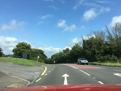

Coastguard Café
Cafe · Coffee Shop · 0.6 mi
Coastguard Lane, Fairlight
Tu-Sa 09:00-17:00; Su 10:00-17:00

Where to stay2
Churches and places of worship13
Schools, colleges and libraries1
Map of Fairlight
44 places. The map loads OpenStreetMap tiles when you open it.
Getting there and nearby towns
Lydd Airport (LYX) is the nearest airport with scheduled flights listed in OpenStreetMap, 14 miles away.
- Hastings 4 mi southwest, about 6 min by car
- Saint Leonards-on-Sea 5 mi west, about 8 min by car
- Bexhill-on-Sea 8 mi west, about 13 min by car
- Northiam 8 mi north, about 14 min by car
- Ninfield 10 mi west, about 16 min by car
- Herstmonceux 15 mi west, about 23 min by car
- Woodchurch 15 mi north, about 23 min by car
- Ticehurst 16 mi northwest, about 26 min by car
- Hailsham 17 mi west, about 28 min by car
- Eastbourne 18 mi southwest, about 29 min by car
Drive times are estimates from straight-line distance, not routes.
Towns near Fairlight


Keep exploring
Local news
Headlines from INDB.
Reviews, tips and questions
Loading what members have shared...
Sources and licences
- GeoNames (CC BY 4.0): population, coordinates, regions and time zone
- Mapillary (see each image): photos
- OpenStreetMap contributors (ODbL 1.0): places, airports, map data
- Wikidata (CC0 1.0): elevation, founding date, time zone, website, landmarks and historic places
- Wikimedia Commons (see each image): photos
- Wikipedia (CC BY-SA 4.0): overview and history text
Photo credits
- Hastings Castle 2012-07-28, Kreepin Deth, CC BY-SA 3.0
- Jerwood Gallery, yellow book, CC BY 2.0
- Former St Nicholas' Church (Fishermen's Church), Old Town, Hastings (IoE Code 294063), The Voice of Hassocks, Public domain
- Speckled wood hastings, FOSWMT, CC BY-SA 3.0
- All Souls Church, Clive Vale, Hastings (IoE Code 293707), The Voice of Hassocks, Public domain
- Christ Church, Ore, Hastings (IoE Code 294029), The Voice of Hassocks, Public domain
- Former Ebenezer Particular Baptist Chapel, Old Town, Hastings (IoE Code 293813), The Voice of Hassocks, Public domain
- Hastings Unitarian Church, South Terrace, Hastings (June 2020) (3), Hassocks5489, CC0
- Church of St Mary Star of the Sea, Old Town, Hastings (IoE Code 293874), The Voice of Hassocks, Public domain
- Wellington Square Baptist Church, Hastings (IoE Code 294127), The Voice of Hassocks, Public domain
- Hastings Country Park - Fairlight Road, Unknown author, Public domain
- Pett Methodist Chapel, Pett Road, Pett (NHLE Code 1217586) (July 2011) (1), User:Hassocks5489, CC0
- St Peter's Church, Broadway, Fairlight Cove (July 2011) (3), User:Hassocks5489, CC0
- CovehurstBayfromCliffs2005, No machine-readable author provided. Sandpiper assumed (based on copyright claims)., Public domain
- Stade20, Unknown author, CC BY 3.0
- EntranceSWM, Kirkbooth, CC BY-SA 4.0
- Street-level photo, southglos, CC BY-SA 4.0
- Street-level photo, wasd42, CC BY-SA 4.0
- Street-level photo, wasd42, CC BY-SA 4.0
- Street-level photo, southglos, CC BY-SA 4.0


Page built November 10, 2026. Spotted a mistake? Tell us or suggest a place.