


Saint Leonards-on-Sea, United Kingdom
Saint Leonards-on-Sea is a town of 10,001 people in England, United Kingdom.
Why visit Saint Leonards-on-Sea
Townapedia lists 25 museums and landmarks, 26 parks and trails, 131 places to eat, 14 places to stay and 3 attractions in and around town.
Highlights include White Rock Theatre, The Stade, Hastings Pier and The True CRIME Museum.
Weather in Saint Leonards-on-Sea
Forecast from MET Norway (CC BY 4.0). Full forecast
About Saint Leonards-on-Sea
St Leonards-on-Sea (commonly known as St Leonards) is a town and seaside resort in the borough of Hastings in East Sussex, England. It has been part of the borough since the late 19th century and lies to the west of central Hastings. The original part of the settlement was laid out in the early 19th century as a new town: a place of elegant houses designed for the well-off; it also included a central public garden, a hotel, an archery, assembly rooms and a church. Today's St Leonards has extended well beyond that original design, although the original town still exists within it.
From the Wikipedia article St Leonards-on-Sea (this version), under CC BY-SA 4.0.
Photos of Saint Leonards-on-Sea


Things to do3

White Rock Theatre
Cinema and theater · 1.2 mi
Theatre in Hastings, England, originally a concert hall, also used as a cinema
White Rock, Hastings


Museums and landmarks25

Hastings Pier
Monument and historic site · 1.2 mi
Pier in Hastings, England
1-10 White Rock, Hastings
10:00-22:00

Amsterdam
Monument and historic site · 1.2 mi
Cargo ship built in 1748, wrecked in a storm on the English Channel. There have been discussions about recovering and relocating the...

Hastings Castle
Monument and historic site · 1.7 mi
Grade I listed ruins in Hastings, East Sussex, England, UK


Hastings Fishermen's Museum
Museum · 2.2 mi
Grade II listed maritime museum in Hastings, East Sussex, England, UK



Hastings Museum and Art Gallery
Museum · 1.1 mi
Museum and art gallery in Hastings, England, United Kingdom
Bohemia Road, Hastings
13 more on the map.
Parks, trails and playgrounds26

Alexandra Park
Park · 1.2 mi
Public park in Hastings, East Sussex, England, UK


Speckled Wood, Hastings
Park · 2.8 mi
Woodland area in East Sussex, United Kingdom


St Helen's Wood
Park · 2.1 mi
Woodland in Hastings, East Sussex, England, UK

14 more on the map.
Restaurants and cafes131
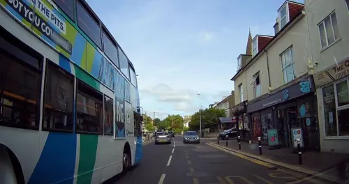
Hastings Spice
Restaurant · Indian · 0.8 mi
51 Bohemia Road, St Leonards-on-Sea
Mo-Su 11:00-14:00,17:00-22:30
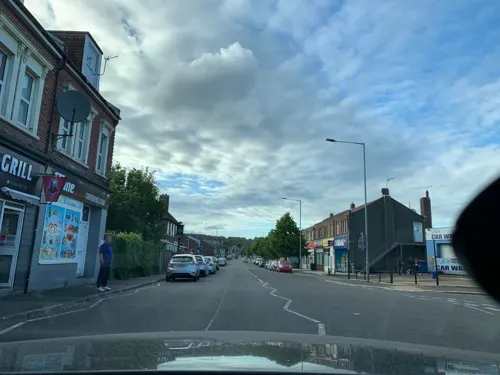
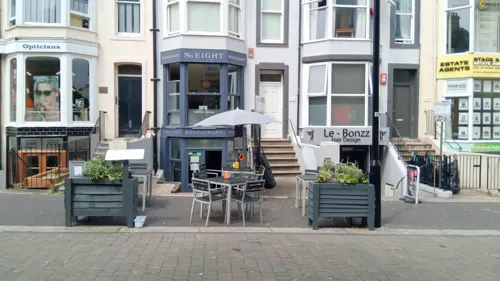
No. Eight
Restaurant · International · 1.5 mi
8 Cambridge Road, Hastings
We-Sa 12:00-14:30,17:30-21:30; Su 12:00-16:00

Mama Geny's
Restaurant · Filipino · 1.4 mi
1 Cambridge Gardens, Hastings
We-Fr 11:30-14:30, We-Fr 17:30-20:30, Sa 11:30-20:30

Barnaby's Lounge
Bar and pub · 1.4 mi
46 Robertson Street, Hastings
Mo-Th 11:00-19:00; Fr-Sa 11:00-00:00; Su 10:00-17:00

Caffè Nero
Cafe · Coffee Shop · 1.5 mi
2-3 Station Road, Hastings
Mo-Fr 07:00-18:00; Sa 07:00-18:30; Su 08:00-18:00
Costa
Cafe · Coffee Shop · 1.4 mi
Station Approach
Mo-Fr 06:00-19:00; Sa 06:30-19:00; Su 09:00-17:00
No.40 Bar Kitchen
Bar and pub · 0.7 mi
38 Norman Road, St Leonards-on-sea
Tu-Th 17:00-22:30; Fr-Su 12:00-22:30
119 more on the map.
History
The land that is now St Leonards was once owned by the Levett family, an ancient Sussex gentry family of Norman origin who owned the adjacent manor of Hollington, and subsequently by their descendants, the Eversfields, who rose to prominence from their iron foundries and widespread property holdings during Tudor times. Eversfields served as sheriffs of Surrey and Sussex in the 16th and 17th centuries and were later baronets before the family became extinct.
James Burton, a successful London property developer who had developed large areas of Bloomsbury and the houses around Regent's Park, purchased land from the Eversfield estate to put into being his concept of a seaside resort. The land was part of Gensing Farm, and included a small wooded valley leading down to the sea. Work on the plan started in early 1826. It included a house for himself (West Villa: now 57 Marina); service areas were provided, such as shops and laundering (Mercatoria and Lavatoria), as well as public buildings for entertainment and the picturesque siting of villas amongst the wooded slopes and water of the central gardens, to be paid for by subscription.
Read more of the history
In addition he persuaded the Turnpike Commissioners to have the road leading to St Leonards included in the scheme, and arranged for the road through Silverhill to be built so as to give access. Before he died in 1837, St Leonards (Royal Victoria) Hotel, the South Colonnade, an archway marking the town boundary with Hastings, and tall seafront houses (as far as 71 Marina) had also been completed. His grave is marked by a pyramid in the churchyard above St Leonard's Church. In 1850 his son Decimus (1800–1881) started the second phase of building, by acquiring more land and extending the development westward. He lived in the town for the remainder of his life.
Decimus Burton became a Commissioner of the new town in 1833. He leased a triangle of land bounded by Mercatoria, St John's Church, Maze Hill and Kenilworth Road. Here he built The Cottage (now St Leonards Lodge), Maze Hill House (demolished), The Mount (13 houses), The Uplands (6), The Lawn (10), and six semi-detached houses which later became a school (later part of the college but now closed for redevelopment). Later, in Upper Maze Hill he built Baston Lodge, Tower House and Clone House (now Healey House). He gave some land in Mercatoria for a National School, and completed his father's seafront terrace by building 72 to 82 Marina. Modern (2006) photographs give a flavour of this development.
St Leonards became a fashionable seaside destination. Princess Sophia of Gloucester stayed at Gloucester Lodge on Quarry Hill in 1831. The building was formerly named the Castellated Villa but changed to Gloucester Lodge in honour of her. Princess Victoria and her mother the Duchess of Kent, stayed in the town for the winter of 1834–1835, occupying a residence since renamed Crown House. In 1837 Queen Adelaide passed the winter there.
The popularity of St Leonards, however, was not lost upon the town of Hastings. It had already begun to expand westwards, through Pelham Place and Wellington Square, and further building began. The Eversfield Estate, from whom the Burtons had bought land, saw the potential and it too began to sell off more space, having obtained an Act of Parliament opening the way for speculative builders beyond the Burton boundaries. As a result, the area between the two towns began to fill with properties. In 1875, the two towns merged into the County Borough of Hastings, and by then the total seafront had reached some three miles (4.8 km). Soon after that, the Warrior Square and Upper St Leonards areas were being developed.
By now the railways had arrived: the London, Brighton and South Coast Railway reached West Marina in 1845, although it was not until 1852 that the station later named St Leonards Warrior Square was opened by the South Eastern Railway.
Construction of the pier began in March 1888, and it was opened by Lord and Lady Brassey on 28 October 1891. Positioned almost opposite the Royal Victoria Hotel, the shore end had a pavilion constructed of intricate ironwork at the entrance so that visitors could drive straight to the door and avoid the seafront weather. There was also a tollhouse to the left of the entrance that was demolished by a storm on 12 February 1899. The far end of the pier had a building used for dancing, and later as a roller hockey rink. During the 1920s the pier was modernised and finally cut in half during the Second World War as protection against invasion. The remains were removed in 1951.
In 1901 the civil parish called Hastings St Leonards had a population of 7693. On 1 April 1909 the parish was abolished and merged with Hastings.
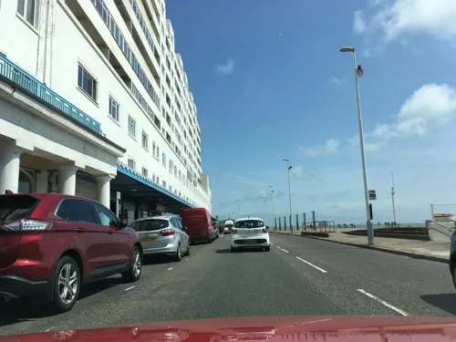
On the seafront stands an ocean liner shaped art-deco building known as Marine Court, which upon completion in 1937 was the tallest block of flats in the United Kingdom, comprising some 153 flats and 3 restaurants. Despite this claim to fame, entries to a competition to name the building show that it was not universally popular. Now a listed building, it has recently been bought by the residents after many years of neglect and is in the process of being fully restored.
St Leonards Golf Club, Hastings, (now defunct) was founded in 1902/3. The club closed in 1960.
From the History section of St Leonards-on-Sea on Wikipedia, under CC BY-SA 4.0.
More about Saint Leonards-on-Sea
Geography
The town of St Leonards today occupies, firstly, the fairly steeply climbing land immediately adjacent to the west of Hastings, leading up towards Silverhill and Hollington; and secondly, an area to the west where the land is lower lying. The latter part of the town – Bulverhythe – is thought to be the original site of the port of Hastings, since cut off by longshore drift of pebbles. Within the higher land there are some small valleys: that through which the Priory stream flows through Alexandra Park being the main one.
In November 2023, the steep land between Marina on the sea front and the West Hill Road was affected by a series of landslips, leading to local homes being evacuated.
From the Wikipedia article St Leonards-on-Sea, under CC BY-SA 4.0.
Notable people from Saint Leonards-on-Sea
 David HareBritish playwright, screenwriter and theatre and film director (1947- )Photo: Peter Burnett, CC0
 Mark DavisEnglish snooker playerPhoto: Benutzer:Bill da Flute, CC BY-SA 3.0
 Phoebe Holcroft WatsonBritish tennis player (1898-1980)Photo: Agence de presse Meurisse, Public domain
 Barbara FlynnBritish actressPhoto: S Pakhrin from DC, USA, CC BY 2.0
 Kennedy Joseph Previté OrtonBritish chemistPhoto: Unknown author Unknown author, Public domain
 Charles Ferdinand Marksphysician and politician in Queensland, AustraliaPhoto: Unknown author Unknown author, Public domain
 Frederic UrquhartAustralian politicianPhoto: Unknown author Unknown author, Public domain
- Claud Buchanan TicehurstBritish ornithologist & surgeon (1881-1941)
- Sheila Kaye-SmithBritish writer (1887-1956)
- Harold Knox-ShawBritish astronomer
- George ColeEnglish cricketer (1885-1964)
- Grace PailthorpeBritish painter (1883-1971)
Born in Saint Leonards-on-Sea, according to Wikidata (CC0). Each name links to its Wikipedia article.
Where to stay14
Churches and places of worship39
St Leonards Baptist Church
Church · Baptist · 0.7 mi
Chapel Park Road, St Leonards-on-sea
Church of St Thomas of Canterbury and English Martyrs, St Leonards-on-Sea
Church · 0.9 mi
Church of St Thomas of Canterbury and the English Martyrs
Church · Catholic · 0.9 mi
Magdalen Road, St Leonards-on-Sea
His Place Community Church
Church · United Reformed · 1.4 mi
23 Cambridge Road, Hastings
Shopping20
Gas and EV charging4
Schools, colleges and libraries15
St Mary Star of the Sea Catholic Primary School
School · Roman Catholic · 0.9 mi
Magdalen Road, St Leonards-on-Sea
Christ Church CE Primary & Nursery Academy
School · Anglican · 0.7 mi
Woodland Vale Road, St Leonards-on-Sea
Healthcare8
Inner Peace Counselling Service
Clinic and pharmacy · 0.8 mi
64 Bohemia Road, St Leonards-on-sea
Sedlescombe Road Surgery
Clinic and pharmacy · 0.9 mi
8 Sedlescombe Road South, St Leonards-on-Sea
Map of Saint Leonards-on-Sea
250 places. The map loads OpenStreetMap tiles when you open it.
Getting there and nearby towns
Lydd Airport (LYX) is the nearest airport with scheduled flights listed in OpenStreetMap, 19 miles away.
- Eastbourne 13 mi southwest, about 21 min by car
- Seaford 20 mi west, about 32 min by car
- Uckfield 21 mi west, about 34 min by car
- Maidstone 28 mi north, about 46 min by car
- Brighton 30 mi west, about 48 min by car
- Sevenoaks 33 mi northwest, about 53 min by car
- Snodland 33 mi north, about 53 min by car
- Crawley 36 mi northwest, about 58 min by car
- Shoreham-by-Sea 36 mi west, about 58 min by car
- Gillingham 37 mi north, about 59 min by car
Drive times are estimates from straight-line distance, not routes.
Towns near Saint Leonards-on-Sea


Keep exploring
Local news
Headlines from INDB.
Reviews, tips and questions
Loading what members have shared...
Sources and licences
- GeoNames (CC BY 4.0): population, coordinates, regions and time zone
- Mapillary (see each image): photos
- OpenStreetMap contributors (ODbL 1.0): places, airports, map data
- Wikidata (CC0 1.0): elevation, founding date, time zone, website, landmarks and historic places
- Wikimedia Commons (see each image): photos
- Wikipedia (CC BY-SA 4.0): overview and history text
Photo credits
- White Rock Theatre, Hastings, Exotropic Snail, CC BY-SA 4.0
- VOC Amsterdam wreck at low tide, MarshallPearce, CC BY-SA 4.0
- Hastings Castle 2012-07-28, Kreepin Deth, CC BY-SA 3.0
- Jerwood Gallery, yellow book, CC BY 2.0
- Former St Nicholas' Church (Fishermen's Church), Old Town, Hastings (IoE Code 294063), The Voice of Hassocks, Public domain
- BukcsholeReservoirAlexandraPark, Jaminnun, CC BY 3.0
- Church-in-the-Wood, Hollington, Hastings (Churchyard), The Voice of Hassocks, Public domain
- Speckled wood hastings, FOSWMT, CC BY-SA 3.0
- Christ Church, St Leonards-on-Sea (from Northeast), The Voice of Hassocks, Public domain
- St Leonards Baptist Church, St Leonards, Hastings (IoE Code 294178), The Voice of Hassocks, Public domain
- All Souls Church, Clive Vale, Hastings (IoE Code 293707), The Voice of Hassocks, Public domain
- Christ Church, Ore, Hastings (IoE Code 294029), The Voice of Hassocks, Public domain
- Church-in-the-Wood, Hollington, Hastings (South Side), The Voice of Hassocks, Public domain
- Former Ebenezer Particular Baptist Chapel, Old Town, Hastings (IoE Code 293813), The Voice of Hassocks, Public domain
- Hastings Unitarian Church, South Terrace, Hastings (June 2020) (3), Hassocks5489, CC0
- Church of St Thomas of Canterbury and English Martyrs, St Leonards, Hastings (IoE Code 495311), The Voice of Hassocks, Public domain
- Holy Trinity Church, Hastings (IoE Code 294055), The Voice of Hassocks, Public domain
- Tomb of James Burton (1761-1837) at St Leonards-on-Sea, Anthony McIntosh, CC BY-SA 2.5
- Robertson Street United Reformed Church, Hastings (April 2010) (Main Elevation) (1), The Voice of Hassocks5489, Public domain
- Hastings library (40646452122), Libraries Taskforce, CC BY 2.0
- VOC Amsterdam wreck at low tide (aerial) 02, Alexis Markwick, CC BY-SA 4.0
- Stade20, Unknown author, CC BY 3.0
- Holy Trinity Church, Robertson Street, Hastings (NHLE Code 1043423) (June 2020) (2), Hassocks5489, CC0
- EntranceSWM, Kirkbooth, CC BY-SA 4.0
- 375713 & 375617, West St Leonards, December 5th 2024, Southsea_Matt, CC BY-SA 4.0
- Hastings Pier at sunset, Fanfwah, CC BY-SA 4.0
- Pseudo Roman Bath in Summerfields Wood, Hastings. (7314141412), Phil Sellens from East Sussex, CC BY 2.0
- Street-level photo, southglos, CC BY-SA 4.0
- Street-level photo, tallguy, CC BY-SA 4.0
- Street-level photo, tallguy, CC BY-SA 4.0
- Street-level photo, wasd42, CC BY-SA 4.0
- Street-level photo, wasd42, CC BY-SA 4.0
- Street-level photo, andreste96, CC BY-SA 4.0
- Street-level photo, southglos, CC BY-SA 4.0
- Street-level photo, tallguy, CC BY-SA 4.0
- Street-level photo, southglos, CC BY-SA 4.0
- Street-level photo, andreste96, CC BY-SA 4.0
- Street-level photo, tallguy, CC BY-SA 4.0
- Street-level photo, wasd42, CC BY-SA 4.0
- Street-level photo, tallguy, CC BY-SA 4.0
- Street-level photo, southglos, CC BY-SA 4.0
- Street-level photo, tallguy, CC BY-SA 4.0
- Street-level photo, tallguy, CC BY-SA 4.0
- Street-level photo, andreste96, CC BY-SA 4.0
- Street-level photo, southglos, CC BY-SA 4.0


Page built November 10, 2026. Spotted a mistake? Tell us or suggest a place.