


Hastings, United Kingdom
Hastings is a town of 92,855 people in England, United Kingdom.
Why visit Hastings
Townapedia lists 66 museums and landmarks, 43 parks and trails, 244 places to eat, 27 places to stay and 16 attractions in and around town.
Highlights include The Stables Theatre, White Rock Theatre, Hastings Contemporary and Hastings Pier.
Weather in Hastings
Forecast from MET Norway (CC BY 4.0). Full forecast
About Hastings
Hastings is a seaside town and borough in East Sussex on the south coast of England,
From the Wikipedia article Hastings (this version), under CC BY-SA 4.0.
Travel tips from other travellers: Hastings on Wikivoyage (CC BY-SA 4.0).
Photos of Hastings


Things to do16

White Rock Theatre
Cinema and theater · 0.4 mi
Theatre in Hastings, England, originally a concert hall, also used as a cinema
White Rock, Hastings







4 more on the map.
Museums and landmarks66

Hastings Contemporary
Museum · 0.6 mi
Art museum in Hastings
Rock-a-Nore Road, Hastings
Tu-Su 11:00-17:00

Hastings Pier
Monument and historic site · 0.4 mi
Pier in Hastings, England
1-10 White Rock, Hastings
10:00-22:00


Amsterdam
Monument and historic site · 2.6 mi
Cargo ship built in 1748, wrecked in a storm on the English Channel. There have been discussions about recovering and relocating the...

Hastings Castle
Monument and historic site
Grade I listed ruins in Hastings, East Sussex, England, UK

Hastings Fishermen's Museum
Museum · 0.7 mi
Grade II listed maritime museum in Hastings, East Sussex, England, UK



Hastings Museum and Art Gallery
Museum · 0.4 mi
Museum and art gallery in Hastings, England, United Kingdom
Bohemia Road, Hastings
54 more on the map.
Parks, trails and playgrounds43

Alexandra Park
Park · 0.9 mi
Public park in Hastings, East Sussex, England, UK


Speckled Wood, Hastings
Park · 1.6 mi
Woodland area in East Sussex, United Kingdom

St Helen's Wood
Park · 1.5 mi
Woodland in Hastings, East Sussex, England, UK

31 more on the map.
Restaurants and cafes244


The Stag Inn
Bar and pub · 0.7 mi
14 All Saints' Street, Hastings
Mo-Th 18:00-23:00; Fr-Sa 12:00-23:00; Su 12:00-19:00
Boulevard Bookshop and Thai Cafe
Restaurant · Thai · 0.4 mi
32 George Street, Hastings
We-Su 18:30-23:00
Hastings Spice
Restaurant · Indian · 1.1 mi
51 Bohemia Road, St Leonards-on-Sea
Mo-Su 11:00-14:00,17:00-22:30
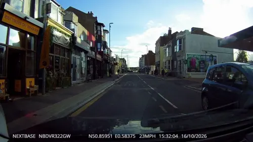
Hastings Wine and Coffee
Cafe
Cafe and wine bar that also sells packaged coffee and bottled wine.
91 Queens Road, Hastings
Th-Sa 09:30-20:00; Su 09:30-18:00
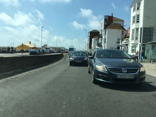
Pelican Diner
Restaurant · Burger · 0.5 mi
20 East Parade, Hastings
Th-Fr 10:00-16:00; Sa-Su 09:00-16:00

Coastguard Café
Cafe · Coffee Shop · 3.1 mi
Coastguard Lane, Fairlight
Tu-Sa 09:00-17:00; Su 10:00-17:00

Mama Geny's
Restaurant · Filipino
1 Cambridge Gardens, Hastings
We-Fr 11:30-14:30, We-Fr 17:30-20:30, Sa 11:30-20:30
232 more on the map.
History
The first mention of Hastings is from the late 8th century in the form Hastingas. This is derived from the Old English tribal name Hæstingas, meaning 'the constituency (followers) of Hæsta'. Symeon of Durham records the victory of Offa in 771 over the Hestingorum gens, that is, "the people of the Hastings tribe." Hastingleigh in Kent was named after that tribe. The place name Hæstingaceaster is listed in the Anglo-Saxon Chronicle entry for 1050, and may be an alternative name for Hastings. However, the absence of any archaeological remains of or documentary evidence for a Roman fort at Hastings suggest that Hæstingaceaster may refer to a different settlement, most likely that based on the Roman remains at Pevensey.
Read more of the history
Evidence of prehistoric settlements is present at the town site; flint arrowheads and Bronze Age artefacts have been found. Iron Age forts were excavated on both the East and West Hills. This suggests that the inhabitants moved early to the safety of the valley in between the forts. The settlement was already based on the port when the Romans arrived in Britain for the first time in 55 BC. At this time, they began to exploit the iron (Wealden rocks provide a plentiful supply of the ore), and shipped it out by boat. Iron was worked locally at Beauport Park, to the north of the town. It employed up to one thousand men and is considered to have been the third-largest mine in the Roman Empire. There was also a possible iron-working site near Blacklands Church in the town – the old name of 'Ponbay Bridge' for a bridge that used to exist in the area is a corruption of 'Pond Bay' as suggested by Thomas Ross (Mayor of Hastings and author of an 1835 guide book).
With the departure of the Romans, the town suffered setbacks. The Beauport site was abandoned, and the town suffered from problems from nature and man-made attacks. The Sussex coast has always suffered from occasional violent storms; with the additional hazard of longshore drift (the eastward movement of shingle along the coast), the coastline has frequently changed. The original Roman port is probably now under the sea.
Bulverhythe was probably a harbour used by Danish invaders, which suggests that -hythe or hithe means a port or small haven.
From the 6th century AD until 771, the people of the area around modern-day Hastings, identified the territory as that of the Haestingas tribe and a kingdom separate from the surrounding kingdoms of Suth Saxe ("South Saxons", i.e. Sussex) and Kent. It worked to retain its separate cultural identity until the 11th century. The kingdom was probably a sub-kingdom, the object of a disputed overlordship by the two powerful neighbouring kingdoms: when King Wihtred of Kent settled a dispute with King Ine of Sussex & Wessex in 694, it is probable that he ceded the overlordship of Haestingas to Ine as part of the treaty.
In 771, King Offa of Mercia invaded Southern England, and over the next decade gradually seized control of Sussex and Kent. Symeon of Durham records a battle fought at an unidentified location near Hastings in 771, at which Offa defeated the Haestingas tribe, effectively ending its existence as a separate kingdom. By 790, Offa controlled Hastings effectively enough to confirm grants of land in Hastings to the Abbey of St Denis, in Paris. But, the Anglo-Saxon Chronicle for 1011 relates that Vikings overran "all Kent, Sussex, Surrey and Haestingas", indicating the town was still considered a separate 'county' or province to its neighbours 240 years after Offa's conquest.
During his reign, Athelstan established a royal mint in Hastings in AD 928.
The start of the Norman Conquest was the Battle of Hastings, fought on 14 October 1066, although the battle itself took place 6 mi (9.7 km) to the northwest at Senlac Hill. William had landed on the coast between Hastings and Eastbourne at Pevensey. It is thought that the Norman encampment was on the town's outskirts, where there was open ground; a new town was already being built in the valley to the east. That "New Burgh" was founded in 1069 and is mentioned in the Domesday Book as such. William defeated and killed Harold Godwinson, the last Saxon King of England, and destroyed his army, opening England to the Norman conquest.
William ordered a castle to be built at Hastings, probably using the earthworks of the existing Saxon castle. Hastings was shown as a borough by the time of the Domesday Book (1086); it had also given its name to the Rape of Hastings, one of the six administrative divisions of Sussex. As a borough, Hastings had a corporation consisting of a "bailiff, jurats, and commonalty". By a charter of Elizabeth I in 1589, the bailiff was replaced by a mayor. Muslim scholar Muhammad al-Idrisi, writing c. 1153, described Hastings as "a town of large extent and many inhabitants, flourishing and handsome, having markets, workpeople and rich merchants".
By the end of the Saxon period, the port of Hastings had moved eastward near the present town centre in the Priory Stream valley, whose entrance was protected by the White Rock headland (since demolished). It was to be a short stay: Danish attacks and huge floods in 1011 and 1014 motivated the townspeople to relocate to the New Burgh. In the Middle Ages Hastings became one of the Cinque Ports: Sandwich, Dover and New Romney were the first, followed by Hastings and Hythe then Rye and Winchelsea. At one point 42 towns were directly or indirectly affiliated with the group.
From the History section of Hastings on Wikipedia, under CC BY-SA 4.0.
More about Hastings
Geography
Hastings is situated where the sandstone beds, at the heart of the Weald, known geologically as the Hastings Sands, meet the English Channel, forming tall cliffs to the east of the town. Hastings Old Town is in a sheltered valley between the East Hill and West Hill (on which the remains of the Castle stand). In Victorian times and later the town has spread westwards and northwards, and now forms a single urban centre with the more suburban area of St Leonards-on-Sea to the west. Roads from the Old Town valley lead towards the Victorian area of Clive Vale and the former village of Ore, from which "The Ridge", marking the effective boundary of Hastings, extends north-westwards towards Battle. Beyond Bulverhythe, the western end of Hastings is marked by low-lying land known as Glyne Gap, separating it from Bexhill-on-Sea.
The sandstone cliffs have been the subject of considerable erosion in relatively recent times: much of the Castle was lost to the sea before the present sea defences and promenade were built, and a number of cliff-top houses are in danger of disappearing around the nearby village of Fairlight.
The beach is mainly shingle, although wide areas of sand are uncovered at low tide. The town is generally built upon a series of low hills rising to 500 ft (150 m) above sea level at "The Ridge" before falling back in the river valley further to the north.
Economy
Until the development of tourism, fishing was Hastings' major industry. The fishing fleet, based at the Stade, remains Europe's largest beach-launched fishing fleet and has recently won accreditation for its sustainable methods. The fleet has been based on the same beach, below the cliffs at Hastings, for at least 400, possibly 600, years. Its longevity is attributed to the prolific fishing ground of Rye Bay nearby. Hastings fishing vessels are registered at Rye, and thus bear the letters "RX" (Rye, SusseX).
There are now various industrial estates that lie around the town, mostly on the outskirts, which include engineering, catering, motoring and construction; however, most of the jobs within the Borough are concentrated on health, public services, retail and education. 85% of the firms (in 2005) employed fewer than 10 people; as a consequence the unemployment rate was 3.3% (cf. East Sussex 1.7%). However, qualification levels are similar to the national average: 8.2% of the working-age population have no qualifications while 28% hold degree-level qualifications or higher, compared with 11% and 31% respectively across England.
Arts and culture
Hastings has an Army Cadet Force (ACF) detachment which is part of Sussex ACF. This detachment is based in the old Territorial Army Unit Building on Cinque Ports Way, and is affiliated to PWRR. Hastings also has a Royal Air Force Air Cadet Squadron, 304 (Hastings) Squadron of Sussex Wing RAFAC, based in the same building. The town also has a Sea Cadet squadron, T.S. Hastings. This sits adjacent to the Army and Air Cadet building on the seafront. The site features a climbing wall and other training facilities.
Throughout the year many annual events take place in Hastings, the largest of which being the May Day bank holiday weekend, which features a Jack-in-the-Green festival (revived since 1983) and usually falls around 1–3 May, and the culmination of the Maydayrun—tens of thousands of motorcyclists having ridden the A21 to Hastings. The yearly carnival during Old Town Week takes place every August, which includes a week of events around Hastings Old Town, including a Seaboot race, bike race, street party and pram race. In September, there is a month-long arts festival 'Coastal Currents' and a Seafood and Wine Festival. During Hastings Week held each year around 14 October the Hastings Bonfire Society stages a traditional Sussex Bonfire which includes a torchlight procession through the streets, a beach bonfire and firework display.
Education
Hastings has 18 primary schools, four secondary schools, one further education college and one higher education institution.
The University of Brighton in Hastings offers higher education courses in a range of subjects and currently attracts over 800 students. The university's Hastings campus doubled in size in 2012, with the addition of the new Priory Square building designed by Proctor and Matthews Architects. This is located in the town centre a short distance from the railway station.
Sussex Coast College, formerly called Hastings College, is the town's further education college; it is located at Station Plaza, next to the railway station.
The secondary schools in the town include Ark Alexandra Academy, Hastings Academy and The St Leonards Academy. East Sussex County Council closed three mixed comprehensive schools: Filsham Valley, The Grove and Hillcrest, replacing them with two academy schools; The St Leonards Academy, and The Hastings Academy. The sponsors for the academies are University of Brighton (lead sponsor), British Telecom and East Sussex County Council itself.
From the Wikipedia article Hastings, under CC BY-SA 4.0.
Notable people from Hastings
 Sophia Jex-BlakeBritish physician and suffragist (1840–1912)Photo: Margaret Todd, Public domain
 Winifred WagnerWife of Siegfried Wagner (1897–1980)Photo: Unknown photographer, Public domain
 Simon FullerBritish entrepreneur, artist manager, and film and television producerPhoto: Lovefromjuliaxo, CC0
 Tom ChaplinBritish musicianPhoto: D B, CC BY 2.0
 Jo BrandBritish comedianPhoto: Rodw, CC BY-SA 4.0
 John DigweedBritish DJ, record producer and actorPhoto: Peter Chiapperino a concert..., CC BY-SA 4.0
- Gareth BarryEnglish association football player
- Marianne NorthEnglish philanthropist, painter, biologist and botanical artist (1830-1890)
- Grey OwlCanadian writer and lecturer (1888–1938) who passed as half Indian in the latter years of his life
- Cecil Parkeractor (1897-1971)
- H. R. F. KeatingEnglish crime fiction writer (1926–2011)
- Shirley CollinsBritish folk singer
Born in Hastings, according to Wikidata (CC0). Each name links to its Wikipedia article.
Where to stay27
Churches and places of worship62
Christ Church, Ore
Church · Anglican · 1.7 mi
Victoria Avenue, Hastings
St Leonards Baptist Church
Church · Baptist · 0.8 mi
Chapel Park Road, St Leonards-on-sea
Church of St Thomas of Canterbury and English Martyrs, St Leonards-on-Sea
Church · 0.7 mi
Shopping55
Gas and EV charging9
Schools, colleges and libraries30
St Mary Star of the Sea Catholic Primary School
School · Roman Catholic · 0.6 mi
Magdalen Road, St Leonards-on-Sea
Healthcare17
Inner Peace Counselling Service
Clinic and pharmacy · 1.1 mi
64 Bohemia Road, St Leonards-on-sea
Sedlescombe Road Surgery
Clinic and pharmacy · 1.4 mi
8 Sedlescombe Road South, St Leonards-on-Sea
Hastings & St Leonards Children's Services
Clinic and pharmacy · 1.8 mi
Old London Road, Hastings
Map of Hastings
250 places. The map loads OpenStreetMap tiles when you open it.
Getting there and nearby towns
Lydd Airport (LYX) is the nearest airport with scheduled flights listed in OpenStreetMap, 17 miles away.
- Saint Leonards-on-Sea 2 mi west, about 2 min by car
- Eastbourne 14 mi southwest, about 23 min by car
- Hailsham 14 mi west, about 23 min by car
- Seaford 22 mi west, about 35 min by car
- Uckfield 23 mi west, about 36 min by car
- Crowborough 23 mi northwest, about 37 min by car
- Newhaven 23 mi west, about 37 min by car
- Royal Tunbridge Wells 24 mi northwest, about 38 min by car
- Lewes 25 mi west, about 40 min by car
- Maidstone 29 mi north, about 46 min by car
Drive times are estimates from straight-line distance, not routes.
Towns near Hastings


Keep exploring
Local news
Headlines from INDB.
Reviews, tips and questions
Loading what members have shared...
Sources and licences
- GeoNames (CC BY 4.0): population, coordinates, regions and time zone
- Mapillary (see each image): photos
- OpenStreetMap contributors (ODbL 1.0): places, airports, map data
- Wikidata (CC0 1.0): landmarks and historic places
- Wikimedia Commons (see each image): photos
- Wikipedia (CC BY-SA 4.0): overview and history text
Photo credits
- Hastings town centre, Ross Burgess, CC BY-SA 3.0
- Advertisement for Ferrari's Cafe & Restaurant, Havelock Road, Hastings. 1930 (8379331301), Phil Sellens from East Sussex, CC BY 2.0
- Hastings Town Centre. (6346693523), Phil Sellens from East Sussex, CC BY 2.0
- White Rock Theatre, Hastings, Exotropic Snail, CC BY-SA 4.0
- Jerwood Gallery, yellow book, CC BY 2.0
- VOC Amsterdam wreck at low tide, MarshallPearce, CC BY-SA 4.0
- Hastings Castle 2012-07-28, Kreepin Deth, CC BY-SA 3.0
- Former St Nicholas' Church (Fishermen's Church), Old Town, Hastings (IoE Code 294063), The Voice of Hassocks, Public domain
- BukcsholeReservoirAlexandraPark, Jaminnun, CC BY 3.0
- Church-in-the-Wood, Hollington, Hastings (Churchyard), The Voice of Hassocks, Public domain
- Christ Church, St Leonards-on-Sea (from Northeast), The Voice of Hassocks, Public domain
- Christ Church, Ore, Hastings (IoE Code 294029), The Voice of Hassocks, Public domain
- Hastings Unitarian Church, South Terrace, Hastings (June 2020) (3), Hassocks5489, CC0
- St Leonards Baptist Church, St Leonards, Hastings (IoE Code 294178), The Voice of Hassocks, Public domain
- Wellington Square Baptist Church, Hastings (IoE Code 294127), The Voice of Hassocks, Public domain
- All Souls Church, Clive Vale, Hastings (IoE Code 293707), The Voice of Hassocks, Public domain
- Church-in-the-Wood, Hollington, Hastings (South Side), The Voice of Hassocks, Public domain
- Church of St Thomas of Canterbury and English Martyrs, St Leonards, Hastings (IoE Code 495311), The Voice of Hassocks, Public domain
- Speckled wood hastings, FOSWMT, CC BY-SA 3.0
- Hillcrest School, Hastings, East Sussex November 2010, Jpanzerj, CC BY-SA 3.0
- Hastings Country Park - Fairlight Road, Unknown author, Public domain
- Holy Trinity Church, Hastings (IoE Code 294055), The Voice of Hassocks, Public domain
- Stag Inn, All Saints Street, Hastings (NHLE Code 1043626), The Voice of Hassocks, CC0
- Tomb of James Burton (1761-1837) at St Leonards-on-Sea, Anthony McIntosh, CC BY-SA 2.5
- VOC Amsterdam wreck at low tide (aerial) 02, Alexis Markwick, CC BY-SA 4.0
- The Bull Inn, 530 Bexhill Road, St Leonards-on-Sea, Alexis Markwick, CC0
- CovehurstBayfromCliffs2005, No machine-readable author provided. Sandpiper assumed (based on copyright claims)., Public domain
- Smugglers tableau, Smuggler's Cave Adventure, Hastings, UK-15049806300, Cory Doctorow, CC BY-SA 2.0
- Stade20, Unknown author, CC BY 3.0
- Holy Trinity Church, Robertson Street, Hastings (NHLE Code 1043423) (June 2020) (2), Hassocks5489, CC0
- EntranceSWM, Kirkbooth, CC BY-SA 4.0
- Table Talk. (6965431203), Phil Sellens from East Sussex, CC BY 2.0
- Hastings Pier at sunset, Fanfwah, CC BY-SA 4.0
- Street-level photo, southglos, CC BY-SA 4.0
- Street-level photo, southglos, CC BY-SA 4.0
- Street-level photo, southglos, CC BY-SA 4.0
- Street-level photo, andreste96, CC BY-SA 4.0
- Street-level photo, southglos, CC BY-SA 4.0
- Street-level photo, tallguy, CC BY-SA 4.0
- Street-level photo, tallguy, CC BY-SA 4.0
- Street-level photo, southglos, CC BY-SA 4.0
- Street-level photo, andreste96, CC BY-SA 4.0
- Street-level photo, southglos, CC BY-SA 4.0
- Street-level photo, matth81, CC BY-SA 4.0
- Street-level photo, southglos, CC BY-SA 4.0
- Street-level photo, matth81, CC BY-SA 4.0
- Street-level photo, tallguy, CC BY-SA 4.0
- Street-level photo, tallguy, CC BY-SA 4.0
- Street-level photo, southglos, CC BY-SA 4.0
- Street-level photo, wasd42, CC BY-SA 4.0
- Street-level photo, wasd42, CC BY-SA 4.0
- Street-level photo, southglos, CC BY-SA 4.0
- Street-level photo, tallguy, CC BY-SA 4.0
- Street-level photo, southglos, CC BY-SA 4.0
- Street-level photo, andreste96, CC BY-SA 4.0
- Street-level photo, tallguy, CC BY-SA 4.0
- Street-level photo, southglos, CC BY-SA 4.0
- Street-level photo, southglos, CC BY-SA 4.0


Page built November 10, 2026. Spotted a mistake? Tell us or suggest a place.