


Bexhill-on-Sea, United Kingdom
Bexhill-on-Sea is a town of 43,754 people in England, United Kingdom, founded in August 19, 772.
Why visit Bexhill-on-Sea
Townapedia lists 63 museums and landmarks, 59 parks and trails, 145 places to eat, 14 places to stay and 9 attractions in and around town.
Highlights include Hastings Pier, White Rock Theatre, Bexhill Museum and De La Warr Pavilion.
Weather in Bexhill-on-Sea
Forecast from MET Norway (CC BY 4.0). Full forecast
About Bexhill-on-Sea
Bexhill-on-Sea (often shortened to Bexhill) is a seaside town and civil parish in the Rother district of the East Sussex county of South East England. It is located along the Sussex Coast and between the towns of Hastings and Eastbourne. In 2021, it had a population of 43,754.
From the Wikipedia article Bexhill-on-Sea (this version), under CC BY-SA 4.0.
Travel tips from other travellers: Bexhill-on-Sea on Wikivoyage (CC BY-SA 4.0).
Photos of Bexhill-on-Sea


Things to do9


White Rock Theatre
Cinema and theater · 4.4 mi
Theatre in Hastings, England, originally a concert hall, also used as a cinema



Chestnut Meadow Farm Shop
Farm and orchard · 1.5 mi
Ninfield Road, Bexhill-on-Sea
Tu-Sa 09:00-17:00
Julie's Plants
Farm and orchard · 3.1 mi
Barnhorn Road
Mo 09:00-16:00; We-Sa 09:00-16:00; Su 10:00-16:00

Cooden Mount
Scenic view · 1.8 mi
This hill could be "Cylla's Hill" referred to in the 772AD Bexhill Charter Boundaries of Barnhorne.
Former Combe Haven Viaduct
Scenic view · 1.7 mi
Elevated view of Combe Valley from the south side of the demolished viaduct. Visability depends on how broad the surrounding trees are.
Museums and landmarks63

Bexhill Museum
Museum · 0.9 mi
Local history museum in Bexhill-on-Sea, East Sussex, England, United Kingdom
Egerton Road, Bexhill-on-Sea
Tu-Su 11:00-16:00; PH 11:00-16:00


Amsterdam
Monument and historic site · 2.3 mi
Cargo ship built in 1748, wrecked in a storm on the English Channel. There have been discussions about recovering and relocating the...

Battle Abbey
Monument and historic site · 4.5 mi
Benedictine abbey in Battle, East Sussex, England, UK

Bexhill War Memorial
Monument and historic site · 0.9 mi
Unveiled by Brigadier General H O’Donnell. The figure is of Victory grasping the sword of sacrifice and a wreath, looking out towards...
East Parade

Cooden Moat
Monument and historic site · 2.1 mi
This is the remains of a medieval moat, which once surrounded Cooden Manor. The manor house was demolished in the middle of the 19th...
Maple Walk


Hastings Castle
Monument and historic site · 5.0 mi
Grade I listed ruins in Hastings, East Sussex, England, UK

HMS Resolution
Monument and historic site · 4.2 mi
1677 third-rate ship of the line

Hoad's Mill
Monument and historic site · 0.5 mi
Collapsed 1965-08-06 during a storm. Trestle removed 2009.
Gunters Lane

Hastings Museum and Art Gallery
Museum · 4.4 mi
Museum and art gallery in Hastings, England, United Kingdom
51 more on the map.
Parks, trails and playgrounds59


Alexandra Park
Park · 4.3 mi
Public park in Hastings, East Sussex, England, UK

Barrack Road Memorial Gardens
Park
Former burial ground for the Brtish Army and King George III's King German Legion. At least 150 men were buried here.
Barrack Road


Highwoods
Park · 1.8 mi
Site of Special Scientific Interest in East Sussex, England, UK



Ashburnham Park
Park · 4.7 mi
Park in Catsfield, Rother, East Sussex, England
47 more on the map.
Restaurants and cafes145

Royal Sovereign
Bar and pub · 0.7 mi
15 Sea Road, Bexhill-on-Sea
Mo-Th 12:00-23:00; Fr-Sa 00:00-02:00,12:00-23:59; Su...


The Picture Playhouse
Bar and pub · 0.7 mi
36-38 Western Road, Bexhill-on-Sea
Mo-Fr 08:00-23:59; Sa,Su 00:00-01:00,08:00-23:59

The Town House
Bar and pub · 0.6 mi
1 London Road, Bexhill-on-Sea
Su-Th 12:00-23:00; Fr-Sa 12:00-23:59

Wheatsheaf Inn
Bar and pub · 1.7 mi
2 Barnhorn Road, Bexhill-on-Sea
Mo 09:00-23:00; Tu-Th 11:00-23:00; Fr-Sa 11:00-23:59; Su 12:00-22:30

The Chilli Tree
Restaurant · Indian
Originally the Church of the Good Shepherd and Malet Memorial Institution. Its use ended in 1995.
1 King Offa Way, Bexhill-on-Sea
Mo-We,Fr-Su 18:00-23:00; Th 18:00-21:30
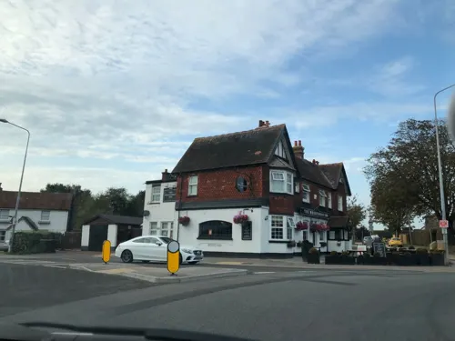
Little Common Fish & Grill
Restaurant · Fish And Chips · 1.7 mi
11 Cooden Sea Road, Bexhill-on-Sea
Tu-Sa 11:30-14:00, 16:30-21:00; Mo 16:30-21:00
Little India
Restaurant · Indian · 1.7 mi
17 Cooden Sea Road, Bexhill-on-Sea
Su-Th 12:00-14:30, 17:30-22:30; Fr 17:30-23:00; Sa 12:00-14:30, 17:30-23:00
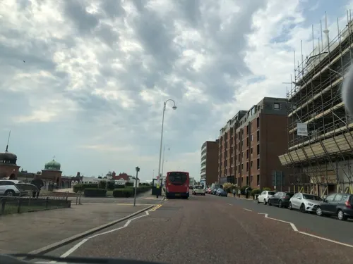
Mowgli
Restaurant · Indian · 0.9 mi
41-43 Marina, Bexhill-on-Sea
Su-Th 12:00-22:00; Fr 17:00-23:00; Sa 12:00-23:00

The Rose and Crown
Bar and pub · 0.8 mi
162-164 Turkey Road, Bexhill-on-Sea
Mo-Th 12:00-23:00; Fr 12:00-00:00; Sa 12:00-23:00; Su 12:00-22:30

Bentley's Steakhouse
Restaurant · Steak House · 0.7 mi
12 Western Road, Bexhill-on-Sea
Mo-We 17:30-21:30; Th-Su 11:00-21:30
133 more on the map.
History
The first reference to Bexhill, or Bexelei as it was originally called, was in a charter granted by King Offa of Mercia in 772 AD. It is recorded that Offa had "defeated the men of Hastings" in 771 AD.
At this time, the term Hastings would have referred to this whole area rather than the town itself as it does today. In the charter, Offa established a church and religious community in Bexhill.
The name Bexhill derives from the Old English byxelēah meaning 'boxtree wood or clearing'.
During the Norman Conquest of 1066, it appears that Bexhill was largely destroyed. The Domesday survey of 1086 records that the manor was worth £20 before the conquest, was "waste" in 1066, and was worth £18 10s in 1086. King William I used the lands he had conquered to reward his knights and gave Bexhill manor to Robert, Count of Eu, with most of the Hastings area. Robert's grandson, John, Count of Eu, gave back the manor to the bishops of Chichester in 1148 and it is probable that the first manor house was built by the bishops at this time. The later manor house, the ruins of which can still be seen at the Manor Gardens in Bexhill Old Town, was built about 1250, probably on the instructions of St. Richard, Bishop of Chichester. St Richard's Catholic College, the local Catholic school, was duly for said Bishop.
Read more of the history
The Manor House was the easternmost residence owned by the bishops and would have been used as a place to stay while travelling around or through the eastern part of their diocese. There were often disputes between the Bishops of Chichester and the Abbots of Battle Abbey, usually about land ownership in this area. In 1276 a large portion of Bexhill was made into a park for hunting and in 1447 Bishop Adam de Moleyns was given permission to fortify the Manor House.
In 1561, Queen Elizabeth I took possession of Bexhill Manor and three years later she gave it to Sir Thomas Sackville, Earl of Dorset. The Earls, later Dukes, of Dorset owned Bexhill until the mid-19th century. Their main residences were Buckhurst Place in Sussex and Knole House in Kent.
In 1804, soldiers of the King's German Legion were stationed in barracks at Bexhill. These troops were Hanoverians who had escaped when their country was overrun by Napoleon's French Army. As King George III was also the Elector of Hanover, he welcomed them, and they fought as part of the British Army. At about this time, defensive Martello towers were built along the south-east coast, some near Bexhill, in order to repel any French invasion.
In 1814 the soldiers of the King's German Legion left Bexhill, eventually playing an important part in the Battle of Waterloo the following year. The German troops had been here to protect Bexhill from the French. However, many of the local people were actively trading with the enemy by way of smuggling. The best known of the local smugglers were in the Little Common Gang and the most famous incident was the infamous Battle of Sidley Green in 1828.
In 1813, Elizabeth Sackville married George Sackville-West, 5th Earl De La Warr, and when the male line of the Dukes of Dorset died out in 1865 she and her husband inherited Bexhill.
It was Reginald Sackville, 7th Earl De La Warr who decided to transform the small rural village of Bexhill into an exclusive seaside resort. He contracted the builder, John Webb, to construct the first sea wall and to lay out De La Warr Parade. Webb, in part payment for his work, was given all the land extending from Sea Road to the Polegrove, south of the railway line.
Opened in 1890, the luxurious Sackville Hotel was built for the 7th Earl De La Warr and originally included a house for the use of his family. In 1891 George West, Viscount Cantelupe, his eldest surviving son, married Muriel Brassey, the daughter of Sir Thomas and the late Annie, Lady Brassey of Normanhurst Court near Bexhill. The Manor House was fully refurbished so that Lord and Lady Cantelupe could live in style as Lord and Lady of the Manor. Finally, when the 7th Earl De La Warr died in 1896, he transferred control of his Bexhill estate to Viscount Cantelupe.
Viscount Cantelupe became the 8th Earl De La Warr. At this time he organised the building on the sea front of the Kursaal, a pavilion for refined entertainment and relaxation. He also had a bicycle track made, with a cycle chalet, at the eastern end of De La Warr Parade. These amenities were provided to promote the new resort. Meanwhile, many independent schools were being attracted to the expanding town due to its health-giving reputation. The railway came through Bexhill in 1846, the first railway station being a small country halt situated roughly where Sainsbury's car park is today. This was some distance from the village on the hill. A new station, north of Devonshire Square, was opened in 1891 to serve the growing resort. In 1902 the current railway station was opened, and a Bexhill West Station was built for the newly built Crowhurst Branch Line.
1902 was the year that Bexhill became an Incorporated Borough. This was the first Royal Charter granted by Edward VII. Bexhill was the last town in Sussex to be incorporated, and it was the first time a Royal Charter was delivered by motorcar. To celebrate the town's newfound status and to promote the resort, the 8th Earl De La Warr organised the country's first-ever motorcar races along De La Warr Parade in May 1902. The town was scandalised at this time by the divorce of Earl De La Warr.
Muriel had brought the action on the grounds of adultery and abandonment. She was granted a divorce and given custody of their three children. Muriel, with her children, Myra, Avice and Herbrand, went back to live with Earl Brassey at Normanhurst Court. The 8th Earl De La Warr remarried but was again divorced for adultery. He also suffered recurrent and well-publicised financial difficulties.
At the start of the First World War in 1914, the Earl bought a Royal Naval commission. He died of fever at Messina in 1915.
From the History section of Bexhill-on-Sea on Wikipedia, under CC BY-SA 4.0.
More about Bexhill-on-Sea
Economy
Reginald Sackville, seventh Earl De La Warr, decided to transform what was then a village on a hill around its church into an exclusive seaside resort, which he named Bexhill-on-Sea. He was instrumental in building a sea wall south of the village, and the road above it was then named De La Warr Parade. Large houses were built inland from there, and the new town began.
Bexhill was the location for the first motor race in the United Kingdom, in May 1902. Signs at the town's outskirts have the text "Birthplace of British Motor Racing" appended below the town's name. The Bexhill 100 Festival of Motoring, held on Bexhill's seafront, celebrated this important milestone in motoring history from 1990 until 2002. This final festival commemorated the Centenary of the original "Races". During the life of the festival, in 1999, the organisers launched the Bexhill 100 Motoring Club, so although the Festival no longer exists, the club still exists, and their committee organises the Bexhill 100 Motoring Club Classic Car Show annually, held on August bank holiday Monday in the Polegrove, Bexhill.
The De La Warr Pavilion, brainchild of the ninth Earl De La Warr, opened in 1935 as one of the earliest examples of Modern architecture in a major British public building. It closed for major restoration work in December 2003 and reopened in October 2005.
Arts and culture
In 2013, the BBC conducted a survey into 'Englishness'. The results of this survey for the Rother area, in which Bexhill is found, revealed that 68% of people living in Rother were 'proud to be English' – 11% above the national average of 57%.
Bexhill also holds the world record for the greatest number of mermaids in one area (325), a feat achieved in September 2017 at the annual 'Festival of the Sea'. The town also held the record for the largest Charleston dance, which took place as part of the 'Bexhill Roaring 20s' festival, formerly held every summer, though it was overtaken by Shrewsbury in 2018.
From the Wikipedia article Bexhill-on-Sea, under CC BY-SA 4.0.
Notable people from Bexhill-on-Sea
 Jimmy RobertsonEnglish snooker playerPhoto: Benutzer:Bill da Flute, CC BY-SA 3.0
 Trevor RichardsBritish drummerPhoto: Sven Teschke, CC BY-SA 3.0 de
- Angus WilsonBritish author (1913–1991)
- Hugh WilliamsBritish actor (1904-1969)
- Ruth GippsEnglish composer (1921–1999)
- Richard BrandramBritish military personnel (1911-1994)
- Herbrand Sackville, 9th Earl De La WarrBritish peer (1900-1976)
- Christopher BeazleyBritish politician (born 1952)
- Michael CowplandBritish businessman
- Amy-Leigh HickmanBritish actor
- Philip LedgerEnglish composer (1937–2012)
- Richard ThomsonBritish cricketer (born 1938)
Born in Bexhill-on-Sea, according to Wikidata (CC0). Each name links to its Wikipedia article.
Where to stay14
Churches and places of worship46
Shopping37
Gas and EV charging9
Schools, colleges and libraries25
St. Mary Magdalene Catholic Primary School
School · Roman Catholic · 1.0 mi
Hastings Road, Bexhill-on-Sea
Healthcare12
Map of Bexhill-on-Sea
250 places. The map loads OpenStreetMap tiles when you open it.
Getting there and nearby towns
Lydd Airport (LYX) is the nearest airport with scheduled flights listed in OpenStreetMap, 22 miles away.
- Saint Leonards-on-Sea 3 mi east, about 5 min by car
- Hastings 5 mi east, about 8 min by car
- Hailsham 9 mi west, about 15 min by car
- Eastbourne 10 mi southwest, about 16 min by car
- Seaford 17 mi west, about 27 min by car
- Uckfield 18 mi northwest, about 29 min by car
- Newhaven 19 mi west, about 30 min by car
- Crowborough 20 mi northwest, about 32 min by car
- Lewes 20 mi west, about 33 min by car
- Royal Tunbridge Wells 22 mi northwest, about 35 min by car
Drive times are estimates from straight-line distance, not routes.
Towns near Bexhill-on-Sea


Keep exploring
Local news
Headlines from INDB.
Reviews, tips and questions
Loading what members have shared...
Sources and licences
- GeoNames (CC BY 4.0): population, coordinates, regions and time zone
- Mapillary (see each image): photos
- OpenStreetMap contributors (ODbL 1.0): places, airports, map data
- Wikidata (CC0 1.0): elevation, founding date, time zone, website, landmarks and historic places
- Wikimedia Commons (see each image): photos
- Wikipedia (CC BY-SA 4.0): overview and history text
Photo credits
- Barrack Hall Park, Bexhill-on-Sea, Alexis Markwick, CC0
- White Rock Theatre, Hastings, Exotropic Snail, CC BY-SA 4.0
- Bexhill Museum, Egerton Road, Bexhill, Alexis Markwick, CC0
- VOC Amsterdam wreck at low tide, MarshallPearce, CC BY-SA 4.0
- Battleabbey-wyrdlight-0170, Antony McCallum, CC BY-SA 3.0
- Hastings Castle 2012-07-28, Kreepin Deth, CC BY-SA 3.0
- The 'Resolution' In a Gale title QS:P1476,en:"The 'Resolution' In a Gale " label QS:Len,"The 'Resolution' In a Gale ", Willem van de Velde the Younger, Public domain
- BukcsholeReservoirAlexandraPark, Jaminnun, CC BY 3.0
- Church-in-the-Wood, Hollington, Hastings (Churchyard), The Voice of Hassocks, Public domain
- De la warr front view, Marta Gutowska, CC BY-SA 3.0
- St Peter's Church, Bexhill (NHLE Code 1352817), The Voice of Hassocks, CC0
- St Barnabas' Church, Bexhill (NHLE Code 1044250), The Voice of Hassocks, CC0
- All Saints Church, Sidley, Bexhill, The Voice of Hassocks, CC0
- St Augustine's Church, Bexhill, The Voice of Hassocks, CC0
- St Stephen's Church, Bexhill, The Voice of Hassocks, CC0
- Barrack Road Memorial Gardens board, Barrack Road, Bexhill, Alexis Markwick, CC0
- Egerton Park entrance, Bexhill, Alexis Markwick, CC0
- The Wheatsheaf Inn, Little Common, Bexhill, Edmund Bird, CC BY 4.0
- The Cooden Beach Hotel, Bexhill, Alexis Markwick, CC0
- The Mount, Bexhill (aerial), Alexis Markwick, CC BY-SA 4.0
- De La Warr Pavilion, Bexhill, Alan Stanton, CC BY-SA 2.0
- VOC Amsterdam wreck at low tide (aerial) 02, Alexis Markwick, CC BY-SA 4.0
- Cooden Moat, Bexhill, Alexis Markwick, CC0
- Footbridge Gallery, Bexhill-on-Sea, Alexis Markwick, CC0
- Hoad's Mill, Bexhill-on-Sea, Alexis Markwick, CC0
- Egerton Park, Bexhill 2 (aerial), Alexis Markwick, CC BY-SA 4.0
- Gillham Wood, Bexhill, Alexis Markwick, CC0
- Barrack Road Memorial Gardens, Barrack Road, Bexhill, Alexis Markwick, CC0
- Combe Valley Countryside Park, Bexhill, Alexis Markwick, CC0
- Cooden Beach Golf Club, Cooden Sea Road, Bexhill, Alexis Markwick, CC0
- Highwoods Golf Club, Ellerslie Lane, Bexhill, Alexis Markwick, CC0
- Entrance to Highwoods, Bexhill, Alexis Markwick, CC0
- Royal Sovereign, Bexhill-on-Sea, Alexis Markwick, CC0
- The Bull Inn, 530 Bexhill Road, St Leonards-on-Sea, Alexis Markwick, CC0
- The Picture Playhouse, Bexhill (Front), Anne and David, Public domain
- The Town House, 1 London Road, Bexhill, Alexis Markwick, CC0
- Wheatsheaf Inn, 2 Barnhorn Road, Little Common, Bexhill, Alexis Markwick, CC0
- Former Good Shepherd Mission Hall, Bexhill, The Voice of Hassocks, CC0
- Kloofs Caravan Park, Sandhurst Lane, Bexhill, Alexis Markwick, CC0
- Dunselma Bed and Breakfast, Bexhill-on-Sea, Alexis Markwick, CC0
- St Augustine's Church, Bexhill (aerial), Alexis Markwick, CC BY-SA 4.0
- All Saints Church, All Saints Lane, Bexhill, Alexis Markwick, CC0
- St Mark's Church, Little Common, Bexhill, The Voice of Hassocks, CC0
- St Martha's Church, Little Common, Bexhill, The Voice of Hassocks, CC0
- St Mary Magdalene's RC Church, Bexhill (NHLE Code 1352844), The Voice of Hassocks, CC0
- St. Michael and All Angels Church, Bexhill (aerial, S), Alexis Markwick, CC BY 4.0
- St Peter's Church, Bexhill (aerial) (2), Alexis Markwick, CC BY-SA 4.0
- St Stephen's Church, Newlands Avenue, Bexhill (June 2011) (4), User:Hassocks5489, CC0
- Bexhill Masjid & Islamic Centre, Clifford Road, Bexhill, Alexis Markwick, CC0
- Maitreya Buddhist Centre, Bexhill, The Voice of Hassocks, CC0
- West Station, 16 Terminus Road, Bexhill (3), Alexis Markwick, CC0
- Aldi, 57-69 London Road, Bexhill, Alexis Markwick, CC0
- Bexhill library (34555960746), JuliaC2006 from Rochester, UK, CC BY 2.0
- All Saints CoE School (former National School), All Saints Lane, Sidley (June 2011), User:Hassocks5489, CC0
- St Richard's School Building, Phroyarc, CC BY-SA 4.0
- Bexhill College, Penland Road, Bexhill (aerial), Alexis Markwick, CC BY-SA 4.0
- Bexhill Hospital (aerial), Alexis Markwick, CC BY 4.0
- Bexhill Community Diagnostic Centre, Beeching Road, Bexhill, Alexis Markwick, CC0
- Boots, Devonshire Road, Bexhill, Sludge G, CC BY-SA 2.0
- Hastings Pier at sunset, Fanfwah, CC BY-SA 4.0
- Galley Hill Open Space, Bexhill (360 panorama), Alexis Markwick, CC BY-SA 3.0
- Viewpoint, Little Galley Hill, Bulverhythe (360 panorama), Alexis Markwick, CC BY-SA 3.0
- Bexhill War Memorial Plaque (west) (2), Alexis Markwick, CC0
- Fungi Information Board, Highwoods, Bexhill-on-Sea, Alexis Markwick, CC0
- Street-level photo, jjhaslanded, CC BY-SA 4.0
- Street-level photo, jjhaslanded, CC BY-SA 4.0
- Street-level photo, jjhaslanded, CC BY-SA 4.0
- Street-level photo, jjhaslanded, CC BY-SA 4.0
- Street-level photo, jjhaslanded, CC BY-SA 4.0
- Street-level photo, jjhaslanded, CC BY-SA 4.0
- Street-level photo, jjhaslanded, CC BY-SA 4.0
- Street-level photo, jjhaslanded, CC BY-SA 4.0
- Street-level photo, tallguy, CC BY-SA 4.0
- Street-level photo, tallguy, CC BY-SA 4.0
- Street-level photo, southglos, CC BY-SA 4.0
- Street-level photo, jjhaslanded, CC BY-SA 4.0


Page built November 10, 2026. Spotted a mistake? Tell us or suggest a place.