


Why visit Felling
Townapedia lists 38 museums and landmarks, 28 parks and trails, 186 places to eat, 5 places to stay and 19 attractions in and around town.
Highlights include Balmbra's Music Hall, Bambuco Bridge, BALTIC Centre and Shipley Art Gallery.
Weather in Felling
Forecast from MET Norway (CC BY 4.0). Full forecast
About Felling
Felling is a town in the Metropolitan Borough of Gateshead in Tyne and Wear, England. Historically part of County Durham, the town became part of the metropolitan borough of Gateshead in 1974. It lies on the B1426 Sunderland Road and the A184 Felling bypass, less than 1 mile (1.6 km) east of Gateshead, 1 mile (1.6 km) south east of Newcastle-upon-Tyne and 10 miles north west of the City of Sunderland. In 2011, Felling had a population of 8,908.
From the Wikipedia article Felling, Tyne and Wear (this version), under CC BY-SA 4.0.
Things to do19

Balmbra's Music Hall
Cinema and theater · 2.0 mi
Music hall theatre in Newcastle upon Tyne, United Kingdom

Bambuco Bridge
Bridge · 1.7 mi
Former sculpture in Newcastle upon Tyne, England

Gateshead Millennium Bridge
Bridge · 1.6 mi
Pedestrian and cyclist tilt bridge spanning the River Tyne in England between Gateshead and Newcastle upon Tyne

King Edward VII Bridge
Bridge · 1.9 mi
Railway bridge over the River Tyne in Newcastle upon Tyne and Gateshead, UK

Live Theatre
Cinema and theater · 1.8 mi
Theatre in Newcastle upon Tyne, England

Northern Stage, Newcastle upon Tyne
Cinema and theater · 2.5 mi
Theatre and producing theatre company in Newcastle upon Tyne, England

People's Theatre
Cinema and theater · 2.6 mi
Theatre and former cinema in Newcastle upon Tyne, England

Queen Elizabeth II Metro Bridge
Bridge · 1.9 mi
Railway bridge in Newcastle, England

Redheugh Bridge
Bridge · 2.0 mi
Bridge across the River Tyne in North East England, UK; opened in 1983

Little Theatre Gateshead
Cinema and theater · 1.2 mi
Theatre in Gateshead, England
1-4 Saltwell View, Gateshead

Byker Bridge
Bridge · 1.8 mi
Road bridge in Newcastle upon Tyne, Tyne and Wear, England
7 more on the map.
Museums and landmarks38

BALTIC Centre
Museum · 1.5 mi
An old flour mill. Full title: BALTIC Centre for Contemporary Art
South Shore Road, Gateshead
We-Su 10:00-18:00; Mo,Tu off

Shipley Art Gallery
Museum · 1.2 mi
Art gallery in Gateshead, United Kingdom
Prince Consort Road, Gateshead
Tu-Fr 10:00-16:00; Sa 10:00-17:00

Baltic Centre for Contemporary Art
Museum · 1.5 mi
Art gallery in Gateshead, Tyne and Wear.

Bessie Surtees House
Museum · 1.8 mi
Grade I listed historic house museum in Newcastle upon Tyne, United Kingdom

Centre for Life
Museum · 2.2 mi
Science museum in Newcastle upon Tyne, England

Discovery Museum
Museum · 2.4 mi
Science museum in Newcastle upon Tyne, United Kingdom

Great North Museum: Hancock
Museum · 2.5 mi
Natural history museum in Newcastle upon Tyne, United Kingdom

Grey's Monument
Monument and historic site · 2.2 mi
Monument in Newcastle, UK

Hatton Gallery
Museum · 2.5 mi
Art museum in Newcastle upon Tyne, United Kingdom

Bowes Railway
Museum · 2.2 mi
British preserved standard gauge cable railway system (built 1826)

Castrum Segedunum
Monument and historic site · 2.9 mi
Roman fort in Wallsend, North Tyneside, Tyne and Wear, England, UK
26 more on the map.
Parks, trails and playgrounds28

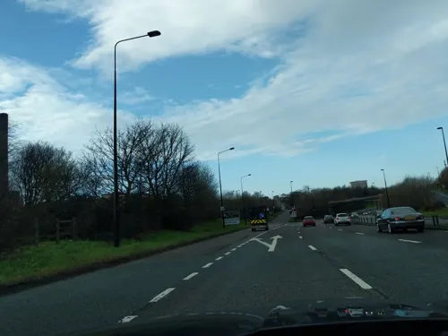
Castle Leazes
Park · 2.8 mi
Park in Newcastle upon Tyne, United Kingdom


Town Moor
Park · 3.3 mi
Grass pasture in Newcastle upon Tyne, United Kingdom



16 more on the map.
Restaurants and cafes186
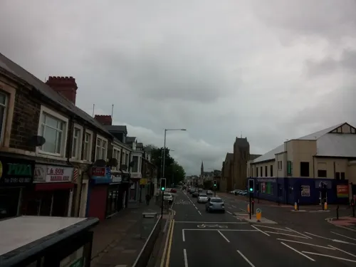


Savour Bakery, Cafe & Patisserie
Cafe · Bakery · 1.4 mi
205-207 Coatsworth Road, Gateshead
Mo-Th 08:00-20:30; Fr 08:00-17:00; Su 08:00-17:00; Sa off


Di Meo's Riverside Cafe, Gelateria and Pizzeria
Ice cream · 1.5 mi
1 Riverside Walk, Newcastle upon Tyne
Mo-Su 10:00-19:00
Full Circle Brew
Bar and pub · 1.2 mi
167 Walker Road, Newcastle upon Tyne
Th 16:00-22:00; Fr-Sa 12:00-23:00; Su 12:00-20:00

Tyne Bank Brewery
Brewery and winery · 1.1 mi
375 Walker Road, Newcastle upon Tyne
Mo-Tu off; We 12:00-23:00; Th-Sa 12:00-00:00; Su 12:00-23:00

The Fog on the Tyne
Bar and pub · 0.8 mi
South Shore Road, Gateshead
Mo-Sa 12:00-23:00; Su 12:00-22:30
174 more on the map.
History
The name of Felling is recorded as early as 1217 and, in 1920, was said to refer to a clearing where woods and trees were felled. Since there are no other places in Britain which bear this name, despite country-wide tree felling, it is much more likely to be because it lies on the eastern descent of a Fell, which rises from Team Valley in the west to Low Fell, then still rising to High Fell, before descending down to the Tyne through Felling. Ing is a place name ending which means "the people of". In the 13th century, the Prior of Durham enfeoffed Sir Walter de Selby a manor at Felling "to hold by homage, fealty, knights' service, two marks rent, and suit at the prior's every fortnight". The estate then passed to Walter's son, Adam, whose own son forfeited the estate the manor upon his death, whereupon it was passed to Ralph de Applingden. In 1331, the manor was granted to Sir Thomas Surtees by Bishop Lewis Beaumont, who passed it to his son Alexander and whose own son, Thomas, inherited the estate in 1400 when he was only 20 weeks old. Thomas lived only 35 years, but is notable for having been High Sheriff of Northumberland in 1422. The estate continued to pass through the Surtees family until 1509, when the last surviving member of that family died.
Read more of the history
There followed a period of extensive litigation as the future of the considerable Surtees estate, which also included Low Dinsdale Manor near Darlington, was contested between the families Brandling, a staunchly Royalist and Catholic family, Blaxton and Wyclyffe. While several elements of the estate where divided by share, in 1509 the entire manor of Felling was granted by Deed of Partition to Robert Brandling and his heirs "for life and to the total extinction" of any other claims.
Brandling duly lived at Felling with his wife Anne. He became sheriff of Newcastle-upon-Tyne in 1524, was mayor of Newcastle five times and was knighted by the Duke of Somerset at Mussleburgh. When he died in 1568, the estate passed to his brother Thomas. In 1605, Thomas' grandson, Robert Brandling, inherited the manor. Robert Brandling was granted Newminster Abbey by King James in 1610, served as High Sheriff of Northumberland in 1617 and was in 1621 elected Member of Parliament for Morpeth. When he died in 1636, the estate passed to his son, Sir Francis Brandling. Francis was also an MP, albeit for Northumberland, between 1624 and 1625 though he abandoned Felling in favour of residence at Alnwick Abbey. He died in 1641 and was succeeded by Charles Brandling, a cavalry colonel who also resided at both Felling and Alnwick. Charles had two brothers. The older of which, Ralph, was killed at the Battle of Marston Moor, while the second brother, Robert, also participated in the English Civil War and was captured in an otherwise successful Royalist engagement at Corbridge in February 1644 after which he switched sides and fought for the Roundheads; an action which earned him the reputation as "a very knave" which he carried until his death in 1669.
By the turn of the 18th century, Felling consisted of little more than the large Brandling estate and a small scattering of tiny farming villages. However, Ralph Brandling, the incumbent of the Brandling estate at that time, had come to realise the value of the rich coal deposits on his estate and began drift mining around 1670. He initially found the large coal seams under his estate difficult to extract due to their depth, and indeed it was imported coal from Newcastle-upon-Tyne which saw the development of more extensive industries in salt, glass and chemicals which began to attract workers to the area. At around 1750, a large copper-works was opened at the banks of the River Tyne; the first such works to be developed on the river. Encouraged by these developments, Ralph Brandling's son, Charles Brandling, firstly commissioned more extensive mining of near-surface coal on his estate and then, encouraged by the discovery of several strata below his estate, began boring operations in 1758 to allow ultimately for deeper coal extraction. The result was the opening of Felling Colliery in 1779, working on the High Main stratum at a depth of 125 fathoms. A brown paper mill was also opened in 1798.
On 19 January 1811, the original High Main seam at Felling Colliery was closed, but by that time the colliery had grown enormously. The colliery was deepened to reach the Low Main seam. Two shafts were provided: John Pit and William Pit. The Low Main began operation in October 1810. Disaster struck Felling Colliery on 25 May 1812 when, despite the colliery containing the most up-to-date safety measures, firedamp ignited and at around 11.30 am, "one of the most tremendous explosions in the history of coal mining took place". Two explosions rocked the colliery, the blast appearing in both pits. A cloud of coal dust and debris over a radius of a mile and a half was ejected from the colliery. One account recalled:
Immense quantities of dust and coal rose high into the air in an inverted cone...In the village of Heworth, this cloud caused a darkness like that of early twilight and covered the roads so thickly that the footsteps of passengers were deeply imprinted in it. As soon as the explosion was heard, wives and children of the workmen ran to the pit. Wildness and terror were pictured in every countenance. The crowd soon collected to several hundreds, some crying out for a husband, others for a parent or a son, and all affected by a mixture of horror, anxiety and grief.
Following the first blast at 11:30, rescue attempts started at 12:15. At 14:00 the second blast occurred and no further rescues occurred. Some 29 men were saved, but the remaining 92 men and boys were killed. Two days later the decision was made to seal the colliery to starve the fire of oxygen. Just one year later, on 24 December 1813, a further catastrophe occurred:
From the History section of Felling, Tyne and Wear on Wikipedia, under CC BY-SA 4.0.
More about Felling
Geography
Felling, at latitude 54.950° N and longitude 1.564° W, lies less than 1 mile (1.6 km) south and east of Gateshead town centre on a bed of carboniferous sandstone and clay, interspersed with coal measures laid down around 300 million years. It is split bilaterally by the Felling By-Pass to the north and by Sunderland Road more centrally. The distance from Felling to London is 255 miles (410 km).
The urban expansion of Gateshead makes exact overall boundaries difficult to define. Although administratively considered one area, official documentation has split Felling into three distinct neighbourhoods: North, Central and High Felling. Felling North is roughly comparable to the old settlement at Felling Shore, bounded to the north by the River Tyne and the south by Sunderland Road. The other neighbourhoods also broadly follow their historical boundaries; the central area includes Felling town centre and the surrounding streets, while High Felling incorporates Coldwell Lane and the adjoining streets moving south towards Windy Nook.
Felling lies on land which is steep at the riverbank but which initially flattens at the north then begins to climb, with some slope south to north centrally before consistently sloping, at times steeply, in High Felling. At the south-west corner, the land reaches a maximum height of around 130 metres (430 ft) above sea-level.
Economy
There are two principal economic areas in Felling. The first of these is at Felling Shore, where the East Gateshead Riverside Park was built in 1966 and which, combined with the Felling Shore industrial estate, today houses 241 businesses employing around 6,400 people. The second is in central Felling in the town centre area around Victoria Square. The town centre has seen massive investment since 2006, with the complete redevelopment of the main shopping centre and addition of a new Asda superstore and other retailers. Other amenities include a Post Office, several bookmakers, as well as four public houses and several fast food outlets.
The Felling Health Care Centre is the main source of General Healthcare for the town's population, and houses St Alban's medical group and Crowhall Medical Group.
Levels of unemployment in Felling are high. Only 52.4% of the total working age population are in employment, as compared to 61.7% in the borough overall. Around 10% of residents claim Jobseeker's Allowance; this is double the Gateshead average and is the highest figure in the borough. Youth unemployment levels are also very high at 14%, which compares to a borough average of 9% and is also the highest figure in Gateshead. The average income of residents is only £18,000 per annum; this compares to a Gateshead average of £27,000 and is the lowest figure in the borough.
Arts and culture
In 1963, Felling was twinned with Saint-Étienne-du-Rouvray, France. When it was absorbed into Gateshead in 1974, the twinning arrangement was transferred to Gateshead.
A number of listed buildings are located in and around the town centre. Arguably the most significant is Crow Hall, a Grade II* listed building, is an early 18th-century sandstone and ashlar, one-room deep building at Crowhall Lane. The adjacent Crow Hall Cottage and gate piers are Grade II listed buildings. At Victoria Terrace stands Felling post office; a two-story course sandstone building with quoins and a Welsh slate roof. Close by is the Imperial Bingo Club, built as a dance hall in 1927 and converted to a bingo hall in 1930, at Victoria Square. Both are Grade II listed buildings.
Also a Grade II listed building is Ardallan; the first house built at Holly-Hill field in Felling constructed of sandstone and with three sash windows.
The gates, gate piers and walls are also Grade II listed. Almost immediately next door stands a house and shop at 35 Davison Street; another Grade II listed building.
Education
Felling is served by a number of primary schools. Colegate Community primary school, at Colegate West, is a satisfactory school with well behaved pupils who make satisfactory progress. Falla Park Community primary school on Falla Park Road is an average sized school where the number of pupils entitled to free school meals is well above the national average. This is a good school where pupils perform consistently well at key stage two. Also a good school is The Drive Community primary school; a smaller than average school which achieves good results despite being located in an area of "considerable social disadvantage". To the north, at Mulberry Street, lies Brandling primary school; another good, smaller than average-sized school. Bede Community primary school, at Old Fold Road, is in an area with a "high incidence of social and economic deprivation" with a very high proportion of children entitled to free school meals and with learning difficulties. Here children do not achieve as well in examinations but instead enjoy a high level of personal development and so, according to the latest OFSTED report, this too is a good school.
From the Wikipedia article Felling, Tyne and Wear, under CC BY-SA 4.0.
Notable people from Felling
 Chris WaddleEnglish footballer (born 1960)Photo: Shane Rounce, CC BY-SA 2.0
 Peter WilsonEnglish-Australian association football player (defender) and association football coach (born 1947)Photo: Australian Information Service, Public domain
 William GreenerBritish gun maker (1806–1869)Photo: Lazyman9191, CC BY-SA 4.0
 Les McDonaldCanadian triathlete (1933-2017)Photo: Sirnoodleton, CC BY-SA 4.0
 Edwin ClarkeBritish medical historian and neurologist (1919–1996)Photo: Unknown author, CC BY 4.0
- Jimmy AndersonEnglish footballer (1913-1993)
- Albert Watsonfootball player (born 1903)
- Jimmy LodgeEnglish association football player (1895-1971)
- Joseph JohnsonEnglish footballer
- Gavin OliverBritish footballer (born 1962)
- Daniel CassidyEnglish footballer (1907-1995)
- Thompson KirkhamEnglish footballer (1901-1986)
Born in Felling, according to Wikidata (CC0). Each name links to its Wikipedia article.
Where to stay5
Churches and places of worship59
St James & St Bede Church
Church · Anglican · 0.9 mi
Wordsworth Street, Gateshead
Our Lady and St Wilfrid's Catholic Church
Church · Roman Catholic · 0.4 mi
Sunderland Road, Gateshead
Shopping34
Gas and EV charging4
Schools, colleges and libraries54
Central Walker Church of England Primary School
School · Anglican · 1.2 mi
Lancefield Avenue, Newcastle upon Tyne
St Lawrence's Catholic Primary School
School · Roman Catholic · 1.5 mi
Headlam Street, Newcastle upon Tyne
St Vincents Catholic Primary School
School · Roman Catholic · 1.0 mi
Monkchester Road, Newcastle upon Tyne
Healthcare15
Fewster Square Pharmacy
Clinic and pharmacy · 1.4 mi
11 Fewster Square, Gateshead
Map of Felling
250 places. The map loads OpenStreetMap tiles when you open it.
Getting there and nearby towns
Newcastle International Airport (NCL) is the nearest airport with scheduled flights listed in OpenStreetMap, 7 miles away.
- Gateshead 1 mi northwest, about 2 min by car
- Newcastle upon Tyne 2 mi northwest, about 4 min by car
- Hebburn 3 mi northeast, about 4 min by car
- Wallsend 3 mi northeast, about 5 min by car
- Gosforth 4 mi northwest, about 6 min by car
- Jarrow 4 mi northeast, about 6 min by car
- Washington 4 mi southeast, about 7 min by car
- Whickham 4 mi west, about 7 min by car
- The Boldons 5 mi east, about 8 min by car
- Blaydon-on-Tyne 6 mi west, about 9 min by car
Drive times are estimates from straight-line distance, not routes.
Towns near Felling


Keep exploring
Local news
Headlines from INDB.
Reviews, tips and questions
Loading what members have shared...
Sources and licences
- GeoNames (CC BY 4.0): population, coordinates, regions and time zone
- Mapillary (see each image): photos
- OpenStreetMap contributors (ODbL 1.0): places, airports, map data
- Wikidata (CC0 1.0): elevation, founding date, time zone, website, landmarks and historic places
- Wikimedia Commons (see each image): photos
- Wikipedia (CC BY-SA 4.0): overview and history text
Photo credits
- Felling Metro station, 16 July 2010 (2), Andrew Curtis, CC BY-SA 2.0
- Felling Metro station, 16 July 2010 (1), Andrew Curtis, CC BY-SA 2.0
- Felling Metro station, 31 March 2012, JThomas, CC BY-SA 2.0
- Bambuco Bridge 1, Mankind 2k, CC BY-SA 3.0
- Gateshead millennium bridge open, Mike1024, Public domain
- EWS 67001 + Northern 156453 King Edward VII Bridge, Thryduulf, CC BY-SA 4.0
- Live Theatre Newcastle - 2010, John-Paul Stephenson, CC BY-SA 3.0
- Northern Stage, Newcastle University, 5 September 2013 (1), Ultra7, Public domain
- Peoples Theatre, Heaton, Newcastle, John-Paul Stephenson, CC BY-SA 3.0
- QEII Metro Bridge from Forth Banks 1, Chris McKenna ( Thryduulf ( talk )), CC BY-SA 4.0
- Redheugh Bridge, River Tyne, John-Paul Stephenson, Public domain
- Shipley Art Gallery2, Dposte46, Public domain
- Newcastle upon Tyne - Bessie Surtees House and Milbank House, Benjamin Smith, CC BY-SA 4.0
- Centre for Life, Simon Cobb, CC0
- Discovery Museum Newcastle Tyne 1, Chabe01, CC BY-SA 4.0
- The Hancock Museum Newcastle September 2009, TubularWorld, CC BY-SA 3.0
- Newcastle upon Tyne - Grey's Monument, Benjamin Smith, CC BY-SA 4.0
- Exhibition Park mow, Victuallers, CC BY-SA 4.0
- Leazes Park, Peter Scott, CC BY-SA 4.0
- Vaches Parc Town Moor Newcastle Tyne 20, Chabe01, CC BY-SA 4.0
- Église St Edmund Gateshead 1, Chabe01, CC BY-SA 4.0
- St Dominic's Church, Newcastle, Andrew Curtis, CC BY-SA 2.0
- St Thomas Haymarket Newcastle, Chemical Engineer, CC BY-SA 3.0
- Jesmond Parish Church, Newcastle upon Tyne, AlixChaytor, CC BY-SA 4.0
- Newcastle upon Tyne (2022-03-28) 030, Simon Cobb, CC0
- Baltic centre for contemporary art, 06benste, CC BY-SA 3.0
- Fineartbuildingnewcastle, Xtrememachineuk at English Wikipedia, CC BY 3.0
- Balmbras advert, Peter Jefferies, CC BY-SA 3.0
- Baltic Centre for Contemporary Art, 5 January 2012 (1), Neil Turner from Sowerby Bridge, United Kingdom, CC BY-SA 2.0
- Gateshead International Stadium, John Lord, CC BY 4.0
- Street-level photo, livingwithdragons, CC BY-SA 4.0
- Street-level photo, floatingboater, CC BY-SA 4.0
- Street-level photo, floatingboater, CC BY-SA 4.0
- Street-level photo, livingwithdragons, CC BY-SA 4.0


Page built November 10, 2026. Spotted a mistake? Tell us or suggest a place.