


Why visit Fleet
Townapedia lists 13 museums and landmarks, 25 parks and trails, 77 places to eat, 6 places to stay and 8 attractions in and around town.
Highlights include Inglis Pipe Bridge, equestrian statue of the Duke of Wellington, Caesar's Camp and Elvetham Heath Local Nature Reserve and Open Spaces.
Weather in Fleet
Forecast from MET Norway (CC BY 4.0). Full forecast
About Fleet
Fleet is a town and civil parish in the Hart District of Hampshire, England, centred 38 miles (61 km) south-west of London and 13 miles (21 km) east of Basingstoke, near the towns of Farnborough, Aldershot and Farnham. The town is sometimes referred to as Fleet and Crookham, as the urban development is continuous and inseparable between Fleet, Church Crookham and Crookham Village, while the civil parish of Fleet Town Council manages Fleet town centre and its surrounding areas.
From the Wikipedia article Fleet, Hampshire (this version), under CC BY-SA 4.0.
Travel tips from other travellers: Fleet on Wikivoyage (CC BY-SA 4.0).
Things to do8


Museums and landmarks13

equestrian statue of the Duke of Wellington
Monument and historic site · 3.1 mi
Statue in Aldershot, Hampshire, England, UK

Caesar's Camp
Monument and historic site · 3.0 mi
Iron Age hill fort on the Surrey/Hampshire border, England
National Gas Turbine Establishment
Monument and historic site · 1.2 mi
Historic site of Pyestock Industrial Area, now demolished.
1 more on the map.
Parks, trails and playgrounds25
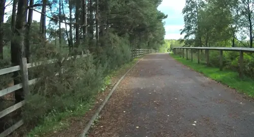
Elvetham Heath Local Nature Reserve and Open Spaces
Park · 1.0 mi
Local Nature Reserve in Elvetham Heath, Hampshire

Ancells Farm Nature Reserve
Hiking and trails · 1.1 mi
UK nature reserve
Ancells Road
24/7


13 more on the map.
Restaurants and cafes77
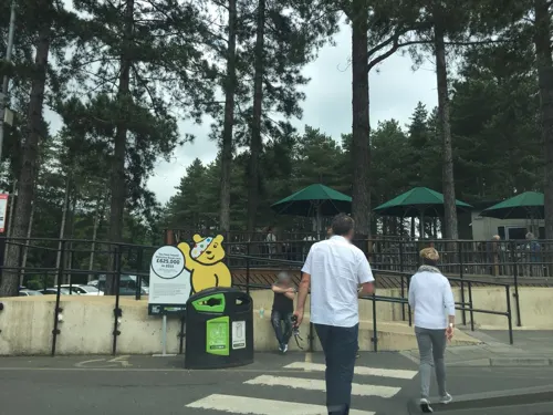

The Station
Restaurant · Burger, Chicken, Coffee Shop, Fish And Chips, Grill, Pasta · 0.5 mi
1-3 Fleet Road, Fleet
Mo-Su 11:00-11:00

De Havilland Arms
Bar and pub · 1.2 mi
The Key, Fleet
Mo-Th 11:00-22:00; Fr-Sa 11:00-24:00; Su 11:30-22:00

The Falkners Arms
Bar and pub · 0.9 mi
Falkners Close, Fleet
Mo-Tu 12:00-22:30; We-Th 12:00-23:00; Fr 12:00-24:30; Sa...
65 more on the map.
History
The Fleet area has yielded few archaeological finds. Some have speculated that the Fleet Pond was built by the Romans, and later Saxons named it Fuglemere, meaning "wildfowl lake".
Isaac Taylor's Map of Hampshire (1759) shows three small habitations in the area, namely Crookham Common, that was later to become Fleet.
The site of Fleet was originally heathland in the northern part of the Crondall Hundred. It either refers to Fleet Pond or a stream flowing north of the pond. The fish in the pond had been taken for the monks in Winchester in Medieval times.
According to Taylor's Map of 1759, the area now occupied by the town of Fleet was once uninhabited land known as Crookham Common, situated between the village of Crookham and Fleet Pond. Two streams ran into the pond and several road ran cross the surrounding wilderness. A range of hills separated the common from Aldershot Common in the east. At this time, Fleet Pond was divided into a large and a small pond by a road, long before the construction of the railway. To the north of the smaller pond stood Fleet Mill, and beyond that lay another range of hills, situated to the south of Yateley Heath.
Read more of the history
In 1792, the Basingstoke Canal opened. The canal passed through the town site, but apart from a few inns to serve the passing trade, it had little effect on the locality. Apart from the Farnham to Reading road, the site remained largely undeveloped until the construction of the London and South Western Railway, which opened in 1840. In that year, a church - Christ Church, which was to become the heart of the new ecclesiastical parish of Crookham-cum-Ewshot was built midway between the villages of Crookham and Ewshot. This parish included the area that was later to become the separate town of Fleet. The railway company promoted Fleet Pond for a destination for day excursions, and many people came down from London to skate on the Pond during the Winter. This attracted a number of gentry, particularly retired army officers, who moved to the area bounded by Fleet Road, Elvetham Road and Reading Road North, and laid the foundations of what was to become known locally as "The Blue Triangle".
By 1860, Charles Lefroy, a local squire, commissioned All Saints' Church – in the Blue Triangle area, in memory of his wife who had died in 1857. The architect was William Burges. The ecclesiastical parish of Crookham-cum-Ewshot was split into two in 1862, with the northern section based on All Saints' church becoming the new parish of Fleet. On 22 June 2015, the roof of All Saints' church was destroyed by fire following an arson attack. The church was returned to a condition where it could hold services by 30 April 2023 when it was reconsecrated.
The development of Fleet accelerated when the land to the south east of the Blue Triangle was sold for development in 1882. Development on this land was laid out in a grid pattern.
Under the Local Government Act 1894, many of the duties that had previously been shouldered by the ecclesiastical parishes were transferred to new civil parishes, and Crookham, Fleet and Crondall each gained an elected parish council. In 1904, Fleet became an urban district, just ten years after becoming an independent parish. In 1925, and again in 1932, it expanded by taking parts of Elvetham, as a result of the Local Government Act 1929, which saw smaller urban districts merge with their surrounding rural districts, with the result that new districts emerged covering rural as well as urban parishes. As a consequence, the Fleet Urban District in 1932 expanded south of the canal and took 45% of the Crookham acreage and 61% of the population, with the rump of the parish of Crookham being returned to Crondall parish. In addition, a small area of Minley with Hawley, that consequently became the modern development of Ancells Farm, was also transferred to the expanded Fleet Urban District.
Fleet expanded over the decades, with new residential areas being built at Ancells Farm, Zebon Copse (Church Crookham, Crookham Village and Dogmersfield are included in the built-up area, as per the Government Statistical Service) and Elvetham Heath. Completed in 2008, Elvetham Heath was one of the UK's largest new housing developments at the time, and added some 3,500 inhabitants to Fleet's population, bringing its total population up to around 35,000. This represented a 20% population increase in less than a decade.
Earlier in the 1990s, two developments in Fleet involved a double opening on 10 May 1991; the Hart Shopping Centre, which was opened officially by the Duchess of York, and the old Hart Leisure Centre on Hitches Lane. The old Hart Leisure Centre was replaced by a new one on the other side of the road in 2019.
Fleet had been a dormitory town for commuters to London. It now has several business parks, mainly occupied by Information Technology companies.
From the History section of Fleet, Hampshire on Wikipedia, under CC BY-SA 4.0.
More about Fleet
Geography
Fleet is located in Hart District, in the northeast of Hampshire, South East England, at coordinate 51°17′00″N 0°50′44″W to be exact. To the northwest is Hartley Wintney, while to the northeast lie Blackwater and Hawley. To the east, it borders Rushmoor, namely Farnborough and Aldershot. To the south, it is adjacent to Ewshot and Crondall, also Waverley of Farnham, Surrey. To the west, it is bordered by Dogmersfield and Winchfield.
The boundaries of Fleet town encompass both the built-up area and its surrounding regions. Roughly speaking, the M3 motorway marks the northern boundary. From Junction 4A in the northeast, the boundary follows the A327 road, Kennel's Lane, Old Ively Road (now part of Cody Technology Park), and the Basingstoke Canal, forming part of the eastern boundary. It then continues southwards through Tweseldown, Beacon Hill and Caesar's Camp in military training area. The southern boundary lies in Ewshot and meets the River Hart, which then forms the western boundary of Fleet.
Arts and culture
The Harlington, also known as (The) Harlington Centre or Fleet Civic Centre, situated between Fleet Road and Harlington Way, is the two-storey civic centre in the town centre. Next to Fleet Library, the centre serves as a venue for arts and entertainment, as well as community functions. It consists of an auditorium, a dance studio, a function room and a bar.
Education
Schools in Fleet are generally under the administration of Hampshire County Council. Education in Fleet Town consists of infant schools, junior schools and secondary schools, but there is no sixth form provision locally. The nearest sixth form provider is The Sixth Form College Farnborough. Students pursuing further education must attend schools outside the town. In addition, there are numerous pre-school education establishments in the form of pre-schools or nurseries.
The following list of schools is categorised and arranged alphabetically.
An infant school is a school that includes Reception year (Year R) and Years 1 and 2, catering for children aged four to seven years old. Year R follows the Early Years Foundation Stage (EYFS), while Years 1 and 2 fall under Key Stage 1 of the National Curriculum.
Crookham Church of England Aided Infant School, commonly referred to as Crookham CE Aided Infant School, is a voluntary aided primary school, registered as number 2229 with the Department for Education.
Located on Gally Hill Road, at the junction with Ferndale Road in Church Crookham, it is a Church of England aided school under Diocese of Guildford and is affiliated with the nearby Christ Church Crookham. It is situated next to Church Crookham War Memorial, directly opposite across Gally Hill Road.
From the Wikipedia article Fleet, Hampshire, under CC BY-SA 4.0.
Notable people from Fleet
 Corinne YorstonEnglish footballer (born 1983)Photo: Zider red, CC BY 3.0
 Cecil BouchierRoyal Air Force air marshalPhoto: Unknown author Unknown author, Public domain
 Jayda PechovaEnglish professional netball player (born 2004)Photo: Soodge, CC0
- Raquel CassidyBritish actress
- Juliet Aubreyactress
- John FeaverBritish tennis player
- Gordon CoppuckBritish racing car designer
- Christian JolleyBritish footballer
- John RussellBritish American art critic (1919-2008)
- Alex HaddowEnglish footballer (born 1982)
- Jeremy MetcalfeBritish racing driver
- Charlie Clark(1917-1943)
Born in Fleet, according to Wikidata (CC0). Each name links to its Wikipedia article.
Where to stay6
Churches and places of worship13
Shopping18
Gas and EV charging9
Schools, colleges and libraries13
Healthcare6
Map of Fleet
188 places. The map loads OpenStreetMap tiles when you open it.
Getting there and nearby towns
Farnborough Airport (FAB) is the nearest airport with scheduled flights listed in OpenStreetMap, 2 miles away.
- Yateley 4 mi north, about 7 min by car
- Frimley 4 mi northeast, about 7 min by car
- Sandhurst 5 mi northeast, about 8 min by car
- Camberley 5 mi northeast, about 9 min by car
- Crowthorne 6 mi north, about 10 min by car
- Wokingham 9 mi north, about 14 min by car
- Basingstoke 11 mi west, about 18 min by car
- Lower Earley 11 mi north, about 17 min by car
- Guildford 12 mi east, about 19 min by car
- Woking 12 mi east, about 19 min by car
Drive times are estimates from straight-line distance, not routes.
Towns near Fleet


Keep exploring
Local news
Headlines from INDB.
Reviews, tips and questions
Loading what members have shared...
Sources and licences
- GeoNames (CC BY 4.0): population, coordinates, regions and time zone
- Mapillary (see each image): photos
- OpenStreetMap contributors (ODbL 1.0): places, airports, map data
- Wikidata (CC0 1.0): elevation, founding date, time zone, website, landmarks and historic places
- Wikimedia Commons (see each image): photos
- Wikipedia (CC BY-SA 4.0): overview and history text
Photo credits
- Fleet, Hampshire - England (UK) (12148562703), Mic from Reading - Berkshire, United Kingdom, CC BY 2.0
- Inglis Bridge Aldershot 2020, Jack1956, CC BY-SA 4.0
- Wellingtonstatue, The original uploader was Wyrdlight at English Wikipedia ., CC BY-SA 3.0
- Allsaintsalder-wyrd-29O6-0121, http://www.wyrdlight.com Author: Antony McCallum, CC BY-SA 3.0
- Street-level photo, essexboy, CC BY-SA 4.0
- Street-level photo, laye, CC BY-SA 4.0
- Street-level photo, jpennycook, CC BY-SA 4.0
- Street-level photo, jpennycook, CC BY-SA 4.0
- Street-level photo, jpennycook, CC BY-SA 4.0
- Street-level photo, jpennycook, CC BY-SA 4.0
- Street-level photo, laye, CC BY-SA 4.0
- Street-level photo, laye, CC BY-SA 4.0
- Street-level photo, jpennycook, CC BY-SA 4.0
- Street-level photo, essexboy, CC BY-SA 4.0
- Street-level photo, adam2, CC BY-SA 4.0
- Street-level photo, jpennycook, CC BY-SA 4.0
- Street-level photo, laye, CC BY-SA 4.0
Page built November 10, 2026. Spotted a mistake? Tell us or suggest a place.