


Guildford, United Kingdom
Guildford is a town of 71,873 people in England, United Kingdom.
Why visit Guildford
Townapedia lists 33 museums and landmarks, 44 parks and trails, 198 places to eat, 12 places to stay and 13 attractions in and around town.
Highlights include Electric Theatre, Yvonne Arnaud Theatre, Guildford House Gallery and Guildford Museum.
Weather in Guildford
Forecast from MET Norway (CC BY 4.0). Full forecast
About Guildford
Guildford is a town in west Surrey, England, around 27 mi (43 km) southwest of central London. As of the 2011 census, the town had a population of about 77,000; it is the seat of the wider Borough of Guildford, which had around 152,148 inhabitants in 2025. Its name is thought to derive from a crossing of the River Wey, a tributary of the River Thames, that flows through the town centre.
From the Wikipedia article Guildford (this version), under CC BY-SA 4.0.
Travel tips from other travellers: Guildford on Wikivoyage (CC BY-SA 4.0).
Photos of Guildford


Things to do13

Electric Theatre
Cinema and theater
Theatre in Guildford, England
Onslow Street, Guildford

Yvonne Arnaud Theatre
Cinema and theater
Theatre in Guildford, England
Millbrook, Guildford




1 more on the map.
Museums and landmarks33

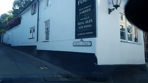
Guildford Museum
Museum
Local museum in Guildford, England, United Kingdom
Quarry Street, Guildford
Mo-Sa 11:00-17:00


Clandon Park
Museum · 3.0 mi
Country house and museum in Surrey, England, UK


Lewis Elton Gallery
Museum · 0.9 mi
Art gallery at the University of Surrey's Guildford campus

Loseley Park
Museum · 1.9 mi
Grade I listed historic house museum in Artington, United Kingdom


21 more on the map.
Parks, trails and playgrounds44


St Martha's Hill and Colyer's Hanger
Park · 2.1 mi
Nature reserve in Surrey, England, UK


Littlefield Common
Park · 3.0 mi
Nature reserve south-west of Worplesdon in Surrey, England
32 more on the map.
Restaurants and cafes198

The Three Pigeons
Bar and pub
169 High Street, Guildford
Mo-Th 11:00-23:00; Fr,Sa 11:00-24:00; Su 11:00-22:30
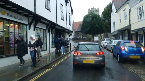
Starbucks
Cafe · Coffee Shop
13-14 White Lion Walk, Guildford
Mo-Fr 06:30-18:30; Sa 07:00-18:00; Su 09:30-17:00
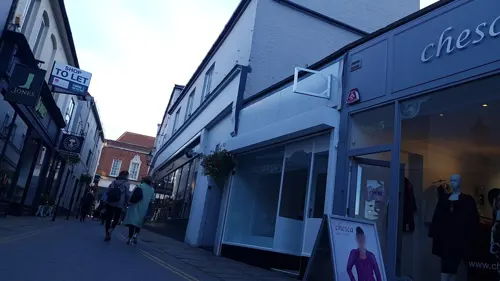
De Nada
Restaurant · Spanish, Tapas
12A Market Street, Guildford
Mo 17:00-22:00; Tu-Th 12:00-15:00,17:00-23:00; Fr...
Franco Manca
Restaurant · Pizza
24 Friary Street, Guildford
Mo-Th 11:30-22:00; Fr-Sa 11:30-23:00; Su 11:30-22:00


Caffè Nero
Cafe · Coffee Shop
69 High Street, Guildford
Mo-Fr 07:00-18:30; Sa 07:30-19:00; Su 08:30-18:30
Unplug + Play
Cafe · Cake, Coffee Shop, Tea
17 Jeffries Passage, Guildford
Tu-Fr 12:00-23:00; Sa 10:00-23:00; Su 10:00-22:00
186 more on the map.
History
The earliest evidence of human activity in the Guildford area is from St Catherine's Hill, where Mesolithic flint tools have been found. There may also have been Bronze Age and Iron Age settlements on the hill. The areas now occupied by Christ's College and Manor Farm were farmed in the Bronze Age, Iron Age and Roman period. Traces of a 2nd-century villa were discovered at Broadstreet Common during an excavation in 1998.
There is thought to have been an Anglo-Saxon settlement in the Guildford area by the early 6th century, although its precise location is unclear. Excavations in the 1930s revealed a Saxon cemetery at Guildown at the east end of the Hog's Back. Burials took place at the site up to the mid-11th century, but the oldest skeletons were buried in the late 6th century.
The first written record of Guildford is from the will of Alfred the Great, dated to around 880, in which the settlement was left to his nephew, Aethelwold. Although it does not appear in the Burghal Hidage, compiled c. 914, by the end of the 10th century the town was sufficiently important to be the location of a Royal Mint. Coins were struck at Guildford from 978 until at least 1099.
Read more of the history
Around 220 of the skeletons excavated at Guildown are thought to be the remains of soldiers massacred during the arrest of Alfred Aetheling in 1035 or 1036. Contemporary accounts are somewhat contradictory, but the modern consensus is that Aetheling, a pretender to the throne and the brother of Edward the Confessor, was travelling through Guildford with a large bodyguard when the incident occurred. Aetheling was arrested by Godwin, Earl of Wessex and his men were killed. Many of the skeletons showed evidence of a violent death and the skulls of two were between their legs, suggesting that they had been executed by decapitation. Aetheling was taken to Ely, where he was blinded, and he is thought to have died there in February 1036.
The oldest extant building in Guildford is St Mary's Church, the tower of which was built c. 1040. Its location, on Quarry Street, may indicate that, at the time of its construction, the High Street had either not been laid out or was not the principal road. There is no significant archaeological evidence of human activity in the modern town centre before the 11th century and it is possible that, for the majority of the Saxon period, Stoke next Guildford, to the north, was the primary area of settlement.
In Domesday Book of 1086, Guildford appears as Gildeford and is divided into seven parts, all of which were the property of William I. Two of the areas were held by reeves and four were held by lesser tenants, one of whom was Ranulf Flambard. The land directly controlled by the king included 175 homagers (heads of household), who lived in 75 hagae. Flambard's holding included three hagae that accommodated six homagers and, in total, the town provided an annual income of £30 for the king. William I is also listed as holding Stoke-by-Guildford, which had a population of 24 villagers, ten smallholders and five slaves. The manor had sufficient land for 22 plough teams, 16 acres of meadow, woodland for 40 swine and two mills.
Guildford remained a property of the Crown throughout the Middle Ages and several kings, including Henry II and John are known to have visited regularly. Henry III granted the town its first borough charter in January 1257, which permitted it to send two representatives to parliament. In August of the same year, he designated Guildford as the location of the Surrey County Court and Assizes. In 1366, Edward III issued a fee farm grant, enabling the town to become partially self-governing in exchange for a yearly rent of £10. Henry VII was responsible for granting Guildford its coat of arms in 1485 and, three years later, he awarded the charter of incorporation, which placed the administration of the borough in the hands of a mayor and burgesses, appointed from the merchants' guild.
The modern system of local government began to emerge in the 1830s. Under the Municipal Corporations Act 1835, a democratically elected council replaced the mayor and burgesses, and the borough expanded beyond the medieval town boundaries. A year later, the Guildford Poor Law Union was formed, with responsibility for a total area of 12 sq mi (31 km2) stretching from Godalming to Woking. As a result of the Local Government Act 1888, several responsibilities were transferred from the borough to the newly formed Surrey County Council. The borough boundaries were extended again in both 1904 and 1933. The final enlargement took place in March 1974, when the present local authority was created from the merger of the borough with the Guildford Rural District.
Guildford Castle is to the south of the modern town centre. Although it is not explicitly mentioned in Domesday Book, it is possible that it was included in one of the areas of land held by Ranulf Flambard. The date of its original construction is uncertain, but the consensus among historians is that it was built as a motte-and-bailey castle soon after the Norman Conquest. A polygonal stone shell keep was built in chalk and flint rubblestone around the top of the motte in the early 12th Century, the remains of which are still visible.
From the History section of Guildford on Wikipedia, under CC BY-SA 4.0.
More about Guildford
Geography
Charlotteville is one of the first planned suburbs in Britain. The estate was funded by a local doctor, Thomas Sells, and named after his wife, Charlotte. It was developed by the Guildford architect Henry Peak in 1862 and is loosely bound between Shalford Road and Sydenham Road, encompassing the beauty spot of Pewley Down. The area's roads were named after English doctors, including Addison Road, Cheselden Road, Harvey Road and Jenner Road. Public footpaths lead from the town through Charlotteville to the downs and towards St Martha's Hill and Albury. It houses a great many cottages and a few large, mostly privately owned properties. The official designation of the heart of Charlotteville as a conservation area means that Peak's work may survive. The development introduced institutions such as the Cork Club, the Charlotteville Cycling Club, founded in 1903 with the then mayor as its first president, and the Charlotteville Jubilee Trust charity, formed at the time of the Golden Jubilee. Two schools were established in the village - one infant and one junior school. merging to form the Holy Trinity Pewley Down School in the late 2000s. The last of the shops closed in 2006.
Arts and culture
Guildford House Gallery, in the High Street, is run by Guildford Borough Council. Its art collection includes works of Guildford and the surrounding area, and works by Guildford artists, most notably John Russell.
In Sir Thomas Malory's 1470 version of the Arthurian romances, Le Morte d'Arthur, Guildford is identified with Astolat of Arthurian renown. Continuing the Arthurian connection, there is a local public house, the Astolat. Guildford has been associated with the 1863 novel Alice's Adventures in Wonderland because of its importance in the life of its author, Lewis Carroll. There are several reminders of this connection throughout the town. Guildford Museum has a collection of items belonging to Carroll, see above. In addition to this, sculptor Jean Argent created two full-size bronze sculptures of Alice passing through the Looking-Glass and Alice and the White Rabbit, which can be found in the Castle Grounds and by the River Wey at Millmead respectively. In The Hitchhiker's Guide to the Galaxy by Douglas Adams, the character Ford Prefect, actually an alien from Betelgeuse, claims to be an out-of-work actor from Guildford. Crime at Guildford (1935), a novel by Freeman Wills Crofts, is set in the town.
Guildford has been captured on film in Carry On Sergeant, which was filmed at the former Queens Barracks, and The Omen, a scene from which was filmed at Guildford Cathedral.
Education
As in the rest of Surrey, Guildford's state schools operate a two/three age group system. Primary schools in the town include Holy Trinity (which merged with Pewley Down in 1995), Burpham, St Thomas of Canterbury (Catholic), Sandfield Primary School, Boxgrove Primary School and Guildford Grove Primary School. Amongst the junior schools are Bushy Hill, Northmead Junior and Queen Eleanor's C of E. Secondary schools include George Abbot, Guildford County School, St Peter's, King's College and Christ's College.
The Royal Grammar School was established in 1509. The old school building, which was constructed over the turn of the Tudor and Elizabethan periods and houses a chained library, lies towards the top of High Street. In 1552, the school received the patronage of Edward VI. Nearby is the Royal Grammar preparatory school which is the choir school for Guildford Cathedral.
Other independent schools in the town include Guildford High School (founded 1876), Tormead School (founded 1905), Priors Field School and Rydes Hill Preparatory School.
The campus of the University of Surrey is in Guildford. Battersea College of Technology (previously the Battersea Polytechnic Institute) moved to the town in 1966, gaining a Royal Charter in order to award its own degrees and changing its name to its current title.
From the Wikipedia article Guildford, under CC BY-SA 4.0.
Notable people from Guildford
 Lily CollinsBritish-American actress (born 1989)Photo: Montclair Film, CC BY 2.0
 P. G. WodehouseEnglish author (1881–1975)Photo: Unlisted photographer for Screenland, Public domain
 Piers MorganBritish journalist and television host (born 1965)Photo: DavidPMaynard, CC BY-SA 4.0
 David HemmingsEnglish actor and director (1941–2003)Photo: Dario Argento (director), Luigi..., Public domain
 Mike RutherfordBritish guitarist and bassistPhoto: Raph_PH, CC BY 2.0
 Peter MolyneuxEnglish video game designer and game programmerPhoto: DanielAlexanderSmith, CC BY 2.5
 Celia ImrieBritish actressPhoto: JaceMerlyn, CC BY-SA 4.0
 George AbbotArchbishop of CanterburyPhoto: Unidentified painter, Public domain
 Andrew LatimerEnglish musicianPhoto: kitmasterbloke, CC BY 2.0
 Emily ThornberryBritish politician (born 1960)Photo: Laurie Noble, CC BY 3.0
 Katherine LeggeBritish racing driverPhoto: Nascar9919, CC BY 4.0
 Simon BirdBritish actor and comedianPhoto: Alison Martin, CC BY-SA 2.0
Born in Guildford, according to Wikidata (CC0). Each name links to its Wikipedia article.
Where to stay12
Churches and places of worship36
Shopping36
Gas and EV charging11
Schools, colleges and libraries39
Queen Eleanor's Church of England Junior School
School · Anglican · 0.9 mi
Queen Eleanor's Road, Guildford
St Thomas of Canterbury Catholic Primary School
School · Roman Catholic · 1.5 mi
Horseshoe Lane West, Guildford
Healthcare12
Map of Guildford
250 places. The map loads OpenStreetMap tiles when you open it.
Getting there and nearby towns
Farnborough Airport (FAB) is the nearest airport with scheduled flights listed in OpenStreetMap, 9 miles away.
- Godalming 4 mi southwest, about 6 min by car
- Woking 6 mi north, about 9 min by car
- Cranleigh 8 mi southeast, about 12 min by car
- Great Bookham 9 mi east, about 15 min by car
- Frimley 9 mi northwest, about 15 min by car
- Cobham 10 mi northeast, about 15 min by car
- Camberley 10 mi northwest, about 16 min by car
- Addlestone 10 mi north, about 16 min by car
- Dorking 10 mi east, about 17 min by car
- Weybridge 11 mi northeast, about 17 min by car
Drive times are estimates from straight-line distance, not routes.
Towns near Guildford


Keep exploring
Local news
Headlines from INDB.
Reviews, tips and questions
Loading what members have shared...
Sources and licences
- GeoNames (CC BY 4.0): population, coordinates, regions and time zone
- Mapillary (see each image): photos
- OpenStreetMap contributors (ODbL 1.0): places, airports, map data
- Wikidata (CC0 1.0): elevation, founding date, time zone, website, landmarks and historic places
- Wikimedia Commons (see each image): photos
- Wikipedia (CC BY-SA 4.0): overview and history text
Photo credits
- Guildford & Cathedral of Surrey, Himar Santana Hernández, Public domain
- 75-81 High Street, Guildford, Tim Sheerman-Chase, CC BY 2.0
- 83 High Street, Guildford, Tim Sheerman-Chase, CC BY 2.0
- Electric Theatre, Guildford, Weydonian ( talk ), CC BY 3.0
- Yvonne Arnaud Theatre View 2016, Jack1956, CC0
- Guildford castle 1, SuzanneKn at English Wikipedia, Public domain
- Clandon House, Murraypaul at English Wikipedia, Public domain
- Lewis Elton Gallery, Murgatroyd49, CC BY-SA 4.0
- Loseley Park 03, Andrew Wilkinson from London, CC BY-SA 2.0
- Surrey county show 20040531, SGBailey, CC BY-SA 3.0
- Farncombe Wood (2), Dudley Miles, CC BY-SA 4.0
- Riverside Park, Guildford, view of the lake, AndyScott, CC BY-SA 4.0
- St Martha Hill, Colin Smith, CC BY-SA 2.0
- Compton, Surrey. Church of St. Nicholas DSC 2785 edited-1, Ainslie, CC BY-SA 3.0
- Guildford Holy Trinity fr NE GeoUK 2639999, Paul Gillett, CC BY-SA 2.0
- Meadrow Unitarian Chapel, Meadrow, Godalming (April 2015) (3), Hassocks5489, CC0
- St Mary's Church, Quarry Street, Guildford (April 2014) (1), Hassocks5489, CC0
- Guildford Cathedral, Stag Hill, Guildford (Seen from Onslow Village) (May 2014) (1), Hassocks5489, CC0
- Abbot's Hospital, Guildford 1, Photograph by Mike Peel ( www.mikepeel.net )., CC BY-SA 4.0
- Dapdune wharf Guildford General view, HARTLEPOOLMARINA2014, CC BY-SA 4.0
- G Live, Murgatroyd49, CC BY-SA 4.0
- Guildhall, Guildford, Photograph by Mike Peel ( www.mikepeel.net )., CC BY-SA 4.0
- Lido1 edited 640, Fredley, CC BY-SA 3.0
- Interior Undercroft Guildford 2019 (3), Jack1956, CC BY-SA 4.0
- The Seahorse Shalford, Switchwitch2007, CC BY-SA 4.0
- St Mary the Virgin's Church, The Street, Shalford (May 2014) (4), Hassocks5489, CC0
- The Three Pigeons Pub, Guildford, Tim Sheerman-Chase, CC BY 2.0
- Church Of St Saviour, Dreampoolimages, CC BY-SA 4.0
- Guildford war memorial, Murgatroyd49, CC BY-SA 4.0
- All Saints Church, Vicarage Gate, Onslow Village, Guildford (May 2014) (5), Hassocks5489, CC0
- Guildford Cathedral, Purple at English Wikipedia, Public domain
- Dapdune Wharf steam day, Murgatroyd49, CC BY-SA 4.0
- Guildford Mill, Murgatroyd49, CC BY-SA 4.0
- Print Undercroft Guildford 18th century, Unknown author Unknown author, Public domain
- St Catherine's Hill, Guildford 1, Simon Burchell, CC BY-SA 3.0
- Guildford Castle great tower roof (1), Richard Nevell, CC BY-SA 3.0
- Guildford House Gallery, Tim Sheerman-Chase, CC BY 2.0
- Pewley Down near Guildford, Surrey, looking south east - April 2025 - 02, Mertbiol, CC0
- Street-level photo, richardc, CC BY-SA 4.0
- Street-level photo, richardc, CC BY-SA 4.0
- Street-level photo, richardc, CC BY-SA 4.0
- Street-level photo, richardc, CC BY-SA 4.0
- Street-level photo, richardc, CC BY-SA 4.0
- Street-level photo, richardc, CC BY-SA 4.0
- Street-level photo, richardc, CC BY-SA 4.0
- Street-level photo, southglos, CC BY-SA 4.0
- Street-level photo, richardc, CC BY-SA 4.0
- Street-level photo, southglos, CC BY-SA 4.0
- Street-level photo, richardc, CC BY-SA 4.0
- Street-level photo, southglos, CC BY-SA 4.0
- Street-level photo, southglos, CC BY-SA 4.0
- Street-level photo, richardc, CC BY-SA 4.0
- Street-level photo, richardc, CC BY-SA 4.0
- Street-level photo, themadcabbie, CC BY-SA 4.0
- Street-level photo, themadcabbie, CC BY-SA 4.0
- Street-level photo, Stewart532445, CC BY-SA 4.0
- Street-level photo, richardc, CC BY-SA 4.0
- Street-level photo, richardc, CC BY-SA 4.0
- Street-level photo, richardc, CC BY-SA 4.0
- Street-level photo, richardc, CC BY-SA 4.0
- Street-level photo, richardc, CC BY-SA 4.0
- Street-level photo, richardc, CC BY-SA 4.0


Page built November 10, 2026. Spotted a mistake? Tell us or suggest a place.