


Why visit Gargrave
Townapedia lists 3 museums and landmarks, 2 parks and trails, 6 places to eat, 3 places to stay and 19 attractions in and around town.
Highlights include Kirk Sink roman villa and Aireville Park.
Weather in Gargrave
Forecast from MET Norway (CC BY 4.0). Full forecast
About Gargrave
Gargrave is a large village and civil parish in the county of North Yorkshire, England. It is located along the A65, 4 miles (6 km) north-west of Skipton. The village is situated on the very edge of the Yorkshire Dales; the River Aire and the Leeds and Liverpool Canal pass through it. It had a population of 1,764 at the 2001 census, reducing slightly to 1,755 in 2011.
From the Wikipedia article Gargrave (this version), under CC BY-SA 4.0.
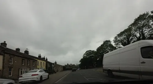
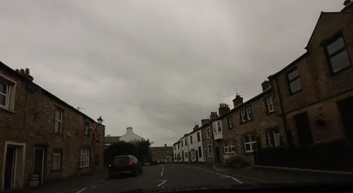
Photos of Gargrave


Things to do19

7 more on the map.
Museums and landmarks3

Kirk Sink roman villa
Monument and historic site · 0.6 mi
Substantial roman villa excavated 1968-75. All back-filled, no visible surface remains
Parks, trails and playgrounds2

Aireville Park
Park · 3.4 mi
Park in Skipton, North Yorkshire, England
Restaurants and cafes6

The Dalesman Cafe, Tea Room and Sweet Emporium
Cafe
54 High Street, Skipton
Tu-Su 09:00-16:00; Mo off

The Frying Yorkshireman
Fast food · Fish And Chips
26 - 28 High Street, Skipton
Mo-Fr 11:30-14:30,16:00-20:30; Sa 11:30-20:30


History
In the second century, the Romans built a villa in flat meadowland near the River Aire at Kirk Sink; it was excavated in 1968–1974 by Brian Hartley. Its central room had a seven-metre square mosaic floor and a bath house was built alongside. The villa was surrounded by two ditches.
In the 1820s, the main industry in Gargrave was cotton manufacturing and there were numerous warehouses along the side of the canal. The population at this time was 972 and there were several public houses including the Masons Arms and the Swan Inn.
Gargrave House was built in 1917 by the distinguished Scottish architect, James Dunn; it is a Grade II listed building.
The Old Swan is also Grade II listed and was named the Keighley and Craven CAMRA Pub of the Season in summer 1998.
From the History section of Gargrave on Wikipedia, under CC BY-SA 4.0.
Notable people from Gargrave
 Peter FoxcroftEnglish vegetarianism activist (1819–1896)Photo: Unknown author Unknown author, Public domain
- Robert Harkerassociation football player
Born in Gargrave, according to Wikidata (CC0). Each name links to its Wikipedia article.
Where to stay3
Churches and places of worship6
Shopping5
Schools, colleges and libraries2
Healthcare1
Map of Gargrave
47 places. The map loads OpenStreetMap tiles when you open it.
Getting there and nearby towns
Leeds Bradford Airport (LBA) is the nearest airport with scheduled flights listed in OpenStreetMap, 20 miles away.
- Skipton 4 mi southeast, about 6 min by car
- Hellifield 5 mi west, about 8 min by car
- Barnoldswick 6 mi southwest, about 9 min by car
- Cross Hills 7 mi southeast, about 12 min by car
- Grassington 7 mi northeast, about 12 min by car
- Colne 9 mi south, about 15 min by car
- Keighley 11 mi southeast, about 18 min by car
- Nelson 11 mi south, about 18 min by car
- Ilkley 12 mi east, about 20 min by car
- Burnley 14 mi southwest, about 22 min by car
Drive times are estimates from straight-line distance, not routes.
Towns near Gargrave


Keep exploring
Local news
Headlines from INDB.
Reviews, tips and questions
Loading what members have shared...
Sources and licences
- GeoNames (CC BY 4.0): population, coordinates, regions and time zone
- Mapillary (see each image): photos
- OpenStreetMap contributors (ODbL 1.0): places, airports, map data
- Wikidata (CC0 1.0): elevation, founding date, time zone, website, landmarks and historic places
- Wikimedia Commons (see each image): photos
- Wikipedia (CC BY-SA 4.0): overview and history text
Photo credits
- Leeds&LiverpoolCanalGargrave, User:Fenners, Public domain
- Summer Seat, Gargrave, Donnylad, CC BY-SA 2.0
- Poppyfields Florists, Gargrave (5812689913), Tim Green from Bradford, UK, CC BY 2.0
- St Peter's church - Marton in Craven, Tomw37, CC BY-SA 4.0
- Coniston Cold Church, Gammock, CC BY-SA 4.0
- St Andrew, Gargrave, Tim Green, CC BY 2.0
- Gargrave - The Old Swan Inn, Dave Bevis, CC BY-SA 2.0
- Dalesman Cafe, Gargrave, robert wade, CC BY-SA 2.0
- Ellison Meat and Ellison Fish (5815569295), Tim Green from Bradford, UK, CC BY 2.0
- St Andrews Court - panoramio, flipflopnick, CC BY-SA 3.0
- Street-level photo, tallguy, CC BY-SA 4.0
- Street-level photo, tallguy, CC BY-SA 4.0
- Street-level photo, tallguy, CC BY-SA 4.0
- Street-level photo, tallguy, CC BY-SA 4.0
- Street-level photo, jethro10, CC BY-SA 4.0
- Street-level photo, tallguy, CC BY-SA 4.0
Page built November 10, 2026. Spotted a mistake? Tell us or suggest a place.