


Keighley, United Kingdom
Keighley is a town of 50,171 people in England, United Kingdom.
Why visit Keighley
Townapedia lists 10 museums and landmarks, 9 parks and trails, 104 places to eat, 2 places to stay and 3 attractions in and around town.
Highlights include The Picture House, Ireland Bridge, Cliffe Castle and East Riddlesden Hall.
Weather in Keighley
Forecast from MET Norway (CC BY 4.0). Full forecast
About Keighley
in the City of Bradford Borough of West Yorkshire, England. It is the second-largest settlement in the borough, after Bradford.
From the Wikipedia article Keighley (this version), under CC BY-SA 4.0.
Travel tips from other travellers: Keighley on Wikivoyage (CC BY-SA 4.0).
Photos of Keighley

Things to do3

Ireland Bridge
Bridge · 2.9 mi
Bridge in Bingley, West Yorkshire, England,UK

Museums and landmarks10


East Riddlesden Hall
Monument and historic site · 1.1 mi
Grade I listed historic house museum in North Yorkshire, UK

Brontë Parsonage Museum
Museum · 3.3 mi
Grade I listed historic house museum in Haworth, Cross Roads and Stanbury, West Yorkshire, England,UK
Cliffe Castle Museum
Museum · 0.6 mi
Heritage centre, historic house museum. in West Yorkshire, England, United Kingdom


Museum of Rail Travel
Museum · 0.9 mi
Rail travel museum operated by the Vintage Carriages Trust in West Yorkshire, England, United Kingdom

Roman Road - Ribchester to Tadcaster (Margary 72)
Monument and historic site · 0.7 mi
Parks, trails and playgrounds9



Bingley St Ives
Park · 2.4 mi
Country park in West Yorkshire, England


Restaurants and cafes104
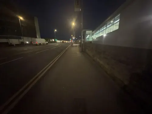
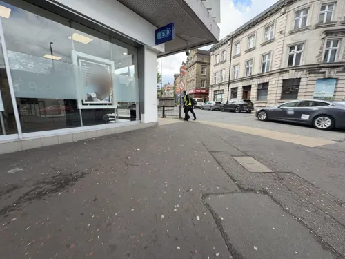
Chop Wok Express
Restaurant
96 Cavendish Street, Keighley
Mo-Th 11:00-23:00, Fr,Sa 15:00-24:00, Su 16:00-23:00
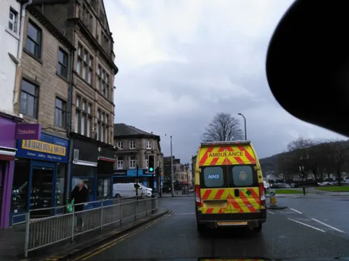



Queens Gelato
Ice cream · 0.9 mi
160 Queen's Road, Keighley
Mo-Th 18:00-01:00; Fr 17:00-00:30; Sa 17:00-02:00; Su 17:00-00:30

92 more on the map.
History
The name Keighley, which has gone through many changes of spelling throughout its history, means "Cyhha's farm or clearing", and was mentioned in the Domesday Book of 1086: "In Cichhelai, Ulchel, and Thole, and Ravensuar, and William had six carucates to be taxed."
Henry de Keighley, a Lancashire knight, was granted a charter to hold a market in Keighley on 17 October 1305 by King Edward I. The poll tax records of 1379 show that the population of Keighley, in the wapentake of Staincliffe in the West Riding of Yorkshire, was 109 (47 couples and 15 single people).
From 1753, the Union stage coach departed on the Keighley and Kendal Turnpike from what was the Devonshire Arms coaching inn on the corner of Church Street and High Street. Rebuilt about 1789, this public house has a classical style pedimented doorcase with engaged Tuscan columns in the high fashion of that age. The original route towards Skipton was Spring Gardens Lane – Hollins Lane – Hollins Bank Lane. Keighley was to become an intersection with other turnpikes, including the Two-Laws to Keighley branch of the Toller Lane – Blue Bell turnpike (1755) from Bradford to Colne, the Bradford to Keighley turnpike (1814), and the Keighley—Halifax turnpike.
Read more of the history
The 1842 Leeds Directory description of Keighley reads, "Its parish had no dependent townships though it is about six miles [10 km] long and four miles [6 km] broad, and comprises 10,160 acres [4,110 ha] of land (including a peaty moor of about 2,000 acres or 800 ha) and a population which amounted, in the year 1801, to 5,745."
Utley Cemetery contains the grave of Christopher Ingham, a veteran of the conflict against Napoleon. He was a member of the Duke of Wellington's elite 95th Rifle Regiment and fought in ten battles against the French in Spain, France and Belgium, including the Spanish Peninsula War and the Battle of Waterloo, for which he was awarded several medals, including the Peninsula Medal. He died in 1866. Some local historians believe Mr Ingham's heroism may have inspired the author Bernard Cornwell's saga about Major Richard Sharpe. The TV series episode Sharpe's Justice, which focuses on the roots of the title character, is set in and around Keighley.
On 22 May 1936, the Zeppelin Hindenburg crossed Yorkshire in a diversion of her normal route between the United States and Germany. As the airship passed over the town, a parcel was dropped and landed in the High Street, where two boys, Jack Gerrard and Alfred Butler, picked it up. The parcel contained a bunch of carnations, a small silver and jet crucifix, some postage stamps, a picture postcard and some Hindenburg notepaper.
The note was written by John P Schulte, who called himself the first flying priest. The note requested that the carnations and crucifix be placed on the grave of his brother, Lieutenant Franz Schulte, who had died of Spanish flu, during the deadly influenza pandemic of 1918, as a Prisoner of War at Raikeswood Prisoner of War Camp, Skipton, originally built as a training camp for the Bradford Pals, in 1915. Schulte was, at that time, buried at Morton Cemetery, two miles (three kilometres) east of Keighley (though the letter stated that he was buried at Skipton, which was incorrect).
To the finder of this letter. Please deposit these flowers and the cross on the grave of my dear brother, Lieutenant Franz Schulte, I. Garde Regt zu Fuss. Prisoner of War in Skipton Cemetery in Keighley near Leeds. Many thanks for your kindness, John P Schulte, the first flying priest. N.B. Please accept the stamps and picture as a small souvenir from me. God bless you!
The carnations were placed on the grave and the two boys kept the postage stamps and the postcard. The crucifix was placed in St Anne's Church to avoid it being stolen.
From the History section of Keighley on Wikipedia, under CC BY-SA 4.0.
More about Keighley
Geography
Keighley lies at the confluence of the rivers Worth and Aire in Airedale, in the South Pennines. It benefits from an electrified railway service with connections to Leeds, Bradford, Shipley, Bingley, Skipton, Carlisle and Morecambe.
The post town of Keighley's northern boundary is with Bradley and its southern limit is the edge of Oxenhope. To the west, the town advances up the hill to the suburb of Black Hill, and in the east it terminates at the residential neighbourhoods of Long Lee and Thwaites Brow. The outlying north-eastern suburb of Riddlesden is sometimes incorrectly referred to as a separate village but is part of the town.
Past Black Hill and via Braithwaite Edge Road lies Braithwaite village, which leads to Laycock, which was also mentioned in the Domesday Book. Laycock is a conservation area which overlooks the hamlet of Goose Eye.
The River Aire passes through north-eastern Keighley, dividing the neighbourhood of Stockbridge and running roughly parallel to the Leeds and Liverpool Canal. The Worth links up with the Aire in Stockbridge and runs south-westerly, dividing eastern Keighley from central and western districts of the town. The Worth is lined with abandoned, semi-derelict industrial sites and tracts of waste ground dating from the period when Keighley thrived as a major textile centre.
Economy
The town's industries have typically been in textiles, particularly wool and cotton processing. In addition to the manufacture of textiles, there were several large factories making textile machinery. These included Dean, Smith & Grace, George Hattersley & Son, and Prince, Smith & Stell. The first of these operated as a manufacturer of CNC machine tools, particularly precision lathes, until 2008.
Keighley is home to Timothy Taylor Brewery, the makers of CAMRA, Champion Beer of Britain award-winning ales Landlord and Boltmaker (previously known as 'Best Bitter'). They also brew Landlord Dark (previously known as Ram Tam), Golden Best, Dark Mild, Knowle Spring and a French style blonde ale, Le Champion, which was first brewed for the Tour de France in 2014 and has been brewed for the Tour de Yorkshire in 2015 and 2016. A new light refreshing session IPA called Hopical Storm appeared in 2020. They also own many pubs in the area, including the Albert Hotel, Boltmakers Arms, Taylor’s on the Green, Royal Oak and The Fleece Inn in Haworth.
Education
Local high schools are Carlton Keighley in Utley, Beckfoot Oakbank, Parkside School in Cullingworth and the Holy Family Catholic School.
Keighley College, formerly the local campus of Leeds City College, itself formerly known as Park Lane College, is situated near Keighley railway station on Bradford Road. In 2010, the college opened this new £30 million campus, moving away from the former site on Cavendish Street, which was in need of repair and has since been demolished. The college includes an Industrial Centre of Excellence and a nationally acclaimed Star Centre facility, designed to encourage more young people to study STEM subjects (science, technology, engineering, and mathematics). This features a mock mission control centre, a planetarium, a simulated rocky planet surface and many other space-related items.
From the Wikipedia article Keighley, under CC BY-SA 4.0.
Notable people from Keighley
 Simon BeaufoyBritish screenwriter and producerPhoto: RealTVfilms, CC BY-SA 3.0
 Eric PicklesBritish politician (born 1952)Photo: ©House of Lords / photography by Roger Harris, CC BY 3.0
 Alastair CampbellBritish director of communications and strategy, journalist, author and broadcasterPhoto: Kevin Payravi, CC BY-SA 4.0
 James MacNabbBritish rower (1901-1990)Photo: Stephencdickson, CC BY-SA 4.0
 Ashley FletcherEnglish association football player (born 1995)Photo: Egghead06, CC BY-SA 4.0
 Ricky WilsonBritish singerPhoto: Raph_PH, CC BY 4.0
 Gawain JonesBritish chess playerPhoto: Andreas Kontokanis from Piraeus, Greece, CC BY-SA 2.0
 Ruth EdwardsAmerican racing cyclistPhoto: Hoebele, CC BY-SA 4.0
 Jonny O'Maratennis player from the United KingdomPhoto: si.robi, CC BY-SA 2.0
 Ellie KildunneEnglish rugby union playerPhoto: Stefano Delfrate, CC BY-SA 2.0
 Chris LeslieBritish politician (born 1972)Photo: Chris McAndrew, CC BY 3.0
 Gordon BottomleyBritish poet (1874–1948)Photo: not stated, Public domain
Born in Keighley, according to Wikidata (CC0). Each name links to its Wikipedia article.
Where to stay2
Churches and places of worship32
Shopping21
Gas and EV charging3
Schools, colleges and libraries20
Keighley St Andrew's C of E Primary School and Nursery
School · Anglican · 0.5 mi
Lustre Street, Keighley
Healthcare11
Map of Keighley
215 places. The map loads OpenStreetMap tiles when you open it.
Getting there and nearby towns
Leeds Bradford Airport (LBA) is the nearest airport with scheduled flights listed in OpenStreetMap, 10 miles away.
- Bingley 3 mi southeast, about 5 min by car
- Cross Hills 4 mi northwest, about 7 min by car
- Baildon 5 mi east, about 8 min by car
- Ilkley 5 mi northeast, about 8 min by car
- Shipley 6 mi southeast, about 10 min by car
- Bradford 8 mi southeast, about 13 min by car
- Guiseley 8 mi east, about 13 min by car
- Skipton 8 mi northwest, about 13 min by car
- Yeadon 9 mi east, about 14 min by car
- Otley 9 mi east, about 15 min by car
Drive times are estimates from straight-line distance, not routes.
Towns near Keighley


Keep exploring
Local news
Headlines from INDB.
Reviews, tips and questions
Loading what members have shared...
Sources and licences
- GeoNames (CC BY 4.0): population, coordinates, regions and time zone
- Mapillary (see each image): photos
- OpenStreetMap contributors (ODbL 1.0): places, airports, map data
- Wikidata (CC0 1.0): elevation, founding date, time zone, website, landmarks and historic places
- Wikimedia Commons (see each image): photos
- Wikipedia (CC BY-SA 4.0): overview and history text
Photo credits
- A view over Keighley (31st July 2010), Flickr user:Tim Green atouch, CC BY 2.0
- Townfield entrance to the Airedale Centre, Keighley (29th August 2026), Mtaylor848, CC BY-SA 3.0
- TSB, Towngate, Keighley (29th August 2026), Mtaylor848, CC BY-SA 3.0
- Bingley Ireland Bridge 1, Unknown author, CC BY-SA 2.0
- Bronte Parsonage Museum, SpaceMonkey at en.wikipedia, Public domain
- Bingley All Saints Parish Church1, Unknown author, CC BY-SA 2.0
- Cliffe Castle (21360550470), Tim Green from Bradford, CC BY 2.0
- Holy Family Catholic School, ElijahTheYorkshireman, CC BY-SA 4.0
- St John, Ingrow, Keighley (8208492745), Tim Green from Bradford, CC BY 2.0
- Keighley War Memorial, No machine-readable author provided. SpaceMonkey~commonswiki assumed (based on copyright claims)., Public domain
- M79964 - 30820794802, hugh llewelyn, CC BY-SA 2.0
- East Riddlesden Hall 3 (2822557136), Tim Green from Bradford, CC BY 2.0
- Boundary Wall, Holden Park, Roger Templeman, CC BY-SA 2.0
- Drinking Fountain in Devonshire Park (4030081188), Tim Green from Bradford, CC BY 2.0
- Street-level photo, chris_debian, CC BY-SA 4.0
- Street-level photo, tallguy, CC BY-SA 4.0
- Street-level photo, ChloeEdmondson, CC BY-SA 4.0
- Street-level photo, ChloeEdmondson, CC BY-SA 4.0
- Street-level photo, ChloeEdmondson, CC BY-SA 4.0
- Street-level photo, ChloeEdmondson, CC BY-SA 4.0
- Street-level photo, ChloeEdmondson, CC BY-SA 4.0
- Street-level photo, chris_debian, CC BY-SA 4.0
- Street-level photo, jethro10, CC BY-SA 4.0
- Street-level photo, jethro10, CC BY-SA 4.0
- Street-level photo, chris_debian, CC BY-SA 4.0
- Street-level photo, ChloeEdmondson, CC BY-SA 4.0
- Street-level photo, ChloeEdmondson, CC BY-SA 4.0


Page built November 10, 2026. Spotted a mistake? Tell us or suggest a place.