


Why visit Gobowen
Townapedia lists 3 museums and landmarks, 2 parks and trails, 13 places to eat, 2 places to stay and 4 attractions in and around town.
Highlights include Chirk Aqueduct, Cambrian Railways works, Chirk War Memorial and Old Oswestry.
Weather in Gobowen
Forecast from MET Norway (CC BY 4.0). Full forecast
About Gobowen
Gobowen is a village in Shropshire, England, about 2 miles north of Oswestry. The population according to the 2011 census was 3,270.
From the Wikipedia article Gobowen (this version), under CC BY-SA 4.0.
Things to do4

Chirk Aqueduct
Bridge · 2.4 mi
Aqueduct carrying the Llangollen Canal

Cambrian Railways works
Bridge · 2.4 mi
Building in Oswestry, Shropshire, England, UK


Museums and landmarks3
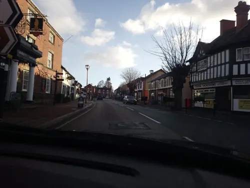
Chirk War Memorial
Monument and historic site · 2.6 mi
Grade II* listed building in Wrexham County Borough

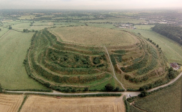
Old Oswestry
Monument and historic site · 1.7 mi
Hillfort in Shropshire, England, UK

Parks, trails and playgrounds2


Restaurants and cafes13




1 more on the map.
History
The village was previously called Bryn-y-Castell ("Hill of the Castle" in English) after the Norman motte castle adjacent to the Preeshenlle United Reformed Church, the eastern edge of the site being cut into when the church was built. Alongside this monument there is a section of the 8th century Wat's Dyke.
The name changed to Gobowen; this name is believed to originate from Gob (from 'gobennydd', a pillow) and Owen (Owain Glyndŵr) who was believed to have rested here. However, this name may also originate from a man named Owen who started mining here, and an old Welsh word for mine is 'gob', hence Gobowen (Owen's mine).
The mines were filled in by hand during the Second World War by displaced persons and prisoners of war, who were housed in a camp which is now called Bank Top Industrial Estate in the nearby village of St Martins.
The population of Gobowen, however, grew up around the railway. The mainline route between Chester and Shrewsbury was diverted through Gobowen after permission was denied to route the railway through the local historic town of Oswestry. Gobowen railway station is a Grade II listed building.
The village's main primary school was opened in 1907, with local educational provision previously being offered at the school hall attached to Preeshenlle United Reform Church.
Read more of the history
The Foundation Stone for All Saints Church was laid in 1926 and the memorial to this event can be found on the east end of the building. The church was built as a daughter church to St. Barnabas Church at Hengoed and remained as such until the Hengoed church was made redundant in 1981, at which point All Saints became the parish church for 'Hengoed with Gobowen'. The parish of Hengoed with Gobowen was originally in the Diocese of St Asaph but transferred to the Diocese of Lichfield when the Church in Wales disestablished. All Saints was officially opened in 1928 and its vicar was George Owen Browne, the first of nine vicars to date who have served the parish. Others have included: Bertram Russell, Arthur Cecil Roberts, Glyn Owen Jones, John Michael Allen, Paul Wilkinson, Michael John Withey, Christopher John Groocock and Adrian Richard Bailey (the current vicar). The church was extended variously throughout its history including the extension of the West End, the addition of a second vestry (to the rear) and a bell tower. In 1979, the building was devastated by fire and services continued during that period in the hall next to the Church. It re-opened in 1981 with a newly commissioned stained glass window to the East End, a donated window depicting the nativity in the West End, and various pieces of furniture donated from churches elsewhere.
From the History section of Gobowen on Wikipedia, under CC BY-SA 4.0.
Where to stay2
Churches and places of worship4
Schools, colleges and libraries3
Healthcare2
Map of Gobowen
33 places. The map loads OpenStreetMap tiles when you open it.
Getting there and nearby towns
Hawarden Airport (CEG) is the nearest airport with scheduled flights listed in OpenStreetMap, 20 miles away.
- Oswestry 2 mi south, about 4 min by car
- Whittington 2 mi southeast, about 3 min by car
- Rhosllannerchrugog 8 mi north, about 13 min by car
- Pant 8 mi south, about 12 min by car
- Ruyton-XI-Towns 9 mi southeast, about 14 min by car
- Wrexham 11 mi north, about 17 min by car
- Baschurch 11 mi southeast, about 17 min by car
- Brymbo 12 mi north, about 19 min by car
- Whitchurch 16 mi east, about 25 min by car
- Shrewsbury 18 mi southeast, about 28 min by car
Drive times are estimates from straight-line distance, not routes.
Towns near Gobowen


Keep exploring
Local news
Headlines from INDB.
Reviews, tips and questions
Loading what members have shared...
Sources and licences
- GeoNames (CC BY 4.0): population, coordinates, regions and time zone
- Mapillary (see each image): photos
- OpenStreetMap contributors (ODbL 1.0): places, airports, map data
- Wikidata (CC0 1.0): elevation, founding date, time zone, website, landmarks and historic places
- Wikimedia Commons (see each image): photos
- Wikipedia (CC BY-SA 4.0): overview and history text
Photo credits
- Traphont y Waun, ger y Waun, Cyngor Bwrdeisdref Wrecsam - Chirk Aquaduct nr Chirk, Wrexham Borough Council, Wales 27, Llywelyn2000, CC BY-SA 4.0
- Old Oswestry Hillfort (aerial), Oswestry Borderland Tourism, CC BY-SA 2.0
- Y Santes Fair, yr Waun,Wrecsam; St Mary's Church, Chirk, Wrexham, Wales 29, Llywelyn2000, CC BY-SA 3.0
- Street-level photo, trigpoint, CC BY-SA 4.0
- Street-level photo, RyanBush, CC BY-SA 4.0
Page built November 10, 2026. Spotted a mistake? Tell us or suggest a place.