


Shrewsbury, United Kingdom
Shrewsbury is a town of 76,782 people in England, United Kingdom, founded in 1189.
Why visit Shrewsbury
Townapedia lists 53 museums and landmarks, 49 parks and trails, 221 places to eat, 24 places to stay and 18 attractions in and around town.
Highlights include Atcham Bridge, Belvidere Bridge, Oteley Road and Soldiers of Shropshire Museum.
Weather in Shrewsbury
Forecast from MET Norway (CC BY 4.0). Full forecast
About Shrewsbury
Shrewsbury ( SHROHZ-bree, also SHROOZ-) is a market town and civil parish in Shropshire, England. It is sited on the River Severn, 33 miles (53 km) northwest of Wolverhampton, 15 miles (24 km) west of Telford, 31 miles (50 km) southeast of Wrexham and 53 miles (85 km) north of Hereford. At the 2021 census, the parish had a population of 76,782. It is the county town of the ceremonial county of Shropshire.
From the Wikipedia article Shrewsbury (this version), under CC BY-SA 4.0.
Travel tips from other travellers: Shrewsbury on Wikivoyage (CC BY-SA 4.0).
Photos of Shrewsbury


Things to do18

Atcham Bridge
Bridge · 3.6 mi
18th century bridge in Atcham, Shropshire, England, UK

Belvidere Bridge
Bridge · 1.7 mi
Historic bridge in Shrewsbury, Shropshire, England, UK

Cantlop Bridge
Bridge · 4.3 mi
Bridge in Berrington, Shropshire, England, UK


English Bridge
Bridge
Bridge over the River Severn in Shrewsbury, Shropshire, England, UK


Porthill Bridge
Bridge · 0.5 mi
Bridge crossing the River Severn in Shrewsbury, Shropshire, England

Shrewsbury Museum and Art Gallery
Cinema and theater
Former theatre, now museum in Shrewsbury, England, United Kingdom



6 more on the map.
Museums and landmarks53

Shrewsbury Castle
Monument and historic site
Feb 10-May 24 Mo-We,Fr,Sa 10:30-16:00; May 25-Sep 15 Mo-We,Fr,Sa...


Shrewsbury Museum (The Music Hall)
Museum
The Square, Shrewsbury
Apr-Sep Mo-Sa 10:00-17:00; Oct-Mar Tu-Sa 10:00-16:00; Oct-Mar Su...

Attingham Park
Museum · 4.0 mi
Grade I listed country house in Shropshire, England, United Kingdom


Bear Steps Hall Art Gallery
Museum
Restored Medieval Hall
Saint Alkmond's Place, Shrewsbury
Mo-Su 10:00-16:00
41 more on the map.
Parks, trails and playgrounds49


The Dingle
Park · 0.4 mi
Oct-Mar Mo-Th,Sa-Su,PH 08:30-15:45; Oct-Mar Fr,PH 08:30-15:15;...

Meole Brace Golf Course
Golf course · 1.2 mi
12 hole Par 68
Nov-Mar: Mo-Fr,Su 08:00-17:00; Nov-Mar: Sa 07:30-17:00; Apr-Oct...

Shrewsbury Business Park
Park · 2.0 mi
Business park in Shrewsbury, Shropshire, England


Castle Walk Countryside Site
Hiking and trails · 0.4 mi
Mix of riparian and and wet habitats. Part of the Castle Walk recreation ground
37 more on the map.
Restaurants and cafes221
ASK Italian
Restaurant · Italian
23 High Street, Shrewsbury
Mo-Th 11:30-22:00; Fr,Sa 11:30-23:00; Su 11:30-22:00
House of Grain
Bar and pub · Steak House, Burger, Sandwich, Mediterranean
59a Wyle Cop, Shrewsbury
Mo-Su 11:00-23:00; We-Sa 11:00-24:00
Oh For Goodness Cake
Cafe · Cake, Juice
2 Chester Street, Shrewsbury
Mo, Tu, Th, Fr, Sa 07:00-17:00; Su 10:00-16:00

The Wheatsheaf
Bar and pub
Frankwell, Shrewsbury
Mo-Su 12:00-00:00

Anchor Inn
Bar and pub
137 Frankwell, Shrewsbury
Mo,Th-Sa 12:00-24:00; Tu,We,Su 12:00-23:00


Starbucks
Cafe · Coffee Shop
Castle Foregate, Shrewsbury
Mo-Th 06:00-19:30; Fr 06:00-20:00; Sa 07:00-20:00; Su 09:00-17:00;...
AleoOli y Tu
Restaurant · Tapas
Tapas bar
167 Frankwell, Shrewsbury
Tu-Th 17:00-21:00; Fr,Sa 12:00-22:00
209 more on the map.
History
Evidence of Neolithic occupation of a religious form dating back before 2,000 BC, was discovered in 2017 in the grounds of the medieval Church of the Holy Fathers in Sutton Farm, making it Britain's oldest place of worship. An Early Bronze Age urned burial was excavated at Crowmeole in 2015. An Iron Age double ring ditch has been excavated at Meole Brace. Amongst other finds, parts of an Iron Age sword and scabbard were recovered.
At Meole Brace, an extensive roadside settlement along the line of the Roman military road connecting Viroconium Cornoviorum and Caersws was uncovered, with evidence of trading of amphorae and mortaria. A major discovery was the finding of the Shrewsbury Hoard of more than 9000 Roman coins in a field near the town in 2009.
Read more of the history
It is claimed that Pengwern, sometime capital of the Kingdom of Powys (itself established by the 440s), was at Shrewsbury, and it has been said in Parliament that the town was founded by the late 600s, the basis for this likely the Anglo-Saxon Chronicle's account of the 584 battle at Fethanleag, where Ceawlin defeated the Britons and captured numerous settlements including possibly Uriconium, which sets the historical context for the first likely textual mention of Shrewsbury in the poetry of the British prince Llywarch Hen, who mourned the destruction of Uriconium. Llywarch Hen's presence at the court of Prince Cynddylan at Pengwern, understood as the British name for Shrewsbury, implies the town's existence during this period. There is consistent tradition that the town was "founded in the 5th century, on occasion of the decay of the Roman Uriconium." Historian John Wacher suggests that Shrewsbury may have been refortified by refugees fleeing an outbreak of a plague in Viroconium around this time. Context for the nature of early Medieval period life in the wider district can be found in archaeological evidence on the nearby Attingham estate, where foundations of two rare 25m-long Anglo-Saxon timber halls dating to around 650 AD have been discovered, highlighting a significant and well-resourced Anglo-Saxon community in the region.
The first attested association of Pengwern with Shrewsbury is mentioned by Giraldus Cambrensis in the 12th century. Alternative suggestions as to the location of Pengwern include Whittington Castle near Oswestry, and Berth, a hillfort near Baschurch. The Historia Divae Monacellae, composed in the 14th or 15th century, says that Brochwel Ysgithrog, the 6th-century king of Powis, had a palace at Shrewsbury that became the site of the foundation of St Chad.
In the late 8th century, it is said that Offa took the town for the Mercians in 778, and he is associated by some sources with establishing the town's first church and dedicating it to St Chad. If so, then there may have been an ecclesiastical foundation in the town within a century of the death of Chad of Mercia.
Shrewsbury remained part of the Mercian kingdom until its incorporation into the larger realm of England under Egbert in the first half of the ninth century. During the subsequent Saxon period, historical records of the town are scarce.
Early in the tenth century Athelstan made a law to secure uniformity of coinage throughout his dominion, and this enactment specified the number of moneyers in the principal towns. Shrewsbury possessed one such moneyer, proving that while it reached a certain point of importance it did not rank among towns of the first class (this number was later raised to three in the reign of Edward the Confessor; and all through the period from Athelstan to Henry III, the Shrewsbury mint was busy).
Viking raiders from the north were reaching as far south as Bridgnorth by 910, and in 914, Æthelflæd, daughter of Alfred the Great and known as the Lady of the Mercians, fortified Shrewsbury, along with Hereford and two other fortresses, at Scergeat (a currently unknown location) and Weardbyrig (thought to be Whitchurch, which would make sense given the strategic importance of the Roman Road link via the Via Devana). Recent excavations at Shrewsbury Castle, funded by the Castle Studies Trust, revealed a massive defensive ditch surrounding the Norman motte and evidence of fortified presence on the castle site, predating the Norman invasion.
Some time before 918, the relics of St Alkmund were translated to Shrewsbury and back to Shropshire from Derby, this was probably the work of Æthelflæd. This return to Shropshire move followed Alkmund's initial burial in Shropshire after his death in 800.
Later, King Edgar (957–75) established a collegiate church with a dean and 10 prebendaries at St Alkmund's Church, it was a Royal peculiar, and subsequently, it became the property of Lilleshall Abbey in about 1145, when the relics were retranslated back to Derby.
Following Æthelflæd's fortification of Shrewsbury, the town largely avoided the devastating wave of the Danish invasions that impacted other parts of England. This immunity, which extended across Shropshire, is notable despite evidence of Danish ships on the River Severn (suggested by the name Danesford near Bridgnorth) and a recorded Danish defeat at Buttington (near Welshpool) in 894. The protection of the region is mainly attributed to Æthelred, the ealdorman of Mercia appointed by Alfred, and Æthelflæd herself. Subsequently, during the tenth century, Shrewsbury appears to have experienced a period of relative stability. An historical narrative, well established in the nineteenth century, asserts that during the devastating Danish invasion of 1006, Æthelred the Unready withdrew to his royal seat in Shrewsbury. In this account, the King experienced "great perplexity," reflecting the collapse of the national defense. This strategic withdrawal preceded the disastrous decision to pay the immense sum of £30,000 Danegeld in 1007 to halt the Danish advance.
From the History section of Shrewsbury on Wikipedia, under CC BY-SA 4.0.
More about Shrewsbury
Geography
Shrewsbury is about 14 miles (23 km) west of Telford, and 43 miles (69 km) northwest of Birmingham. The border with Wales is 9 miles (14 km) to the west.
The town centre is partially built on a hill whose elevation is, at its highest, 246 feet (75 m) above sea level. The longest river in the United Kingdom, the River Severn, flows through the town, forming a meander around its centre. The Rea Brook is a small river that has its confluence with the Severn at Shrewsbury, just upstream from the English Bridge, and much of the Rea Brook Valley within the town is a country park and local nature reserve, encompassing 36 hectares (89 acres). The town is subject to flooding from these rivers.
The town lies to the west of Haughmond Hill, a site where Precambrian rocks, some of the oldest rocks in the county can be found, and the town itself is sited on an area of largely Carboniferous rocks. A fault, the Hodnet Fault, starts near the town and runs north-east into the Stoke-on-Trent area.
The climate of Shrewsbury is similar to that of the rest of Shropshire, generally moderate.
Economy
Throughout the medieval period, Shrewsbury was a centre for the wool trade, and later used its position on the River Severn to transport goods across England via the canal system.
By the early 1900s, the town became focused on transport services and the general service and professional sector, owing to its position on the A5, part of the strategic route to North Wales. Unlike many other towns in this period, Shrewsbury never became a major centre for heavy industry though, in 1915, the Sentinel Waggon Works at Shrewsbury was opened for the building of steam rail and road locomotives. Later it converted to the production of diesel locomotives before being taken over, in 1958, by Rolls-Royce Limited for the manufacture of their range of diesel industrial engines, so that the Derby facility could concentrate on aero engines.
The town is the location of both town and county councils and a number of retail complexes, both in and out of the town centre. These provide significant employment. Shrewsbury is home to a high number of independent businesses, including shops, cafes and restaurants. Wyle Cop in Shrewsbury is said to have the 'longest uninterrupted row of independent shops'. Four in five jobs in the town are in the service industry. Within this sector, the largest employers are the administration and distribution sectors, which includes retail, food and accommodation.
Arts and culture
Prior to the Reformation, there are accounts of major festivals in Kingsland: In ancient times, while the Romish religion prevailed, all the companies united once a year in celebrating the day of Corpus Christi, with great pomp and splendour. At the reformation this ceremony was commuted for another, held on the second Monday after Trinity Sunday, which is still continued, though with less pomp and circumstance than formerly. The Companies form themselves into processions, headed severally by men on horseback in gaudy apparel, called kings, probably as representatives of the monarchs who granted their charters* They move in marshalled array to Kingsland, where they are met by the mayor and corporation and the day is spent in festivity.
Education
Prior to the reformation, Shrewsbury Abbey and the Collegiate Churches of St Mary (established by King Edgar in the 10th century) and St Chad (established in the 13th) were providing education in the town. Remains of the college of St Chad can be traced in the land adjoining the south-western extremity of the church on the old site, with portions of the wall traceable to a considerable distance in the neighbouring gardens. These were closed by the dissolutions. There is mention of a grammar school at Shrewsbury in a court case of 1439.
An effort was made to found a university in the 1600s during the Commonwealth which followed the execution of Charles I. Richard Baxter, a puritan minister from Shropshire, suggested the establishment of a university for Wales at Shrewsbury in the belief that he could obtain the support of Cromwell and Parliament for the scheme.
Shrewsbury School is a public school, on a large site in Kingsland, just south of the town centre overlooking the loop of the Severn. The school was located in the town centre between 1552 and 1882. The buildings it formerly occupied then are now occupied by the main county library on Castle Street. Opposite it on the other side of the river is Shrewsbury High School, an independent girls' day school.
From the Wikipedia article Shrewsbury, under CC BY-SA 4.0.
Notable people from Shrewsbury
 Charles DarwinEnglish naturalist and biologist (1809–1882)Photo: Charles_Darwin_seated.jpg : Henry..., Public domain
 Edward WaringEnglish mathematicianPhoto: Unknown author Unknown author, Public domain
 Richard of Shrewsbury, 1st Duke of YorkSecond son of King Edward IV of England, younger of the princes in the TowerPhoto: Unknown author Unknown author, Public domain
 Steven FletcherScottish association football playerPhoto: @cfcunofficial (Chelsea Debs) London, CC BY-SA 2.0
 David Edwardsassociation football playerPhoto: Steindy ( talk ) 16:17, 10 November..., CC BY-SA 3.0
 Eliot HigginsBritish citizen journalist and former bloggerPhoto: Superbass, CC BY-SA 4.0
 John BenbowRoyal Navy Admiral (1653-1702)Photo: Godfrey Kneller, Public domain
- Joe HartEnglish association football player
- Danny GuthrieEnglish association football player (born 1987)
- Charles BurneyEnglish music historian (1726-1814)
- Dalian AtkinsonEnglish footballer (1968–2016)
- Adam RaynerBritish actor
Born in Shrewsbury, according to Wikidata (CC0). Each name links to its Wikipedia article.
Where to stay24
Churches and places of worship55
Shopping65
Gas and EV charging10
Schools, colleges and libraries41
Bicton Church of England Primary School and Nursery
School · Anglican · 3.1 mi
Bicton Lane, Shrewsbury
Meole Brace Church of England Primary School and Nursery
School · Anglican · 1.5 mi
Church Road, Shrewsbury
Healthcare24
Radbrook Green Pharmacy
Clinic and pharmacy · 1.4 mi
Adjacent to Radbrook Green Surgery Bank Farm Lane
Map of Shrewsbury
250 places. The map loads OpenStreetMap tiles when you open it.
Getting there and nearby towns
Hawarden Airport (CEG) is the nearest airport with scheduled flights listed in OpenStreetMap, 34 miles away.
- Wellington 10 mi east, about 16 min by car
- Hadley 11 mi east, about 18 min by car
- Telford 13 mi east, about 21 min by car
- Oswestry 16 mi northwest, about 26 min by car
- Newport 16 mi east, about 26 min by car
- Market Drayton 17 mi northeast, about 28 min by car
- Whitchurch 18 mi north, about 29 min by car
- Bridgnorth 18 mi southeast, about 30 min by car
- Ludlow 23 mi south, about 37 min by car
- Wolverhampton 28 mi east, about 45 min by car
Drive times are estimates from straight-line distance, not routes.
Towns near Shrewsbury


Keep exploring
Local news
Headlines from INDB.
Reviews, tips and questions
Loading what members have shared...
Sources and licences
- GeoNames (CC BY 4.0): population, coordinates, regions and time zone
- Mapillary (see each image): photos
- OpenStreetMap contributors (ODbL 1.0): places, airports, map data
- Wikidata (CC0 1.0): elevation, founding date, time zone, website, landmarks and historic places
- Wikimedia Commons (see each image): photos
- Wikipedia (CC BY-SA 4.0): overview and history text
Photo credits
- The Square, Shrewsbury, Gnesener1900, CC BY-SA 3.0
- 201909 Shrewsbury library, WFan, CC BY-SA 3.0
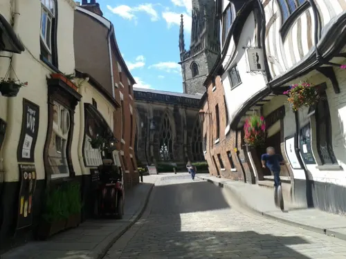
- Shrewsbury is half timbered, half not - panoramio, Peter Gill / UK, CC BY 3.0
- Part of the early Shrewsbury School building - panoramio, Peter Gill / UK, CC BY 3.0
- Old School House, Shrewsbury, Stephen Richards, CC BY-SA 2.0
- Atcham Bridge over the River Severn, Atcham, Shropshire, Christian David, CC BY-SA 4.0
- Belvidere Bridge 01, Harry Mitchell, CC BY 4.0
- Castle walk footbridge, kevin skidmore, CC BY-SA 2.0
- English Bridge a, Dpaajones, CC BY-SA 3.0
- Kingsland BridgeCB, Chris Bayley at en.wikipedia, CC BY-SA 2.5
- Porthill BridgeCB, The original uploader was ChrisJB at English Wikipedia ., CC BY-SA 2.5
- Welsh Bridge, Shrewsbury, Brian Clift, CC BY 2.0
- The Mansion at Attingham Park, Wehha, CC BY-SA 3.0
- Shrewsburycathedral, Fountain Posters, CC BY-SA 3.0
- Shrewsbury Abbey Exterior, Shropshire, UK - Diliff, Diliff, CC BY-SA 3.0
- Shrewsbury Unitarian Church, The Almightey Drill, CC BY-SA 4.0
- The Music Hall, Shrewsbury 01, Tyssil, CC BY-SA 4.0
- The Quarry, Shrewsbury (7251), Nilfanion, CC BY-SA 4.0
- Christ Church, Bicton Heath, John S Turner, CC BY-SA 2.0
- STFC - New Meadow (Aerial), Alice Humphreys - transatracurium, CC BY-SA 3.0
- Shrewsbury School 1, Gnesener1900, CC BY-SA 3.0
- Shrewsbury Castle 2, Unknown author, CC BY-SA 3.0
- Shrewsbury 9 (7048676077), Tony Hisgett from Birmingham, UK, CC BY 2.0
- Shrewsbury Library - School Gardens, Shrewsbury (25533569416), Elliott Brown from Birmingham, United Kingdom, CC BY-SA 2.0
- Church of St Chad, Shrewsbury 02, Necrothesp, CC BY-SA 3.0
- Anchor Inn, Shrewsbury, Chris Whippet, CC BY-SA 2.0
- Shrewsbury Hotel, Jaggery, CC BY-SA 2.0
- The Wheatsheaf, Shrewsbury, Chris Whippet, CC BY-SA 2.0
- Former Church of St Nicholas, Shrewsbury, Jaggery, CC BY-SA 2.0
- Shrewsbury School Crest, ShrewsburySchool, CC BY-SA 4.0
- Shrewsbury Schloss, Julian Nyča, CC BY-SA 3.0
- ShrewsburyDingle, The original uploader was ChrisJB at English Wikipedia ., CC BY-SA 2.5
- St Chads Shrewsbury, Steve Aze, CC BY-SA 3.0
- 2 And 3, School Gardens, Sic19, CC BY-SA 3.0
- The Old Police House, Simon Cobb, CC0
- Cantlop Bridge 2016, DeFacto, CC BY-SA 4.0
- Coleham Pumping Station, Shrewsbury, Stephen Richards, CC BY-SA 2.0
- A gate at Dingle Gardens, Quarry Park, Shrewsbury, Jwslubbock, CC BY-SA 4.0
- Street-level photo, trigpoint, CC BY-SA 4.0
- Street-level photo, trigpoint, CC BY-SA 4.0
- Street-level photo, trigpoint, CC BY-SA 4.0
- Street-level photo, cyclestreets, CC BY-SA 4.0
- Street-level photo, tonys999, CC BY-SA 4.0
- Street-level photo, trigpoint, CC BY-SA 4.0
- Street-level photo, trigpoint, CC BY-SA 4.0
- Street-level photo, trigpoint, CC BY-SA 4.0
- Street-level photo, trigpoint, CC BY-SA 4.0
- Street-level photo, trigpoint, CC BY-SA 4.0
- Street-level photo, trigpoint, CC BY-SA 4.0
- Street-level photo, trigpoint, CC BY-SA 4.0
- Street-level photo, trigpoint, CC BY-SA 4.0
- Street-level photo, trigpoint, CC BY-SA 4.0
- Street-level photo, southglos, CC BY-SA 4.0
- Street-level photo, trigpoint, CC BY-SA 4.0
- Street-level photo, trigpoint, CC BY-SA 4.0
- Street-level photo, trigpoint, CC BY-SA 4.0
- Street-level photo, trigpoint, CC BY-SA 4.0
- Street-level photo, trigpoint, CC BY-SA 4.0
- Street-level photo, trigpoint, CC BY-SA 4.0
- Street-level photo, trigpoint, CC BY-SA 4.0
- Street-level photo, cyclestreets, CC BY-SA 4.0
- Street-level photo, tonys999, CC BY-SA 4.0
- Street-level photo, trigpoint, CC BY-SA 4.0
- Street-level photo, trigpoint, CC BY-SA 4.0
- Street-level photo, trigpoint, CC BY-SA 4.0
- Street-level photo, trigpoint, CC BY-SA 4.0
- Street-level photo, trigpoint, CC BY-SA 4.0
- Street-level photo, laye, CC BY-SA 4.0


Page built November 10, 2026. Spotted a mistake? Tell us or suggest a place.