




Whittington, United Kingdom
Whittington is a town of 1,481 people in England, United Kingdom.
Why visit Whittington
Townapedia lists 4 museums and landmarks, 4 parks and trails, 6 places to eat, 1 place to stay and 2 attractions in and around town.
Highlights include Cambrian Railways works, Old Oswestry, Whittington Castle and Park Hall Stadium.
Weather in Whittington
Forecast from MET Norway (CC BY 4.0). Full forecast
About Whittington
Whittington is a village and civil parish in north west Shropshire, England, lying east and north-east of Oswestry. The parish had a population of 2,592 at the 2011 census. The village of Whittington is in the centre of the parish, and three smaller villages, Park Hall to its west, Hindford to the north-east and Babbinswood to the south, are also within the parish.
From the Wikipedia article Whittington, Shropshire (this version), under CC BY-SA 4.0.
Travel tips from other travellers: Whittington on Wikivoyage (CC BY-SA 4.0).
Photos of Whittington


Things to do2

Cambrian Railways works
Bridge · 2.0 mi
Building in Oswestry, Shropshire, England, UK

Museums and landmarks4

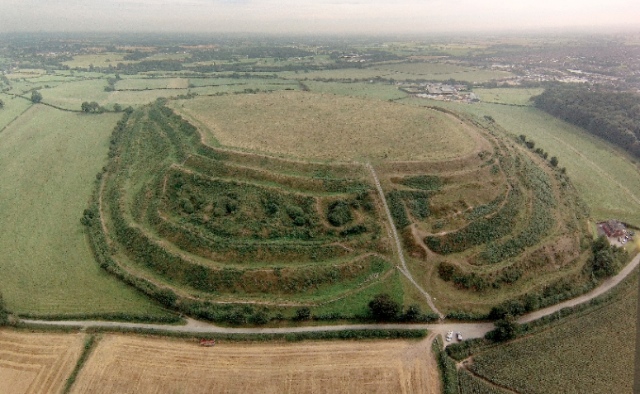
Old Oswestry
Monument and historic site · 1.9 mi
Hillfort in Shropshire, England, UK



Parks, trails and playgrounds4


Restaurants and cafes6


History
Whittington appears to have inhabited since prehistoric times and may have been a Dark Age fortress of some eminence, with an extensive settlement recorded in the Domesday Book of 1086. Whittington has been identified with Trefwen (white-town), the famous stronghold of Cynddylan king of Pengwern.
Whittington was granted to William Peverel probably in the summer of 1114 when King Henry I of England invaded Powys. William probably founded Whittington Castle which was taken from his descendants by the Welsh under Madog ap Maredudd of Powys and later granted to Roger Powys by King Henry II. It remained in the Powys family until King John granted it to the FitzWarin family, namely Fulk III FitzWarin (d.1258), whose life is recorded in a medieval romance.
In 1221, Henry III gave grudging permission for the castle to be re-built in stone after it had fallen to Llywelyn the Great. It was recaptured by Llywelyn in 1223 but was handed back the same year. It remained in the hands of the FitzWarins until 1420.
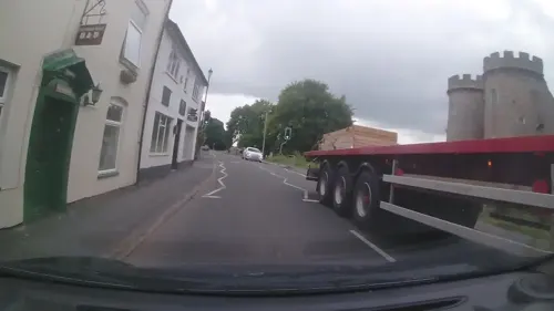
The castle ruins still exist today and were recently renovated. They are open to the public.
A small silver decorative brooch dating back to between 1115 and 1400 AD was discovered in a field outside Whittington in 2019.
The redbrick church of St Michael dates from 1894, and is on the site of a much older church.
From the History section of Whittington, Shropshire on Wikipedia, under CC BY-SA 4.0.
Notable people from Whittington
- Reg HumphreysEnglish footballer
Born in Whittington, according to Wikidata (CC0). Each name links to its Wikipedia article.
Where to stay1
Churches and places of worship3
Gas and EV charging1
Schools, colleges and libraries2
Healthcare1
Map of Whittington
24 places. The map loads OpenStreetMap tiles when you open it.
Getting there and nearby towns
Hawarden Airport (CEG) is the nearest airport with scheduled flights listed in OpenStreetMap, 21 miles away.
- Oswestry 2 mi west, about 4 min by car
- Ruyton-XI-Towns 7 mi southeast, about 11 min by car
- Rhosllannerchrugog 10 mi north, about 16 min by car
- Wrexham 12 mi north, about 19 min by car
- Brymbo 14 mi north, about 22 min by car
- Shrewsbury 15 mi southeast, about 25 min by car
- Whitchurch 15 mi northeast, about 24 min by car
- Buckley 21 mi north, about 33 min by car
- Chester 22 mi north, about 36 min by car
- Hawarden 22 mi north, about 35 min by car
Drive times are estimates from straight-line distance, not routes.
Towns near Whittington


Keep exploring
Local news
Headlines from INDB.
Reviews, tips and questions
Loading what members have shared...
Sources and licences
- GeoNames (CC BY 4.0): population, coordinates, regions and time zone
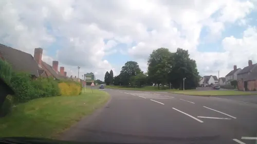
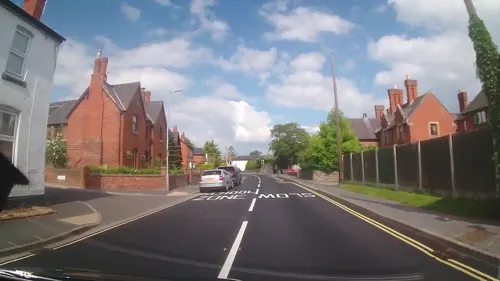
- Mapillary (see each image): photos
- OpenStreetMap contributors (ODbL 1.0): places, airports, map data
- Wikidata (CC0 1.0): elevation, founding date, time zone, website, landmarks and historic places
- Wikimedia Commons (see each image): photos
- Wikipedia (CC BY-SA 4.0): overview and history text
Photo credits
- Whittington Castle October 2014, AtticTapestry, CC BY-SA 4.0
- Whittington castle - panoramio (3), Tanya Dedyukhina, CC BY 3.0
- Whittington castle - panoramio (4), Tanya Dedyukhina, CC BY 3.0
- Old Oswestry Hillfort (aerial), Oswestry Borderland Tourism, CC BY-SA 2.0
- Whittington Castle gatehouse, AtticTapestry, CC BY-SA 4.0
- Halston Hall, 1871, in Sketches, vol. 4, by Stanley Leighton, Daderot, Public domain
- St John the Baptist's Church, Whittington, nick macneill, CC BY-SA 2.0
- Whittington Castle, Shropshire, UK, Jeffpmcdonald, CC BY-SA 4.0
- Halston house, Thomas Pennant, Public domain
- Street-level photo, trigpoint, CC BY-SA 4.0
- Street-level photo, trigpoint, CC BY-SA 4.0
- Street-level photo, trigpoint, CC BY-SA 4.0
- Street-level photo, trigpoint, CC BY-SA 4.0
- Street-level photo, trigpoint, CC BY-SA 4.0
- Street-level photo, RyanBush, CC BY-SA 4.0

Page built November 10, 2026. Spotted a mistake? Tell us or suggest a place.