


Godalming, United Kingdom
Godalming is a town of 22,689 people in England, United Kingdom.
Why visit Godalming
Townapedia lists 22 museums and landmarks, 19 parks and trails, 62 places to eat, 1 place to stay and 5 attractions in and around town.
Highlights include Electric Theatre, Yvonne Arnaud Theatre, Godalming Museum and Phillips Memorial Cloister.
Weather in Godalming
Forecast from MET Norway (CC BY 4.0). Full forecast
About Godalming
Godalming is a market town and civil parish in south-west Surrey, England, around 30 miles (49 km) south-west of central London. It is in the Borough of Waverley, at the confluence of the Rivers Wey and Ock. The civil parish covers 3.74 sq mi (9.7 km2) and includes the settlements of Farncombe, Binscombe and Aaron's Hill. Much of the area lies on the strata of the Lower Greensand Group and Bargate stone was quarried locally until the Second World War.
From the Wikipedia article Godalming (this version), under CC BY-SA 4.0.
Travel tips from other travellers: Godalming on Wikivoyage (CC BY-SA 4.0).
Photos of Godalming

Things to do5

Electric Theatre
Cinema and theater · 3.8 mi
Theatre in Guildford, England

Yvonne Arnaud Theatre
Cinema and theater · 3.7 mi
Theatre in Guildford, England

Museums and landmarks22

Godalming Museum
Museum
Museum in Godalming, Surrey, England, United Kingdom
109A High Street, Godalming

Phillips Memorial Cloister
Monument and historic site
Memorial in Godalming, Waverley, Surrey, England, UK
Borough Road
Busbridge War Memorial
Monument and historic site · 0.8 mi
War memorial in Busbridge, Surrey, England, UK

Guildford Castle
Museum · 3.8 mi
Castle in Guildford, Surrey, England, UK
Guildford Museum
Museum · 3.8 mi
Local museum in Guildford, England, United Kingdom

Jekyll Memorial, Busbridge
Monument and historic site · 0.8 mi
Memorial in Godalming, Waverley, Surrey, England, UK

Loseley Park
Museum · 2.1 mi
Grade I listed historic house museum in Artington, United Kingdom



Oakhurst Cottage
Museum · 3.7 mi
A Grade II listed building located in Hambledon, Surrey, in the United Kingdom

Church House Business Centre
Monument and historic site
30 Church Street, Godalming
10 more on the map.
Parks, trails and playgrounds19



Farncombe Community Garden
Park · 1.5 mi
Summers Road, Godalming
We 13:00-15:00; Fr 10:00-12:00; Sa 10:00-12:00
Rodborough Common, Surrey
Park · 2.7 mi
Local Nature Reserve in Surrey, England



7 more on the map.
Restaurants and cafes62
The Wharf
Restaurant · Indian
This premises is a Bar, Restaurant and Takeaway. Traditional Bangladeshi & Indian cuisine.
131 High Street, Godalming
Mo-Su 07:00-23:00

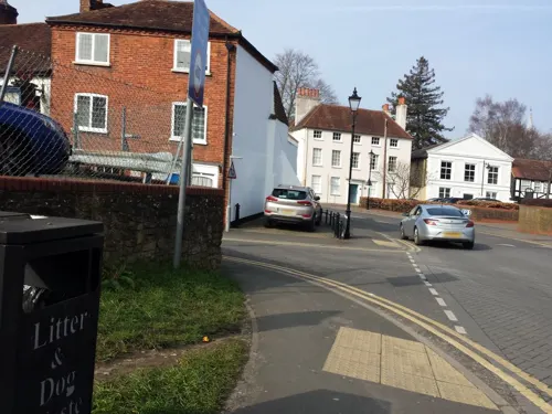
PizzaExpress
Restaurant · Pizza
127-129 High Street
Mo-We 11:30-21:00; Th 11:30-22:00; Fr-Sa 11:30-23:00; Su 11:30-21:30
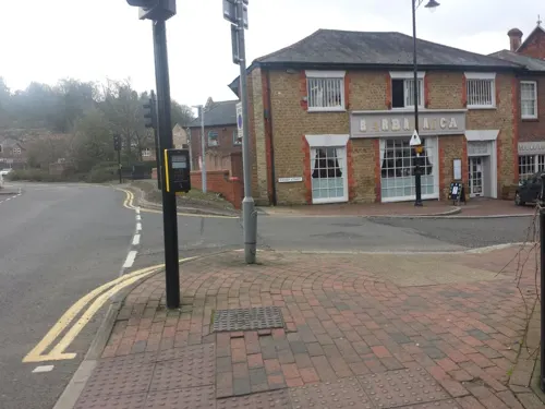

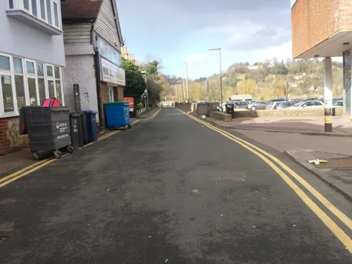
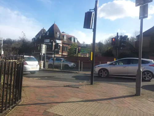

Coffee#1
Cafe · Coffee Shop
53-55 High Street, Godalming
Mo-Fr 07:30-18:00; Sa 08:00-18:00; Su 09:00-17:00

50 more on the map.
History
The earliest evidence of human activity in the Godalming area is from the Stone Age. At least two Paleolithic hand axes as well as Mesolithic flint blades and flakes have been found in the civil parish. In 2017, a local schoolboy discovered a Bronze Age barbed and tanged arrowhead, which he subsequently donated to Godalming Museum. The higher ground above the River Wey floodplain at Charterhouse was occupied during the middle Iron Age and human habitation is thought to have continued into the early Roman period. There is thought to have been a small farmstead on the site in the late first century C.E. and there was also a villa at Binscombe.
The Anglo-Saxon settlement at Godalming is thought to have been founded in the 6th or early 7th centuries, in the area surrounding the parish church. The oldest stonework in the church dates from c. 820 – c. 840 and the base of the west wall of the tower is of Anglo-Saxon origin. The earliest documentary evidence for Godalming, is from the will of Alfred the Great in 880, in which the settlement and surrounding land is left to his nephew, Æthelwold ætheling. By the end of the Anglo-Saxon period, the town was the administrative centre of the Godalming Hundred, which stretched from Puttenham in the north-west to Chiddingfold in the south-east.
Read more of the history
The town appears as Godelminge in Domesday Book; in 1086 it was held by Ranulf Flambard, who also held Tuesley and parts of Guildford. The manor had sufficient land for 25 plough teams. It included 40 acres of meadow, woodland for 103 swine, three mills, two churches, and generated an annual income of £34. Farncombe appears in Domesday Book as Fernecome and was held by Odo of Bayeux.
At some point in the late 11th century, the Manor of Godalming was divided into two parts. The King's Manor was held by the Crown through the 12th century. There is evidence to suggest that it was held by Stephen de Turnham in 1206, but in 1221 it was granted to the Bishop of Salisbury by Henry III. It was held by the Bishop until 1541, when it was conveyed to Thomas Paston, who returned it to the Crown the following year. It was held by the monarch through the Tudor period until 1601, when Elizabeth I sold it to George More of Loseley Park.
The second part of the Manor of Godalming, known as the Rectory Manor or Deanshold, was granted to Salisbury Cathedral by Henry I in the early 12th century. It remained in the custodianship of the dean and chapter until the mid-19th century. For much of its history, the manor was leased to the Castillion family, but was held by the Ogelthorpe family in the 18th century. In 1846, the Rectory Manor was transferred to the Ecclesiastical Commissioners, who began to break up and sell off the estate in the early 1860s.
The first charter to be granted to Godalming was issued by Edward I on 7 June 1300. In it, he authorised a weekly market and a three-day annual fair on the Feast of Saints Peter and Paul in late June. The right to hold a market was confirmed by Elizabeth I in 1563 and, in January 1575, she issued a Charter of Incorporation, enabling Godalming to become a self-governing borough. The charter specified that a "warden" (effectively a mayor) should be elected by the town each year at Michaelmas. In 1620, Francis Bacon, the Lord Chancellor under James I, issued a document entitled "Ordinances and constitutions made and established for the better and government of the Town of Godalming in the County of Surry", which specified that the administration of the town should be the responsibility of the warden and eight assistants. It also provided for the appointment of a bailiff and restricted the amount of time that townspeople could spend in local inns and hostelries.
The modern system of local government began to emerge in the first half of the 19th century. Under the Municipal Corporations Act 1835, the town became a borough corporation under the control of a mayor and elected councillors. The following year, the Guildford Poor Law Union was formed, with responsibility for a total area of 12 sq mi (31 km2) stretching from Godalming to Woking. As a result of the Local Government Act 1888, several responsibilities were transferred from the borough to the newly formed Surrey County Council. Farncombe was originally a separate civil parish, but became part of Godalming borough in 1892. The most recent change in local government took place in 1974, when the municipal boroughs of Godalming and Haslemere were merged with the Farnham Urban District and Hambledon Rural District to form Waverley District. At the same time, Godalming Town Council was constituted as the lowest tier of local government in the civil parish. The district became a borough on 21 February 1984, following the grant of a royal charter by Elizabeth II.
The right to hold a market was granted to Godalming in 1300 by Edward I. It probably took place each week at the junction of Church Street and the High Street. The right was confirmed in the 1563 charter of Elizabeth I, which stipulated that the market should be held every Wednesday. In 1674, the day was changed to Friday, but had reverted to Wednesday by the start of the 19th century. The market ceased in around 1879. The right to hold a fair each July was also granted in the charter of 1300 and continued to be held until 1870. A second annual fair, which originally took place over three days around Candlemas each February, was granted by Elizabeth I. By the start of the 19th century, the fair had been reduced to a single day and is last recorded in 1910.
From the History section of Godalming on Wikipedia, under CC BY-SA 4.0.
More about Godalming
Geography
Godalming is a town in the Borough of Waverley in south-west Surrey, around 30 mi (49 km) from central London and 4 mi (6.4 km) from Guildford. The town is in the valley of the River Wey, which flows northwards through Guildford to join the River Thames at Weybridge. Godalming High Street runs roughly east to west, linking an ancient crossing point of the Wey to the road leading south over Holloway Hill. The town is almost completely surrounded by the Metropolitan Green Belt and the Surrey Hills National Landscape is to the north and west.
Godalming Civil Parish has a total area of 3.74 sq mi (9.7 km2). It includes the settlements of Binscombe, Frith Hill and Charterhouse (north of the river) and Aaron's Hill, Ockford Ridge and Crownpits (to the south). The majority of the built-up area of Busbridge is also in Godalming Civil Parish. Farncombe, to the north of the town, has a strong village identity and incorporates a small cluster of local shops on Farncombe and St John's Streets. Godalming has good transport links to London and Portsmouth via the railway line and A3 road.
Arts and culture
Godalming Museum owns paintings by James Peel and Gertrude Jekyll as well as a sculpture of the artist, George Frederic Watts, by Louis Reid Deuchars. The collection also includes portraits of Thomas Henry Huxley and Jack Phillips by John Collier and Ellis Martin respectively. The Tate holds an oil painting by J. M. W. Turner entitled Godalming from the South, dated to 1805; the gallery also holds two pencil sketches of the town skyline by the same artist.
In Charles Dickens' novel Nicholas Nickleby, Nicholas and Smike stay the night in Godalming, en route from London to Portsmouth: "To Godalming they came at last, and here they bargained for two humble beds, and slept soundly." Much of the action in Bulldog Drummond by Sapper takes place in Godalming. Binscombe features as a location in The Hog's Back Mystery (1933) by the detective-fiction writer Freeman Wills Crofts.
Education
There are thought to have been dame schools operating in Godalming in the 16th and 17th centuries, but the first surviving reference to formal education in the town is from 1715, in which a school for 50 poor boys is recorded. The National school opened in Mint Road in February 1813 and moved to the former workhouse in Moss Lane in 1843. The workhouse buildings were demolished in 1910 and new classrooms were constructed on the same site. The school moved to new premises on Franklyn Road in the early 1970s and was renamed to become St Mark's School. A further change of name took place in 2008 and the school is now known as Green Oak School.
A British school opened in Hart's Yard in December 1812, but moved to Bridge Road in February the following year. It educated children between the ages of 6 and 13. The premises were rebuilt in 1872 and are now occupied by the Busy Bees nursery school. Busbridge School was founded in 1865 and three years later it became a National school. In 1868 there were 64 children on the roll, but by 1906, the school had 166 pupils.
St John's School, Farncombe opened in 1856; both the George Road and Meadrow Schools opened in 1906. Moss Lane County Primary School opened on the former workhouse site in 1975, but became an infants school in 1994.
From the Wikipedia article Godalming, under CC BY-SA 4.0.
Notable people from Godalming
 Aldous Huxleyviva el completo (1894–1963)Photo: sinaloaarchivohistorico, No restrictions
 Sam WorthingtonAustralian and English actor (born 1976)Photo: Dick Thomas Johnson from Tokyo, Japan, CC BY 2.0
 Mary ToftEnglish medical hoaxerPhoto: John Laguerre, Public domain
 Frederick DuCane GodmanEnglish lepidopterist, entomologist and ornithologist (1834–1919)Photo: Unknown author Unknown author, Public domain
 John Wakeham, Baron WakehamBritish businessman and Conservative Party politician (born 1932)Photo: Roger Harris, CC BY 3.0
 Julius CaesarEnglish cricketer (1830-1878)Photo: "A.R.", Public domain
 Jonathan Mance, Baron ManceBritish judge (born 1943)Photo: Roger Harris, CC BY 3.0
 George CarewEnglish admiral and adventurer (c.1504-1545)Photo: Circle of Hans Holbein the Younger /..., Public domain
- Mick MillsEnglish footballer and manager
- Arthur KnightEnglish footballer (1887-1956)
- Raymond TuckeyEnglish tennis player (1910–2005)
- Stephen MilliganBritish politician (1948-1994)
Born in Godalming, according to Wikidata (CC0). Each name links to its Wikipedia article.
Where to stay1
Churches and places of worship28
St Mark's Church and Community Centre
Church · Anglican · 0.8 mi
Franklyn Road, Godalming
Shopping22
Gas and EV charging10
Schools, colleges and libraries18
St Mary's CofE Voluntary Controlled Infant School
School · Anglican · 1.8 mi
Shackleford Road, Godalming
Healthcare8
Map of Godalming
195 places. The map loads OpenStreetMap tiles when you open it.
Getting there and nearby towns
Farnborough Airport (FAB) is the nearest airport with scheduled flights listed in OpenStreetMap, 9 miles away.
- Haslemere 8 mi southwest, about 12 min by car
- Woking 10 mi north, about 15 min by car
- Great Bookham 12 mi northeast, about 20 min by car
- Sandhurst 13 mi northwest, about 22 min by car
- Weybridge 14 mi northeast, about 23 min by car
- Sunninghill 15 mi north, about 24 min by car
- Walton-on-Thames 16 mi northeast, about 26 min by car
- Shepperton 16 mi northeast, about 26 min by car
- Sunbury-on-Thames 17 mi northeast, about 28 min by car
- Crawley 19 mi east, about 31 min by car
Drive times are estimates from straight-line distance, not routes.
Towns near Godalming


Keep exploring
Local news
Headlines from INDB.
Reviews, tips and questions
Loading what members have shared...
Sources and licences
- GeoNames (CC BY 4.0): population, coordinates, regions and time zone
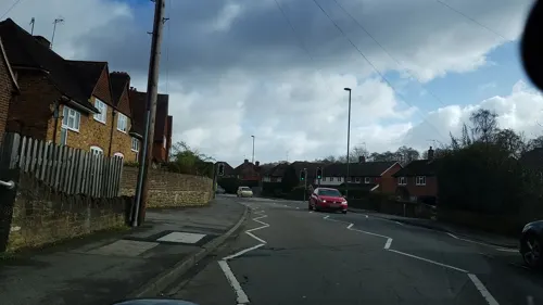
- Mapillary (see each image): photos
- OpenStreetMap contributors (ODbL 1.0): places, airports, map data
- Wikidata (CC0 1.0): elevation, founding date, time zone, website, landmarks and historic places
- Wikimedia Commons (see each image): photos
- Wikipedia (CC BY-SA 4.0): overview and history text
Photo credits
- Electric Theatre, Guildford, Weydonian ( talk ), CC BY 3.0
- Yvonne Arnaud Theatre View 2016, Jack1956, CC0
- Guildford castle 1, SuzanneKn at English Wikipedia, Public domain
- Agnes Jekyll gravestone in St John the Baptist's church, Busbridge, Carcharoth, CC BY-SA 4.0
- Loseley Park 03, Andrew Wilkinson from London, CC BY-SA 2.0
- Watts Gallery (Restored), ©Watts Gallery, CC BY-SA 3.0
- Farncombe Wood (2), Dudley Miles, CC BY-SA 4.0
- Middlebriars Wood (5), Dudley Miles, CC BY-SA 4.0
- Godalming United Church, Bridge Road, Godalming (April 2015) (6), Hassocks5489, CC0
- Meadrow Unitarian Chapel, Meadrow, Godalming (April 2015) (3), Hassocks5489, CC0
- Compton, Surrey. Church of St. Nicholas DSC 2785 edited-1, Ainslie, CC BY-SA 3.0
- St Peter's Church, School Lane, Hascombe (April 2015) (12), Hassocks5489, CC0
- St Peter and St Paul's Church, Church Street, Godalming (April 2015) (2), Hassocks5489, CC0
- Former Godalming Congregational Church, Bridge Road, Godalming (April 2015) (1), Hassocks5489, CC0
- Hambledon Church Surrey in the snow, Mdhsmith, CC BY-SA 3.0
- St Edmund King and Martyr's Church, Croft Road, Godalming (April 2015) (3), Hassocks5489, CC0
- St John the Baptist's Church, Brighton Road, Busbridge (April 2015) (10), Hassocks5489, CC0
- St Mary's Church, Quarry Street, Guildford (April 2014) (1), Hassocks5489, CC0
- Prior's Field School, Celia Toms Cghamel ( talk ) Prior's Field School, CC BY-SA 3.0
- The Pepperpot, High Street, Godalming, Surrey 01, Mertbiol, CC0
- Richmond Arms pub, 149 High Street, Godalming (April 2015) (2), User:Hassocks5489, CC0
- The Three Lions, 55 Meadrow, Farncombe, Godalming, Surrey - May 2026, Mertbiol, CC0
- Milford School, Back ache, CC BY-SA 3.0
- Godalming Museum, 107-109 High Street, Godalming, Surrey, Mertbiol, CC0
- The Pepperpot, High Street, Godalming, Surrey 04, Mertbiol, CC0
- Jack Phillips Memorial Cloister, Godalming, Surrey, Mertbiol, CC0
- Godalming Bandstand, Phillips Memorial Park, Godalming, Surrey, Mertbiol, CC0
- Street-level photo, sterylmreep, CC BY-SA 4.0
- Street-level photo, sterylmreep, CC BY-SA 4.0
- Street-level photo, sterylmreep, CC BY-SA 4.0
- Street-level photo, richardc, CC BY-SA 4.0
- Street-level photo, sterylmreep, CC BY-SA 4.0
- Street-level photo, sterylmreep, CC BY-SA 4.0
- Street-level photo, richardc, CC BY-SA 4.0
- Street-level photo, sterylmreep, CC BY-SA 4.0
- Street-level photo, sterylmreep, CC BY-SA 4.0
- Street-level photo, richardc, CC BY-SA 4.0
- Street-level photo, richardc, CC BY-SA 4.0
- Street-level photo, richardc, CC BY-SA 4.0
- Street-level photo, richardc, CC BY-SA 4.0
- Street-level photo, sterylmreep, CC BY-SA 4.0
- Street-level photo, sterylmreep, CC BY-SA 4.0
- Street-level photo, sterylmreep, CC BY-SA 4.0
- Street-level photo, sterylmreep, CC BY-SA 4.0
- Street-level photo, sterylmreep, CC BY-SA 4.0
- Street-level photo, richardc, CC BY-SA 4.0
- Street-level photo, richardc, CC BY-SA 4.0
- Street-level photo, richardc, CC BY-SA 4.0
- Street-level photo, richardc, CC BY-SA 4.0
- Street-level photo, richardc, CC BY-SA 4.0


Page built November 10, 2026. Spotted a mistake? Tell us or suggest a place.