


Why visit Gourock
Townapedia lists 10 museums and landmarks, 12 parks and trails, 26 places to eat, 1 place to stay and 6 attractions in and around town.
Highlights include The Beacon Arts Centre, Arts Guild Theatre, Granny Kempock Stone and McLean Museum and Art Gallery.
Weather in Gourock
Forecast from MET Norway (CC BY 4.0). Full forecast
About Gourock
Gourock ( GOOR-ək; Scottish Gaelic: Guireag [ˈkuɾʲak]) is a town in the Inverclyde council area and formerly a burgh of the County of Renfrew in the west of Scotland. It was a seaside resort on the East shore of the upper Firth of Clyde. Its main function today is as a residential area, extending contiguously from Greenock, with a railway terminus and ferry services across the Clyde.
From the Wikipedia article Gourock (this version), under CC BY-SA 4.0.
Travel tips from other travellers: Gourock on Wikivoyage (CC BY-SA 4.0).
Things to do6

The Beacon Arts Centre
Cinema and theater · 2.8 mi
Theatre and arts centre in Greenock, Inverclyde, Scotland, United Kingdom



Arts Guild Theatre
Cinema and theater · 2.0 mi
Former theatre in Greenock, Scotland

Cloch Lighthouse
Lighthouse · 2.7 mi
Lighthouse on Cloch Point, Inverclyde, Scotland, UK
Cragburn Pavilion
Cinema and theater · 0.5 mi
Former entertainment venue in Gourock, Scotland
Museums and landmarks10

Granny Kempock Stone
Monument and historic site
Standing stone in Gourock, Inverclyde, Scotland, UK

McLean Museum and Art Gallery
Museum · 2.1 mi
Museum in Inverclyde, Scotland, United Kingdom

MV Captayannis
Monument and historic site · 3.1 mi
Greek freighter shipwrecked in the Firth of Clyde, Scotland
Scottish Fire and Rescue Service Museum and Heritage Centre
Museum · 2.6 mi
Museum in Greenock, Scotland




HMS Cumberland
Monument and historic site · 3.1 mi
1842 Cumberland-class third-rate ship of the line
Parks, trails and playgrounds12





Restaurants and cafes26
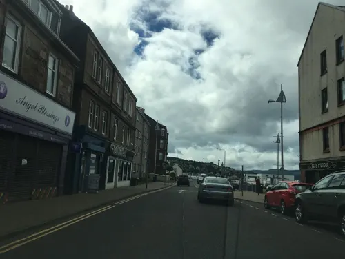
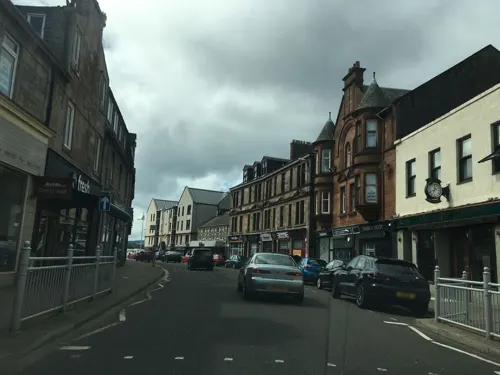
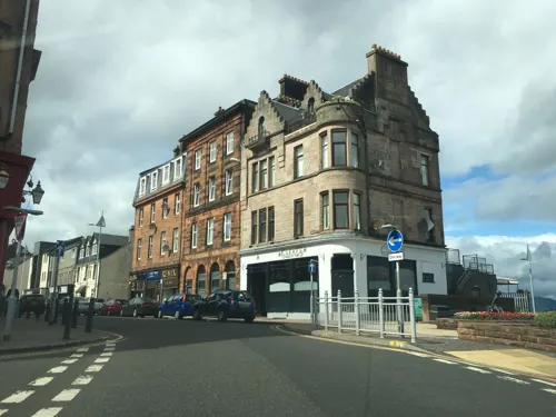
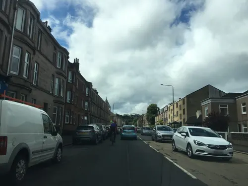
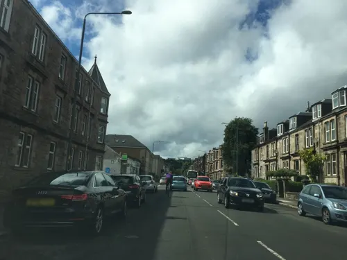
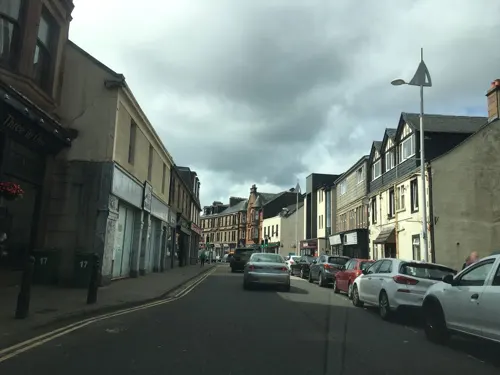

14 more on the map.
History
The name Gourock comes from a Gaelic word for "pimple", in reference to the hill above the town. As far back as 1494 it is recorded that James IV sailed from the shore at Gourock to quell the rebellious Highland clans. Two hundred years later William and Mary granted a Charter in favour of Stewart of Castlemilk which raised Gourock to a Burgh of Barony. In 1784 the lands of Gourock were purchased by Duncan Darroch, a former merchant in Jamaica. He built Gourock House near the site of the castle in what the family eventually gifted to the town as Darroch Park, later renamed by the council as Gourock Park.
From a small fishing village in the traditional county of Renfrewshire, Gourock grew into a community involved in herring curing, copper mining, ropemaking, quarrying and latterly yacht-building and repairing. Within sight of Gourock, in the early hours of 21 October 1825, PS Comet (II) was run into by the steamer Ayr, some 62 people losing their lives.
Read more of the history
When the competing railway companies extended their lines to provide fast connections to Clyde steamer services the Pierhead was built as a railway terminus. Nowadays a passenger ferry serves Kilcreggan and electric trains provide a service to Glasgow from Gourock railway station at the pierhead. The David MacBrayne Ltd headquarters is at the pier, and CalMac run a passenger ferry service to Dunoon. A car ferry service is run by Western Ferries from McInroy's Point on the west side of the town to Hunter's Quay to the north of Dunoon.
Like many Scottish seaside towns, Gourock's tourist heyday was in the latter half of the nineteenth century and the first half of the twentieth. Evidence of this part of its past is gradually disappearing - The Bay Hotel and Cragburn Pavilion and The Ashton, three local landmarks, disappeared towards the end of the last century. At the same time, Gourock has continued to expand along the coastline, with new estates above the medieval Castle Levan which has been restored and is in use as a bed and breakfast. Further development is taking place, though a short stretch of green belt still separates the town from the Cloch lighthouse which looks out over the firth to Innellan in Argyll.
From the History section of Gourock on Wikipedia, under CC BY-SA 4.0.
More about Gourock
Geography
The promenade at Ashton forms part of the Inverclyde Coastal Path.
McInroy's Point is a small peninsula to the west of the town. Around 1973, a pier was constructed here to form the departure point for Western Ferries. The port has since been expanded and now incorporates two floating ramps. The port is a terminus for the service to Hunters Quay, near Dunoon on the Cowal peninsula, on the western shore of the upper Firth of Clyde.
The area was the home of the Drumshantie Rifle Range in the late 19th century. It was developed in the mid-20th century as a series of prefabs (pre-fabricated houses) which were built on part of the "Tower Hill" as a temporary response to the post-war housing shortage.
Trumpethill is a residential area situated between Midton and Levan and lies to the north of Gourock Golf Club, which stretches all the way behind to the back of Levan.
From the Wikipedia article Gourock, under CC BY-SA 4.0.
Notable people from Gourock
 Robert PhillipsonBritish linguistPhoto: PicMirandole, CC BY-SA 4.0
 Ailsa MaxwellBritish Bletchley Park code breaker and historian (1922-2020)Photo: unknown and over 70 years old, Public domain
- David ProvanScottish former footballer
- Joan McAlpineScottish journalist and politician (born 1962)
- Melissa StriblingScottish actress (1926–1992)
- Eddie MorrisonScottish footballer (1948-2011)
- Charlie BarrAmerican yacht racer
- Dave Millarassociation football player (born 1945)
- Bet LowScottish painter (1924–2007)
- John CampbellScottish farmer and businessperson
- Grant AndersonScottish rugby player (born August 1989)
- R. McL. WilsonScottish biblical scholar, translator and Church of Scotland minister (1916-2010)
Born in Gourock, according to Wikidata (CC0). Each name links to its Wikipedia article.
Where to stay1
Churches and places of worship7
Shopping6
Schools, colleges and libraries8
Healthcare2
Map of Gourock
78 places. The map loads OpenStreetMap tiles when you open it.
Getting there and nearby towns
Glasgow Airport (GLA) is the nearest airport with scheduled flights listed in OpenStreetMap, 16 miles away.
- Greenock 2 mi southeast, about 4 min by car
- Helensburgh 5 mi northeast, about 8 min by car
- Port Glasgow 5 mi east, about 9 min by car
- Largs 12 mi south, about 19 min by car
- Johnstone 15 mi southeast, about 24 min by car
- Paisley 17 mi southeast, about 28 min by car
- Renfrew 18 mi east, about 28 min by car
- Milngavie 19 mi east, about 31 min by car
- Kilwinning 22 mi south, about 35 min by car
- Glasgow 23 mi east, about 37 min by car
Drive times are estimates from straight-line distance, not routes.
Towns near Gourock


Keep exploring
Local news
Headlines from INDB.
Reviews, tips and questions
Loading what members have shared...
Sources and licences
- GeoNames (CC BY 4.0): population, coordinates, regions and time zone
- Mapillary (see each image): photos
- OpenStreetMap contributors (ODbL 1.0): places, airports, map data
- Wikidata (CC0 1.0): elevation, founding date, time zone, website, landmarks and historic places
- Wikimedia Commons (see each image): photos
- Wikipedia (CC BY-SA 4.0): overview and history text
Photo credits
- PS Waverley at Gourock 1990, User:Dave souza, CC BY-SA 2.5
- Beacon Arts Centre from west, dave souza, CC BY-SA 4.0
- Granny Kempock Stone 3, Mgordon42, CC BY 3.0
- GreenockMcLeanMuseum, Hajotthu, CC BY-SA 3.0
- MV Captayannis-May2023-Hassan Ghani, Hassanghani, CC BY-SA 4.0
- Old West Kirk east, dave souza, CC BY-SA 4.0
- Organ with carved screen, Wikidiapason, CC BY-SA 4.0
- Craigs Top viewpoint, dave souza, CC BY-SA 4.0
- A View From Lyle Hill - panoramio, dan kearney, CC BY-SA 3.0
- Free French Memorial, Greenock, west plaque & wreath, dave souza, CC BY-SA 4.0
- John Galt memorial fountain closeup, dave souza, CC BY-SA 4.0
- Tower Hill, Gourock, archways and tower, dave souza, CC BY-SA 4.0
- Street-level photo, toho, CC BY-SA 4.0
- Street-level photo, ccbb7766, CC BY-SA 4.0
- Street-level photo, ccbb7766, CC BY-SA 4.0
- Street-level photo, ccbb7766, CC BY-SA 4.0
- Street-level photo, ccbb7766, CC BY-SA 4.0
- Street-level photo, ccbb7766, CC BY-SA 4.0
- Street-level photo, ccbb7766, CC BY-SA 4.0
- Street-level photo, ccbb7766, CC BY-SA 4.0
- Street-level photo, ccbb7766, CC BY-SA 4.0
- Street-level photo, ccbb7766, CC BY-SA 4.0
- Street-level photo, ccbb7766, CC BY-SA 4.0
- Street-level photo, ccbb7766, CC BY-SA 4.0
- Street-level photo, ccbb7766, CC BY-SA 4.0
- Street-level photo, ccbb7766, CC BY-SA 4.0
- Street-level photo, ccbb7766, CC BY-SA 4.0
- Street-level photo, ccbb7766, CC BY-SA 4.0
- Street-level photo, ccbb7766, CC BY-SA 4.0
- Street-level photo, ccbb7766, CC BY-SA 4.0

Page built November 10, 2026. Spotted a mistake? Tell us or suggest a place.