


Why visit Redhill
Townapedia lists 34 museums and landmarks, 19 parks and trails, 112 places to eat, 4 places to stay and 4 attractions in and around town.
Highlights include Everyman Cinema, Reigate, Harlequin, Reigate Tunnel Road Caves and Gatton Town Hall.
Weather in Redhill
Forecast from MET Norway (CC BY 4.0). Full forecast
About Redhill
Redhill () is a town in the borough of Reigate and Banstead within the county of Surrey, England. The town, which adjoins the town of Reigate to the west, is due south of Croydon in Greater London, and is part of the London commuter belt. The town is also the post town, entertainment and commercial area of three adjoining communities: Earlswood, Merstham and Whitebushes, as well as of two small rural villages to the east in the Tandridge District, Bletchingley and Nutfield.
From the Wikipedia article Redhill, Surrey (this version), under CC BY-SA 4.0.
Travel tips from other travellers: Redhill on Wikivoyage (CC BY-SA 4.0).
Photos of Redhill

Things to do4
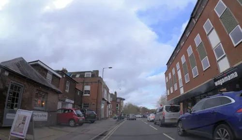

Reigate Hill
Scenic view · 1.4 mi
Engraved Panorama directional marker on level top of plinth (about 70cm high) includes places out of sight such as Canterbury 59 miles

Museums and landmarks34
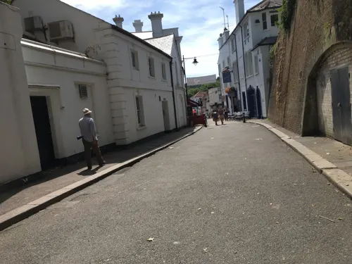
Reigate Tunnel Road Caves
Monument and historic site · 1.5 mi
Tunnel Road, Reigate
May 09; Jun 13; Jul 11; Aug 08; Sep 12



The Fire Brigades of Surrey
Museum · 1.1 mi
Croydon Road, Reigate
"During Surrey Fire HQ Open Days, or by Appointment"

Boys Air raid shelter
Monument and historic site · 0.9 mi
Naif painting, by children?, stories of Dick Wittington, Treasure Island etc.
Heritage weekend - Sept [booking required]
Holmesdale Natural History Club Museum
Monument and historic site · 1.2 mi
The Museum, 14 Croydon Road, Reigate
Bletchingley Castle
Monument and historic site · 2.7 mi
Castle in Surrey, England, UK
22 more on the map.
Parks, trails and playgrounds19


Kitchen Copse
Park · 3.3 mi
English private wooded nature reserve in Surrey



7 more on the map.
Restaurants and cafes112
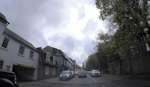
Parkside
Restaurant · Fine Dining, International, Breakfast, Brunch · 1.5 mi
A highly regarded family run independent restaurant in the heart of Reigate serving breakfast, lunch & dinner. We use local produce from...
71 Bell Street, Reigate
Mo-Su 08:30-15:00, Th-Sa 18:00-23:00
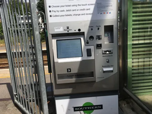
Five Spice
Restaurant · Chinese · 1.5 mi
7 Holmesdale Road, Reigate
Mo-Th 12:00-14:00,18:00-22:00; Fr-Sa 12:00-14:00,17:30-22:00; Su...
borgo
Restaurant · Italian · 1.5 mi
1 Church Street, Reigate
Mo-Th 12:00-14:30,17:00-22:00; Fr 12:00-14:30,17:00-22:30; Sa...
Beryl and Peg's
Cafe · 1.5 mi
15 Holmesdale Road, Reigate
Mo-Th 06:30-16:30; Fr 06:30-16:00; Sa 08:00-14:00


Merstham Park Cafe
Cafe · Burger, Sandwich, Salad, Hot Dog, Ice Cream · 1.6 mi
Merstham Recreational Ground, Merstham
Mo-Fr 08:30-17:00; Sa-Su 08:30-18:00
Sea Salt
Restaurant · Fish And Chips · 1.3 mi
41 Lesbourne Road, Reigate
Mo-We 16:30-21:00, Th-Sa 11:30-14:00,16:30-21:00, Su closed
Caffè Nero
Cafe · Coffee Shop · 1.6 mi
High Street, Reigate
Mo-Fr 07:00-18:30; Sa 07:30-18:30; Su 08:00-17:00
100 more on the map.
History
A settlement was formed here in part of the rural parishes of Reigate Foreign and Merstham when a turnpike road was built in 1818. The London-Brighton road passed through the Merstham Gap in the North Downs, and the Redhill Gap in the Greensand Ridge. The settlement was originally known as "Warwick Town" after Warwick Road, and became known as Redhill when the post office moved from Red Hill Common in the south-west of the town in 1856.
A major factor in the development of the town was the coming of the railways. The gap through the Greensand Ridge at Redhill was a major advantage for routing a railway from London to Brighton. A railway station opened in Redhill on 12 July 1841, after the London and Brighton Railway created a rail line by excavating the first of two rail tunnels under the North Downs at Merstham. Another railway station at Redhill followed on 26 May 1842, located on the South Eastern Railway's London to Dover to line, which branched off the original line south of the Merstham tunnel. Then on 15 April 1844 both these two stations were closed, as a new combined station was opened at the junction that same day, serving both railways, at the site of the present station. In 1849 a branch line to Reigate was added.
Read more of the history
St John the Evangelist, built in 1843, was the first of Redhill's three Anglican parish churches. The parish originally stretched from Gatton in the north to Sidlow in the south.
Richard Carrington, an amateur astronomer, moved to Redhill in 1852, and built a house and observatory. Dome Way, where one of Redhill's two tower block stands, is named after it. The site suited an isolated observatory, being on a spur of high ground surrounded by lower fields and marsh. Here in 1859 he made astronomical observations that first corroborated the existence of solar flares as well as their electrical influence upon the Earth and its aurorae. In 1863 he published records of sunspot observations that first demonstrated differential rotation in the Sun. In 1865 ill health prompted him to sell his house and move to Churt, Surrey. A pub is named the sun in recognition of his work.
In 1855, a large psychiatric hospital complete with well-trimmed grounds, was opened in Earlswood, south of Redhill. Prince Albert had laid the first stone in 1852. One inmate James Henry Pullen (1835–1916) was an autistic savant. He was a brilliant craftsman and artist whose work was accepted by Queen Victoria and Prince Albert. Some of Pullen's ship models, designs and artwork used to be on display at the town's Belfry Shopping Centre, but have now been moved to the Langdon Down Museum in Teddington. The asylum was renamed The Royal Earlswood Institution for Mental Defectives in June 1926, and more recently was simply named the Royal Earlswood Hospital or the royal Earlswood asylum. In 1941, the hospital became home to two of Queen Elizabeth the Queen Mother's cousins, Katherine Bowes-Lyon and Nerissa Bowes-Lyon, both of whom had learning difficulties. The hospital closed in March 1997 following the introduction of Care in the Community. The buildings were then converted to residential apartments and the site is now known as Royal Earlswood Park.
In 1868 Alfred Nobel demonstrated dynamite for the first time at a Merstham quarry, two miles north of Redhill.
In 1884, a large residential school for children, called St Anne's School, was opened by the St Anne's Society (a city of London charity) to accommodate 400 boys and girls. Built on a rise to the east of the town, and overlooking the railway station and the countryside around, it had a swimming bath, a gymnasium, tennis courts (asphalted and grassed), an external recreation ground as well as covered playgrounds, 21 pianos, a clock turret, a chapel and a dining room both capable of seating 600, a bakery, a steam laundry, an infirmary, an isolation hospital, and extensive gardens and orchards, all in property of 17½ acres. The school closed in 1919 after funding difficulties. In 1926 the Foundling Hospital used the site to house its own school, until moving elsewhere in 1935. Later, Surrey County Council used St Anne's as a Home for the Aged. In 1973 it became a home for the homeless, but closed in 1975 after being damaged by fire, and was demolished in 1987, to be replaced by housing.
The construction, to the east of Redhill, of the M23 motorway between 1972 and 1975 reduced north–south traffic through the town.
From the History section of Redhill, Surrey on Wikipedia, under CC BY-SA 4.0.
More about Redhill
Geography
Redhill is located within the Weald Basin, and the Weald-Artois Anticline. The town is situated in the east–west lying Vale of Holmesdale at a place where there is a natural water-cut gap in the Greensand Ridge, which connects the town with the low-lying land of the Low Weald to the south. Today the Redhill Brook runs through the gap in the Greensand Ridge on its way to join the Salfords Stream and the River Mole to the south. (The brook is now mainly culverted through the town centre: it enters a culvert behind Redhill station and briefly reappears in town at the Halford's car park, before emerging as a free-running stream again in Earlswood). The gap through the Greensand Ridge provides a way south for the London to Brighton railway and the A23 road. Gatwick Airport is also nearby 7 miles south of the town. The housing of the town is built in the Vale of Holmesdale, and on the hillsides of the two ends of the Greensand Ridge (Redstone Hill and the hillside of Redhill Common), and on the flat of the water-cut gap in between.
Economy
SES Water, Santander Consumer Finance, Axa breakdown assistance, Travelers Insurance and Aon Risk Services have their headquarters in the town. There are also three industrial and business estates: Holmethorpe Industrial Estate, Kingsfield Business Centre, and Reading Arch.
Redhill Aerodrome (IATA: KRH, ICAO: EGKR) lies 1.73 miles (2.78 km) south-east of Redhill and operates pleasure flights, flying courses, and private commercial flights.
Whilst the town is a hub in commercial terms, with a shopping centre and several offices of large companies, a large proportion of the economically active population work in Greater London and other parts of Surrey.
For some central government statistical purposes, Redhill and Reigate are classified as a subdivision of the Crawley Urban Area. Redhill is 18 miles east of Guildford. The average commuting distance in 2001 for workers was 13.8 kilometres (8.6 mi) in Redhill East and 13.6 kilometres (8.5 mi) in Redhill West. Unemployment stood at 1.81% in the east and 2.13% in the west in 2001.
The first iteration of British Island Airways had its head office at Congreve House in Redhill.
Arts and culture
Redhill is part of the Reigate and Banstead local government district. Not far from the town is Gatton Park, an estate once owned by the Colmans; the estate has a private chapel (now open to the public) and a Japanese garden.
The town has a distinctive red-brick complex called the Warwick Quadrant, which houses the Harlequin Theatre and Cinema, and the public library, as well as Sainsbury's and other shops. The original glass canopy above the quadrant that had been installed in 1986, was replaced in 2016.
The former Odeon cinema was built in 1938. It was converted into a nightclub in 1976, operating under various names, most recently Liquid and envy, until 2011 when it was closed down permanently to make way for new housing. Despite a plan to retain the listed Art Deco façade, delays in rebuilding and a reluctance to use the façade meant it "fell into decay" and was demolished in December 2017.
The London to Brighton Veteran Car Run passes through the town each year.
Education
St. Bede's School, a secondary school specialising in Music and IT.
Carrington School, a state secondary school is in Noke Drive.
Dunottar School, close by Redhill Common. Founded in 1926, this independent girls' school moved here in 1933, into "High Trees", built by Walter Blanford Waterlow in 1867.
From the Wikipedia article Redhill, Surrey, under CC BY-SA 4.0.
Notable people from Redhill
 Nick HornbyEnglish novelist, screenwriter, essayist, and film producer (born 1957)Photo: Joe Mabel, CC BY-SA 3.0
 David HewlettBritish-born Canadian actorPhoto: JaceMerlyn, CC BY-SA 4.0
 Maxim BaldryBritish actorPhoto: Raboe001, CC BY-SA 3.0
 Omari HutchinsonEnglish footballer (born 2003)Photo: James Cracknell, CC BY-SA 4.0
 Nicholas Edward BrownBritish botanist (1849–1934)Photo: Unknown author Unknown author, Public domain
 Matt WestonBritish skeleton racerPhoto: Sandro Halank , Wikimedia Commons, CC BY-SA 4.0
 Anna SmithBritish tennis playerPhoto: si.robi, CC BY-SA 2.0
 John BaronBritish politician (born 1959)Photo: David Woolfall, CC BY 3.0
 Mattie PollockEnglish association football playerPhoto: Timmy96, CC0
- Liz May BriceBritish actress
- Karen Brownfield hockey player from the United Kingdom
- Walter KingsfordBritish actor (1882-1958)
Born in Redhill, according to Wikidata (CC0). Each name links to its Wikipedia article.
Where to stay4
Churches and places of worship28
Shopping38
Gas and EV charging4
Schools, colleges and libraries27
Healthcare12
Map of Redhill
250 places. The map loads OpenStreetMap tiles when you open it.
Getting there and nearby towns
London Gatwick Airport (LGW) is the nearest airport with scheduled flights listed in OpenStreetMap, 6 miles away.
- Reigate 2 mi west, about 2 min by car
- Horley 5 mi south, about 7 min by car
- Caterham 5 mi northeast, about 8 min by car
- Coulsdon 6 mi north, about 9 min by car
- Kenley 7 mi northeast, about 11 min by car
- Dorking 7 mi west, about 11 min by car
- Oxted 7 mi east, about 12 min by car
- Ashtead 7 mi northwest, about 12 min by car
- Sutton 8 mi north, about 12 min by car
- Epsom 8 mi northwest, about 12 min by car
Drive times are estimates from straight-line distance, not routes.
Towns near Redhill


Keep exploring
Local news
Headlines from INDB.
Reviews, tips and questions
Loading what members have shared...
Sources and licences
- GeoNames (CC BY 4.0): population, coordinates, regions and time zone
- Mapillary (see each image): photos
- OpenStreetMap contributors (ODbL 1.0): places, airports, map data
- Wikidata (CC0 1.0): elevation, founding date, time zone, website, landmarks and historic places
- Wikimedia Commons (see each image): photos
- Wikipedia (CC BY-SA 4.0): overview and history text
Photo credits
- Redhill - St Matthews C of E Church - Nov 2011 - Altar, Gareth Williams, CC BY 2.0
- Kitchen Copse (3), Dudley Miles, CC BY-SA 4.0
- St Andrew's, Gatton - exterior, Dlg south, CC BY-SA 4.0
- St John the Evangelist's Church, Woodlands Road, Redhill (NHLE Code 1029141) (September 2012), The Voice of Hassocks, CC0
- Reigate Castle 002, Rjwilmsi, Public domain
- Gatton Town Hall, GrindtXX, CC BY-SA 4.0
- Strict Baptist Chapel, Station Road, Redhill (NHLE Code 1391762) (June 2013) (2), Hassocks5489, CC0
- St Mark's Church, Alma Road, Reigate (June 2013) (2), Hassocks5489, CC0
- Steps to serenity, Sidney Sambu, CC BY-SA 3.0
- Reigate Hill Viewpoint, Tim Sheerman-Chase, CC BY 2.0
- Earlswood Common - May 2011 - Great Crested Grebe, Gareth Williams, CC BY 2.0
- Street-level photo, 4004, CC BY-SA 4.0
- Street-level photo, 4004, CC BY-SA 4.0
- Street-level photo, 4004, CC BY-SA 4.0
- Street-level photo, 4004, CC BY-SA 4.0
- Street-level photo, 4004, CC BY-SA 4.0
- Street-level photo, southglos, CC BY-SA 4.0
- Street-level photo, 4004, CC BY-SA 4.0


Page built November 10, 2026. Spotted a mistake? Tell us or suggest a place.