
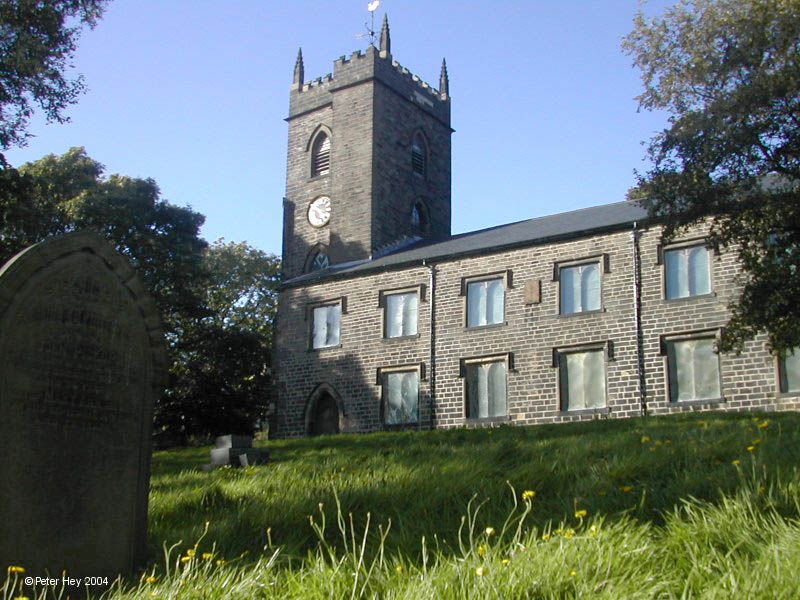


Haslingden, United Kingdom
Haslingden is a town of 15,204 people in England, United Kingdom.
Why visit Haslingden
Townapedia lists 7 museums and landmarks, 12 parks and trails, 41 places to eat and 3 attractions in and around town.
Highlights include The Whitaker and Helmshore Mills Textile Museum.
Weather in Haslingden
Forecast from MET Norway (CC BY 4.0). Full forecast
About Haslingden
Haslingden is a town in the borough of Rossendale, Lancashire, England. It lies 16 miles (26 km) north of Manchester. At the time of the 2021 census, the town (including Helmshore) had a population of 15,969. The town is surrounded by high moorland: 370 metres (1,210 ft) to the north; 396 metres (1,299 ft) Cribden to the east; and 418 metres (1,371 ft) Bull Hill to the south.
From the Wikipedia article Haslingden (this version), under CC BY-SA 4.0.
Things to do3

Museums and landmarks7



Haworth Art Gallery
Museum · 2.9 mi
Art gallery, museum and park in Lancashire, England, United Kingdom

Pilgrims Cross, Holcombe Moor
Monument and historic site · 3.1 mi
Monument marking the site of the ancient Pilgrims Cross on Holcombe Moor
Parks, trails and playgrounds12



Ground work bamboo tunnel.
Playground · 1.1 mi
Bam boo foliage tunnel for children.
Restaurants and cafes41
Woolpack
Bar and pub · 0.8 mi
488-490 Manchester Road, Rossendale
Mo,Tu,We 12:00-23:00; Th,Fr,Sa 12:00-24:00; Su 12:00-22:30

Mr. Fitzpatrick's
Bar and pub · Temperance · 1.5 mi
Temperance Bar
5 Bank Street, Rossendale
We 11:00-17:00; Th-Fr 10:00-17:00; Sa 10:00-16:00; Su 11:00-15:00


Blossom Chinese Restaurant
Restaurant · Chinese · 1.5 mi
13 Bacup Road, Rossendale

29 more on the map.
History
There is some evidence of Bronze Age human presence in the area of Haslingden. Thirteen Stones Hill is 2 km (1.2 mi) west of the town and probably dates from about 3000BC. There is now just one stone visible.
Part of what is now Haslingden, along with the neighbouring towns of Rawtenstall and Bacup, were part of the Forest of Rossendale, itself part of the Forest of Blackburnshire. During the late 13th and 14th centuries, the forest was a hunting park; the term 'Forest' referred to it being parkland rather than being heavily wooded, as the forest declined much earlier during the Neolithic period. The Forest of Rossendale contained eleven vaccaries (cow pastures) and was poorly populated, with Haslingden being the only town of significance and possessed of a church.
Read more of the history
Haslingden appears to have held markets during the 16th century, with the first reference in a Court Roll of 1555 where it records a John Radcliffe being fined for being a 'forestaller of the lords market of Haslyngden'. There are later references to markets and fairs in The Shuttleworth Accounts (1582-1621) and the map-maker Richard Blome writing in 1673 describes Haslingden as originally having 'a small Market-town on Wednesdays', and later, at the time of Charles I, the market had been moved to Saturday. The market continued to grow and Haslingden was designated a market town in 1676. It became a coaching station and a significant industrial borough during the Industrial Revolution. Haslingden benefitted in particular with the mechanisation of the wool and cotton spinning and weaving industries from the 18th to the 19th centuries, and the development of watermills, and later steam power. By the latter half of the nineteenth century, the diversity and wealth of industry earned the area the name 'The Golden Valley'.
In the 20th century, the population declined from 19,000 in the 1911 census to 15,000 in 1971. The 2001 census recorded a population of 16,849 living in the town.
Haslingden was once connected to Accrington and Bury Bolton Street by railway (Rush, 1983). The East Lancashire Railway built a station here, which remained open to passengers under British Railways until 7 November 1960 and to goods until 2 November 1964. The Bury–Accrington line itself remained in use until December 1966.
Much of the trackbed of the railway is no longer visible, with the A56 by-pass built over it between Grane Road and Blackburn Road; however, the line can still be traced through Helmshore towards Stubbins, where several magnificent viaducts still remain. The East Lancashire Railway Preservation Society was originally established at Helmshore station in the mid 1960s, with the aim of reopening the railway line to Stubbins. The project was abandoned with the organisation relocating to Bury in the 1970s and eventually reopening the Rawtenstall to Bury line.
From the History section of Haslingden on Wikipedia, under CC BY-SA 4.0.
More about Haslingden
Education
The Wesleyan School, formerly on the site of the current health centre, was the site of the first experiment in the world at a standardised intelligence test. It followed from a suggestion by the industrialist and Liberal politician Sir William Mather in 1900, given after a prize-giving to students to members of the Haslingden Technical Instruction Committee. The test was set by Henry Holman, a schools inspector and educationalist, in 1903. It included questions like 'is there a good reason for making a pie crust ornamental instead of plan?'. Mather introduced apprentice schemes at his factories which used testing as part of the selection method. He also introduced a 48-hour working week for employees.
Haslingden High School is a specialist arts, maths and computing college.
From the Wikipedia article Haslingden, under CC BY-SA 4.0.
Notable people from Haslingden
 Antony HigginbothamBritish politician and Conservative MPPhoto: David Woolfall, CC BY 3.0
 James CockerillBritish entrepreneurPhoto: Unknown author Unknown author, Public domain
 James DuckworthBritish politicianPhoto: Fleets, CC BY-SA 4.0
 Ethel BidwellEnglish research scientistPhoto: History of Modern Biomedicine Research Group, CC BY-SA 4.0
 James AltyBritish computer scientistPhoto: JLenton, CC BY-SA 4.0
- William FosterBritish swimmer, Olympic gold medallist, former world record-holder
- John CockerillBritish businessman (1790-1840)
- Alan RawsthorneBritish composer (1905-1971)
- William CockerillBritish entrepreneur
- Choppy WarburtonAthlete and cycling coach (1845–1897)
- Walter ChadwickEnglish footballer (1903-1966)
- Jack Briggscricketer (1916-1984)
Born in Haslingden, according to Wikidata (CC0). Each name links to its Wikipedia article.
Churches and places of worship15
Shopping7
Gas and EV charging4
Schools, colleges and libraries17
St James-the-Less Roman Catholic Primary School, Rawtenstall
School · Roman Catholic · 1.3 mi
Unity Way, Rossendale
Healthcare2
Map of Haslingden
108 places. The map loads OpenStreetMap tiles when you open it.
Getting there and nearby towns
Warton Aerodrome (WRT) is the nearest airport with scheduled flights listed in OpenStreetMap, 23 miles away.
- Rawtenstall 2 mi east, about 3 min by car
- Ramsbottom 4 mi south, about 6 min by car
- Blackburn 7 mi northwest, about 12 min by car
- Padiham 7 mi north, about 11 min by car
- Burnley 8 mi northeast, about 12 min by car
- Bolton 9 mi southwest, about 15 min by car
- Todmorden 9 mi east, about 15 min by car
- Nelson 10 mi northeast, about 17 min by car
- Little Lever 10 mi south, about 16 min by car
- Littleborough 10 mi southeast, about 16 min by car
Drive times are estimates from straight-line distance, not routes.
Towns near Haslingden


Keep exploring
Local news
Headlines from INDB.
Reviews, tips and questions
Loading what members have shared...
Sources and licences
- GeoNames (CC BY 4.0): population, coordinates, regions and time zone
- Mapillary (see each image): photos
- OpenStreetMap contributors (ODbL 1.0): places, airports, map data
- Wikidata (CC0 1.0): elevation, founding date, time zone, website, landmarks and historic places
- Wikimedia Commons (see each image): photos
- Wikipedia (CC BY-SA 4.0): overview and history text
Photo credits
- StNicholas, CalTPD, Public domain
- St Paul's Church, Constable Lee, Dangerousismyname, CC BY-SA 4.0
- St Mary, Rawtenstall, David Dixon, CC BY-SA 2.0
- The Whitaker, Rawtenstall, formerly Rossendale Museum, Lancashire, England 2008, Acabashi, CC BY-SA 4.0
- St Paul's Church Constable Lee 20200911, Wilbur Platt, CC BY-SA 4.0
- Helmshore Mills Textile Museum, Dave.Dunford, CC BY-SA 4.0
- Higher Mill and chimney, Plucas58, CC BY-SA 4.0
- Street-level photo, endszbrxns, CC BY-SA 4.0
- Street-level photo, endszbrxns, CC BY-SA 4.0
- Street-level photo, endszbrxns, CC BY-SA 4.0
- Street-level photo, endszbrxns, CC BY-SA 4.0
- Street-level photo, southglos, CC BY-SA 4.0
- Street-level photo, southglos, CC BY-SA 4.0
- Street-level photo, southglos, CC BY-SA 4.0
- Street-level photo, trigpoint, CC BY-SA 4.0
Page built November 10, 2026. Spotted a mistake? Tell us or suggest a place.