


Ramsbottom, United Kingdom
Ramsbottom is a town of 17,067 people in England, United Kingdom.
Why visit Ramsbottom
Townapedia lists 7 museums and landmarks, 9 parks and trails, 43 places to eat, 3 places to stay and 3 attractions in and around town.
Highlights include Peel Monument, Peel Tower, Burrs Country Park and Clarence Park.
Weather in Ramsbottom
Forecast from MET Norway (CC BY 4.0). Full forecast
About Ramsbottom
Ramsbottom is a market town in the Metropolitan Borough of Bury, Greater Manchester, England. The population at the 2011 census was 17,872. Historically in Lancashire, it lies on the River Irwell in the West Pennine Moors, 3.9 miles (6.3 km) north-west of Bury and 12 miles (19 km) of Manchester. Its Victorian architecture, Pennine landscape and industrial heritage, including the East Lancashire Railway, contribute to heritage tourism in the town.
From the Wikipedia article Ramsbottom (this version), under CC BY-SA 4.0.
Travel tips from other travellers: Ramsbottom on Wikivoyage (CC BY-SA 4.0).
Photos of Ramsbottom

Things to do3


Museums and landmarks7

Peel Monument
Monument and historic site · 0.9 mi
Commemorative monument

Pilgrims Cross, Holcombe Moor
Monument and historic site · 1.5 mi
Monument marking the site of the ancient Pilgrims Cross on Holcombe Moor
Parks, trails and playgrounds9


Clarence Park
Park · 3.1 mi
Urban park in Bury, Greater Manchester, England
Kirklees Valley Local Nature Reserve
Park · 2.4 mi
Nature Reserve in Tottington, Greater Manchester, UK


Restaurants and cafes43
Levanter
Restaurant · Tapas
10 Square Street, Bury
Mo,Tu closed; We 17:00-23:00 open "Kitchen till 10PM"; Th...
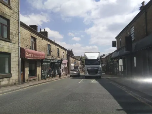
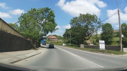
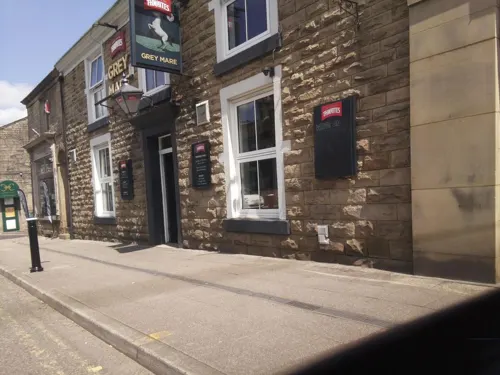
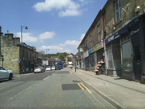


31 more on the map.
History
The name either means 'ram's valley' from the Old English ramm, 'a ram' and botm, 'a valley' but could mean a 'wild garlic valley', with the first element representing the Old English hramsa meaning 'wild garlic'. A record from 1324 recording the name as Ramesbothum is inconclusive. The town was alternatively recorded as Ramysbothom in 1540.
Evidence of prehistoric human activity has been discovered in the hills surrounding the town. Early records show that in Norman times Ramsbottom was part of the Forest of Rossendale. There are a number of Bronze Age burial sites around the town, the most notable of which is Whitelow Cairn, one mile (1.6 km) south-east of the town centre and three miles (4.8 km) north of Bury. The cairn was excavated by Bury Archaeological Group between 1960–62, under the leadership of Norman Tyson. Finds include one main and seven secondary cremations, four in urns, dating to the mid Bronze Age. Artefacts found during the excavation are housed in Bury Museum.
The early Anglo-Saxons who gave Ramsbottom its name progressively felled the woodland during the Middle Ages. Ramsbottom became an area of scattered woods, farmsteads, moorland and swamp with a small community of families until the late 18th century.
Read more of the history
Ramsbottom developed during the 19th century as a manufacturing and mill town on the road from Bury to Haslingden by the River Irwell; its suburbs stretched south to Hazelhurst and north to Stubbins. Mills were built for spinning, weaving and printing. Square Mill was, in its day, innovative in combining many such processes under one roof.
With a readily available source of water power, Sir Robert Peel purchased land in Ramsbottom in the late 18th century to commence a major manufacturing career. It is this exchange that effectively founded Ramsbottom as a homogeneous settlement; the factory system, and Industrial Revolution facilitated a process of unplanned urbanisation in the area, contributing to it becoming an important and populous mill town.
The Grant Arms Hotel in Market Place was the home of William and Daniel Grant, 19th century industrialists closely associated with the rise of the town and reputed to be the inspiration for the Cheeryble brothers in Nicholas Nickleby by Charles Dickens. The Grants' employees were paid in tokens that had to be redeemed at a public house owned by the company. The landlord converted the tokens into cash, but only after deducting threepence per person, which had to be spent on beer, a variation on the truck system. The Grant Arms Hotel closed in 2018 and is currently being developed as offices, this has now been completed.
A network of roads and railways routed through Ramsbottom allowed for a series of diverse industries, including calico-printing, cotton spinning, machine-making, rope-making and iron and brass founding. Imports of foreign goods during the mid-20th century precipitated the decline of these sectors.
From the History section of Ramsbottom on Wikipedia, under CC BY-SA 4.0.
More about Ramsbottom
Geography
The Ramsbottom parish formed in 1844 was a mile and a quarter in length and about three-quarters of a mile in width in the Lower Tottington township in the valley of the River Irwell that extends from Bury to Rossendale. It is bounded to the south by Holcombe Brook and Summerseat; to the north by Edenfield, Irwell Vale, Stubbins and the hamlets of Chatterton and Strongstry; to the west by Holcombe and to the east by Shuttleworth and Turn Village.
The area is characterised by its position on the south side of the West Pennine Moors. The high ground rises sharply on either side of the town with Holcombe Moor, Harcles Hill and Bull Hill to the west and Top O' Th' Hoof, Harden Moor, Scout Moor and Whittle Hill to the east.
Arts and culture
Hundreds of people climb Holcombe Hill on Good Friday. A smaller gathering keeps alive the tradition of egg rolling before the start of the climb. Large gatherings on the hill are visible from miles away, and occasionally attract unorthodox religious preachers. In recent years, the celebrations have become more secular, with the public house at the bottom of Holcombe Hill attracting as many as 3,000 visitors leading to complaints from residents and restrictions being imposed by the council.
Ye Olde Gamecock Show, an exhibition of game fowl is held in the town on New Year's Day. The show was held at The Old Dun Horse from 1843 until it closed in 2010 and has since been hosted by the Ramsbottom branch of the Royal British Legion. This competitive show replaced the annual cockfight that took place in the town square after the New Year Holcome Hunt.
The exhibition, organised by the Holcombe Old English Game Fowl Club, is said to be the oldest gamecock show in the world.
Education
In 1841, cotton mill owners, the Ashtons built a day school in Crow Lane which was used as a Sunday school and for church services.
Edenfield CE Primary, Stubbins Community Primary, St Joseph's RC Primary, St Andrew's CE Primary, Hazelhurst County Primary, Emmanuel Holcombe CE Primary, Holcombe Brook Community Primary, Summerseat Methodist Primary, Peel Brow Primary.
Rossendale School, founded in 1989, is a specialist residential and day school for children aged eight to 16 with behavioural, emotional and social difficulties.
From the Wikipedia article Ramsbottom, under CC BY-SA 4.0.
Notable people from Ramsbottom
 Robert PeelFormer Prime Minister of the United Kingdom (1788–1850)Photo: Henry William Pickersgill, Public domain
 Henry HollandEnglish fashion designerPhoto: Craig Grobler, CC BY-SA 2.0
 Victoria DerbyshireBritish journalistPhoto: JaceMerlyn, CC BY-SA 4.0
- Tim GreavesBritish racing driver and team owner
- Ellis CromptonEnglish footballer (1886-1953)
- Stanley Elliscricketer (1896-1987)
- Bernard HackettEnglish footballer (born 1933)
- John SavageEnglish cricketer, born 1929
- Percy SutcliffeEnglish footballer (1889-1971)
- Zak Ford-WilliamsBritish actor
- Alan OrmrodEnglish cricketer (born 1942)
- Alf TootillEnglish footballer (1908-1975)
Born in Ramsbottom, according to Wikidata (CC0). Each name links to its Wikipedia article.
Where to stay3
Churches and places of worship10
Shopping9
Gas and EV charging2
Schools, colleges and libraries12
Darul Uloom Al Arabiya Al Islamiya
School · 1.0 mi
Holcombe Old Road, Bury
Healthcare1
Map of Ramsbottom
99 places. The map loads OpenStreetMap tiles when you open it.
Getting there and nearby towns
Manchester Airport (MAN) is the nearest airport with scheduled flights listed in OpenStreetMap, 21 miles away.
- Rawtenstall 4 mi north, about 6 min by car
- Bolton 7 mi southwest, about 11 min by car
- Whitefield 7 mi south, about 11 min by car
- Blackburn 10 mi northwest, about 16 min by car
- Royton 10 mi southeast, about 16 min by car
- Swinton 10 mi south, about 17 min by car
- Oldham 11 mi southeast, about 18 min by car
- Burnley 11 mi north, about 18 min by car
- Salford 11 mi south, about 18 min by car
- Manchester 12 mi south, about 19 min by car
Drive times are estimates from straight-line distance, not routes.
Towns near Ramsbottom


Keep exploring
Local news
Headlines from INDB.
Reviews, tips and questions
Loading what members have shared...
Sources and licences
- GeoNames (CC BY 4.0): population, coordinates, regions and time zone
- Mapillary (see each image): photos
- OpenStreetMap contributors (ODbL 1.0): places, airports, map data
- Wikidata (CC0 1.0): elevation, founding date, time zone, website, landmarks and historic places
- Wikimedia Commons (see each image): photos
- Wikipedia (CC BY-SA 4.0): overview and history text
Photo credits
- View of Ramsbottom, Paul Anderson, CC BY-SA 2.0
- Feeder aqueduct burrs country park, Dennis Turner, CC BY-SA 2.0
- Christ Church, Walshaw, Alexander P Kapp, CC BY-SA 2.0
- Peel Monument - August 2022 (1), Christian David, CC BY-SA 4.0
- Holcombe Church and Sunday School 2, Photograph by Mike Peel ( www.mikepeel.net )., CC BY-SA 4.0
- St Andrew's Church, Ramsbottom, David Dixon, CC BY-SA 2.0
- Aerial photo of Peel Monument overlooking Holcombe and Bury, Simon Child, CC BY-SA 4.0
- Street-level photo, southglos, CC BY-SA 4.0
- Street-level photo, southglos, CC BY-SA 4.0
- Street-level photo, southglos, CC BY-SA 4.0
- Street-level photo, southglos, CC BY-SA 4.0
- Street-level photo, southglos, CC BY-SA 4.0
- Street-level photo, southglos, CC BY-SA 4.0
- Street-level photo, southglos, CC BY-SA 4.0
- Street-level photo, southglos, CC BY-SA 4.0
- Street-level photo, southglos, CC BY-SA 4.0
- Street-level photo, southglos, CC BY-SA 4.0
- Street-level photo, southglos, CC BY-SA 4.0
- Street-level photo, southglos, CC BY-SA 4.0
- Street-level photo, southglos, CC BY-SA 4.0
- Street-level photo, southglos, CC BY-SA 4.0
Page built November 10, 2026. Spotted a mistake? Tell us or suggest a place.