


Why visit Bolton
Townapedia lists 30 museums and landmarks, 68 parks and trails, 194 places to eat, 12 places to stay and 25 attractions in and around town.
Highlights include Octagon Theatre, Daisyfield Viaduct, Hall i' th' Wood Museum and Smithills Hall.
Weather in Bolton
Forecast from MET Norway (CC BY 4.0). Full forecast
About Bolton
Bolton is a town in Greater Manchester in England. In the foothills of the West Pennine Moors, Bolton is between Manchester, Blackburn, Wigan, Bury and Salford. It is surrounded by several towns and villages that form the wider borough, of which Bolton is the administrative centre. The town is within the historic county boundaries of Lancashire.
From the Wikipedia article Bolton (this version), under CC BY-SA 4.0.
Travel tips from other travellers: Bolton on Wikivoyage (CC BY-SA 4.0).
Photos of Bolton


Things to do25


Daisyfield Viaduct
Bridge · 5.1 mi
Stone structure crossing the Manchester, Bolton and Bury Canal and River Irwell in Bury, Greater Manchester, England

Outwood Viaduct
Bridge · 4.6 mi
Grade II listed footbridge in Bury, Greater Manchester, England, UK

Ringley Old Bridge
Bridge · 4.1 mi
Grade II* listed bridge in Bolton, Greater Manchester, England, UK


Tyldesley Little Theatre
Cinema and theater · 5.0 mi
Theatre in Tyldesley, England


13 more on the map.
Museums and landmarks30


Smithills Hall
Monument and historic site · 1.6 mi
Country house in Bolton, Greater Manchester, England, UK
Smithills Dean Road, Bolton
We-Fr 10:00-16:00; Su 12:00-16:00

Turton Tower
Monument and historic site · 3.6 mi
Grade I listed building in North Turton, Lancashire, England, UK
Mar-Oct We-Su 11:00-16:00


Bolton Cenotaph
Monument and historic site · 0.4 mi
Cenotaph in Bolton, Greater Manchester, England, UK
Bolton Museum
Museum · 0.4 mi
Public museum and art gallery in the town of Bolton, Greater Manchester, England

Bolton Steam Museum
Museum · 0.9 mi
Industrial museum in England, United Kingdom

Bury Castle
Monument and historic site · 5.6 mi
Castle in Greater Manchester, England, UK

Bury War Memorial
Monument and historic site · 5.6 mi
War memorial in Bury, UK

Bury Art Museum
Museum · 5.5 mi
Museum, archives, and gallery in Bury, Lancashire, England, United Kingdom

Cheetham Close
Monument and historic site · 3.8 mi
Megalithic site and scheduled ancient monument in North Turton, Lancashire, England, UK
Gidlow Hall moated site
Monument and historic site · 5.8 mi
Archaeological site in Wigan, Greater Manchester, England, UK
18 more on the map.
Parks, trails and playgrounds68

Blackleach Country Park
Park · 3.8 mi
Country park in Walkden, Greater Manchester, England


Clifton Country Park
Park · 4.9 mi
Nature reserve in Greater Manchester, England

Moses Gate Country Park
Park · 3.0 mi
Park in Moses Gate, United Kingdom


Kirklees Valley Local Nature Reserve
Park · 4.8 mi
Nature Reserve in Tottington, Greater Manchester, UK
Queen's Park, Bolton
Park · 0.5 mi
Park in Bolton, Greater Manchester, England, UK
Seven Acres Country Park, Bolton
Park · 1.4 mi
Park in Bolton, United Kingdom
56 more on the map.
Restaurants and cafes194




Pine Tree Farm
Restaurant · British · 2.9 mi
A1 Cutacre Way, Bolton
08:00-22:00
182 more on the map.
History
Bolton is a common Northern English name derived from the Old English bothl-tun, meaning a settlement with a dwelling. The first recorded use of the name, in the form Boelton, dates from 1185 to describe Bolton le Moors, though this may not be in relation to a dwelling. It was recorded as Bothelton in 1212, Botelton in 1257, Boulton in 1288, and Bolton after 1307.
Later forms of Botheltun were Bodeltown, Botheltun-le-Moors, Bowelton, Boltune, Bolton-super-Moras, Bolton-in-ye-Moors, Bolton-le-Moors.
The town's motto of Supera Moras means "overcome difficulties" (or "delays"), and is a pun on the Bolton-super-Moras version of the name meaning literally, "Bolton on the moors". The name itself is referred to in the badge of the Bolton Metropolitan Borough Council using a form of visual pun, a rebus, in combining motifs of arrow for 'bolt' and heraldic crown for 'tun', the term for the central high point of a defensive position that is the etymon of the suffix of Bolton.
Read more of the history
There is evidence of human existence on the moors around Bolton since the early part of the Bronze Age, including a stone circle on Cheetham Close above Egerton, and Bronze Age burial mounds on Winter Hill. A Bronze Age mound was excavated in Victorian times outside Haulgh Hall. The Romans built roads from Manchester to Ribchester to the east and a road along what is now the A6 to the west. It is claimed that Agricola built a fort at Blackrod by clearing land above the forest. Evidence of a Saxon settlement exists in the form of religious objects found when the Victorian parish church was built.
In 1067 Great Bolton was the property of Roger de Poitou and after 1100, of Roger de Meresheys. Bolton became the property of the Pilkington family until they forfeited the land in the Wars of the Roses. The land was given to the Stanley family and thus the Earls of Derby who became royalists in the English Civil War. The area surrounding Bolton was subsequently divided into four parts including the Stanley family, the Earl of Bradford, a Freeman and various other parties. Great Bolton and Little Bolton were part of the Marsey fee, in 1212 Little Bolton was held by Roger de Bolton as plough-land, by the service of the twelfth part of a knight's fee to Randle de Marsey. The parish church in Bolton has an early foundation although the exact date is unknown; it was given by the lord of the manor to the Gilbertine canons of Mattersey Priory in Nottinghamshire, founded by Roger de Marsey.
A charter to hold a market in Churchgate was granted on 14 December 1251 by King Henry III of England. Bolton became a market town and borough by a charter from the Earl of Derby, William de Ferrers, on 14 January 1253, and a market was held until the 18th century. Burgage plots were laid out on Churchgate and Deansgate in the centre of the medieval town close to where Ye Olde Man & Scythe public house, dating from 1251, is situated today.
In 1337 Flemish weavers settled and introduced the manufacture of woollen cloth. More Flemish weavers, fleeing the persecution of Huguenots, settled here in the 17th century. The second wave of settlers wove fustian, a rough cloth made of linen and cotton. Digging sea coal was recorded in 1374. There was an outbreak of the plague in the town in 1623.
During the English Civil War, the people of Bolton were Puritans and supported the Parliamentarian cause. A parliamentary garrison in the town was attacked twice without success but on 28 May 1644 Prince Rupert's Royalist army with troops under the command of the Earl of Derby attacked again. The attack became known as the Bolton Massacre in which 1,500 died, 700 were taken prisoner and the town plundered. The attackers took to referring to the town as the "Geneva of the North", referencing Geneva's dominant Calvinism, although historian Malcolm Hardman says this was a description borne "more of irritation than accuracy". At the end of the Civil War, Lord Derby was tried as a traitor at Chester and condemned to death. When his appeal for pardon to parliament was rejected he attempted to escape but was recaptured. For his part in the massacre, he was executed outside Ye Olde Man & Scythe Inn on 15 October 1651.
Bolton was a 19th-century boomtown and, at its zenith in 1929, its 216 cotton mills and 26 bleaching and dyeing works made it one of the largest and most productive centres of cotton spinning in the world. The British cotton industry declined sharply after the First World War and, by the 1980s, cotton manufacture had virtually ceased in Bolton.
A tradition of cottage spinning and weaving and improvements to spinning technology by local inventors, Richard Arkwright and Samuel Crompton, led to rapid growth of the textile industry in the 19th century. Crompton, whilst living at Hall i' th' Wood, invented the spinning mule in 1779. Streams draining the surrounding moorland into the River Croal provided the water necessary for the bleach works that were a feature of this area. Bleaching using chlorine was introduced in the 1790s by the Ainsworths at Halliwell Bleachworks. Bolton and the surrounding villages had more than thirty bleachworks including the Lever Bank Bleach Works in the Irwell Valley. The mule revolutionised cotton spinning by combining the roller drafting of Arkwright's water frame with the carriage drafting and spindle tip twisting of James Hargreaves's spinning jenny, producing a high quality yarn. Self-acting mules were used in Bolton mills until the 1960s producing fine yarn. The earliest mills were situated by the streams and river as at Barrow Bridge, but steam power led to the construction of the large multi-storey mills and their chimneys that dominated Bolton's skyline, some of which survive today.
From the History section of Bolton on Wikipedia, under CC BY-SA 4.0.
More about Bolton
Geography
Close to the West Pennine Moors, Bolton is 10 miles (16 km) north-west of Manchester.
The early name, Bolton le Moors, described the position of the town amid the low hills on the edge of the West Pennine Moors southeast of Rivington Pike (456 m). Bolton lies on relatively flat land on both sides of the clough or steep-banked valley through which the River Croal flows in a southeasterly direction towards the River Irwell. The geological formation around Bolton consists of sandstones of the Carboniferous series and Coal Measures; in the northern part of Bolton the lower Coal Measures are mixed with underlying Millstone Grit.
Climate in the Greater Manchester area is generally similar to the climate of England, although owing to protection from the mountains in North Wales it experiences slightly lower than average rainfall except during the summer months, when rainfall is higher than average. Bolton has mild differences between highs and lows, and there is adequate rainfall year-round. The Köppen Climate Classification subtype for this climate is "Cfb" (Marine West Coast Climate/Oceanic climate).
Economy
At the time of the 2001 Census, 56,390 people resident in Bolton were in employment. Of these, 21.13% worked in the wholesale and retail trade, including repair of motor vehicles; 18.71% worked within manufacturing industry; 11.00% worked within the health and social work sector and 6.81% were employed in the transport, storage and communication industries.
In the last quarter of the 20th century heavy industry was replaced by service-based activities including data processing, call centres, hi-tech electronics and IT companies. The town retains some traditional industries employing people in paper-manufacturing, packaging, textiles, transportation, steel foundries and building materials. Missiles were produced at the British Aerospace (BAe) factory in Lostock, now closed. The Reebok brand's European headquarters were located at the Reebok Stadium (the present Toughsheet Community Stadium) until 2009 when its closure heralded the end of Reebok's presence in the town. Bolton is also the home of the family bakery, Warburtons, established in 1876 on Blackburn Road. On 13 February 2003, Bolton was granted Fairtrade Town status.
Bolton attracts visitors to its shopping centres, markets, public houses, restaurants and cafes in the town centre
Arts and culture
Humphrey Spender photographed Bolton calling it Worktown for the Mass-Observation Project, a social research organisation which aimed to record everyday life in Britain. His photographs provide a record of ordinary people living and working in a British pre-World War Two industrial town. According to a 2003 survey of the British Association for the Advancement of Science, Boltonians are the friendliest people in Britain.
Education
Bolton School, a private day school, was founded on a site next to the parish church in 1524 as a grammar school for boys; it merged around 1656 with a free grammar school (Lever's grammar) that had been founded shortly after 1641. In 1898, it moved to its present site in Chorley New Road, and in 1913 merged with Bolton Girls' Day School. In 1855 the Bolton Church Institute was founded by Canon James Slade near to the parish church. The school became Canon Slade School, which has since relocated to Bradshaw. The town's other secondary schools include Bolton St Catherine's Academy, Ladybridge High School, Rivington and Blackrod High School, Sharples School, Smithills School, Thornleigh Salesian College, and University Collegiate School. Bolton College provides further education from sites throughout the borough. Bolton Sixth Form College comprises the Town Centre Campus and Farnworth Campus. The Bolton TIC (Technical Innovation Centre), opened in 2006, supports local schools by providing additional technical training. The University of Greater Manchester, formerly the Bolton University, gained university status in 2005.
From the Wikipedia article Bolton, under CC BY-SA 4.0.
Notable people from Bolton
 Thomas Cole19th-century American painter (1801-1848)Photo: Unknown author Unknown author, Public domain
 Samuel CromptonBritish inventor, pioneer of the spinning industry (1753-1827)Photo: Charles Allingham, Public domain
 Norman DaviesBritish historianPhoto: Cezary Piwowarski, CC BY-SA 4.0
 Jason KennyBritish cyclist (1988-)Photo: Nicola, CC BY-SA 4.0
 Nat PhillipsEnglish association football playerPhoto: Jeollo von VfB-exklusiv.de, CC BY-SA 3.0
 Thomas MoranAmerican artist (1837-1926)Photo: Napoleon Sarony, Public domain
 Diane MorganBritish actress, comedian, and writerPhoto: P. Lovell, CC BY-SA 4.0
 Danny JonesBritish musician, songwriterPhoto: Raph_PH, CC BY 2.0
- William LassellEnglish merchant and astronomer (1799–1880)
- Nat LofthouseEnglish footballer (1925-2011)
- Amir KhanBritish boxer
- Tommy LawtonEnglish association footballer (1919-1996)
Born in Bolton, according to Wikidata (CC0). Each name links to its Wikipedia article.
Where to stay12
Churches and places of worship81
St Stephen and All Martyrs' Church
Church · Anglican · 1.4 mi
178 Radcliffe Road, Bolton
Ainsworth Presbyterian Chapel
Church · Unitarian · 3.0 mi
4 Knowsley Road, Bolton
Shopping82
Gas and EV charging27
Schools, colleges and libraries50
Christ Church Ainsworth Church of England Primary School
School · Anglican · 3.0 mi
Tommy Lane, Bolton
Healthcare46
Breightmet Health Centre
Clinic and pharmacy · 2.0 mi
Breightmet Fold Lane, Bolton
Map of Bolton
250 places. The map loads OpenStreetMap tiles when you open it.
Getting there and nearby towns
Manchester Airport (MAN) is the nearest airport with scheduled flights listed in OpenStreetMap, 17 miles away.
- Wigan 9 mi west, about 14 min by car
- Salford 9 mi southeast, about 14 min by car
- Manchester 11 mi southeast, about 17 min by car
- Oldham 13 mi east, about 21 min by car
- Warrington 14 mi southwest, about 23 min by car
- St Helens 15 mi southwest, about 25 min by car
- Stockport 16 mi southeast, about 27 min by car
- Preston 17 mi northwest, about 27 min by car
- Burnley 17 mi northeast, about 27 min by car
- Liverpool 25 mi southwest, about 41 min by car
Drive times are estimates from straight-line distance, not routes.
Towns near Bolton


Keep exploring
Local news
Headlines from INDB.
Reviews, tips and questions
Loading what members have shared...
Sources and licences
- GeoNames (CC BY 4.0): population, coordinates, regions and time zone
- Mapillary (see each image): photos
- OpenStreetMap contributors (ODbL 1.0): places, airports, map data
- Wikidata (CC0 1.0): elevation, founding date, time zone, website, landmarks and historic places
- Wikimedia Commons (see each image): photos
- Wikipedia (CC BY-SA 4.0): overview and history text
Photo credits
- Bolton Town Hall, Stephen McKay, CC BY-SA 2.0
- St George's Church gate piers, Bolton, Plucas58, CC BY-SA 4.0
- Spinners Hall, Bolton, Plucas58, CC BY-SA 4.0
- St George's Church, Bolton, David Dixon, CC BY-SA 2.0
- St Andrew and St George Sunday School, Bolton, Plucas58, CC BY-SA 4.0
- St Andrew and St George, Bolton, Philip Platt, CC BY-SA 2.0
- Bolton Union Mill, Plucas58, CC BY-SA 4.0
- Former New Jerusalem Church, Bolton, Plucas58, CC BY-SA 4.0
- Octagon Theatre Bolton Front Sidewalk, University of Salford, CC BY 2.0
- Manchester bolton and bury canal, daisyfield viaduct 2, Parrot of Doom at English Wikipedia, Public domain
- Outwood viaduct from river irwell, Parrot of Doom, CC BY-SA 4.0
- Ringley old bridge, Parrot of Doom, CC BY-SA 3.0
- Smithills Hall 01, SG2012, CC BY 2.0
- Turton Tower, Austen Redman at English Wikipedia, CC BY 2.5
- Bolton War Memorial complete, Geni, CC BY-SA 4.0
- Bolton Steam Museum front, User:Griffdsp, Public domain
- Bury Castle moat wall, Chemical Engineer, CC BY-SA 4.0
- Bury War Memorial, Peter Broster, CC BY 4.0
- Long curve, Leverhulme park, darcy lever, bolton - panoramio, Mitt Doot, CC BY 3.0
- Feeder aqueduct burrs country park, Dennis Turner, CC BY-SA 2.0
- Moses gate 002, Original uploader was Geotek at en.wikipedia, Public domain
- Bolton Civic Centre1, The original uploader was Austen Redman at English Wikipedia ., CC BY-SA 2.5
- Hall i th Wood manor house front view, John Darch, CC BY-SA 2.0
- St Matthew's Church, Little Lever, Alexander P Kapp, CC BY-SA 2.0
- St Stephen and all Martyrs, Lever Bridge, Bolton, Plucas58, CC BY-SA 3.0
- Christ Church, Ainsworth, Philip Platt, CC BY-SA 2.0
- Blundell Arms near Horwich, Anthony Parkes, CC BY-SA 2.0
- Old Town Hall, Bolton, Plucas58, CC BY-SA 4.0
- St Paul, Astley Bridge, Bolton, Plucas58, CC BY-SA 3.0
- Irwell Sculpture Trail Lookout, Parrot of Doom, Public domain
- Malta Beach sea- panoramio, Centre Channel, CC BY-SA 3.0
- St Georges Day Centre, Plucas58, CC BY-SA 4.0
- Bolton Victoria Hall Interior, Austen Redman, CC BY-SA 2.5
- Blackleach Country Park 01, SG2012, CC BY 2.0
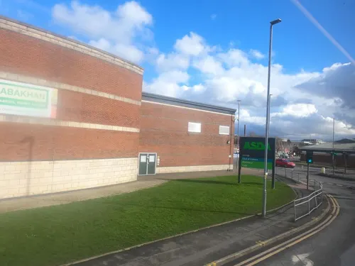
- Street-level photo, tonys999, CC BY-SA 4.0
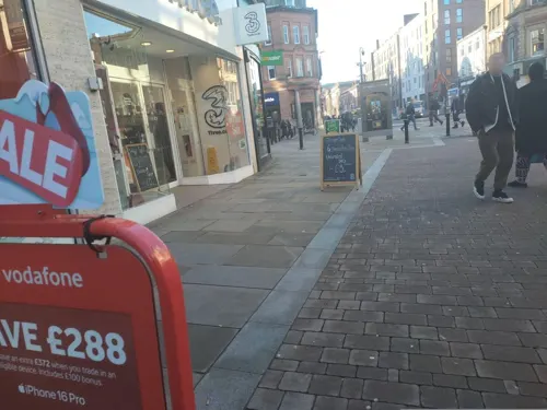
- Street-level photo, tonys999, CC BY-SA 4.0
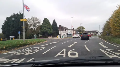
- Street-level photo, tonys999, CC BY-SA 4.0
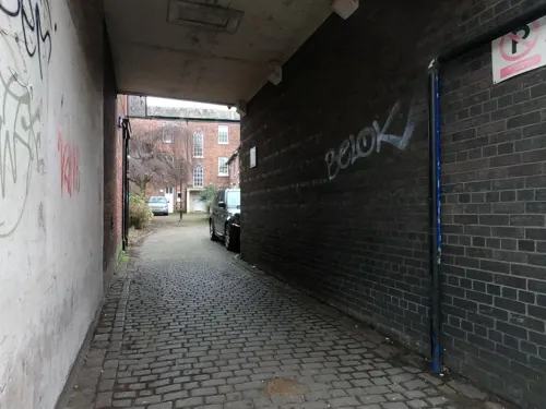
- Street-level photo, tonys999, CC BY-SA 4.0
- Street-level photo, tonys999, CC BY-SA 4.0
- Street-level photo, tonys999, CC BY-SA 4.0
- Street-level photo, tonys999, CC BY-SA 4.0
- Street-level photo, tonys999, CC BY-SA 4.0
- Street-level photo, mappo2, CC BY-SA 4.0
- Street-level photo, tonys999, CC BY-SA 4.0
- Street-level photo, tonys999, CC BY-SA 4.0


Page built November 10, 2026. Spotted a mistake? Tell us or suggest a place.