


Chelmsford, United Kingdom
Chelmsford is a city of 111,511 people in England, United Kingdom.
Why visit Chelmsford
Townapedia lists 95 museums and landmarks, 80 parks and trails, 181 places to eat, 13 places to stay and 9 attractions in and around town.
Highlights include Everyman, Odeon, Chelmsford Museum and Shire Hall.
Weather in Chelmsford
Forecast from MET Norway (CC BY 4.0). Full forecast
About Chelmsford
Chelmsford () is a city in Essex, England. It is the county town of Essex and one of three cities in the county, along with Colchester and Southend-on-Sea. It is located 31 miles (50 km) north-east of Charing Cross in London, and 22 miles (35 km) south-west of Colchester. At the 2021 census the built up area had a population of 110,625.
From the Wikipedia article Chelmsford (this version), under CC BY-SA 4.0.
Travel tips from other travellers: Chelmsford on Wikivoyage (CC BY-SA 4.0).
Photos of Chelmsford


Things to do9


The Farm Shop
Farm and orchard · 0.4 mi
196 Moulsham Street, Chelmsford
Mo-Fr 08:00-19:00; Sa 08:00-18:00; Su 10:00-16:00

Blake's Wood & Lingwood Common
Monument and historic site · 4.1 mi
Educational trail in Danbury, Chelmsford, England, UK

Museums and landmarks95


Museum of Chelmsford
Museum · 0.9 mi
Museum in Chelmsford, Essex, United Kingdom

Essex Police Museum
Museum · 0.9 mi
Police museum in Chelmsford, United Kingdom
Kingston Crescent, Chelmsford
Mo,Su off; Tu-Fr "By appointment"; Sa 10:00-16:00
Springfield Place
Monument and historic site · 1.1 mi
5-8 Springfield Place, Chelmsford
83 more on the map.
Parks, trails and playgrounds80


Central Park, Chelmsford
Park · 0.4 mi
Park in Chelmsford, Essex, England



Galleywood Common
Park · 3.0 mi
Common in Galleywood, Chelmsford, Essex
Little Waltham Meadows
Park · 3.0 mi
Essex Wildlife Trust Nature reserve


68 more on the map.
Restaurants and cafes181

The Bay Horse
Bar and pub · 0.4 mi
189 Moulsham Street, Chelmsford
Mo off; Tu,Th,Su 15:00-23:00; We 15:00-01:00; Fr 13:00-01:00;...
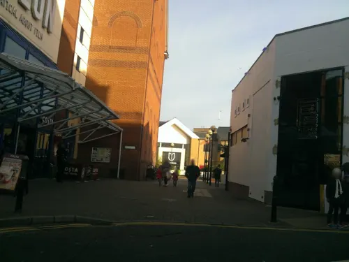
Bar & Beyond
Bar and pub · 0.4 mi
6 Moulsham Street, Chelmsford
Mo,Tu,Su off; We,Fr,Sa 17:00-03:00; Th 17:00-01:00
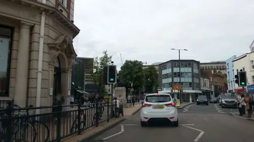
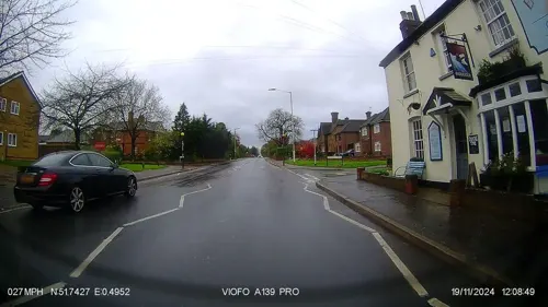
The Endeavour
Bar and pub · 1.2 mi
351 Springfield Road, Chelmsford
Tu-Th,Su 12:00-23:00; Fr,Sa 12:00-23:30; Mo off

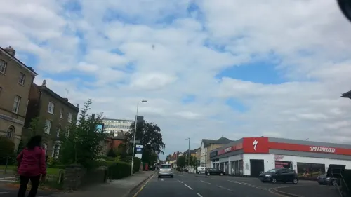
The Two Brewers
Bar and pub · 0.4 mi
80 Springfield Road, Chelmsford
Mo-Fr 12:00-23:00; Sa-Su 12:00-23:59

The Nags Head
Bar and pub · 0.4 mi
22 Baddow Road, Chelmsford
Mo-Tu,Fr 11:00-23:00; We-Th,Sa-Su 12:00-23:00

The Angel
Bar and pub · 1.8 mi
160 Main Road, Chelmsford
Mo-We 12:00-22:00; Th-Sa 12:00-23:00; Su 12:00-22:00

Siam Brasserie
Restaurant · Thai · 0.4 mi
44 Moulsham Street, Chelmsford
Mo off; Tu-Fr 12:00-15:00, 17:30-22:30; Sa 12:00-22:30; Su 12:00-21:30
The Anchor
Bar and pub · 0.5 mi
151 Moulsham Street, Chelmsford
Mo-Th 12:00-23:00; Fr-Sa 12:00-23:30; Su 12:00-22:30
169 more on the map.
History
Before 1199, there were settlements nearby from ancient times. The remains of a Neolithic and a late Bronze Age settlement have been found in the suburb of Springfield, and the town was occupied by the Romans. A Roman fort was built in AD 60, and a civilian town grew up around it. The town was given the name of Caesaromagus (Caesar's field or Caesar's marketplace), although the reason for it being given the great honour of bearing the Imperial prefix is now unclear – possibly indicating that it was on this site that Roman Emperor, Claudius, defeated the remaining British armies during the Roman conquest of Britain, before capturing Camulodunum. The remains of a mansio, a combination post office, civic centre and hotel, lie beneath the streets of modern Moulsham, and the ruins of an octagonal temple are located beneath the Odeon roundabout. In 2025, archaeologists from Archaeology South East found three bodies during a dig at the former Moulsham Street car park.
An Anglo-Saxon burial was discovered at Broomfield to the north of Chelmsford in the late 19th century and the finds are now in the British Museum. The road 'Saxon Way' now marks the site.
Read more of the history
The city's name is derived from Ceolmaer's ford. In the Domesday Book of 1086, it was listed as Celmeresfort. The Domesday Book records that it was then owned by the Bishop of London and had four households, a mill, had three ploughing teams available to the bishop as lord of the manor, 30 acres (12 hectares) of meadow and enough woodland to support 300 pigs. It also gave its name to the wider Chelmsford hundred which covered surrounding villages.
In the year 1100, Maurice, Bishop of London, commissioned the construction of a bridge over the River Can. The bridge meant the traffic flowed through the area instead of Writtle, which grew in importance and size. By 1189 it had changed to Chelmsford.
On 7 September 1199, King John granted to William of Sainte-Mère-Eglise a market charter allowing Chelmsford to hold a market. An under-cover market, operating Tuesday to Saturday, is still an important part of the city centre over 800 years later. Chelmsford's first parish church was built around the same time as the grant of the market charter. The church, dedicated to St Mary the Virgin, was completely rebuilt during the 15th century.
The town became the seat of the county assizes during the early 13th century (though assizes were also held at Brentwood) and by 1218 it was recognised as the county town of Essex, a position it has retained to the present day.
King Robert I of Scotland, better known as Robert the Bruce (1274–1329), had close ties with the nearby village of Writtle and there is some evidence to suggest he was born at Montpeliers Farm in the village, but the story is disputed and possibly conflated with his father, Robert de Brus, 6th Lord of Annandale.
Chelmsford was significantly involved in the Peasants' Revolt of 1381, and King Richard II moved on to the town after quelling the rebellion in London. 'The Sleepers and The Shadows', written by Hilda Grieve in 1988 using original sources, states: "For nearly a week, from Monday 1st July to Saturday 6th July [1381], Chelmsford became the seat of government ... The king probably lodged at his nearby manor house at Writtle. He was attended by his council, headed by the temporary Chancellor ... the new chief justice ... the royal chancery ... Their formidable task in Chelmsford was to draft, engross, date, seal and despatch by messengers riding to the farthest corners of the realm, the daily batches of commissions, mandates, letters, orders and proclamations issued by the government not only to speed the process of pacification of the kingdom, but to conduct much ordinary day-to-day business of the Crown and Government." Richard II famously revoked the charters which he had made in concession to the peasants on 2 July 1381, while in Chelmsford. It could be said that given this movement of government power, Chelmsford for a few days at least became the capital of England. Many of the ringleaders of the revolt were executed on the gallows at what is now Primrose Hill.
King Henry VIII purchased the Boleyn estate in 1516, and built Beaulieu Palace on the current site of New Hall School. This later became the residence of his then mistress, and later wife Anne. Soon after it became the residence of Henry's daughter, by his first marriage, Mary I.
In the 17th century many of the victims of Matthew Hopkins (the self-styled "Witchfinder General") spent their last days imprisoned in Chelmsford, before being tried at the assizes and hanged for witchcraft.
In 1835, when visiting Essex and Suffolk to cover local elections, Charles Dickens visited Chelmsford. He was apparently so upset that he could not find a newspaper on a Sunday that he wrote in a letter to a friend that Chelmsford was "the dullest and most stupid place on earth".
In 1899 Guglielmo Marconi opened the first "wireless" or radio factory in the world at Hall Street in the Moulsham area of Chelmsford. In 1920 Marconi made the first official publicised sound broadcast in the United Kingdom, featuring Dame Nellie Melba at the New Street Works, the first purpose-built radio factory in the world. In 1922, Marconi made the world's first regular wireless broadcasts for entertainment (call sign "2MT") began from the nearby village of Writtle.
Station 2MT led to the creation of its sister station in London "2LO", which subsequently led to the creation of the BBC.
In 1914 Chelmsford's parish church was elevated in status to become Chelmsford Cathedral on the creation of the Diocese of Chelmsford, led by the Bishop of Chelmsford.
From the History section of Chelmsford on Wikipedia, under CC BY-SA 4.0.
More about Chelmsford
Geography
From over 600,000 years ago, during the Pleistocene ice age, until the Anglian Stage around 478,000 to 424,000 years ago, the early River Thames flowed through the area where Chelmsford now stands, from Harlow to Colchester, before crossing what is now the North Sea to become a tributary of the Rhine. Consequently, gravel deposits are frequently found in the area and current and former gravel pits in the district are common.
Chelmsford has two rivers, the River Can and the River Chelmer. Although often confused to be the same river in the city centre, they are quite separate until they join towards the east of the city to form the Chelmer and Blackwater Navigation which heads out towards Maldon before flowing into tidal waters at the Blackwater Estuary. In the other direction, the Chelmer comes from the north from its source near Thaxted while the Can comes from the West from Writtle where it separates from the River Wid.
Economy
Originally an agricultural and market town, Chelmsford has been an important centre for industry since the 19th century. Following the opening of the Chelmer and Blackwater Navigation in 1797, cheaper transportation and raw materials made milling and malting the main industries until the 1850s, when increasing prosperity created a local market for agricultural machinery.
Foundries and engineering works followed including Fell Christy at his Factory (In later years known as Christy Norris Ltd) on the corner of Kings Road and Broomfield Road opened 1858, closed 1985, Coleman and Moreton, Thomas Clarkson (Steam Omnibus manufacturer and Founder of the Eastern National Bus Company) and Eddington and Stevenson (makers of traction engines). The Company Christy Norris still survives, trading as Christy Turner Ltd based in Ipswich. A residential street close to the old Factory was named "Fell Christy" in his honour.
As well as the headquarters of Essex Police, Essex County and Chelmsford City Councils, the modern city is home to a range of national and international companies including M&G Group, Teledyne e2v and ebm-papst.
Education
Higher education in the city is provided at a campus of Anglia Ruskin University (formerly called Anglia Polytechnic) and Writtle University College. Chelmsford College is the main provider of further education in the city. Sixth form colleges are attached to many of the secondary schools listed below.
Secondary school educational establishments in Chelmsford include:
St Peter's College (closed in August 2011 and formerly known as Rainsford High School).
Chelmsford includes many primary schools, including The Bishop's C of E & R C Primary School, one of the few joint Anglican and Roman Catholic primary schools in the country
From the Wikipedia article Chelmsford, under CC BY-SA 4.0.
Notable people from Chelmsford
 James A. RobinsonBritish political scientist and economist (born 1960)Photo: John Sears, CC BY-SA 4.0
 Gus KenworthyAmerican and British freestyle skier and actorPhoto: Adam Rippon, CC BY 3.0
 Jonas BlueBritish DJ and music producerPhoto: MTV UK, CC BY 3.0
 Tom PayneEnglish actor; (born 1982)Photo: Manikman, CC0
 SquarepusherBritish musicianPhoto: digboston, CC BY 2.0
 Harry JuddBritish drummerPhoto: Raph_PH, CC BY 2.0
 Ian StannardEnglish racing cyclistPhoto: Cs-wolves, CC BY-SA 4.0
 Toby Gardvideo game designerPhoto: Jon Jordan, CC BY 2.0
 Norman FowlerBritish politician (born 1938)Photo: Chris McAndrew, CC BY 3.0
- Jack LowdenScottish actor
- James MaynardBritish mathematician
- Grayson PerryEnglish artist, writer and broadcaster (born 1960)
Born in Chelmsford, according to Wikidata (CC0). Each name links to its Wikipedia article.
Where to stay13
The Chelmer Bed and Breakfast
Motel and hotel · 0.5 mi
2-4 Hamlet Road, Chelmsford
Boswell House Hotel
Motel and hotel · 0.5 mi
118-120 Springfield Road, Chelmsford
Churches and places of worship48
St John the Evangelist, Moulsham
Church · Anglican · 0.6 mi
Moulsham Street, Chelmsford
Shopping69
Gas and EV charging15
Schools, colleges and libraries45
Healthcare34
Map of Chelmsford
250 places. The map loads OpenStreetMap tiles when you open it.
Getting there and nearby towns
London Stansted Airport (STN) is the nearest airport with scheduled flights listed in OpenStreetMap, 14 miles away.
- Southend-on-Sea 17 mi southeast, about 28 min by car
- Dagenham 18 mi southwest, about 29 min by car
- Ilford 21 mi southwest, about 34 min by car
- Colchester 21 mi northeast, about 34 min by car
- Walthamstow 23 mi southwest, about 37 min by car
- Enfield Town 24 mi west, about 39 min by car
- Gillingham 24 mi south, about 39 min by car
- Tottenham 25 mi west, about 40 min by car
- Islington 28 mi southwest, about 45 min by car
- London 30 mi southwest, about 48 min by car
Drive times are estimates from straight-line distance, not routes.
Towns near Chelmsford


Keep exploring
Local news
Headlines from INDB.
Reviews, tips and questions
Loading what members have shared...
Sources and licences
- GeoNames (CC BY 4.0): population, coordinates, regions and time zone
- Mapillary (see each image): photos
- OpenStreetMap contributors (ODbL 1.0): places, airports, map data
- Wikidata (CC0 1.0): elevation, founding date, time zone, website, landmarks and historic places
- Wikimedia Commons (see each image): photos
- Wikipedia (CC BY-SA 4.0): overview and history text
Photo credits
- Frank Whitmore 1844-1920 blue plaque site Essex County Council Offices (Block D) 1-3 Duke Street Chelmsford CM1 1HQ, Spudgun67, CC0
- Frank Whitmore 1844-1920 blue plaque - Essex County Council Offices (Block D) 1-3 Duke Street Chelmsford CM1 1HQ (2), Spudgun67, CC0
- Anne Knight Building Duke Street Chelmsford. CM1 1LW, Spudgun67, CC0
- Quakers meeting place blue plaque Anne Knight Building Duke Street Chelmsford. CM1 1LW, Spudgun67, CC0
- Former Quaker meeting house, Duke Street, Chelmsford, July 2023 02, No Swan So Fine, CC BY-SA 4.0
- Former Quaker meeting house, Duke Street, Chelmsford, July 2023 01, No Swan So Fine, CC BY-SA 4.0
- Former Quaker meeting house, Duke Street, Chelmsford, July 2023 03, No Swan So Fine, CC BY-SA 4.0
- Former Quaker meeting house, Duke Street, Chelmsford, July 2023 04, No Swan So Fine, CC BY-SA 4.0
- Anne Knight 1786-1862 blue plaque Anne Knight Building Duke Street Chelmsford. CM1 1LW, Spudgun67, CC0
- Anne Knight Building Duke Street Chelmsford. CM1 1LW (2), Spudgun67, CC0
- Central Park, Chelmsford, John Sutton, CC BY-SA 2.0
- Shirehall, Stuart166axe at English Wikipedia, Public domain
- Oaklands House - August 2012 - panoramio, Forester2009, CC BY-SA 3.0
- Chelmer Valley Riverside 1, Dudley Miles, CC BY-SA 4.0
- Chelmsfordcath, The original uploader was Petepetepete at English Wikipedia ., CC BY-SA 3.0
- Boreham House (John V Nicholls), John V Nicholls, CC BY-SA 2.0
- Essex CCC vs Gloucestershire CCC 2008, Paul Williams from United Kingdom, CC BY 2.0
- Newhall2, Amaibrown, CC BY 3.0
- Chelmsford - Ebenezer Strict Baptist Chapel - 20240928155750, MJL-UK, CC BY-SA 4.0
- The Bay Horse, Moulsham Street, Chelmsford, July 2023, No Swan So Fine, CC BY-SA 4.0
- The Nags Head, Baddow Road, Chelmsford, Essex, July 2023, No Swan So Fine, CC BY-SA 4.0
- The Tulip Public House (Q26434145), Rodney Lewis, CC BY-SA 4.0
- The Saracen's Head Hotel, High Street, Chelmsford, July 2023, No Swan So Fine, CC BY-SA 4.0
- Chelmsford Cathedral Exterior, Essex, UK - Diliff, Diliff, CC BY-SA 3.0
- School view small file, New Hall School, CC BY-SA 4.0
- Jesus, Buriable, CC BY 3.0
- Hylands House, Graham Richter, CC BY-SA 3.0
- Street-level photo, smsm1, CC BY-SA 4.0
- Street-level photo, adam2, CC BY-SA 4.0
- Street-level photo, petermead, CC BY-SA 4.0
- Street-level photo, pseudonym, CC BY-SA 4.0
- Street-level photo, IpswichEdits, CC BY-SA 4.0
- Street-level photo, rskedgell, CC BY-SA 4.0
- Street-level photo, adam2, CC BY-SA 4.0
- Street-level photo, adam2, CC BY-SA 4.0
- Street-level photo, adam2, CC BY-SA 4.0
- Street-level photo, adam2, CC BY-SA 4.0
- Street-level photo, adam2, CC BY-SA 4.0
- Street-level photo, adam2, CC BY-SA 4.0
- Street-level photo, adam2, CC BY-SA 4.0
- Street-level photo, adam2, CC BY-SA 4.0
- Street-level photo, IpswichEdits, CC BY-SA 4.0
- Street-level photo, stephengoodey, CC BY-SA 4.0


Page built November 10, 2026. Spotted a mistake? Tell us or suggest a place.