


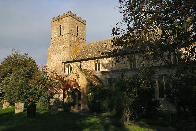

Mildenhall, United Kingdom
Mildenhall is a town of 14,382 people in England, United Kingdom.
Why visit Mildenhall
Townapedia lists 9 museums and landmarks, 9 parks and trails, 39 places to eat and 5 places to stay in and around town.
Highlights include Mildenhall Museum, Mildenhall War Memorial, Aspal Close and Barton Mills Valley.
Weather in Mildenhall
Forecast from MET Norway (CC BY 4.0). Full forecast
About Mildenhall
Mildenhall is a market town in the civil parish of Mildenhall High, in the West Suffolk district, in the county of Suffolk, England. The town is near the A11, and is 37 mi (60 km) north-west of Ipswich. The large Royal Air Force station, RAF Mildenhall, as well as RAF Lakenheath, are located north of the town. Both are used by the United States Air Force and Mildenhall is the headquarters of its 100th Air Refueling Wing and 352nd Special Operations Group.
From the Wikipedia article Mildenhall, Suffolk (this version), under CC BY-SA 4.0.
Travel tips from other travellers: Mildenhall on Wikivoyage (CC BY-SA 4.0).
Museums and landmarks9

Parks, trails and playgrounds9


Norah Hanbury-Kelk Meadows
Park · 0.5 mi
Suffolk Wildlife Trust nature reserve

Royal Worlington and Newmarket Golf Club
Golf course · 1.1 mi
Golf Links Road



Restaurants and cafes39
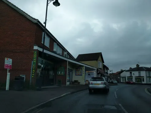
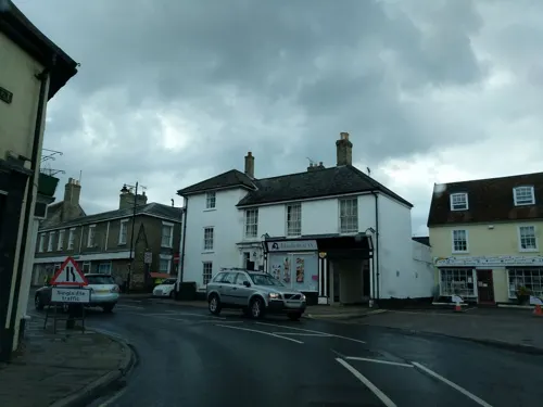
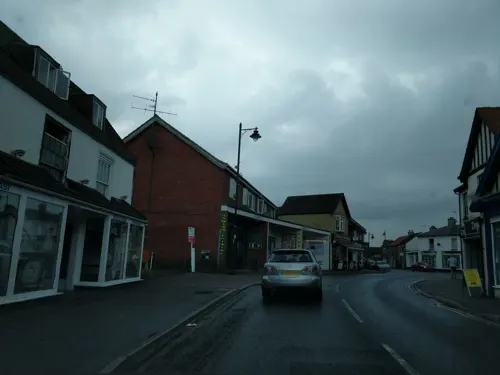
Webb's Sandwich Bar
Cafe · Sandwich
4A Market Place, Bury St Edmunds


27 more on the map.
Where to stay5



History
The Mildenhall Treasure was discovered just outside the town in 1942. The treasure is a hoard of Roman silver objects buried in the 4th century. In 1946, the discovery was made public and the treasure acquired by the British Museum, where it is today.
Roald Dahl wrote an article about the find which was published first in the Saturday Evening Post, and later as "The Mildenhall Treasure" (a short story) in his short story collection The Wonderful Story of Henry Sugar and Six More. The Mildenhall Museum in the centre of the town contains displays of local history and wildlife, the history of the RAF base, and information on the Mildenhall Treasure. Entrance is free, opening times vary throughout the year.
The region between Devil's Dyke and the line between Littleport and Shippea Hill shows a remarkable amount of archaeological findings of the Stone Age, the Bronze Age and the Iron Age.
The area around Mildenhall has been settled by humans since at least the Bronze Age. Following the Roman Empire invasion of Britain, Mildenhall was the site of a Roman settlement, which at some point contained the Mildenhall Treasure.
Read more of the history
The name of the town was first recorded in 1050 as Mildenhale, believed to mean a nook of land belonging to a woman called "Milde" or a man called "Milda". In 1086, the Domesday Book recorded that the town was the property of the Abbot of St Edmunds and had a population of some 64 families.
With the Dissolution of the Monasteries in 1536, ownership of the town was transferred to Edward North, 1st Baron North, whose son, Roger North, lived in Mildenhall for a time. Ownership of the Mildenhall estate remained with the North family for many decades. It was Henry North who, upon retirement, built the Manor house at Mildenhall.
Sir Henry North was elected MP for Suffolk in 1685, but he died a bachelor and so ownership of the estate passed to Sir Thomas Hanmer. Hanmer was elected Speaker of the House of Commons in 1714 and spent little time in his estate. He also died without an heir, and ownership then passed to Thomas Bunbury, who also became MP for Suffolk.
In 1810 Joseph Smedley was able to hire a building as a temporary theatre for £2.
The Bunbury family held the manor of Mildenhall until the estate was broken up in 1933. RAF Mildenhall was officially opened in 1934 and served as a base for RAF Bomber Command during the Second World War. In 1950, the US Air Force took over its operation.
On 1 April 2019 the parish of West Row was split from Mildenhall, on 10 October 2023 the parish was renamed from "Mildenhall" to "Mildenhall High".
From the History section of Mildenhall, Suffolk on Wikipedia, under CC BY-SA 4.0.
More about Mildenhall
Education
Mildenhall has two primary schools: St. Mary's and Great Heath
and one secondary school: Mildenhall College Academy [formerly Mildenhall Upper School]. The secondary school also contains a sixth form, known as MCA6.
From the Wikipedia article Mildenhall, Suffolk, under CC BY-SA 4.0.
Notable people from Mildenhall
 Henry BunburyBritish artist; (1750-1811)Photo: Thomas Ryder / After Thomas Lawrence, CC0
 John YoungEnglish architect and surveyorPhoto: Maull & Co, CC BY-SA 4.0
- Andy Sutclifferacecar driver
- Pelham AldrichRoyal Navy Admiral (1844-1930)
- William GregoryEnglish chronicler and mayor of London (d. 1467)
- Andrew Squirecricketer (born 1964)
- Galand ThaxtonAmerican football linebacker
Born in Mildenhall, according to Wikidata (CC0). Each name links to its Wikipedia article.
Churches and places of worship10
Shopping11
Forest Heath Fasteners
Hardware store · 0.8 mi
12 Hampstead Avenue, Bury St Edmunds
Forest Heath Electrical
Hardware store · 0.7 mi
10 Chiswick Avenue, Bury St Edmunds
Gas and EV charging5
Schools, colleges and libraries6
Healthcare3
Map of Mildenhall
97 places. The map loads OpenStreetMap tiles when you open it.
Getting there and nearby towns
RAF Mildenhall (MHZ) is the nearest airport with scheduled flights listed in OpenStreetMap, 2 miles away.
- Newmarket 8 mi southwest, about 13 min by car
- Thetford 11 mi northeast, about 18 min by car
- Cambridge 19 mi southwest, about 31 min by car
- Sudbury 23 mi southeast, about 37 min by car
- Stowmarket 23 mi southeast, about 37 min by car
- Saint Ives 25 mi west, about 40 min by car
- Saffron Walden 25 mi southwest, about 40 min by car
- Wisbech 27 mi northwest, about 43 min by car
- Royston 31 mi southwest, about 49 min by car
- Ipswich 34 mi southeast, about 54 min by car
Drive times are estimates from straight-line distance, not routes.
Towns near Mildenhall


Keep exploring
Local news
Headlines from INDB.
Reviews, tips and questions
Loading what members have shared...
Sources and licences
- GeoNames (CC BY 4.0): population, coordinates, regions and time zone
- Mapillary (see each image): photos
- OpenStreetMap contributors (ODbL 1.0): places, airports, map data
- Wikidata (CC0 1.0): elevation, founding date, time zone, website, landmarks and historic places
- Wikimedia Commons (see each image): photos
- Wikipedia (CC BY-SA 4.0): overview and history text
Photo credits
- Aspal Close 9, Dudley Miles, CC BY-SA 4.0
- Barton Mills Valley 1, Dudley Miles, CC BY-SA 4.0
- Norah Hanbury-Kelk Meadows, Dudley Miles, CC BY-SA 4.0
- Mildenhall - Church of St Mary, Richard Greenwood, CC BY-SA 2.0
- Worlington - Church of All Saints, Bob Jones, CC BY-SA 2.0
- Riversidehousehotelmilv2, Yeathan21, CC BY-SA 4.0
- Street-level photo, adam2, CC BY-SA 4.0
- Street-level photo, adam2, CC BY-SA 4.0
- Street-level photo, adam2, CC BY-SA 4.0
- Street-level photo, adam2, CC BY-SA 4.0
- Street-level photo, adam2, CC BY-SA 4.0
- Street-level photo, adam2, CC BY-SA 4.0
- Street-level photo, 4004, CC BY-SA 4.0
- Street-level photo, adam2, CC BY-SA 4.0
- Street-level photo, adam2, CC BY-SA 4.0
- Street-level photo, adam2, CC BY-SA 4.0
- Street-level photo, adam2, CC BY-SA 4.0
- Street-level photo, adam2, CC BY-SA 4.0
- Street-level photo, adam2, CC BY-SA 4.0
- Street-level photo, adam2, CC BY-SA 4.0
- Street-level photo, adam2, CC BY-SA 4.0
- Street-level photo, adam2, CC BY-SA 4.0
- Street-level photo, adam2, CC BY-SA 4.0
- Street-level photo, adam2, CC BY-SA 4.0
- Street-level photo, adam2, CC BY-SA 4.0
- Street-level photo, 4004, CC BY-SA 4.0
- Street-level photo, adam2, CC BY-SA 4.0
- Street-level photo, adam2, CC BY-SA 4.0
- Street-level photo, adam2, CC BY-SA 4.0
- Street-level photo, adam2, CC BY-SA 4.0
- Street-level photo, adam2, CC BY-SA 4.0
- Street-level photo, adam2, CC BY-SA 4.0
- Street-level photo, adam2, CC BY-SA 4.0
- Street-level photo, adam2, CC BY-SA 4.0
Page built November 10, 2026. Spotted a mistake? Tell us or suggest a place.