


Heath and Reach, United Kingdom
Heath and Reach is a town of 1,346 people in England, United Kingdom.
Why visit Heath and Reach
Townapedia lists 2 museums and landmarks, 6 parks and trails, 14 places to eat and 1 place to stay in and around town.
Highlights include Stockgrove Country Park and Kings and Bakers Woods and Heaths.
Weather in Heath and Reach
Forecast from MET Norway (CC BY 4.0). Full forecast
About Heath and Reach
Heath and Reach is a village and civil parish near the Chiltern Hills in Bedfordshire, England. It is 2 miles (3.2 km) north of Leighton Buzzard and 3 miles (4.8 km) south of Woburn and adjoins the county boundary with Buckinghamshire. Nearby places are Leighton-Linslade, Great Brickhill and the Duke of Bedford's Woburn Abbey, Woburn Safari Park and Woburn Golf Club.
From the Wikipedia article Heath and Reach (this version), under CC BY-SA 4.0.
Museums and landmarks2


Parks, trails and playgrounds6


Kings and Bakers Woods and Heaths
Park · 1.0 mi
Nature reserve in the United Kingdom

Leighton Buzzard Golf Club
Golf course · 0.5 mi
Plantation Road, Leighton Buzzard



Restaurants and cafes14

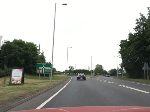
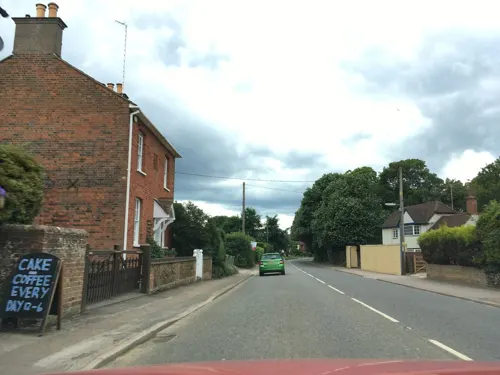


2 more on the map.
Where to stay1

History
There was a sizeable Roman settlement at Heath and Reach. Fragments of pottery, coins and traces of buildings were found in 1971 near Overend Green Farm, by the Roman road, Watling Street. The village was originally two small hamlets in the Royal Manor of Leighton and records are found for Heath in 1220 and Reach in 1216.
Heath and Reach was part of the parish of Leighton and was the property of the King of England. In 1539 a Muster Roll during the reign of Henry VIII listed the fighting men of the village, those aged 16–60, as "25 males who could be relied upon to fight in Henry's wars with France and the defence of Calais."
As a prominent Royalist, Lord Leigh's estates were seized in 1644 and given to Parliamentarians: the Royal Manor of Leighton, which included Heath and Reach, handed to Colonel John Okey, commander of the New Model Army dragoons and a signatory to the execution of Charles I. When Okey was executed for treason at the 1660 Restoration Charles II transferred the royal manor lease back to Lord Leigh whose line continued as lords of the manor into the 19th century.
Read more of the history
Lieutenant Robert Strong, who was killed in action near Ypres in 1915, was from Heath and Reach. First born son of Robert Strong of Gig Lane, Robert Jr was British Army bandmaster in India prior to the war and a noted sportsman. Lieutenant Arthur Pearson was also from Heath and Reach, a pilot of 29 Squadron, Royal Flying Corps, was awarded the Military Cross in the Battle of the Somme for "conspicuous gallantry". He was shot down in flames and killed 1917 by von Richthofen.
From the History section of Heath and Reach on Wikipedia, under CC BY-SA 4.0.
More about Heath and Reach
Geography
The parish is bounded in the south-west by the River Ouzel, in the north-east by the A5 (Watling Street), and includes the Kings's Wood nature reserve and the 400 acres (160 ha) Rushmere Country Park woods. The highest point is 480 feet (150 m) above sea level.
Arts and culture
The village's annual Pancake Race organised every Shrove Tuesday by the Heath and Reach Women's Institute is a major feature of village life, raising money for charity. Leighton Buzzard Children's Theatre, run by Sally and David Allsopp, has been based in Heath and Reach since 1996. The group has raised over £120,000 for various charities through musical theatre and drama productions starring local children aged 4 to 18 who regularly perform at the local Library Theatre and School Theatres.
There are 622 homes in the parish and besides the church, school and golf club, the village has two pubs and a village store and a thriving Royal British Legion. There is also a sports association with tennis courts, playing fields and pavilion and a separate recreation ground. The village benefits from several community use meadows, public footpaths and bridleways. There is also a fishing club at the ten-acre Jones Lakes. Leighton Buzzard Golf Club lies just to the southwest of the village. Heath and Reach is also home to a heritage narrow gauge railway, which maintains the largest collection of narrow-gauge locomotives in the UK.
Education
The village lower school St Leonard's was founded in 1846 by the Church of England and educates 100 children aged 4–9. There is also an on-site pre-school. The school's key stage 1 results remain "exceptionally above national and local averages" and Ofsted rate the school Outstanding.
From the Wikipedia article Heath and Reach, under CC BY-SA 4.0.
Churches and places of worship9
Shopping1
Schools, colleges and libraries6
Map of Heath and Reach
39 places. The map loads OpenStreetMap tiles when you open it.
Getting there and nearby towns
London Luton Airport (LTN) is the nearest airport with scheduled flights listed in OpenStreetMap, 13 miles away.
- Leighton Buzzard 2 mi south, about 3 min by car
- Stanbridge 4 mi southeast, about 6 min by car
- Bletchley 5 mi northwest, about 8 min by car
- Newton Longville 5 mi northwest, about 8 min by car
- Dunstable 7 mi southeast, about 11 min by car
- Milton Keynes 8 mi northwest, about 13 min by car
- Flitwick 8 mi northeast, about 13 min by car
- Lidlington 8 mi northeast, about 13 min by car
- Ampthill 9 mi northeast, about 14 min by car
- Luton 11 mi southeast, about 18 min by car
Drive times are estimates from straight-line distance, not routes.
Towns near Heath and Reach


Keep exploring
Local news
Headlines from INDB.
Reviews, tips and questions
Loading what members have shared...
Sources and licences
- GeoNames (CC BY 4.0): population, coordinates, regions and time zone
- Mapillary (see each image): photos
- OpenStreetMap contributors (ODbL 1.0): places, airports, map data
- Wikidata (CC0 1.0): elevation, founding date, time zone, website, landmarks and historic places
- Wikimedia Commons (see each image): photos
- Wikipedia (CC BY-SA 4.0): overview and history text
Photo credits
- Stockgrovecountrypark, Cameraman, CC BY-SA 2.0
- King's Wood, Heath and Reach 4, Dudley Miles, CC BY-SA 4.0
- The Globe Inn Pub, Linslade, canalandriversidepubs co uk, CC BY-SA 2.0
- Penlee steam locomotive of Leighton Buzzard Light Railway, NearEMPTiness, CC BY-SA 4.0
- Street-level photo, southglos, CC BY-SA 4.0
- Street-level photo, southglos, CC BY-SA 4.0
- Street-level photo, southglos, CC BY-SA 4.0
- Street-level photo, southglos, CC BY-SA 4.0
Page built November 10, 2026. Spotted a mistake? Tell us or suggest a place.