


Why visit Hexham
Townapedia lists 22 museums and landmarks, 11 parks and trails, 65 places to eat, 11 places to stay and 9 attractions in and around town.
Highlights include Chollerford Bridge, Constantius Bridge, Hexham Old Gaol and Aydon Castle.
Weather in Hexham
Forecast from MET Norway (CC BY 4.0). Full forecast
About Hexham
Hexham is a market town and civil parish in Northumberland, England, on the south bank of the River Tyne, formed by the confluence of the North Tyne and the South Tyne at Warden nearby, and close to Hadrian's Wall. Hexham was the administrative centre for the Tynedale district from 1974 to 2009. In 2011, it had a population of 13,097.
From the Wikipedia article Hexham (this version), under CC BY-SA 4.0.
Travel tips from other travellers: Hexham on Wikivoyage (CC BY-SA 4.0).
Things to do9
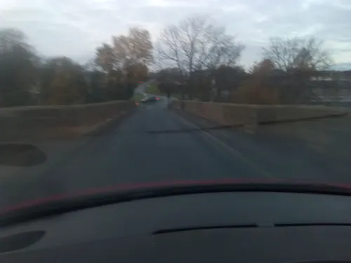
Chollerford Bridge
Bridge · 4.2 mi
Grade II listed bridge in Humshaugh, Northumberland, England, UK
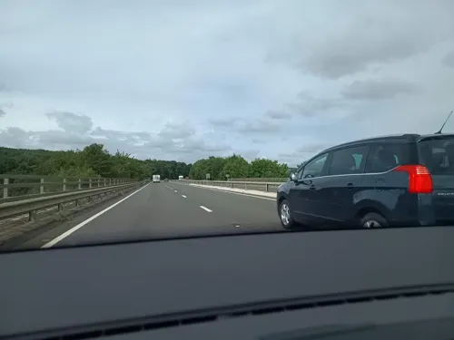
Corbridge Bridge
Bridge · 3.4 mi
Grade I listed bridge in Corbridge, Northumberland, England

Hexham Bridge
Bridge · 0.6 mi
Fourth bridge across the Tyne at Hexham


Border Counties Bridge
Bridge · 1.1 mi
Railway bridge, now ruinous, in Northumberland, England, UK, across the River Tyne
Warden Bridge
Bridge · 2.0 mi
Road bridge across the River South Tyne
Museums and landmarks22

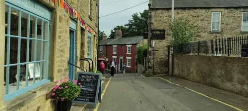
Hexham Old Gaol
Museum
Former prison in Hexham, Northumberland, England, UK
Hallgate, Hexham
PH,We-Su 10:00-16:00

Aydon Castle
Museum · 4.4 mi
Fortified manor house near Corbridge, Northumberland, England, UK

Chesters Roman Fort
Monument and historic site · 4.1 mi
Roman fort at Hadrian's Wall
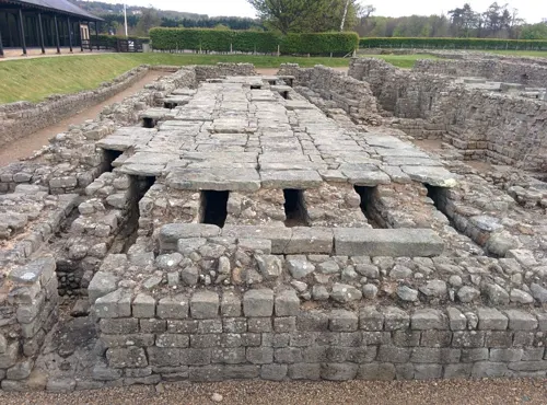
Coria
Monument and historic site · 3.0 mi
Archaeological site in Corbridge, Northumberland, England, UK

Planetrees
Monument and historic site · 3.6 mi
Section of Hadrian's Wall in north England


Queen's Hall Arts Centre
Museum
Arts centre (built as Town Hall and Corn Exchange, now an arts centre)
Beaumont Street, Hexham

10 more on the map.
Parks, trails and playgrounds11



Restaurants and cafes65





53 more on the map.
History
In 671/672, Saint Wilfrid was given the site for a church at Hexham by Northumbrian queen Æthelthryth. Hexham Abbey originated as a monastery founded by St Wilfrid in 674. The crypt of the original monastery survives, and incorporates many stones taken from nearby Roman ruins, probably Corbridge or Hadrian's Wall.
The Anglo-Saxon Chronicle (Manuscript D: Cotton Tiberius B IV) records the murder of King Ælfwald by Sicga at Scythlecester (which may be modern Chesters) on 23 September 788:
This year Alfwald, king of the Northumbrians, was slain by Siga, on the ninth day before the calends of October; and a heavenly light was often seen on the spot where he was slain. He was buried at Hexham in the church.
Her wæs Alfwald Norðhymbra cyning ofslægen fram Sigan on .viiii. Kalendas Octobris, 7 heofonlic leoht wæs lome gesewen þær þær he ofslægen wæs, 7 he wæs bebyrged on Hagustaldesee innan þære cyrican.
Like many towns in the Anglo-Scottish border area and adjacent regions, Hexham suffered from the border wars between the kingdoms of Scotland and England, including attacks from William Wallace who burnt the town in 1297. In 1312, Robert the Bruce, King of Scotland, demanded and received £2000 from the town and monastery in order for them to be spared a similar fate. In 1346 the monastery was sacked in a later invasion led by King David II of Scotland.
Read more of the history
In 1464, during the Wars of the Roses, the Battle of Hexham was fought somewhere to the south of the town; the actual site is disputed. The defeated Lancastrian commander, Henry Beaufort, 3rd Duke of Somerset, was executed in Hexham marketplace. There is a legend that Queen Margaret of Anjou took refuge after the battle in what is known as The Queen's Cave, where she was accosted by a robber; the legend formed the basis for an 18th-century play by George Colman the Younger (The Battle of Hexham); but it has been established that Queen Margaret had fled to France by the time the battle took place. The Queen's Cave in question is on the south side of the West Dipton Burn, to the southwest of Hexham.
Until 1572, Hexham was the administrative centre of the former Liberty or Peculiar of Hexhamshire.
In 1715, James Radclyffe, 3rd Earl of Derwentwater, raised the standard for James Francis Edward Stuart in Hexham Market place.
"Hexham" was used in the Borders as a euphemism for "Hell". Hence the term "To Hexham wi' you an' ye’r whussel!", recorded in 1873, and the popular expression "Gang to Hexham!". "Hexham-birnie" is derived from the term and means "an indefinitely remote place".
In 1761, the Hexham Riot took place in the Market Place when a crowd protesting about changes in the criteria for serving in the militia were fired upon by troops from the North York Militia. Some 45 protesters were killed, earning the Militia the sobriquet of The Hexham Butchers.
From the History section of Hexham on Wikipedia, under CC BY-SA 4.0.
More about Hexham
Economy
Its chipboard factory vents steam which can be seen from miles away.
Hexham had been long famous for its manufacture of leather. Wright (1823) gives some statistics77 men & boys employed as Leather dressers and Glove-cutters, 40 boys employed as Dusters and 1,111 women employed as Sewers. Skins dressed annually were 80,000, and 18,000 skins of dressed leather were imported. From these were made and exported annually 23,504 dozens of pairs of gloves. Dutch Oker was used in the processing, but local fell clay could be used if necessary.Tanning was a necessary allied industry and there were four tanneries, employing a score of men. In a year they dealt with 5,000 hides and 12,000 calf skins. They supplied local saddlers, bootmakers and cobblers.
Hexham also had 16 master hatters, and the trade employed 40 persons. There were two woollen manufactories, worked by steam power, and two rope manufactories. There were corn water mills below the bridge. A windmill on the Sele was ruinous, but there was one still working on Tyne Green. It was, and still is a flourishing market, including a mart for cattle and other farm animals.
In Hexham the Subskimmer was designed and made by Submarine Products.
Education
Hexham is served by state first, middle and high schools and uses the three-tier system as does the rest of Northumberland. Queen Elizabeth High School, partly located in a former hydropathic hotel, is the town's major educational centre. The nearest private school is Mowden Hall School, a prep school located 10 miles (16 km) away in Stocksfield.
From the Wikipedia article Hexham, under CC BY-SA 4.0.
Notable people from Hexham
 Fraser ForsterEnglish association football player (born 1988)Photo: Timmy96, CC0
 Peter BeardsleyEnglish footballerPhoto: Skippo10, CC BY-SA 3.0
 Pete DohertyEnglish musician, actor and poet (born 1979)Photo: Raph_PH, CC BY 2.0
 Robson GreenBritish actor and musicianPhoto: Dnalor 01, CC BY-SA 3.0 at
 Kevin WhatelyEnglish actorPhoto: TwentiethApril1986, CC BY-SA 4.0
 William HewsonBritish physiologistPhoto: Vandergucht; H. Robinson, Public domain
 Jade BirdBritish singerPhoto: Justin Higuchi from Los Angeles, CA, USA, CC BY 2.0
 Glenn BrownBritish artist (born 1966)Photo: Justinakiskyte, CC BY-SA 4.0
- Aelred of RievaulxEnglish monk, author and saint (1110–1167)
- Jak AlnwickEnglish footballer (born 1993)
- Keith WardBritish philosopher, theologian, priest and scholar
- Acca of Hexham8th-century Bishop of Hexham
Born in Hexham, according to Wikidata (CC0). Each name links to its Wikipedia article.
Where to stay11
Churches and places of worship11
Shopping34
Gas and EV charging2
Schools, colleges and libraries12
Healthcare4
Map of Hexham
181 places. The map loads OpenStreetMap tiles when you open it.
Getting there and nearby towns
Newcastle International Airport (NCL) is the nearest airport with scheduled flights listed in OpenStreetMap, 17 miles away.
- Prudhoe 10 mi east, about 16 min by car
- Ponteland 15 mi east, about 25 min by car
- Whickham 17 mi east, about 27 min by car
- Newcastle upon Tyne 19 mi east, about 31 min by car
- Morpeth 21 mi northeast, about 34 min by car
- Jarrow 25 mi east, about 40 min by car
- Spennymoor 27 mi southeast, about 44 min by car
- Sunderland 29 mi east, about 47 min by car
- Ryhope 30 mi east, about 48 min by car
- Seaham 31 mi east, about 51 min by car
Drive times are estimates from straight-line distance, not routes.
Towns near Hexham


Keep exploring
Local news
Headlines from INDB.
Reviews, tips and questions
Loading what members have shared...
Sources and licences
- GeoNames (CC BY 4.0): population, coordinates, regions and time zone
- Mapillary (see each image): photos
- OpenStreetMap contributors (ODbL 1.0): places, airports, map data
- Wikidata (CC0 1.0): elevation, founding date, time zone, website, landmarks and historic places
- Wikimedia Commons (see each image): photos
- Wikipedia (CC BY-SA 4.0): overview and history text
Photo credits
- Hexham BeaumontStreet, Dickpenn, Public domain
- Hexham Park, Hexham, United Kingdom May 21, 2020 02-59-27 pm, Frankylikesnature, CC BY-SA 4.0
- Hexham Old Gaol, Steven Fruitsmaak, Public domain
- Aydon Castle (inner court), Hadrianus1959, CC BY-SA 4.0
- Chesters Roman fort barracks, Steven Fruitsmaak, Public domain
- Hexham - Abbey church - 01, Benjamin Smith, CC BY-SA 4.0
- Stmaryschurchhexham peter brooks, Peter Brooks, CC BY-SA 2.0
- Dilston Castle, Peter Brooks, CC BY-SA 2.0
- Heart Of All England Tavern, Victuallers, CC BY-SA 4.0
- Forum (JD Wetherspoon), Victuallers, CC BY-SA 4.0
- Hexham Bridge viewed from Tyne Green - panoramio, somaliayaswan, CC BY 3.0
- Warden Railway Bridge - panoramio, steelwheelz, CC BY 3.0
- Hadrians Wall at Planetrees, Brunton Bank, Hexham, Northumberland 1, Mertbiol, CC0
- Street-level photo, caranteth, CC BY-SA 4.0
- Street-level photo, jethro10, CC BY-SA 4.0
- Street-level photo, jethro10, CC BY-SA 4.0
- Street-level photo, jethro10, CC BY-SA 4.0
- Street-level photo, jethro10, CC BY-SA 4.0
- Street-level photo, jethro10, CC BY-SA 4.0
- Street-level photo, jethro10, CC BY-SA 4.0
- Street-level photo, jethro10, CC BY-SA 4.0
- Street-level photo, jethro10, CC BY-SA 4.0
- Street-level photo, victuallers, CC BY-SA 4.0
- Street-level photo, victuallers, CC BY-SA 4.0
- Street-level photo, victuallers, CC BY-SA 4.0
- Street-level photo, mapz4lolz, CC BY-SA 4.0
- Street-level photo, victuallers, CC BY-SA 4.0
- Street-level photo, zuse, CC BY-SA 4.0
- Street-level photo, victuallers, CC BY-SA 4.0

Page built November 10, 2026. Spotted a mistake? Tell us or suggest a place.